
6.03.2018
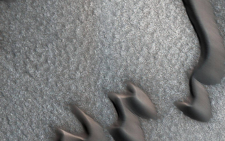
This image was originally meant to track the movement of sand dunes near the North Pole of Mars, but what's on the ground in between the dunes is just as interesting!
The ground has parallel dark and light stripes from upper left to lower right in this area. In the dark stripes, we see piles of boulders at regular intervals.
What organized these boulders into neatly-spaced piles? In the Arctic back on Earth, rocks can be organized by a process called "frost heave." With frost heave, repeatedly freezing and thawing of the ground can bring rocks to the surface and organize them into piles, stripes, or even circles. On Earth, one of these temperature cycles takes a year, but on Mars it might be connected to changes in the planet's orbit around the Sun that take much longer.
The map is projected here at a scale of 25 centimeters (9.8 inches) per pixel. [The original image scale is 32 centimeters (12.6 inches) per pixel (with 1 x 1 binning); objects on the order of 96 centimeters (37.8 inches) across are resolved.] North is up.
This is a stereo pair with ESP_053937_2550.
The University of Arizona, Tucson, operates HiRISE, which was built by Ball Aerospace & Technologies Corp., Boulder, Colorado. NASA's Jet Propulsion Laboratory, a division of Caltech in Pasadena, California, manages the Mars Reconnaissance Orbiter Project for NASA's Science Mission Directorate, Washington.
Quelle: NASA