
.
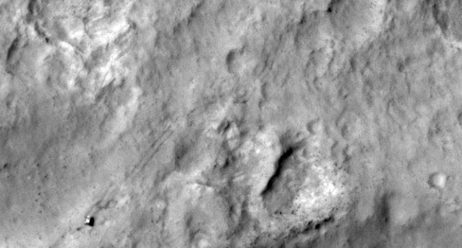
NASA's Curiosity Mars rover and tracks left by its driving appear in this portion of a Dec. 11, 2013, observation by the High Resolution Imaging Science Experiment (HiRISE) camera on NASA's Mars Reconnaissance Orbiter. The rover is near the lower-left corner of this view.
.
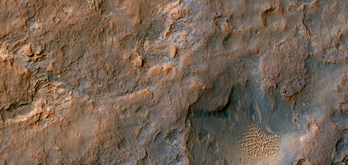
NASA's Curiosity Mars rover and its recent tracks from driving in Gale Crater appear in an image taken by the High Resolution Imaging Science Experiment (HiRISE) camera on NASA's Mars Reconnaissance Orbiter on Dec. 11, 2013.
.
Curiosity Trekking, Viewed from Orbit in December 2013
NASA's Curiosity Mars rover and tracks left by its driving appear in this portion of a Dec. 11, 2013, observation by the High Resolution Imaging Science Experiment (HiRISE) camera on NASA's Mars Reconnaissance Orbiter. The rover is near the lower-left corner of this view. For scale, the two parallel lines of the wheel tracks are about 10 feet (3 meters) apart.
Curiosity has been on the move. By the time this image was taken, it had driven about 2.86 miles (4.61 kilometers) since its August 2012 landing in Gale Crater. This view shows where the rover has driven generally southwestward, with some variation to get around obstacles, on its route toward its long-term destination on the lower slopes of Mount Sharp.
.
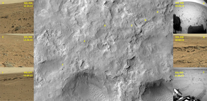
Curiosity Trekking, Viewed from Orbit in December 2013 - Annotated
The central panel of this graphic is a view from orbit that includes tracks of drives made by NASA's Curiosity Mars rover in October to December of 2013. The six images at left and right are rover's-eye views at the locations marked with yellow letters A through F on the central panel. The central image was taken by the High Resolution Imaging Science Experiment (HiRISE) camera on NASA's Mars Reconnaissance Orbiter on Dec. 11, 2013, when the rover was visible at location F. Image A is from Curiosity's rear Hazard-Avoidance Camera, Image C from the rover's Navigation Camera, images B, D, E and F from the rover's Mast Camera.
.
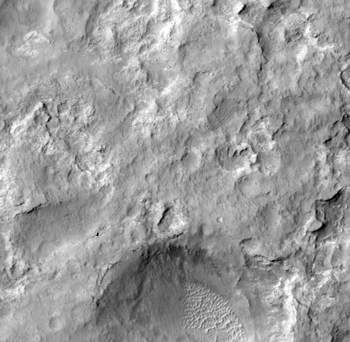
Curiosity has been on the move. In this most recent HiRISE image of the MSL rover, the tracks are visible from Yellowknife Bay to its location on 11 December 2013, several kilometers to the southwest. Tracks from its landing site to Yellowknife Bay made more than a year ago are faded but still discernible.
The enhanced color image shows where the tracks cross the narrow (1-kilometer wide) color swath of HiRISE. A black-and-white image subimage shows the rover itself. Rather than follow a straight path to its next destination, the rover has zig-zagged to avoid steep slopes.
Curiosity is progressing from the bright dust-covered area to a region with a darker surface, where saltating sand keeps the surface relatively free of dust. The scenery seen by the rover will be getting more interesting as it progresses toward Mount Sharp.
.
The tracks show where the rover has zigzagged around obstacles on its route toward the lower slopes of Mount Sharp, its next major destination.
HiRISE first imaged the Mars Science Laboratory spacecraft while it was descending on a parachute to place Curiosity on Mars 17 months ago. Since then, it has provided updated views of the rover's traverse, as seen from orbit.
HiRISE is operated by the University of Arizona, Tucson. The instrument was built by Ball Aerospace & Technologies Corp., Boulder, Colo. The Mars Reconnaissance Orbiter project and Mars Science Laboratory project are managed for NASA's Science Mission Directorate, Washington, by NASA's Jet Propulsion Laboratory, a division of the California Institute of Technology in Pasadena.
.
Quelle: NASA
5812 Views