


The Japanese space agency said Wednesday the launch of an H-2A rocket with the country’s third navigation satellite was preemptively delayed at least 24 hours to Saturday to avoid thunderstorms with lightning in the forecast later this week.
The 174-foot-tall (53-meter) rocket, currently standing inside the vertical assembly building at the Tanegashima Space Center, is now scheduled to launch some time during an unusually-long nine-hour window Saturday that opens at 0500 GMT (1 a.m. EDT; 2 p.m. Japan Standard Time).
The launch was originally scheduled for the same window Friday.
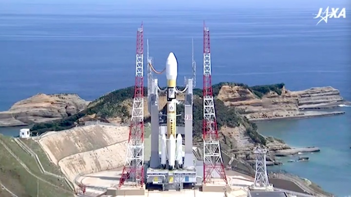
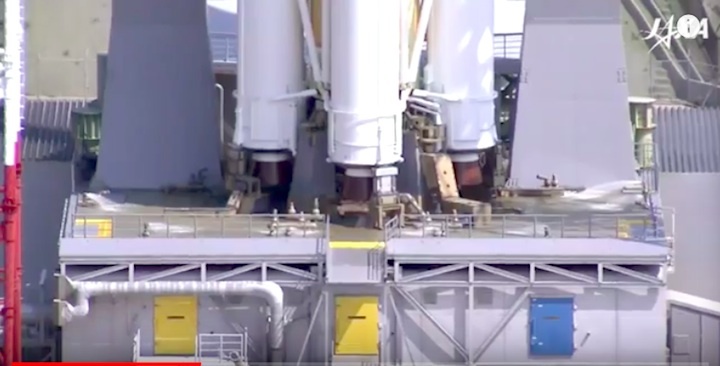
Rollout of the H-2A rocket to the launch pad at Tanegashima is scheduled around a half-day before liftoff. Technicians will connect the two-stage rocket to the pad’s electrical, telemetry and cryogenic propellant infrastructure before the final countdown.
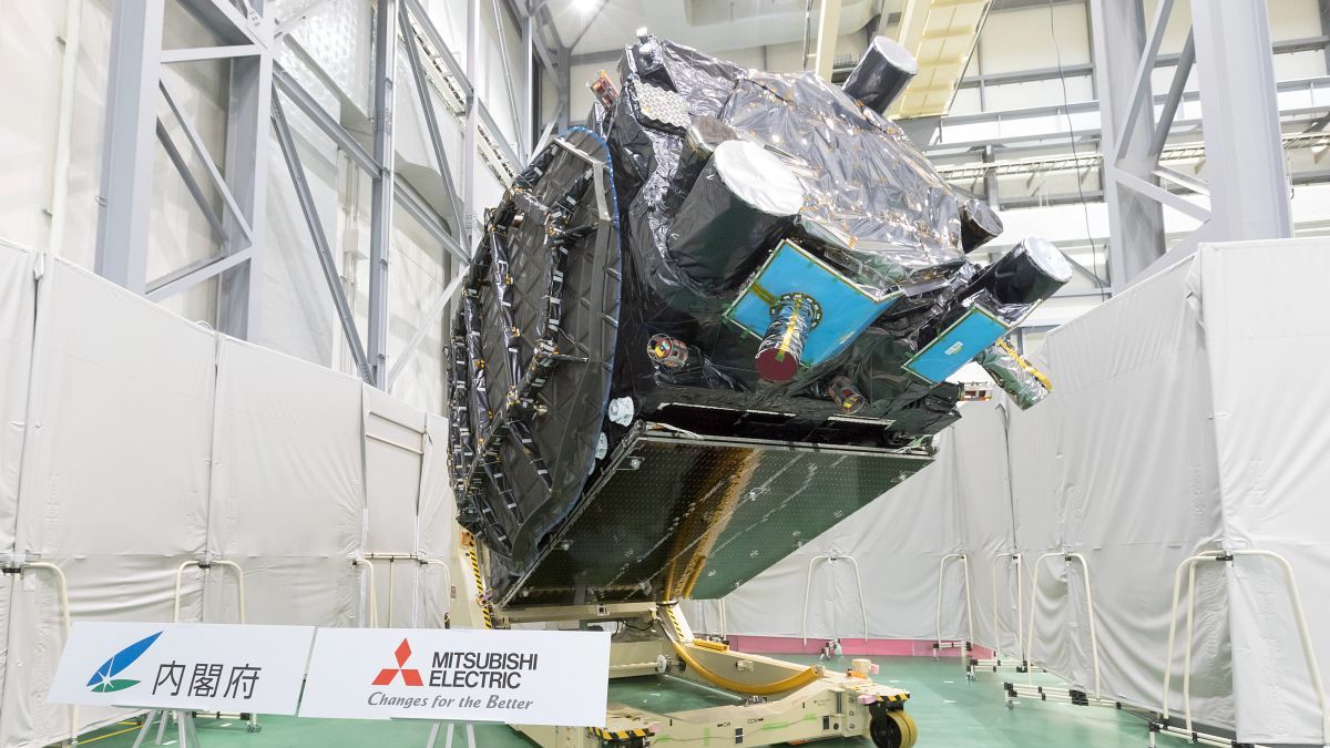
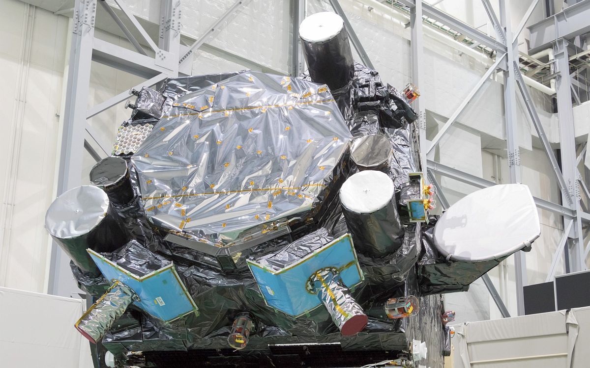
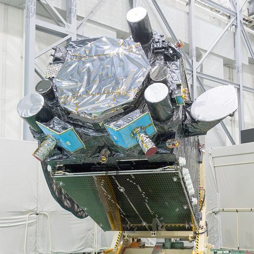
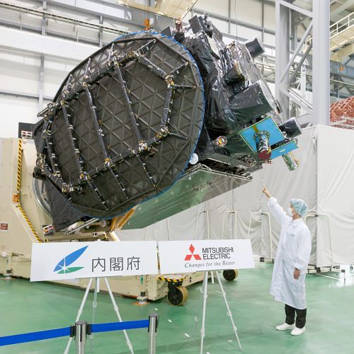
The payload aboard the H-2A rocket is Michibiki 3, the third member of a four-satellite network Japan is deploying to supplement GPS navigation coverage over its territory. The launch of the 4.4-ton (4-metric ton) Michibiki 3 satellite comes after the delivery of two similar navigation stations to orbit by H-2A rockets in September 2010 and in June.
Another Michibiki satellite is scheduled for launch on an H-2A rocket as soon as late this year.
The four-satellite fleet, entirely compatible with the GPS network, is being positioned in orbits loitering over Japan at altitudes more than 20,000 miles (33,000 kilometers) above Earth. The first two Michibiki spacecraft went into inclined geosynchronous-type orbits that oscillate between the northern and southern hemispheres, while Michibiki 3 will launch into a geostationary orbit that hovers over the equator.
GPS satellites, operated by the U.S. Air Force, circle Earth in lower orbits, meaning different spacecraft are visible in the sky at different times, acting as navigation beacons to triangulate the location of ground users.
Japan’s Quasi-Zenith Satellite System will add more beacons to the sky over the Asia-Pacific, resulting in more precise position estimates and improved service in urban areas and remote regions, where high-rise buildings and mountains can obstruct signals from GPS satellites low on the horizon.
Quelle: SN
---
Update: 12.08.2017
.
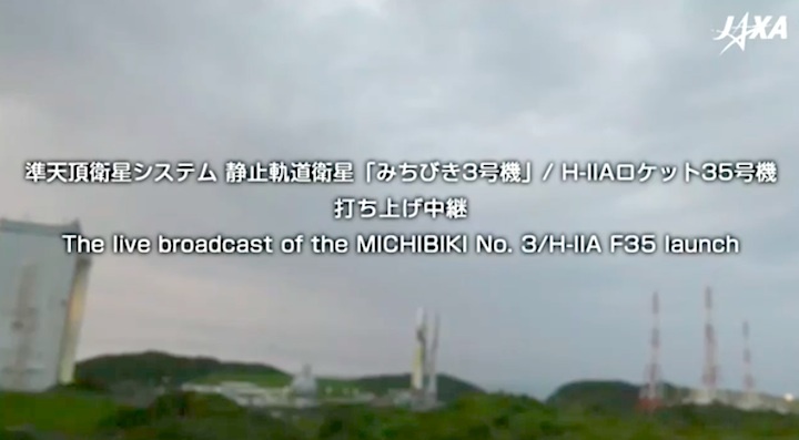
Today’s Launch Cancellation, H-IIA Launch Vehicle No. 35
Encapsulating MICHIBIKI No. 3
August 12, 2017 (JST)
Mitsubishi Heavy Industries, Ltd.
National Research and Development Agency
Japan Aerospace Exploration Agency (JAXA)
Mitsubishi Heavy Industries, Ltd. and JAXA have decided to cancel today's launch of H-IIA Launch Vehicle No. 35 (H-IIA F35) which encapsulates MICHIBIKI No. 3, Quasi-Zenith Satellite System; Geostationary Orbit Satellite.
H-IIA F35 launch was originally scheduled on August 12, 2017 but has been cancelled due to the necessity of additional examinations around rocket propulsion system.
The new launch date will be announced as soon as it is determined.
Quelle: JAXA
---
Update: 18.08.2017
.
Launch Schedule of H-IIA Launch Vehicle No. 35
Encapsulating MICHIBIKI No. 3
August 17, 2017 (JST)
Mitsubishi Heavy Industries, Ltd.
National Research and Development Agency
Japan Aerospace Exploration Agency (JAXA)
Mitsubishi Heavy Industries, Ltd. and JAXA hereby announce the launch schedule of H-IIA Launch Vehicle No. 35 (H-IIA F35) which encapsulates MICHIBIKI No. 3, (Quasi-Zenith Satellite System; geostationary orbit).
- Launch Date:
- August 19, 2017
- Launch Time:
- 2:29 p.m. (JST, Japan Standard Time) *
- Launch Window:
- 2:29 p.m. through 10:16 p.m. (JST)
- Reserved Launch Period:
- August 20 through September 30, 2017
- Quelle: JAXA
- * Launch time during the reserved launch period will vary.
---
Update: 19.08.2017
.
Japan launches navigation satellite after week-long delay

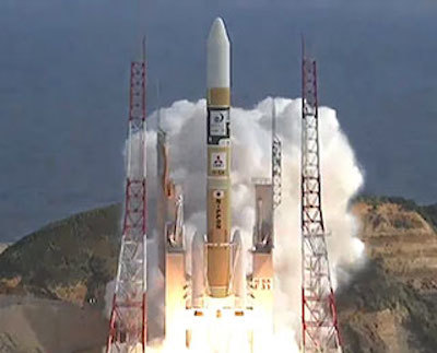
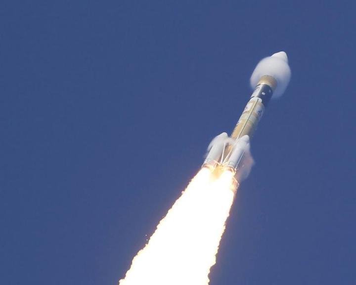
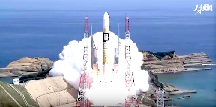
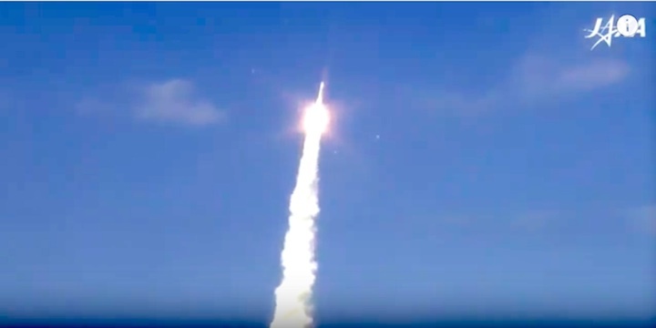
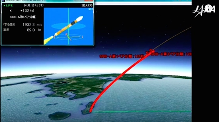
A Japanese H-2A rocket soared away from a launch pad on a rocky overlook on the Pacific Ocean on Saturday, hauling into orbit the country’s third Michibiki satellite to join a constellation of navigation aids to improve positioning services across the country.
The third satellite to join Japan’s Quasi-Zenith Satellite System took off at 0529 GMT (1:29 a.m. EDT; 2:29 p.m. Japan Standard Time) Saturday, eight days later than originally scheduled.
Weather pushed back the mission’s initial Aug. 11 launch date, and a leaky helium pressurization system scrubbed a launch attempt Aug. 12, forcing ground crews to roll the rocket back to its hangar for repairs.
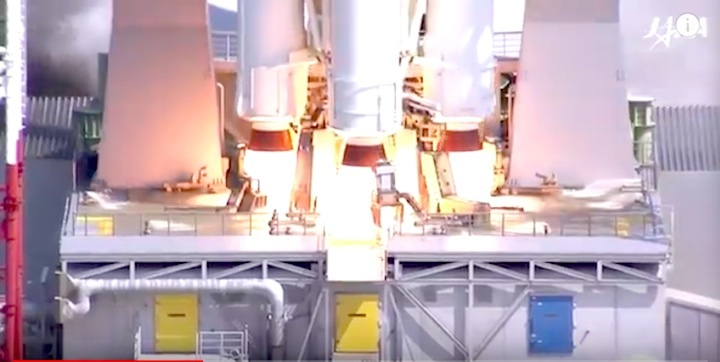
The 174-foot-tall (53-meter) H-2A launcher, powered by a hydrogen-fueled main engine and four strap-on solid rocket boosters, headed east from the Tanegashima Space Center, a spaceport built on an island at the southwestern edge of the country.
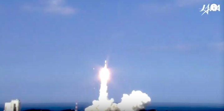
Climbing through a clear afternoon sky on 2.5 million pounds of thrust, the H-2A rocket quickly exceeded the speed of sound and left a twirling column of exhaust in its wake.
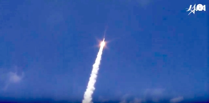
The four solid rocket boosters let go from the launcher around two minutes after liftoff, and the shroud covering the Michibiki 3 spacecraft jettisoned a couple of minutes later.
The H-2A’s cryogenic upper stage engine performed back-to-back burns to guide the Michibiki 3 satellite into an oval-shaped geostationary transfer orbit that will take the payload more than 22,000 miles (nearly 36,000 kilometers) above Earth at its highest point.
The Japanese launch team reported no issues during the flight, and they announced an on-target separation of the Michibiki 3 satellite around 29 minutes into the mission, prompting applause from engineers in the H-2A control center.

The satellite was expected to radio its status to a ground station soon after launch, and Michibiki 3’s on-board engine will conduct multiple firings over the next few days to circularize its orbit at geostationary altitude — around 22,300 miles (35,800 kilometers) over the equator.
Built by Mitsubishi Electric, the navigation craft joins two similar satellites launched on H-2A rockets in September 2010 and in June of this year. Those previous spacecraft circle Earth in orbits tilted at an angle to the equator, causing them to oscillate north and south, but remain always fixed over the Asia-Pacific region.
A fourth Japanese navigation satellite will launch later this year on another H-2A flight.
Michibiki means “guiding” or “showing the way” in Japanese.
The network will help ensure drivers, hikers and other users can constantly locate themselves. Skyscrapers in cities, such as Tokyo, and mountainous terrain can block signals from GPS satellites, which are located in orbits closer to Earth than the Michibiki satellites.
The GPS constellation, operated by the U.S. Air Force, flies 12,550 miles (20,200 kilometers) above Earth. Although there are at least 30 operational GPS spacecraft, only a small fraction of the fleet is visible from a single point on Earth at one time.
It takes four GPS satellites to calculate a precise position on Earth, but a Michibiki satellite broadcasting the same four L-band signals will give a receiver an estimate if there are not enough GPS satellites visible, or it can help produce a more accurate position calculation even with full GPS service.
“The Quasi-Zenith Satellite System is the first in the world to transmit sub-meter and centimeter level augmentation signals,” said Hiromichi Moriyama, executive director of the National Space Policy Secretariat in Japan’s Cabinet Office. “It will be in charge of communications linking evacuation shelters and emergency response headquarters in times of disaster.”
Officials say urban planning, agriculture, disaster response and national security will be supported by the four-satellite navigation fleet.
Japan is not the country developing a regional navigation fleet to improve GPS signals over its territory.
India has launched seven navigation satellites — with an eighth due for liftoff later this month — to work in concert with the GPS satellites across the subcontinent.
Meanwhile, European nations and China are developing and deploying separate navigation networks to provide global services independent of the GPS constellation. Russia already has its own satellite navigation system with near-global coverage.
Quelle: SN
+++
The Michibiki No. 3 satellite, the third of Japan's new quasi-zenith satellites, is launched on an H-2A rocket from the Tanegashima Space Center in Kagoshima Prefecture on Saturday. Photo: KYODO
-
Japan launches 3rd satellite of new GPS constellation
TANEGASHIMA
Japan successfully launched the third of its new quasi-zenith satellites Saturday, one of a constellation being put into orbit to improve the accuracy of available global positioning data.
The launch, overseen by the Japan Aerospace Exploration Agency, came a week later than scheduled after the rocket that was to carry the satellite developed technical issues, causing the originally planned launch to be aborted.
The new satellite system will improve positioning data for a range of applications, including for smartphones and vehicle navigation systems, and will better emergency service personnel's ability to locate people in disasters.
JAXA and Mitsubishi Heavy Industries Ltd launched the Michibiki No. 3 satellite, which is the third in a planned constellation of four GPS satellites, on an H-2A rocket from the Tanegashima Space Center in Kagoshima Prefecture, southwestern Japan.
The planned launch on Aug. 12 was postponed due to concerns over a possible helium leak. The gas is used to move valves in the first-stage rocket's engine, according to the constructor Mitsubishi Heavy.
The problem was resolved through the replacement of a related component, the company said.
The newly launched satellite will work with the first and second Michibiki satellites and complement the existing U.S. satellite network that Japan and many other countries depend on.
Once in its final position, the third satellite will sit in a geostationary orbit with the government scheduled to launch the last satellite in October.
Quelle: JapanToday
+++

Quelle: JAXA