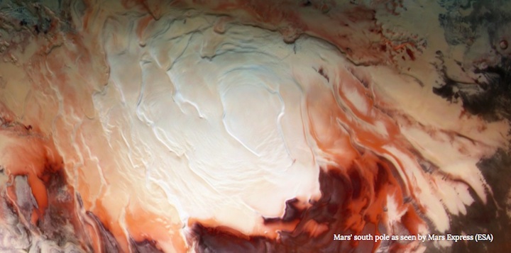
Mars' south pole as seen by Mars Express (ESA)
.

Mars' south pole as seen by Mars Express (ESA)
Like Earth, Mars possesses north and south polar ice caps. Unlike Earth, however, the Martian versions not only contain water ice, there's there's a thick layer of carbon dioxide ice acting as a blanket. Frozen CO2, also known as "dry ice", is known to wax and wane in thickness depending on the Martian season. Though we have a pretty good understanding of the ice caps' surface features and how they interact with Mars' predominately carbon dioxide atmosphere, what lies beneath the most ancient layers of ice has been a mystery.
That was, however, until NASA's Mars Reconnaissance Orbiter (MRO) arrived in orbit in 2006.
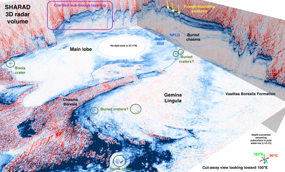
On board the veteran Mars satellite is an instrument called SHARAD — short for "Shallow Radar" — that has been bouncing radio waves off the planet's surface for over a decade. Individual observations by the instrument, for 2,000 orbits over the poles, have revealed some interesting icy findings over the years, but now, with a huge archive of data, planetary scientists have been able to build a 3-D view of the ice covering the north and south poles in the hope of better understanding the structures we cannot see inside the ice and how the ice changes over time. With this information they hope to build a picture of climatic changes over millions of years.
RELATED: Buried Mars Glaciers are Brimming With Water
"We have applied industry-developed techniques in a very novel fashion to a Martian dataset, producing 3-D volumes that are each over 600 times larger than any terrestrial or planetary dataset of this kind," said senior scientist Nathaniel E. Putzig, of the Planetary Science Institute, in a statement.

Hidden within these data are previously unknown features, including possible impact craters and vast layers of ice that likely highlight eras of climate changes as the Red Planet's tilt precessed. There also appears to be a larger than expected volume of frozen carbon dioxide locked in the south pole's cap.
"It is gratifying to see so plainly in the SHARAD volumes structures that took years of effort to characterize with the single-orbit profiles," Putzig added. "I'm excited about what we will learn from newly revealed features such as the probable impact craters."
"While 3-D seismic and ground penetrating radar have become routine tools in terrestrial geophysical exploration, our 3-D treatment of the SHARAD data is a first in planetary geophysical exploration," said Frederick J. Foss of Freestyle Analytical & Quantitative Services. "The 3-D imaged SHARAD volumes significantly enhance the detectability and interpretability of features within the Martian polar ice caps."
These 3-D maps of Martian ice cap interiors will no doubt aid future discoveries of what lies beneath, in turn developing our understanding of how Mars' atmosphere evolved from an apparently habitable state into the harsh, dry climate we find today.
RELATED: The Air On Mars Has A Mysterious Glow, Here's Why