.
15.05.2015
.
COMETWATCH 3 MAY
This image of Comet 67P/Churyumov-Gerasimenko was taken by Rosetta's NAVCAM on 3 May at a distance of 135 km from the comet centre. It is a single frame image, with a resolution of 11.5 m/pixel, and measures 11.7 km across. The intensities and contrast have been tweaked to emphasise the ever increasing activity of the comet.
.
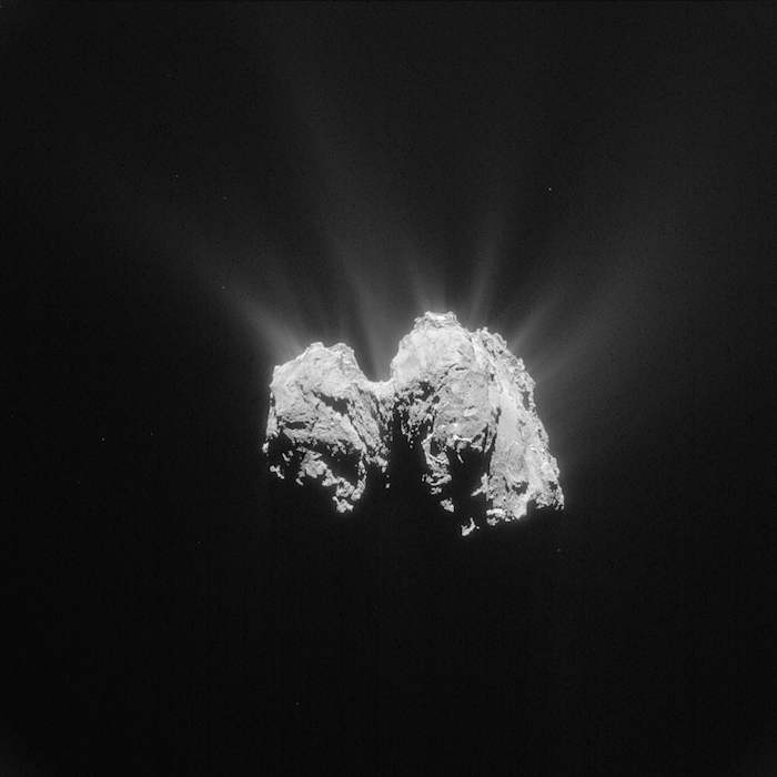
Single frame, processed NAVCAM image of Comet 67P/C-G taken on 3 May 2015 from a distance of 135 km to the comet centre. Credits: ESA/Rosetta/NAVCAM – CC BY-SA IGO 3.0
In this “side-on” view of 67P/C-G, with the small lobe to the left and the large lobe to the right, the equator of the comet runs almost horizontally. The comet equator also passes through the famous Cheops boulder on the Imhotep region, on the underside of the large lobe (visible on the right-hand side of this image) and wraps around both lobes. In this orientation, the rotation axis of the comet runs roughly in the vertical direction, through the comet's “neck”.
On the small lobe, we see parts of the Bastet region, along with neighbouring regions that were in darkness during earlier parts of Rosetta’s time at 67P/C-G. As the comet approaches the Sun, the “seasons” are changing, so these and other parts of the comet are emerging into sunlight.
Hints of Hathor and Hapi are visible in the distance on the neck. On the large lobe, the slab-like feature comprising parts of Aker and Khepry, featured prominently in CometWatch 26 April and 28 April, takes up the upper part of the image.
In the foreground, the landscape shows some particularly bright spots set against darker terrain, although at this relatively large distance it is not possible to see enough detail and help interpret what they are. To their right, Khepry ends in cliffs that border the curved, smooth region within Imhotep.
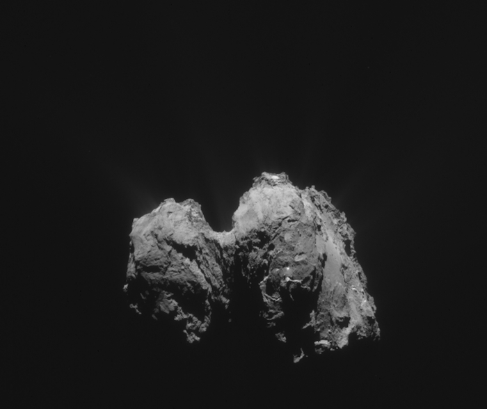
The original 1024 x 1024 image is provided below:
.
-
COMETWATCH CLOSEUP: HATHOR, FROM SETH
Today’s CometWatch post delves back in time to October last year, when Rosetta was orbiting the comet at a distance of just 10 km.
.
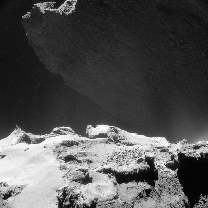
Single frame, processed NAVCAM image of Comet 67P/C-G taken on 23 October from a distance of 9.8 km to the comet centre. Credits: ESA/Rosetta/NAVCAM – CC BY-SA IGO 3.0
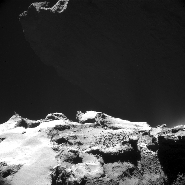
This single frame NAVCAM image was captured on 23 October, when the distance to the centre of the comet was 9.76 km. The average image scale is therefore about 83 cm/pixel and the image measures 850 m across (note that because of the viewing geometry, foreground regions are up to 2 km closer to the viewer, and therefore have an approximate scale of 67 cm/pixel). For reference, an image in a similar orientation was captured on 26 November.
The scene highlights the hauntingly beautiful backlit cliffs of Hathor, the summit just catching the sunlight at top left. The image has been lightly processed to better bring out the details of this region, and also reveals the diffuse glow of the comet’s activity. Indeed, subtly brighter patches can be traced against the darker background, in particular at the right of the frame at the transition from the foreground terrain to Hathor in the background.
If you were standing at the base of Hathor in the Hapi region – out of view in this image – these near-vertical cliffs would tower some 900m above you. As can be seen here, Hathor is characterised by sets of linear features that extend for much of the height of the cliff. In places, lineaments and terraces also cut across roughly perpendicular to them. As described by Thomas et al in an OSIRIS science paper earlier this year, Hathor may be an eroded surface and as such is showing us the internal structure of the comet’s head.
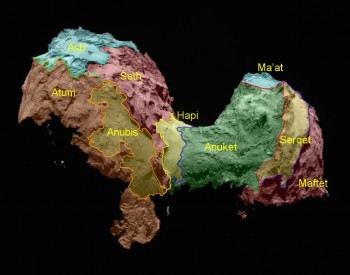
Comet_regional_maps_side viewIn the foreground, contrasting terrains within the Seth region on the comet’s large lobe are observed. While the left-hand portion exhibits a smooth surface, the right-hand portion shows outcrops of more rugged terrain and numerous boulders. The exposed surfaces also display linear structures in various orientations.
The portion of Seth seen here is at an intersection of several regions: at the far right of the frame lies the boundary between Seth and Anubis, while just out of view beyond the bottom of the frame are Ash and Atum.
Today's image is one of many that will be included in the NAVCAM data release scheduled for the end of this month. This will see the release of the entire collection of images taken from the 10 km orbit last year, along with images taken around the events of comet landing. You can browse all NAVCAM images released so far in the Archive Image Browser.
The original 1024 x 1024 pixel image is provided below:
.
.
MAJOR RELEASE OF NAVCAM IMAGES: 800 TO 30 KM
Today marks a major release from the Rosetta downlink and archive groups of detailed images of Comet 67P/Churyumov-Gerasimenko taken by Rosetta’s Navigation Camera, or NAVCAM. The 1297 images, which can be accessed via the Archive Image Browser, were acquired between 1 August and 23 September. This corresponds to the final approach of Rosetta to the comet, its arrival at a distance of 100 km on 6 August and its transition to a global mapping phase at 30 km (click here for an animation describing the spacecraft’s trajectories at this time). It was during these two months that mapping and characterisation of the comet’s surface began, and Philae’s candidate landing sites were proposed, analysed and finally selected.
Shown above is a taste of the images you can find in this latest release. The images are single frame 1024 x 1024 pixel images and cover the period 1-22 August. In late August the imaging scheme changed from single frame images to 2 x 2 rasters, once the spacecraft’s proximity to the comet meant that the nucleus overfilled the NAVCAM field of view. This transition is seen in the latest data release, and below is a montage of just a few incredible single-frame images you can find in the Browser from this period:
.
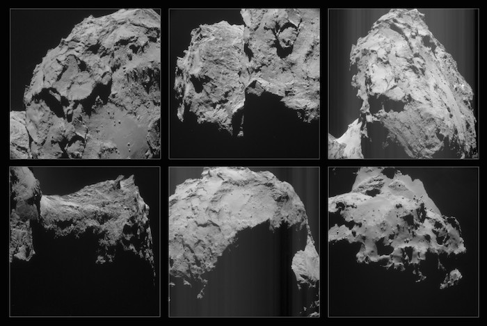
Comet close-ups from the 30 km mapping period are now available in the NAVCAM Archive Image Browser. Click to enter! Credits: ESA/Rosetta/NAVCAM – CC BY-SA IGO 3.0
.
Coming next month
At the end of May even more detailed images will be released in the NAVCAM image browser and in the Planetary Science Archive. This release will again cover two months – this time October and November – and therefore cover the transition from the 30 km mapping phase down to just 10 km from the comet’s surface. In addition, the image release will cover the exciting period leading up to and during the landing, including the days in which Philae was operating on the surface of Comet 67P/C-G.
In the meantime, we look forward to seeing what you do with the August-September image set; if you make movies, mosaics, shape models and so on, we’d be delighted if you share links in the comments box below.
Quelle: ESA
.
Update: 18.05.2015
.
OSIRIS SPOTS BOULDERS IN BALANCING ACT
.
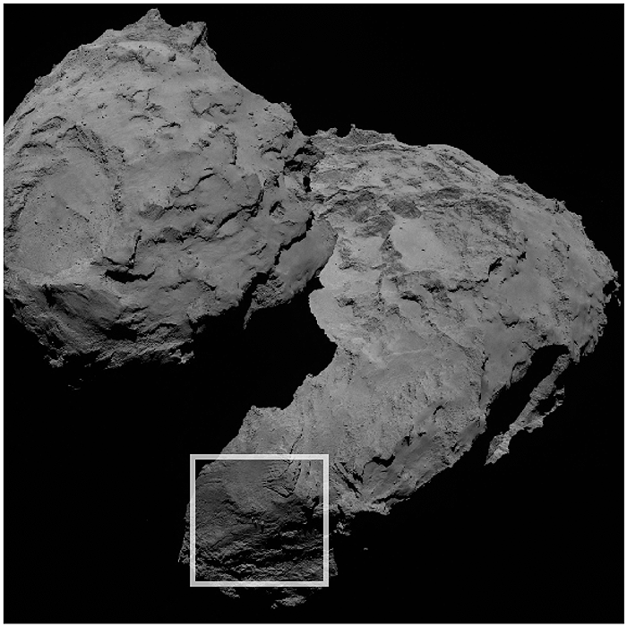
The three curious boulders are found in the Aker region of Comet 67P/C-G, on the comet’s large lobe (in the centre of the region outlined). Credits: ESA/Rosetta/MPS for OSIRIS Team MPS/UPD/LAM/IAA/SSO/INTA/UPM/DASP/IDA
.
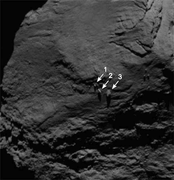
Scientists from Rosetta’s OSIRIS team have discovered an unusual formation of boulders in the Aker region on the large lobe of Comet 67P/Churyumov-Gerasimenko. At first glance they are reminiscent of so-called "balancing rocks" on Earth.
Of the three boulders, the largest (labelled with a ‘3’) has a diameter of approximately 30 metres. In an image taken on 16 September 2014 (below), it stands out as having only a very small contact area with the comet’s surface. It also seems to be perched on the rim of a small depression.
“We had noticed this formation already in earlier images, however, at first the boulders did not seem to differ substantially from others we had seen,” says OSIRIS scientist Sebastien Besse from ESA, who first noticed the formation.
.
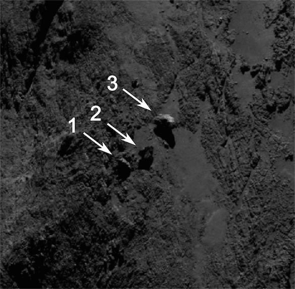
Image of the boulders taken by OSIRIS on 16 September 2014 from a distance of 29 km. The image scale at this distance is around 0.5 m/pixel and the image measures about 292 m across. Boulder 3 measures approximately 30 m across.
Credits: ESA/Rosetta/MPS for OSIRIS Team MPS/UPD/LAM/IAA/SSO/INTA/UPM/DASP/IDA
.
Similar geological formations are also found on Earth. Balancing rocks touch the underlying ground with only a tiny fraction of their surface and often look as if they may tilt or topple over any moment. Some can actually be rocked back and forth and are then referred to as “rocking stones.” Many of these boulders are so-called “erratics” that travelled to their current location within glaciers. In other cases, wind and water eroded softer material in the local bedrock, leaving only the more resistant material behind.
“How this apparent balancing rock on Comet 67P/C-G was formed is not clear at this point,” says OSIRIS Principal Investigator Holger Sierks from the Max Planck Institute for Solar System Research (MPS) in Germany.
Image of the boulders taken by OSIRIS on 16 August 2014 from a distance of 105 kilometres. The image has a resolution of about 2 m/pixel. Boulder 3 measures approximately 30 m across.
.
Credits: ESA/Rosetta/MPS for OSIRIS Team MPS/UPD/LAM/IAA/SSO/INTA/UPM/DASP/IDA
One possibility is that transport processes related to cometary activity played a role, causing such boulders
.
to move from their original site and reach a new location.
Scattered boulders are seen in many places on the comet’s surface, sometimes in otherwise relatively smooth regions. One of the largest – Cheops – measures approximately 45 metres in size and sits in the middle of the smooth part of Imhotep on the underside of the comet’s large lobe. In other regions, it is more common to see rubble piles comprising hundreds of boulders.
“Interpreting images of the comet’s surface can be tricky,” adds Sierks. Depending on the viewing angle, illumination, and spatial resolution, very different and sometimes even misleading impressions are created.
.
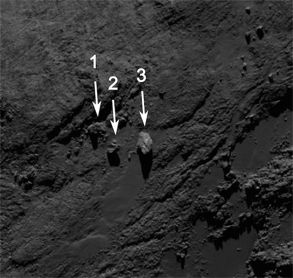
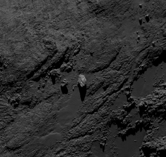
Image of the boulders taken by OSIRIS on 19 September 2014 from a distance of about of 29 km. The image scale at this distance is about 0.5m/pixel and the image measures about 285 m across. Boulder 3 measures approximately 30 m across.
Credits: ESA/Rosetta/MPS for OSIRIS Team MPS/UPD/LAM/IAA/SSO/INTA/UPM/DASP/IDA
For example, in an image taken on 16 August 2014 from a distance of 105 kilometres, one of the smaller boulders
.
[labelled ‘2’] in the balancing rock formation appears to be protruding like a pillar. However, this impression is not confirmed in an image of the same region taken on 19 September 2014 from the much closer distance of 29 km. Similarly, thanks to the change in viewing geometry between images, the appearance of the large boulder also changes quite dramatically, even between the 16 and 19 September images.
Further imaging of these formations should help provide more insight into their true nature and maybe even their origin.
.
Quelle: ESA
-
Update: 19.05.2015
.
COMETWATCH 12 MAY
Today’s CometWatch entry shows a curious view of 67P/Churyumov-Gerasimenko that on first impression (see original image right) gives the illusion that the comet's head is missing. The image was taken by Rosetta’s NAVCAM on 12 May from a distance of 166 km from the centre of the comet. The scale is 14 m/pixel and the 1024 x 1024 pixel frame measures 14.5 km across.
But bringing up the contrast, as we have in the image below, shows that the head is simply hidden in the shadow of the comet’s large lobe, its faint outline silhouetted against the brighter background activity.
The processing also better reveals the vertical shadow cast by the large lobe at its left edge in this orientation, and the beautiful interplay between shadows and activity in this portion of the image.
.
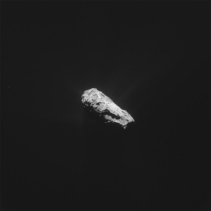
Original NAVCAM frame taken on 12 May 2015. Credits: ESA/Rosetta/NavCam – CC BY-SA IGO 3.0
.
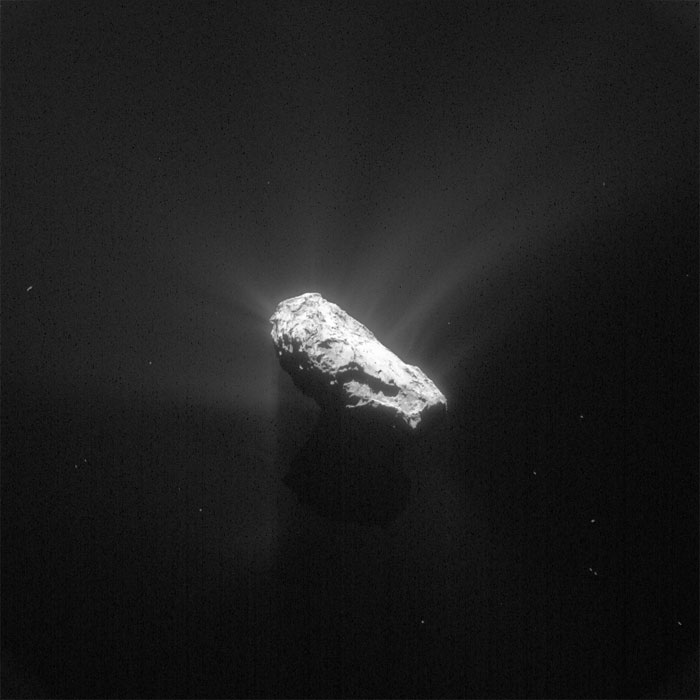
This processed version of the 12 May 2015 image reveals the comet's small lobe in silhouette, along with details of the comet activity. Credits: ESA/Rosetta/NavCam – CC BY-SA IGO 3.0
.
Meanwhile on the surface of the comet, the elongate depression of Aten dominates the view, with the quasi-circular shaped feature immediately to the left part of Ash. Smooth Imhotep extends into the distance in the centre, with distinct jets of activity dancing along the horizon.
Quelle: ESA
.
Update: 26.05.2015
.
COMETWATCH CLOSEUP: LOOMING OVER ATEN
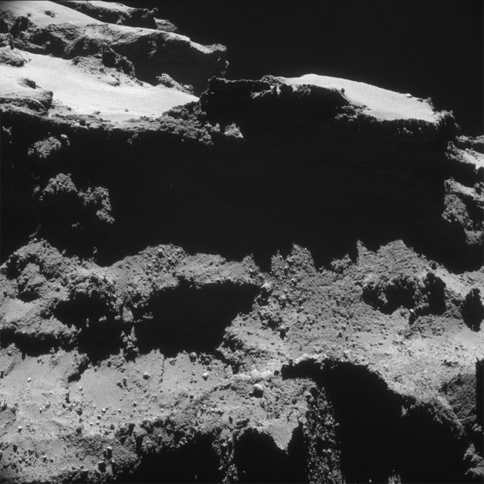
With today's CometWatch we take another trip back in time, to 27 October 2014 when Rosetta was in a bound orbit around Comet 67P/Churyumov-Gerasimenko. At the time this single frame NAVCAM image was taken, the spacecraft was only 9.8 km from the comet centre. Due to the viewing geometry, most of the scene is in fact closer to the camera in this view. The image scale is about 75 cm/pixel, and the image spans 770 m across.
.
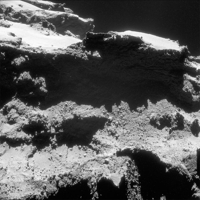
Single frame NAVCAM image of Comet 67P/C-G taken on 27 October 2014 from a distance of 9.8 km from the comet centre. The image has been lightly processed to reveal details on the comet's surface. Credits: ESA/Rosetta/NAVCAM – CC BY-SA IGO 3.0
.
This view highlights the dramatic boundary between two neighbouring but morphologically different regions, Babi and Aten, which are on the comet's large lobe. In the upper part of the image, the two seemingly smooth and bright areas covered in brittle material belong to the Babi region, which overshadows part of the narrow and elongated depression of Aten.
.
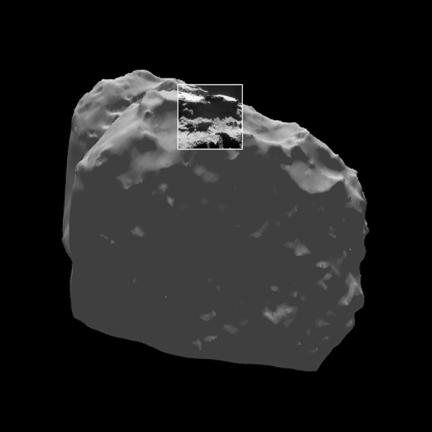
Today's CometWatch entry in context. Credit: ESA
.
The rougher terrains of Aten are visible just below the steep cliff that separates it from its neighbour. In contrast to Babi and the neighbouring Ash region – small portions of which are visible in the lower part of the image as well as towards the top right – Aten is not coated in smooth dust but appears to host many boulders.
As suggested in a paper by Nicolas Thomas and colleagues, the depression of Aten might be the result of one or more episodes of major mass loss in the comet's history. The volume of the depression amounts to about 0.12 km3, which is equivalent to almost 50 times the volume of the Great Pyramid of Giza.
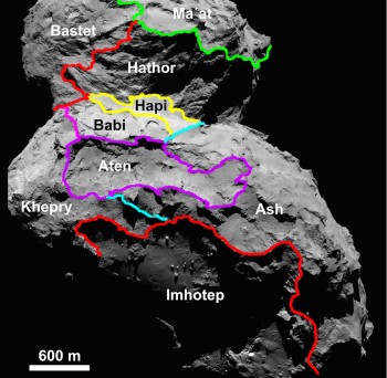
Regional map of Comet 67P/C-G. Credits: ESA/Rosetta/MPS for OSIRIS Team MPS/UPD/LAM/IAA/SSO/INTA/UPM/DASP/IDA
.
The regional map of 67P/C-G shows the shape of the Aten depression, wedged between the neighbouring regions of Babi, Ash and Khepry. The complete depression can be clearly seen in the images from some of our previous blog posts: CometWatch 28 February and 12 May.
Lurking in the upper left corner of today's CometWatch image are parts of the comet’s small lobe, including the Ma'at region and hints of Hathor's cliffs.
Today’s image is one of many NAVCAM views that will be released at the end of this month in the Archive Image Browser. That release will include the entire collection of NAVCAM images taken from the 10 km orbit last year, along with images taken in the period leading up to and just after comet landing.
The original image is provided below:
.
Quelle: ESA
.
Update: 29.05.2015
.
NAVCAM IMAGE BONANZA: CLOSE ORBITS AND COMET LANDING
Today perhaps the most anticipated set of NAVCAM images of Comet 67P/Churyumov-Gerasimenko have been released by the Rosetta Downlink & Archive Team via the Archive Image Browser and ESA’s Planetary Sciences Archive.
The 1776 images cover the period between 23 September and 21 November 2014, corresponding to Rosetta’s close study of the comet down to distances of just 10 km from the comet centre – 8 km from the surface – and the images taken during and immediately following the landing of Philae on the comet.
An animation illustrating Rosetta’s trajectory around this period can be found here, providing context for the range of distances covered by the images in this release. Because of the spacecraft’s proximity to the comet during much of this period, the nucleus overfilled the NAVCAM field of view, and therefore the majority of images are in 2 x 2 rasters to cover the whole comet.
The single frames can certainly be admired individually (see the example above), but they can also be stitched together to create stunning mosaics, as we featured in many of our CometWatch releases from that period. We’re always impressed with the scenes that the image processing fans among you create, and we look forward to seeing what you generate from this release.
In addition to images from the close orbit phase, there are some great gems in this release, such as the NAVCAM’s view of lander Philae shortly after separating from Rosetta on 12 November (below). Although not as detailed as the images captured by Rosetta’s scientific camera OSIRIS, Philae’s body and its three legs can still be made out in a number of NAVCAM images as the lander falls towards the comet.
.
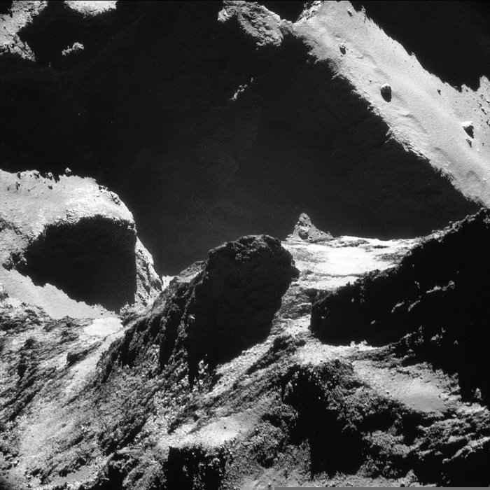
This image was captured on 19 October 2014 and looks across the neck from the comet’s small lobe in the foreground to the large lobe in the background. Parts of the Anuket and Serqet regions are visible in the foreground and a portion of Hapi is present at centre-left, with the dramatic cliff edge in Seth in the background. There are significant variations in the distances between Rosetta and different parts of the comet in the foreground and background, but the average scale in the image is approximately 77 cm/pixel, yielding a frame width of 785m. The image has been contrast enhanced. Credits: ESA/Rosetta/NAVCAM – CC BY-SA IGO 3.0.
.
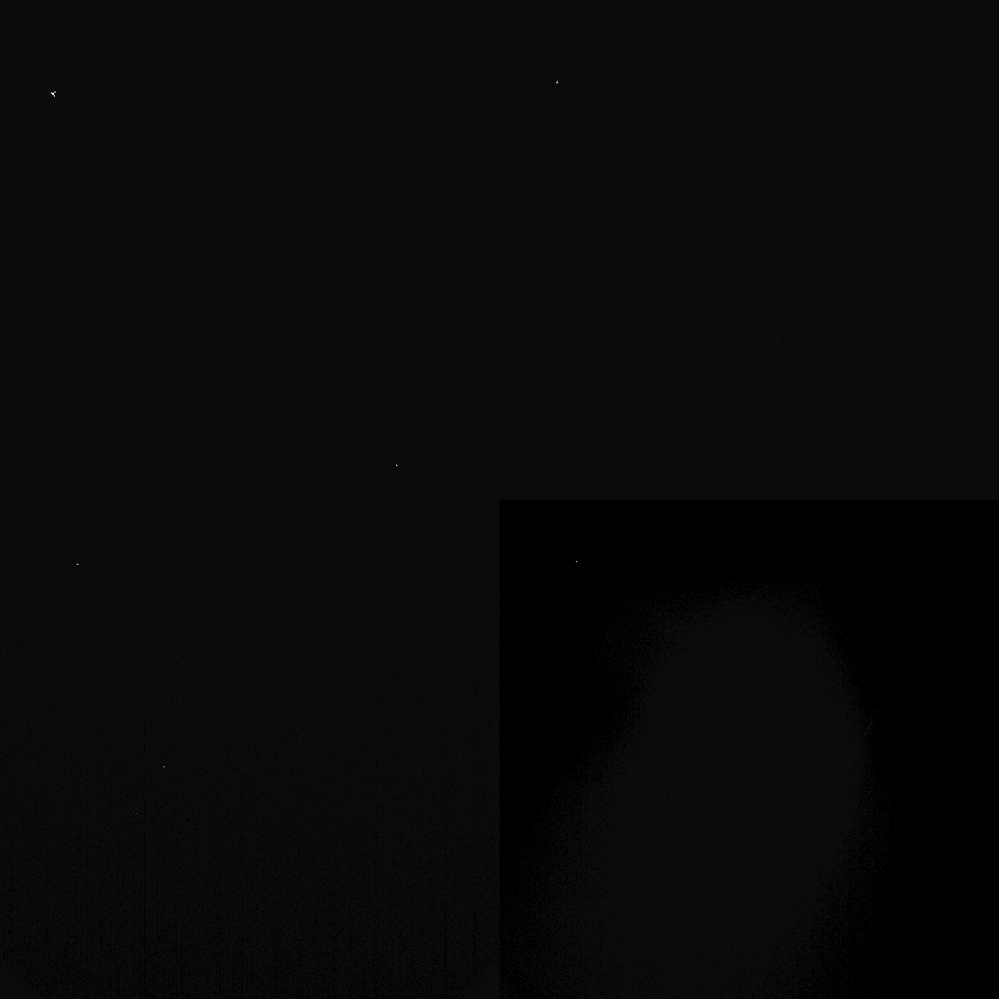
Philae, seen in Rosetta’s NAVCAM at 10:30, 11:30, 13:30 and 14:30 UT (on-board spacecraft time). The lander is in the top left of the field of view. Philae separated from Rosetta at 08:35 UT and made its first touchdown at 15:34 UT. Credits: ESA/Rosetta/NAVCAM – CC BY-SA IGO 3.0.
.
The NAVCAM also captured some wonderful views of Hatmehit, the large, 1 km-wide depression on the comet’s small lobe, around the time of the landing.
The first image in the sequence below includes the first touchdown point, Agilkia, at the bottom left of the frame. Philae subsequently took flight across the surface of the comet and came to rest elsewhere – a site now known as Abydos – nearly two hours later.
.
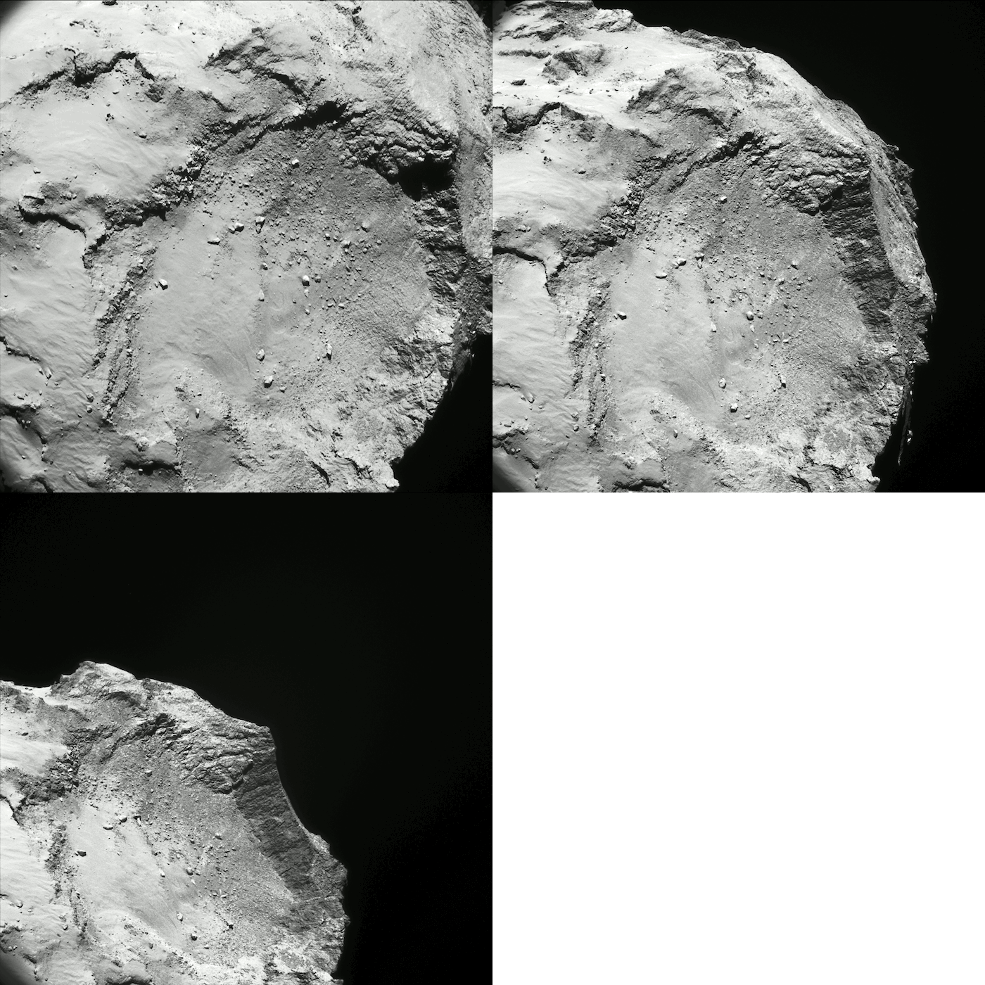
The Hatmehit region on the small lobe of Comet 67P/Churyumov-Gerasimenko as seen by NAVCAM around the time of Philae’s first touchdown, flight over the comet, and final landing at 15:35, 16:35 and 17:35 UT (on-board spacecraft time) on 12 November 2014. The distance between the spacecraft and comet centre over this period was between 17.4 and 17.8 km; apparent changes in the image scale are due to projection effects as the comet rotated underneath the spacecraft. The first landing site can be found in the first image, in the bottom left corner of the frame. The image has been contrast enhanced but vignetting has not been removed. Credits: ESA/Rosetta/NavCam – CC BY-SA IGO 3.0
Quelle: ESA
5036 Views
