
23.12.2025
NASA loses contact with MAVEN, Perseverance continues roving around Jezero
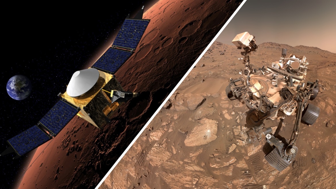
In early December, NASA lost contact with its MAVEN spacecraft, which has been orbiting Mars since 2014. MAVEN was supposed to reestablish communications with NASA’s Deep Space Network on Dec. 6 after emerging from behind Mars during a routine blackout period when the spacecraft’s orbit takes it behind the red planet, blocking all communications to and from Earth. Teams have worked to regain contact, but all attempts have been unsuccessful.
Meanwhile, on the Martian surface, NASA’s Perseverance rover continues to drive toward its next target in Jezero Crater, searching for signs of ancient microbial life in various rocks and minerals along the way. The rover’s team is using the time to analyze the condition of Perseverance and its components, informing new estimates of how long the rover’s mission might last.
NASA attempts to reestablish communications with MAVEN
On Saturday, Dec. 6, NASA scientists lost contact with the agency’s Mars Atmosphere and Volatile Evolution (MAVEN) spacecraft, which is located in orbit around Mars. MAVEN launched to Mars in November 2013 and entered orbit in September 2014, where it has been studying the Martian atmosphere and its disappearance due to solar wind. MAVEN’s research into Mars’ atmospheric loss has also provided insight into the evolution of the red planet’s climate.

MAVEN launches to Mars atop an Atlas V. (Credit: NASA/Bill Ingalls)
MAVEN’s team communicates with the spacecraft through NASA’s Deep Space Network (DSN)– a worldwide network of large radio antennas that send and receive signals from NASA’s fleet of spacecraft throughout the solar system. Normally, when MAVEN’s orbit takes it behind Mars, teams briefly lose contact with the spacecraft until it emerges and reestablishes contact with the DSN. However, on Dec. 6, the DSN received no signals from MAVEN after it orbited behind Mars. Interestingly, before moving behind Mars, data sent to Earth from MAVEN on Dec. 4 showed that all its subsystems and electronics were working as expected.
In a Dec. 15 statement, NASA explained that while all attempts to regain contact with MAVEN have been unsuccessful, mission teams were able to retrieve a small amount of tracking data from Dec. 6. The tracking data revealed that MAVEN was in an unexpected spin when it emerged from behind Mars, and the frequency of the signal suggests that the spacecraft’s orbit may have been altered. NASA and MAVEN teams will continue to attempt to reestablish contact with the spacecraft over the next few weeks while analyzing tracking data for more clues about what happened when MAVEN was behind Mars.
MAVEN’s loss of contact has additional impacts on the operation of other missions at Mars, most notably surface spacecraft like Perseverance and Curiosity. MAVEN works with NASA’s Mars Reconnaissance Orbiter (MRO), Mars Odyssey, and the European Space Agency’s (ESA) ExoMars Trace Gas Orbiter to relay communications to and from the rovers. With MAVEN out of service as a communications relay, NASA is working with MRO, Mars Odyssey, and ESA teams to ensure communications between Earth and the rovers can continue for the next two weeks. Perseverance and Curiosity teams are also adjusting their mission planning to account for the new communications setup without MAVEN.
Perseverance continues its trek around Jezero
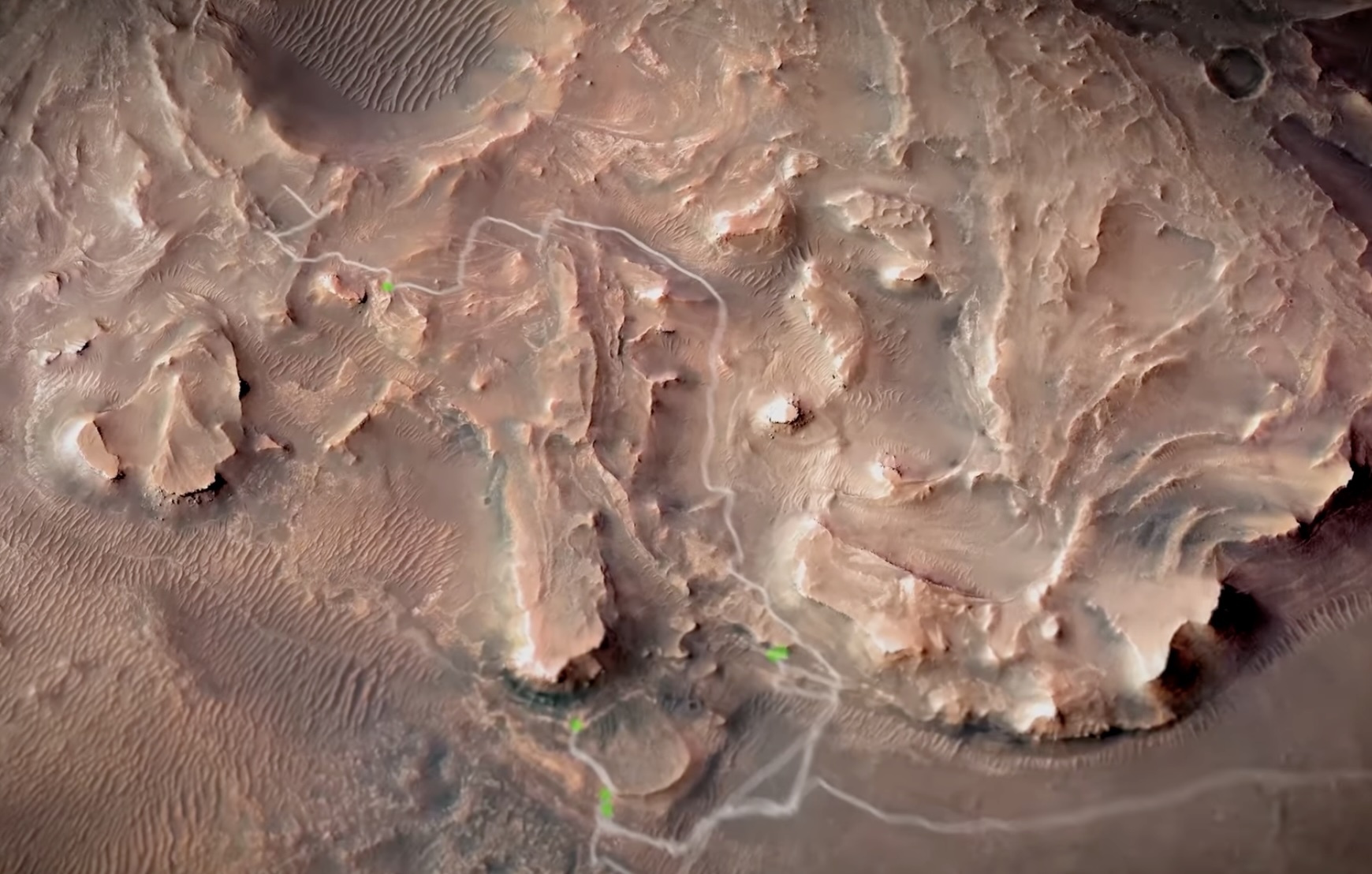
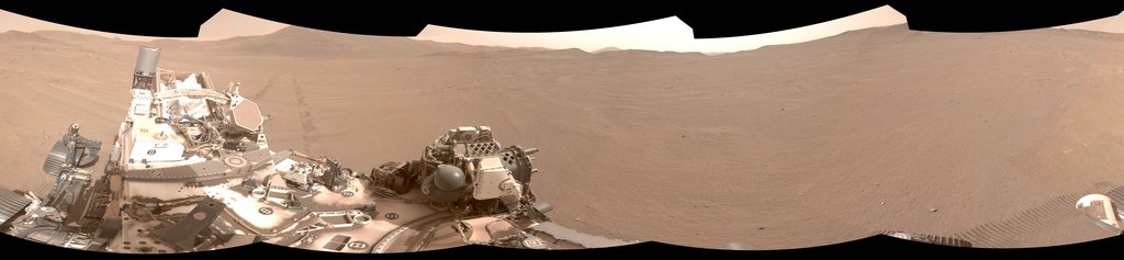
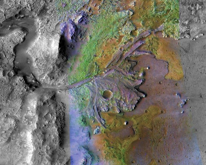
Feb. 18, 2026, will mark the fifth anniversary of Perseverance’s landing on Mars. In the five years since its landing, the rover has traveled an approximately 40 km path through Jezero Crater, collecting surface samples along the way and searching for signs of ancient microbial life. As 2026 draws near, the rover is now driving to a new region of Jezero named “Lac de Charmes.” There, it will search for new surface sample collection locations and targets.
As Perseverance makes its way to Lac de Charmes, the rover’s team at NASA’s Jet Propulsion Laboratory (JPL) is evaluating the condition of its subsystems and components and how they’ve withstood 40 km of near-daily driving. JPL teams are testing duplicate parts on Earth to better understand their durability; one such test this summer confirmed that the rotary actuators in Perseverance’s wheels are expected to perform as expected for at least another 60 km of driving. JPL teams are currently performing similar tests on the rover’s braking system.
After continuous testing over two years, Perseverance teams believe the rover will continue to operate in its current condition until at least 2031. However, Perseverance is built much like its sister rover, Curiosity, which landed on Mars in 2012, has driven 36 km up and around Mount Sharp — a 5.5 km-tall mountain at the center of Gale Crater. Curiosity’s continued operation is a good sign for the longevity of Perseverance‘s mission.

Panorama image of Lac de Charmes taken by Perseverance. (Credit: NASA/JPL-Caltech/ASU/MSSS)
“These tests show the rover is in excellent shape. All the systems are fully capable of supporting a very long-term mission to extensively explore this fascinating region of Mars,” said Perseverance‘s deputy project manager Steve Lee of JPL.
While Curiosity has been on Mars for nine years longer than Perseverance, Perseverance has already driven farther than Curiosity. This is largely due to Perseverance‘s slightly faster driving speed and autonomous driving capabilities. While driving across the Martian surface, Perseverance uses an autonomous planning tool called Enhanced Autonomous Navigation (ENav), which scans a 15 m region ahead of the rover for potential hazards and obstacles. If an obstacle is identified, ENav immediately reroutes the rover around it, providing Perseverance’s six wheels with instructions on how to navigate around the hazard.
“More than 90% of Perseverance’s journey has relied on autonomous driving, making it possible to quickly collect a diverse range of samples,” said Hiro Ono, an autonomy researcher at JPL.
Perseverance‘s team at JPL plans each day of the rover’s mission and the activities it expects the rover to perform. However, after these daily plans are sent to the rover, it completes the drive entirely on its own. ENav enables Perseverance to complete this drive safely and respond to unexpected surface hazards such as sand pits, rocks, and ledges. As part of its algorithm, ENav evaluates each of the rover’s six wheels against terrain elevation, determines the trade-offs of different routes around obstacles, and ensures that the rover stays out of “keep out” areas drawn by JPL teams before a drive.
“As humans go to the Moon and even Mars in the future, long-range autonomous driving will become more critical to exploring these worlds,” Ono said.
ENav is particularly useful during drives through hazardous regions, like the “Margin Unit” — a geologic area located at the inner edge, or margin, of Jezero Crater. Perseverance climbed around 400 m of the Margin Unit from September 2023 to November 2024, collecting three surface samples and studying countless rocks for signs of ancient life. JPL scientists believe that the Margin Unit samples may show how rocks from deep within Mars interacted with surface water and the planet’s atmosphere — possibly creating conditions that could’ve supported life.
Perseverance has been particularly studying rocks with olivine — a mineral formed at high temperatures deep within a planet, offering those who study it a brief look into the planet’s interior when it formed. After analyzing the olivine identified at the Margin Unit, Perseverance scientists believe it formed when magma intruded into underground layers and cooled into igneous rock, a process known in geology as “intrusion.” Erosion at the Martian surface then exposed the igneous rock to flowing water within Jezero and carbon dioxide in the atmosphere. These interactions formed carbonates and olivine.
“This combination of olivine and carbonate was a major factor in the choice to land at Jezero Crater. These minerals are powerful recorders of planetary evolution and the potential for life,” said Perseverance scientist Ken Williford, who led the study that analyzed the rover’s findings at the Margin Unit.

Annotated image showing olivine on the “Cheyava Falls” rock discovered by Perseverance in 2024. (Credit: NASA/JPL-Caltech/MSSS)
Olivine and carbonates are great at preserving signs of ancient life and atmospheric evolution. At the base of the Margin Unit, where any rocks would have been submerged under Jezero Crater’s ancient lake, Perseverance found olivine that appeared to have been altered by flowing water. However, as the rover climbed up the Margin Unit, it found olivine with magma chambers and crystallization rather than signs of water alteration.
Once Perseverance arrives at Lac de Charmes, it is expected to find more olivine and carbonates, which scientists will analyze for signs of ancient life. Furthermore, the minerals found there will be compared more closely to those studied at the Margin Unit.
Quelle: NSF
----
Update: 1.02.2026
.
NASA’s Perseverance Rover Completes First AI-Planned Drive on Mars
The team for the six-wheeled scientist used a vision-capable AI to create a safe route over the Red Planet’s surface without the input of human route planners.
NASA’s Perseverance Mars rover has completed the first drives on another world that were planned by artificial intelligence. Executed on Dec. 8 and 10, and led by the agency’s Jet Propulsion Laboratory in Southern California, the demonstration used generative AI to create waypoints for Perseverance, a complex decision-making task typically performed manually by the mission’s human rover planners.
“This demonstration shows how far our capabilities have advanced and broadens how we will explore other worlds,” said NASA Administrator Jared Isaacman. “Autonomous technologies like this can help missions to operate more efficiently, respond to challenging terrain, and increase science return as distance from Earth grows. It’s a strong example of teams applying new technology carefully and responsibly in real operations.”
During the demonstration, the team leveraged a type of generative AI called vision-language models to analyze existing data from JPL’s surface mission dataset. The AI used the same imagery and data that human planners rely on to generate waypoints — fixed locations where the rover takes up a new set of instructions — so that Perseverance could safely navigate the challenging Martian terrain.
The initiative was led out of JPL’s Rover Operations Center (ROC) in collaboration with Anthropic, using the company’s Claude AI models.
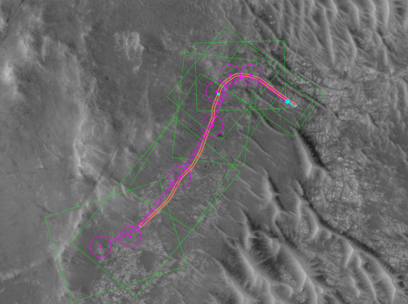
This annotated orbital image depicts the AI-planned (depicted in magenta) and actual (orange) routes the Perseverance Mars rover took during its Dec. 10, 2025, drive at Jezero Crater. The drive was the second of two demonstrations showing that generative AI could be incorporated into rover route planning.
Credit: NASA/JPL-Caltech/UofA
Progress for Mars, beyond
Mars is on average about 140 million miles (225 million kilometers) away from Earth. This vast distance creates a significant communication lag, making real-time remote operation — or “joy-sticking” — of a rover impossible. Instead, for the past 28 years, over several missions, rover routes have been planned and executed by human “drivers,” who analyze the terrain and status data to sketch a route using waypoints, which are usually spaced no more than 330 feet (100 meters) apart to avoid any potential hazards. Then they send the plans via NASA’s Deep Space Network to the rover, which executes them.
But for Perseverance’s drives on the 1,707 and 1,709 Martian days, or sols, of the mission, the team did something different: Generative AI provided the analysis of the high-resolution orbital imagery from the HiRISE (High Resolution Imaging Science Experiment) camera aboard NASA’s Mars Reconnaissance Orbiter and terrain-slope data from digital elevation models. After identifying critical terrain features — bedrock, outcrops, hazardous boulder fields, sand ripples, and the like — it generated a continuous path complete with waypoints.
To ensure the AI’s instructions were fully compatible with the rover’s flight software, the engineering team also processed the drive commands through JPL’s “digital twin” (virtual replica of the rover), verifying over 500,000 telemetry variables before sending commands to Mars.
On Dec. 8, with generative AI waypoints in its memory, Perseverance drove 689 feet (210 meters). Two days later, it drove 807 feet (246 meters).
“The fundamental elements of generative AI are showing a lot of promise in streamlining the pillars of autonomous navigation for off-planet driving: perception (seeing the rocks and ripples), localization (knowing where we are), and planning and control (deciding and executing the safest path),” said Vandi Verma, a space roboticist at JPL and a member of the Perseverance engineering team. “We are moving towards a day where generative AI and other smart tools will help our surface rovers handle kilometer-scale drives while minimizing operator workload, and flag interesting surface features for our science team by scouring huge volumes of rover images.”
“Imagine intelligent systems not only on the ground at Earth, but also in edge applications in our rovers, helicopters, drones, and other surface elements trained with the collective wisdom of our NASA engineers, scientists, and astronauts,” said Matt Wallace, manager of JPL’s Exploration Systems Office. “That is the game-changing technology we need to establish the infrastructure and systems required for a permanent human presence on the Moon and take the U.S. to Mars and beyond."
Quelle: NASA
----
Update: 4.02.2026
.
Bleached Martian rocks offer fresh evidence of a wetter and warmer Mars: 'But where did they come from?
"You need so much water that we think these could be evidence of an ancient warmer and wetter climate where there was rain falling for millions of years."
Bleached, clay-rich rocks spotted by NASA's Perseverance rover offer fresh evidence that Mars may have had rain and a warmer, wetter climate billions of years ago. (Image credit: NASA)
NASA's Perseverance rover has discovered thousands of strangely bleached rocks on Mars that are rich in a mineral difficult to form without long-term exposure to water, adding fresh evidence that the Red Planet was warmer, wetter and possibly rain-soaked billions of years ago.
The newfound Mars rocks are rich in kaolinite, a soft, white, clay mineral that, on Earth, typically forms when water slowly leaches other elements from rock over thousands to millions of years, a new study reports. On Earth, it is most commonly found in warm, humid environments such as rainforests, where frequent rainfall drives intense chemical weathering.
"All life uses water," Adrian Broz, a postdoctoral researcher at Purdue University who led the new study, said in a statement. "So when we think about the possibility of these rocks on Mars representing a rainfall-driven environment, that is a really incredible, habitable place where life could have thrived if it were ever on Mars."
"You need so much water that we think these could be evidence of an ancient warmer and wetter climate where there was rain falling for millions of years," added study co-author Briony Horgan, who is a professor of planetary science in the Department of Earth, Atmospheric and Planetary Sciences at Purdue University and a long-term planner on the Perseverance mission.
Perseverance identified several thousand of these kaolinite-rich rocks — ranging from small pebbles to large boulders — scattered across the surface of Jezero crater, the dry, bowl-shaped depression just north of Mars' equator that likely held a lake billions of years ago.
Since landing on Mars in 2021, the car-sized robot has explored the crater floor searching for evidence of past microbial life. Late last year, it climbed up the crater's inner wall and onto the rim, exploring new terrain. Scientists are trying to understand how that wetter era ended, when Mars lost its global magnetic field and particles from the sun began stripping away its thick atmosphere, transforming the planet into the cold, barren world seen today.
While kaolinite-bearing terrains on Mars had previously been identified from orbit, Perseverance's discoveries allow scientists to study such materials directly on the planet's surface, the study notes.
To better understand how the Martian rocks formed, Broz and his team compared Perseverance data with kaolinite deposits on Earth, including published data from Southern California and South Africa. The chemical signatures closely matched, strengthening the case that the Martian rocks formed through rainfall-driven weathering rather than volcanic or hydrothermal processes, according to the new study.
One lingering mystery the team is still trying to solve is where the rocks came from.
There is no obvious nearby bedrock source, according to the study. The closest potential origin lies about 1.2 miles (2 kilometers) away, where orbital data shows signatures consistent with kaolinite in large chunks of fractured rock created by ancient impacts. Researchers also point to areas along the stretches of Neretva Vallis, a river channel that once flowed into Jezero crater.
"They're clearly recording an incredible water event, but where did they come from?" Horgan said in the statement. The rocks may have been carried into the crater by ancient rivers or blasted there by meteorite impacts, he added. "We're not totally sure."
These findings are described in a paper published in December of 2025 in the journal Nature Communications Earth & Environment.
Quelle: SC
----
Update: 20.02.2026
.
NASA’s Perseverance Now Autonomously Pinpoints Its Location on Mars
How did NASA’s Perseverance gain the ability to find its exact location on Mars without guidance from rover operators on Earth? Vandi Verma, chief engineer of robotics operations for the mission at JPL, explains.
Credit: NASA/JPL-Caltech
There is no GPS at the Red Planet, but a new technology called Mars Global Localization lets Perseverance determine precisely where it is — without human help.
Imagine you’re all alone, driving along in a rocky, unforgiving desert with no roads, no map, no GPS, and no more than one phone call a day for someone to inform you exactly where you are. That’s what NASA’s Perseverance rover has been experiencing since landing on Mars five years ago. Though it carries time-tested tools for determining its general location, the rover has needed operators on Earth to tell it precisely where it is — until now.
A new technology developed at NASA’s Jet Propulsion Laboratory in Southern California enables Perseverance to figure out its whereabouts without calling humans for help. Dubbed Mars Global Localization, the technology features an algorithm that rapidly compares panoramic images from the rover’s navigation cameras with onboard orbital terrain maps. Running on a powerful processor that Perseverance originally used to communicate with the Ingenuity Mars Helicopter, the algorithm takes about two minutes to pinpoint the rover’s location within some 10 inches (25 centimeters). Mars Global Localization was first used successfully in regular mission operations on Feb. 2, then again Feb. 16.
This panorama from Perseverance is composed of five stereo pairs of navigation camera images that the rover matched to orbital imagery in order to pinpoint its position on Feb. 2, 2026, using a technology called Mars Global Localization.
“This is kind of like giving the rover GPS. Now it can determine its own location on Mars,” said JPL’s Vandi Verma, chief engineer of robotics operations for the mission. “It means the rover will be able to drive for much longer distances autonomously, so we’ll explore more of the planet and get more science. And it could be used by almost any other rover traveling fast and far.”
The upgrade is especially valuable given how well Perseverance’s auto-navigation self-driving system has been working. Enabling the rover to re-plan its path around obstacles en route to a preestablished destination, AutoNav has proved so capable that the distance Perseverance can drive without instructions from Earth is largely limited by the rover’s uncertainty about its whereabouts. Now that it can stop and determine its exact location, Perseverance can be commanded to drive to potentially unlimited distances without calling home.
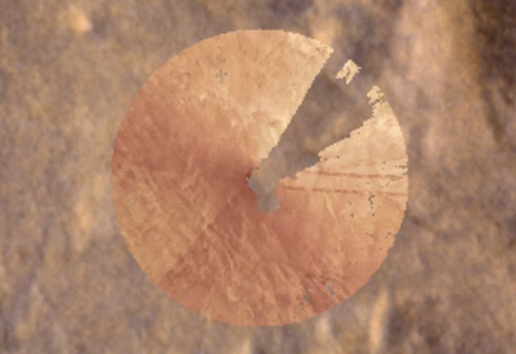
The new technology called Mars Global Localization enables NASA’s Perseverance to pinpoint is location using an onboard algorithm that matches terrain features in navigation camera shots (the circular image, called an orthomosaic) to those in orbital imagery (the background).
Implementation of Mars Global Localization comes on the heels of another innovation from the Perseverance team: the first use of generative artificial intelligence to help plan a drive route by selecting waypoints for the rover, which are normally chosen by human rover operators. Both technologies enable Perseverance to travel farther and faster while minimizing team workload.
Beyond visual odometry
Unlike on Earth, there is no network of GPS satellites in deep space to locate spacecraft on planetary surfaces. So missions — whether robotic or crewed — must come up with other ways to determine their location.
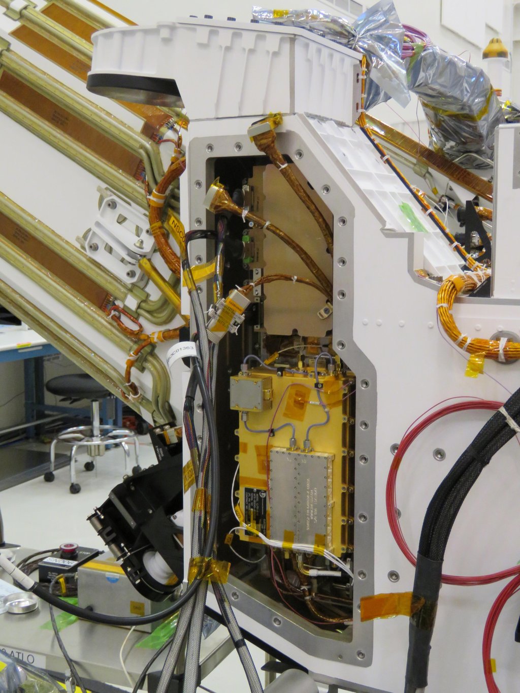
The Mars Global Localization algorithm runs on a fast commercial processor in the Helicopter Base Station — the upper, gold-colored box that was integrated into NASA’s Perseverance rover in a clean room. Perseverance used the base station to communicate with the now-retired Ingenuity Mars Helicopter.
As with NASA’s previous Mars rovers, Perseverance tracks its position using what’s called visual odometry, analyzing geologic features in camera images taken every few feet while accounting for wheel slippage. But as tiny errors in the process add up over the course of each drive, the rover becomes increasingly unsure about its exact location. On long drives, the rover’s sense of its position can be off by more than 100 feet (up to 35 meters). Believing it may be too close to hazardous terrain, Perseverance may prematurely end its drive and wait for instructions from Earth.
“Humans have to tell it, ‘You’re not lost, you’re safe. Keep going,’” Verma said. “We knew if we addressed this problem, the rover could travel much farther every day.”
After each drive comes to a halt, the rover sends a 360-degree panorama to Earth, where mapping experts match the imagery with shots from NASA’s Mars Reconnaissance Orbiter (MRO). The team then sends the rover its location and instructions for its next drive. That process can take a day or more, but with Mars Global Localization, the rover is able to compare the images itself, determine its location, and roll ahead on its preplanned route.
“We’ve given the rover a new ability,” said Jeremy Nash, a JPL robotics engineer who led the team working on the project under Verma. “This has been an open problem in robotics research for decades, and it’s been super exciting to deploy this solution in space for the first time.”
The small team began working in 2023, testing the accuracy of the algorithm they’d developed using data from 264 previous rover stops. The algorithm compared rover panoramic photos to MRO imagery and correctly pinpointed the rover’s location for every single stop.
How Ingenuity helped
Key to Mars Global Localization is the rover’s Helicopter Base Station (HBS), which Perseverance used to communicate with the now-retired Ingenuity Mars Helicopter. Equipped with a commercial processor that powered many consumer smartphones in the mid-2010s, the HBS runs more than 100 times faster than the rover’s two main computers, which, built to survive the radiation-heavy Martian environment, are based on hardware introduced in 1997.
As a technology demonstration designed to test capabilities, the Ingenuity mission was able to risk employing more powerful commercial chips in the HBS and the helicopter even though they hadn’t been proven in space. It paid off: Expected to fly no more than five times, the rotorcraft completed 72 flights.
The power of the HBS processor inspired Verma to look for ways the Perseverance mission might harness it. “It’s almost like a gift. Ingenuity blazed the trail, proving we could use commercial processors on Mars,” Verma said.
Tapping into the HBS computer has had its challenges. To address reliability, the team developed a “sanity check”: The algorithm runs on the HBS multiple times before one of the rover’s main computers checks to ensure the results match. During testing, the team repeatedly found the rover’s position was off by 1 millimeter. They discovered damage to about 25 bits — a minuscule fraction of the processor’s 1 gigabyte of memory — and developed a solution to isolate those bits while the algorithm runs.
Alongside the broader Mars Global Localization process, the team’s sanity check and memory solutions are expected to find new uses as faster commercial processors are employed in future missions. In the meantime, the team has already turned their sights to the Moon, where difficult lighting conditions and long, cold lunar nights make knowing exactly where spacecraft are located all the more critical.
Quelle: NASA
----
Update: 20.03.2026
.
NASA rover detects some of the oldest evidence of water flowing on Mars
Perseverance’s radar revealed ancient subsurface river delta on Mars
There may be a river delta hidden under the obvious delta in a Martian crater.
When NASA’s Perseverance rover landed in Jezero Crater in 2021, its primary mission was to scour the remnants of a dried-up Martian lakebed for signs of ancient life. Scientists have been focused on the crater’s spectacular Western Delta, a fan-shaped geologic feature deposited by a river flowing into the basin billions of years ago. But now Perseverance’s ground-penetrating radar (called RIMFAX) detected what is likely another, even older river delta buried tens of meters beneath it.
“I think it’s a promising place to look for signs of biosignatures at depth,” says Emily L. Cardarelli. “Microbial life could have potentially developed in those types of environments.” Cardarelli, an astrobiologist at the University of California Los Angeles, led the team interpreting RIMFAX imagery.
Peeking underground
Perseverance’s RIMFAX, the Radar Imager for Mars Subsurface Experiment, continuously fires radar waves into the ground, acquiring soundings each time the rover traveled 10 centimeters. When these radio waves hit boundaries between different types of rock, ice, or sediment layers, some of the signal bounces back. The timing and intensity of these reflections allow scientists to construct a two-dimensional, vertical slice of the subsurface, much like a sonogram of the Martian crust.
During a campaign spanning from September 2023 to February 2024, or over 250 Martian sols, Perseverance drove across a geological zone known as the Margin unit. The Margin unit is an expansive deposit flanking the inner rim of Jezero’s inlet valley, occupying the space between the western fan deposits and the crater rim. It is rich in magnesium carbonates, which was one of the main reasons Jezero Crater has been chosen as the Perseverance’s landing site: on Earth, carbonates are exceptionally good at preserving the chemical fingerprint of life. “You can think of the Cliffs of Dover, for example, that are all carbonate—they have tons of fossils in them,” Cardarelli says.
Cardarelli’s team analyzed the RIMFAX data and found that the rock comprising the Margin unit was exceptionally transparent to the radar’s waves. This homogenous, low-loss material allowed the radar signals to penetrate deeper than they had in any other previously explored region of Jezero Crater. Soundings reached down more than 35 meters, roughly 1.75 times deeper than measurements taken on the crater floor or the overlying Delta units. Taking into account the surface topography, the team estimates the true thickness of the Margin unit to be at least 85 to 90 meters.
But the real jackpot was the highly structured geometry of geologic features the radar saw at these depths.
The hidden delta
When geologists look at the cross-section of a river delta on Earth, they see distinct features that tell a story of water flow, sediment dumping, and changing water levels. The RIMFAX data revealed exactly this kind of structured layering beneath the Margin unit, with features ranging from tens of centimeters to hundreds of meters across. “We saw really high complexity in the subsurface,” Cardarelli says.
The radar readouts displayed parallel layers dipping toward the center of the Jezero basin at angles of three to 15 degrees. These sweeping, laterally continuous lines are classic signatures of what geologists call clinoforms, layers of sediment that build outward into the water as the river deposits material, forming underwater ramps.
When a fast-moving river carrying sand and gravel suddenly hits the still, deep waters of a lake, it loses its kinetic energy and drops its contents. The heaviest sediments settle quickly on the lake bottom, forming flat, horizontal layers known as topsets. As the sediment continuously piles up and pushes further out into the lake, it eventually reaches a critical angle at the edge of existing sediments and cascades down the underwater slope, forming angled layers called foresets. At the very bottom of the lake, finer sediments fan out into horizontal bottomsets.
The RIMFAX images seemingly captured these transitions, known as rollover points, spread throughout the Martin crust. These rollover points, the team thinks, are the telltale signs of a dynamic fluvial environment that didn’t just bring lots of dirt once, but experienced multiple distinct episodes of continuous deposition over a long period of time. The now-underground river delta looks remarkably similar in scale and structure to ancient delta environments preserved here on Earth.
Watery timeline
This subsurface architecture reframes the timeline of Jezero Crater’s watery past. The radar data from the rover’s 6.1-kilometer traverse makes it clear that the Margin unit physically sits underneath the rocks of the Western Delta. In geology, the stuff on the bottom is usually older.
If Cardarelli’s interpretation is right, it means that, long before a Martian river system carved out the massive Western Delta that we see from orbit today, an entirely different river system had already built a vast delta in the same exact spot. This hidden delta formed during the Noachian period, an era of Martian history when the planet was significantly warmer and wetter, which ran approximately from 4.2 to 3.7 billion years ago. The presence of these deep sedimentary layers suggests that early Mars wasn’t just briefly wet but likely maintained consistent, long-lived conditions that allowed massive amounts of sediment to be systematically transported and deposited over expansive geologic timescales.
But Cardarelli’s team admits an ancient river delta, while very probable, is just one of several hypotheses that could explain RIMFAX data.
Explaining layers
The first of the alternatives is that the geologic features detected by RIMFAX formed through igneous processes. “We talk about volcanic activity—pyroclastic events and volcanic ash fall moving through,” Cardarelli explains. The layers her team found could be solidified magma and ash that rained down from distant volcanic eruptions.
Another idea suggested by the team is the angled layers could also be remnants of a shoreline of an ancient lake. The team also considered a scenario where the Margin unit was just an area in front of a glacier where meltwater streams deposited materials washed out from the ice, forming broad, layered plains.
“But I think what led us to favor the fluvial, deltaic hypothesis is simply the number and scale of the features we observed and their complexity,” Cardarelli says.
Her leading explanation is also the one most favorable to potential Martian life. If microbial life ever existed on Mars, it would have needed stable, long-lasting aquatic environments. A massive delta system pouring into a crater lake should, in principle, provide the right mix of nutrients, water, and chemical energy. “We know that there are potential signs of past microbial life at the surface of Jezero Crater,” Cardarelli says. “Now we see there was an aqueous history there for quite a long time.” And she thinks there’s a lot more left to see in Jezero Crater.
Cardarelli’s study was based on data from 6.1 kilometers of Perseverance’s traverse. “And we have 40 kilometers of data, so please look for upcoming RIMFAX papers,” Cardarelli says. “We have more to say about this area. There’s a lot of stories to be told.”
Quelle: arsTechnica