
1.09.2022
NASA's Mars rover Curiosity took 3 images in Gale Crater using its mast-mounted Right Navigation Camera (Navcam) to create this mosaic. The seam-corrected mosaic provides a 110-degree cylindrical projection panorama of the Martian surface centered at 146 degrees azimuth (measured clockwise from north). Curiosity took the images on August 23, 2022, Sol 3571 of the Mars Science Laboratory mission at drive 434, site number 97. The local mean solar time for the image exposures was 3 PM. Each Navcam image has a 45 degree field of view.
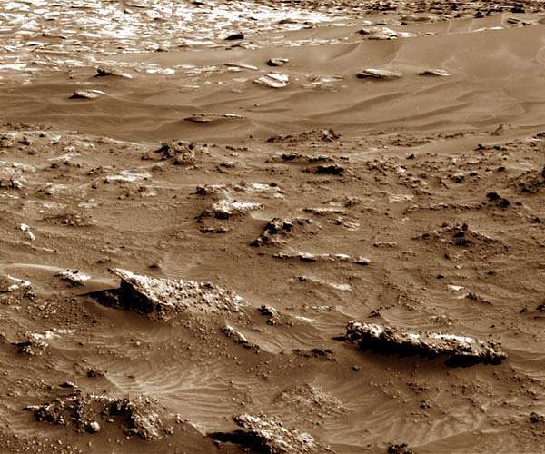
We are almost through Paraitepuy pass, an area between two large buttes that has made for tricky driving while dealing with communication challenges, sand and broken-up rocks. But the end is in sight as we near an area identified from orbit as probably containing hydrated magnesium sulfates, in contrast with the clay-bearing unit that we have been transitioning out of.
Before we get there though, the team noticed that there is an area that appears quite different from what we have been driving over, and the upcoming, potentially sulfate-rich area. The broken-up bedrock is characterized by numerous, relatively large, resistant features.
Although we had these rocks in front of the rover today, because of a low data volume downlink from the previous plan, we did not have the imaging necessary to safely place the arm and the MAHLI and APXS instruments on the rocks.
As the APXS strategic planner this week, I advocated for trying to get APXS compositional data on these rocks before we drive away. We therefore prioritized driving in this plan to put us in a good position to do contact science on one of these interesting rocks in tomorrow's plan.
Given that these "nodule-rich" rocks occur in the vicinity of the "sulfate-bearing" area mapped from orbit, the team decided that it was important to fully characterize them. They could provide insights into the processes that occurred in the rocks as we change from clay-bearing to sulfate-bearing.
Although we could not do contact science, we took full advantage of our remote sensing instruments to investigate the rocks immediately in front of the rover, as well as attempting to place them in context with outcrops exposed in the surrounding buttes. ChemCam will acquire compositional data on an exposure of the nodular bedrock, "Isla Cangrejo," which will also be imaged with Mastcam.
Mastcam images will also be obtained of "Kulishiri," "Jiboia," and "Altana Creek" to further document textures. We also planned a Mastcam mosaic of a section of the Bolivar butte to look at possible exposures of the nodule rich material, and the relationship with underlying and overlying strata. To fully document the terrain around and below us, a Mastcam starboard mosaic and MARDI image were also planned.
The environmental science team were also busy and planned several observations to continue monitoring changes in atmospheric conditions. These included: a Navcam large dust devil survey and cosmic ray survey. Standard REMS, DAN and RAD activities round out this plan.
Quelle: SD