
18.06.2020
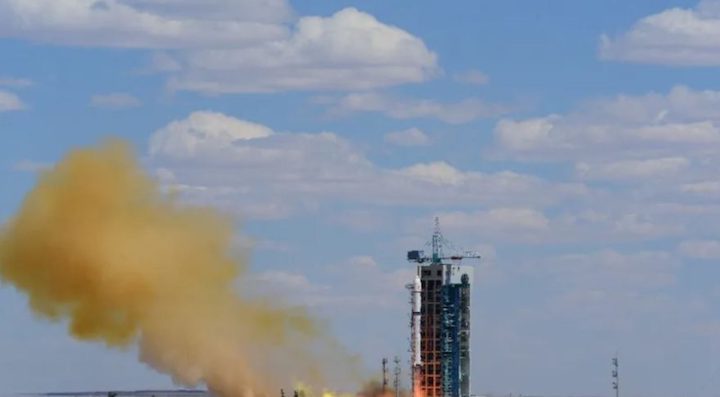
HELSINKI — China launched a Gaofen-9 series Earth observation satellite and two smaller spacecraft Wednesday, a day after postponing a Beidou navigation satellite mission due to unspecified issues.
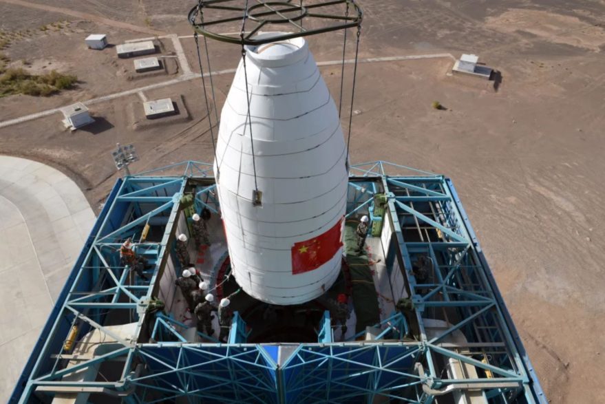
Liftoff of a Long March 2D carrying the Gaofen-9 (03) took place at 3:19 a.m. Eastern at Jiuquan in the Gobi Desert. Launch success was confirmed (Chinese) by main contractor CASC within 30 minutes of liftoff.
Gaofen-9 (03) is a sub-meter resolution optical remote sensing satellite. It follows the launch of the Gaofen-9 (02) satellite on a Long March 2D from Jiuquan May 31 into a 503 x 487 kilometer orbit inclined by 97 degrees. The first Gaofen-9 satellite was launched in 2015.
The satellite was developed by DFH Satellite Co., Ltd., under the China Academy of Space Technology (CAST). The Long March 2D was developed by the Shanghai Academy of Spaceflight Technology (SAST). The two institutes are major subsidiaries of the China Aerospace Science and Technology Corporation (CASC).
Wednesday’s launch also carried a fifth Automated Identification System (AIS) services satellite for private company HEAD Aerospace. It will carry out on-orbit global AIS vessel data collection and ADS-B flight data monitoring.
The final passenger is Pixing-3 (A), a picosatellite technology test developed by Zhejiang University.
The launch was China’s 14th of 2020, which includes failures of the first Long March 7A and a Long March 3B.
Gaofen-9 joins Earth observation system
Gaofen satellites are part of a civilian China High-resolution Earth Observation System (CHEOS). The satellites are used for land surveying, urban planning, road network design, agriculture, disaster relief and other uses, according to Chinese media.
The program was initiated in 2010 to provide all-weather, all-day coverage with optical and synthetic aperture radar satellites. CHEOS may also include airborne and near-space systems such as stratospheric balloons.
Computer generated renders of the Gaofen-11 satellite, launched in July 2018, suggest a large aperture high resolution Earth observation satellite with resemblance to U.S. Keyhole-class satellites.
The Yaogan satellite series is the military reconnaissance counterpart which utilizes similar technology and platforms.
Final Beidou satellite launch postponed
Launch of a final satellite to complete the Beidou navigation and positioning system was scrubbed late Monday. The launch was exceptionally being live streamed by Chinese media.
A Long March 3B rocket was scheduled to send the third generation Beidou satellite to geosynchronous transfer orbit. However an unspecified issue was discovered during pre-launch checks at the Xichang launch center, southwest China.
No new date for the launch has been announced. It is unclear whether the delay will also impact the launch of the APSTAR-6D communications satellite from Xichang. The mission is currently expected near the end of June.
The completed Beidou navigation satellite system will consist of 27 satellites in medium Earth orbits, five in geostationary orbits and three in inclined GEO orbits.
Beidou is used in sectors including public security, transportation, fishing, power, forestry, disaster reduction, the construction of smart cities, social governance and mass market applications. This system can also be used for emergency search and rescue and short message services.
The constellation removes previous Chinese military reliance on the U.S.’ GPS for weapons targeting, guidance and other services.
Quelle: SN