
10.03.2020
A Chinese Long March 3B launcher carried a Beidou satellite into orbit Monday, adding the penultimate satellite to China’s independent navigation fleet before another mission in May completes the constellation to give it a global reach.
The Beidou navigation payload rocketed into space at 1155 GMT (7:55 a.m. EDT; 7:55 p.m. Beijing time) Monday from the Xichang space center in southwestern China’s Sichuan province, according to the state-run Xinhua news agency.
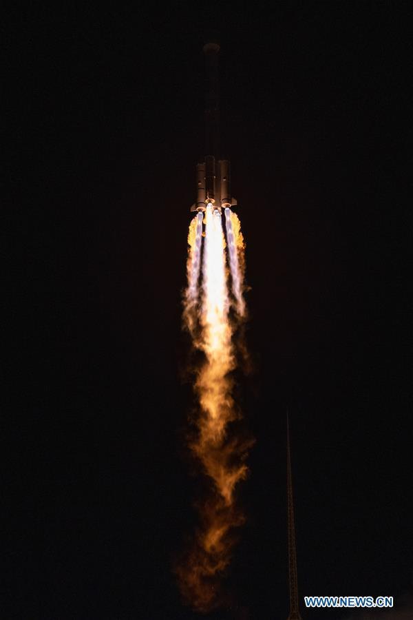
A 184-foot-tall (56-meter) Long March 3B rocket delivered the Beidou navigation satellite into an elliptical, or egg-shaped, geosynchronous transfer orbit. China’s government-owned media declared the launch a success.
China has launched 54 Beidou satellites since 2000, but the launch date has ramped up in recent years. The initial generation of Beidou satellites were designed as prototypes or test platforms, but the Chinese network began limited service over the Asia-Pacific region in 2012.
Chinese officials said the successful launch Monday and a follow-up launch in May will complete the deployment of the Beidou program’s third-generation, or BDS-3, satellite network.
All of the early Beidou satellites have ended their missions, and the Beidou fleet needs 30 satellites for operational global positioning and timing services.
Until now, Chinese military forces have relied on the U.S. military’s Global Positioning System for navigation support.
China designed the Beidou network as an independent version of the GPS network, providing Chinese military and civilian users with a home-grown system in case GPS signals are interrupted during a conflict. Like the GPS network, Russia’s Glonass fleet and Europe’s Galileo navigation constellation, the Beidou system is designed for global service.
The Beidou navigation satellite launched Monday will use its own propulsion system to maneuver into a circular geosynchronous orbit more than 22,000 miles (nearly 36,000 kilometers) over the equator.
Chinese officials said engineers “have overcome difficulties during the novel coronavirus epidemic to ensure the success of the mission,” according to state media.
The Beidou network, named for the Chinese word for the Big Dipper constellation, includes satellites positioned in three different types of orbits.
In December, China launched the last of 24 operational satellites into a medium-altitude orbit more than 13,000 miles above Earth, similar to the orbits used by GPS, Glonass and Galileo satellites.
But unlike the other global navigation systems, the fully-operational Beidou network will include six spacecraft in geosynchronous orbits, with three permanently over the equator and three others in inclined orbits that swing north and south of the equator during each 24-hour orbit.
China launched three satellites into inclined geosynchronous orbit last year, and the spacecraft deployed Monday is the second of three to be permanently stationed over the equator.
The satellite launched Monday was built by the China Academy of Space Technology, part of China’s government-owned aerospace industry, and is based on the DFH-3B satellite platform.
The Beidou satellites “can provide services for the driverless vehicles, accurate berthing of ships, as well as takeoff and landing of airplanes,” Xinhua said. “It will be widely used in the fields of communication, electric power, finance, mapping, transportation, fishery, agriculture and forestry.”
The Beidou satellites also have a communications replay ability.
Chinese smartphones already have the ability to incorporate Beidou navigation data into mapping and tracking apps, and users in dozens of other countries are also using Beidou signals.
China wants to expand usage of the Beidou network worldwide, especially in countries participating in China’s Belt and Road Initiative, a global economic development program and a centerpiece of Beijing’s foreign policy strategy. The Belt and Road Initiative has extended to nearly 70 countries in the Asia-Pacific region, Africa, Europe and the Americas, where China partners with local authorities to fund infrastructure and other drivers of economic growth.
Pakistan’s armed forces, which used to rely on U.S. GPS satellites, is the only military outside China to employ the Beidou network.
Quelle: SN
+++
China launches new BeiDou navigation satellite
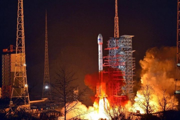
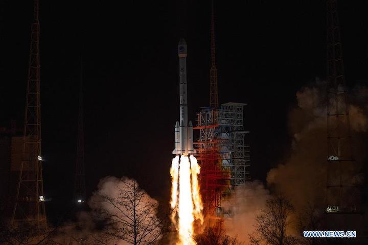
China launches a new satellite of the BeiDou Navigation Satellite System (BDS) from the Xichang Satellite Launch Center in southwest China's Sichuan Province, March 9, 2020, only one step away from completing the whole global system. The satellite, the 54th of the BeiDou family, was sent into a geostationary orbit as planned by a Long March-3B carrier rocket. The newly launched satellite is the second geostationary earth orbit satellite of the BDS-3 system, and the last one is expected to be launched in May. (Photo by Guo Wenbin/Xinhua)
China launched a new satellite of the BeiDou Navigation Satellite System (BDS) from the Xichang Satellite Launch Center in southwest China's Sichuan Province at 7:55 p.m. Monday (Beijing Time), only one step away from completing the whole global system.
The satellite, the 54th of the BeiDou family, was sent into a geostationary orbit as planned by a Long March-3B carrier rocket.
China began to construct its navigation system, named after the Chinese term for the Big Dipper constellation, in the 1990s and started serving the Asia-Pacific Region in 2012. At present, all the first generation BDS-1 satellites have ended operations, and a total of 54 BDS-2 and BDS-3 satellites have been sent into space.
Compared with other navigation systems in the world, the design of the BDS constellation is unique, including medium earth orbit, inclined geosynchronous earth orbit and geostationary earth orbit satellites.
The BDS-3 system will consist of a total of 30 satellites, including 24 medium earth orbit satellites, three geostationary earth orbit satellites and three inclined geosynchronous earth orbit satellites.
The newly launched satellite is the second geostationary earth orbit satellite of the BDS-3 system, and the last one is expected to be launched in May.
The satellite and the carrier rocket were developed by the China Academy of Space Technology (CAST) and the China Academy of Launch Vehicle Technology, respectively.
Space engineers have overcome difficulties during the novel coronavirus epidemic to ensure the success of the mission.
Monday's launch was the 327th mission of the Long March rocket series.
The new satellite has the most functions and signals, the largest size and the longest designed life span among all the BDS-3 satellites, said Chen Zhonggui, chief designer of BDS-3 satellites from CAST.
The satellite is based on the Dongfanghong-3B platform, currently one of the largest satellite platforms being used in China, and can carry more fuels to ensure its long life, said Chen.
The satellite has integrated the functions of navigation and communication. The accuracy of dynamic positioning can reach the decimeter level, according to Liu Tianxiong, deputy chief designer of BDS-3 satellites.
It can provide services for the driverless vehicles, accurate berthing of ships, as well as takeoff and landing of airplanes. It will be widely used in the fields of communication, electric power, finance, mapping, transportation, fishery, agriculture and forestry.
The ability of short message communication has been improved 10 times on this satellite. Users can send a message of over 1,000 Chinese characters at one time as well as pictures via the satellite, quite useful in emergencies.
The satellite's ability to receive signals has also been greatly improved, which could help miniaturize users' terminals, said Pan Yuqian, one of the satellite's designers.
China aims to complete the construction of the BDS constellation in May and provide high-precision, reliable positioning, navigation and timing services anywhere in the world.
Quelle: Xinhua