
20.11.2023
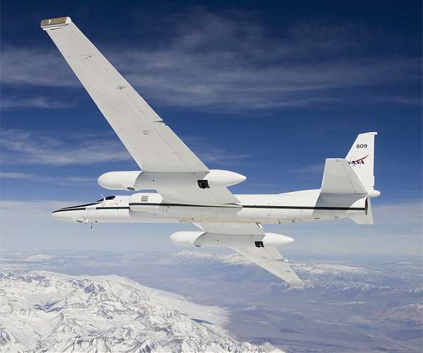
NASA Armstrong Flight Research Center's ER-2 aircraft can fly at high altitudes from 20,000-70,000 feet. For the GEMx mission, pilots flew at approximately 65,000 feet, requiring pilots to wear specially designed suits while in flight.
In September 2023, NASA aircraft began supporting an effort to find and map critical mineral deposits in Western regions of the U.S. Identifying these minerals - often used in everyday products like laptops and cell phones - could help improve environmental processes for mining and geological activities, enhance national security, and boost the economy. This project will continue through Fall 2026.
In a collaboration with the USGS (United States Geological Survey), an ER-2 high-altitude aircraft based at NASA's Armstrong Flight Research Center in Edwards, California, has been supporting GEMx, the Geological Earth Mapping Experiment. The campaign also includes NASA's Gulfstream V aircraft and a diverse team of engineers, pilots, and scientists from NASA, USGS, and the University of Arizona.
"For this mission, we are flying at approximately 65,000 feet to acquire wide swaths of geophysical data with every overflight," said Kevin Reath, NASA deputy program manager for GEMx. The instruments are flying higher than previous airborne instruments to collect data over a wider area, yet the images collected have finer detail than aa satellite view "It's thanks to this high-altitude flying capability that we can cover such a large area."
Researchers mounted instruments on the ER-2 and Gulfstream V to collect measurements over the country's arid and semi-arid regions, including parts of California, Nevada, Arizona, and New Mexico. These instruments include NASA's AVIRIS (Airborne Visible/Infrared Imaging Spectrometer), HyTes (Hyperspectral Thermal Emission Spectrometer), and MASTER (MODIS/ASTER Airborne Simulator).
These instruments collect hyperspectral images, or images that use color to convey the geophysical complexities behind seemingly simple or monochromatic surfaces. The visual data that is produced by these optical sensors indicates the constituents and changes of Earth's surface and atmosphere.
"This mission, data, and its respective data products can help the public along with local, state, tribal, and federal agencies make effective decisions regarding management of natural resource deposits including critical mineral resources," said Dean Riley, a collaborator on the GEMx project from the University of Arizona.
"The U.S. depends on a reliable supply of Earth materials to support its economy and national security," said Raymond Kokaly, research geophysicist with the USGS. "Such materials have been deemed critical minerals because disruption of their supply would have significant negative impacts. Undiscovered deposits of at least some of these critical and strategic minerals almost certainly exist in the United States, but modern geophysical data is needed to increase our knowledge of these resources."
Modern geophysical data is exactly what the GEMx project is procuring. This means data that maps not only the constituents of Earth's surface and atmosphere, but also how those constituents change over time between 2023 and 2026.
"If this mission can successfully identify critical minerals in minable locations in the U.S., we could be less dependent on foreign entities for these critical minerals," Reath said.
Quelle: SD