5.07.2023
Cameras mounted on Europe's new weather satellite will keep an eye on thunderstorms in Europe and Africa like never before.
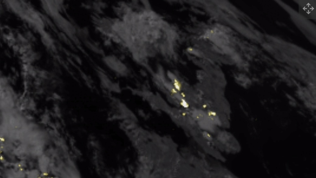
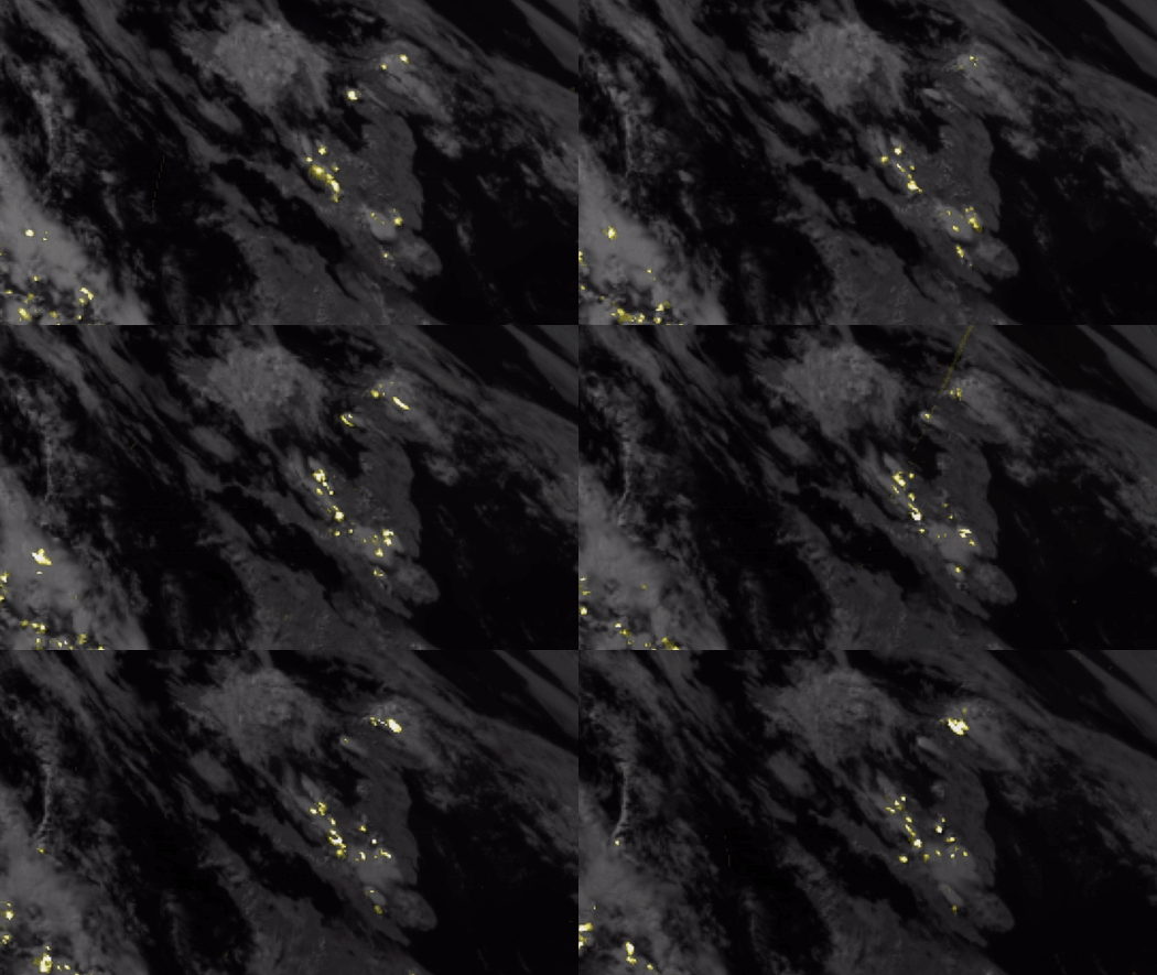
Stunning first videos from a new space-borne instrument designed to improve the monitoring of thunderstorms show the crackle of lightning over Europe, Africa and the Atlantic Ocean.
The images were taken by the Meteosat-12 satellite operated by the European Organisation for the Exploitation of Meteorological Satellites (EUMETSAT) from geostationary orbit, some 22,000 miles (36,000 kilometers) above Earth. This altitude is extremely important for weather forecasters, as the speed of satellites circling the planet in this region matches Earth's rotation. As a result, the satellites in this orbit have a constant view of a part of the globe, allowing meteorologists to observe how weather phenomena evolve in real time.
Satellites of the U.S. National Oceanic and Atmospheric Administration (NOAA) have used lightning imagers before, but Meteosat-12 is the first to provide this type of information to European weather forecasters.
Europe's new weather satellite Eumetsat-12 is the first capable of monitoring lightning activity above Europe. (Image credit: EUMETSAT)
The satellite, the first in the new Meteosat Third Generation family of Europe's weather observers, launched in December 2022 and will help the continent's meteorologists improve their forecasts of extreme weather events.
"Severe storms are often preceded by abrupt changes in lightning activity," Eumetsat Director General Phil Evans said in a statement. "By observing these changes in activity, Lightning Imager data will give weather forecasters additional confidence in their forecasts of severe storms."
As climate change progresses and Earth's climate warms, severe thunderstorms, accompanied by torrential rains, hail and powerful winds, are set to become more common in Europe and around the world. By being able to better forecast these events, meteorologists hope to protect vulnerable populations in affected areas by disseminating earlier and more accurate warnings.
"Lightning is a strong indication that severe weather is occurring," Evans added in a briefing. "Where there is the most severe rainfall, there is often lightning."
Eumetsat-12's' Lightning Imager instrument consists of four cameras, which can detect the atmospheric flashes all over Europe, Africa, the Middle East and parts of South America. The data will be available to weather forecasters in Africa, as well as airliners on trans-Atlantic flights to improve safety.
"The Lightning Imager has four cameras, and each one can capture 1,000 images per second, day and night, detecting even a single lightning bolt faster than the blink of an eye," Guia Pastorini, a project engineering manager at aerospace company Leonardo, which built the instrument, said in the same statement. "Thanks to specific algorithms, data is processed on board to send only useful information to Earth, supporting the development of more accurate weather forecasts, as well as contributing to the study of weather phenomena and air transport safety."
For Europe, which is warming twice as fast as other continents, according to the European environment-monitoring agency Copernicus, having timely and accurate information about approaching disasters will save lives and reduce destruction.
For example, in the summer of 2021, floods triggered by heavy rainfall killed nearly 200 people in Germany in what was described as the nation's worst natural disaster in 60 years.
"In a world where climate change is increasing the intensity of severe weather events, instruments like [Lightning Imager] will become more and more important," Evans added in the briefing.
Eumetsat-12 is the first in a family of six new weather satellites that will bolster Europe's defenses against climate change-induced weather disasters. The second satellite in the constellation will follow its sibling into orbit next year on Europe's new Ariane 6 heavy-lift rocket, which is expected to make its debut flight later this year.
Quelle: SC
+++
European satellite strikes lightning
The first ever satellite instrument capable of continuously detecting lightning across Europe and Africa has now been switched on. New animations from the innovative ‘Lighting Imager’ confirm the instrument will revolutionise the detection and prediction of severe storms.
ESA along with European Organisation for the Exploitation of Meteorological Satellites (Eumetsat) today have released the first animations from the Lightning Imager onboard the first Meteosat Third Generationsatellite, which launched on 13 December 2022.
The Lightning Imager, built by Leonardo, can continuously detect rapid flashes of lighting in Earth’s atmosphere whether day or night from a distance of 36 000 km. The instrument has four cameras covering Europe, Africa, the Middle East and parts of South America. Each camera can capture up to 1000 images per second and will continuously observe lightning activity from space.
Each animation contains a sequence of images created by collecting one minute’s worth of lightning measurements, overlaid on a single image of Earth from the Lightning Imager.

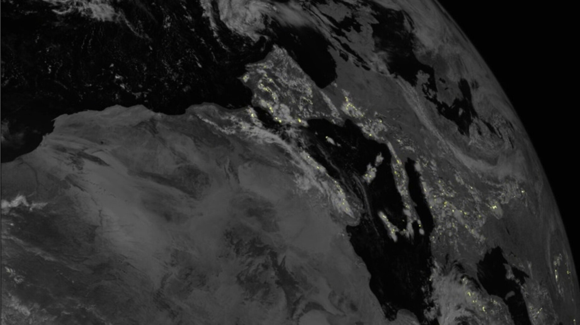
Access the video
Data from the Lightning Imager will give weather forecasters greater confidence in their predictions of severe storms, particularly in remote regions and on the oceans where lightning detection capabilities are limited.
Simonetta Cheli, Director of Earth Observation Programmes at ESA, commented on the remarkable capabilities of the instrument: “The animations show the instrument’s ability to accurately and effectively detect lightning activity over the whole area of the cameras’ field of view, which covers 84% of the Earth disc.
“ESA and Eumetsat, together with European industrial partners, are ensuring the benefits of highly innovative new technology are felt by communities and sectors of the economy in Europe and beyond.”
Detecting and analysing lightning data will provide valuable support to the study of short-term weather forecasts and to understanding the consequences of such phenomena on climate change. At the same time, the Lightning Imager will also play a key role in air traffic safety, given that lightning poses a high risk to aircraft's onboard instrumentation.
Eumetsat Director General, Phil Evans, commented, “Severe storms are often preceded by abrupt changes in lightning activity. By observing these changes in activity, Lightning Imager data will give weather forecasters additional confidence in their forecasts of severe storms.
“When these data are used in conjunction with the high-resolution data from the Flexible Combined Imager, weather forecasters will be better able to track the development of severe storms and have a longer lead-in time to warn authorities and communities.”

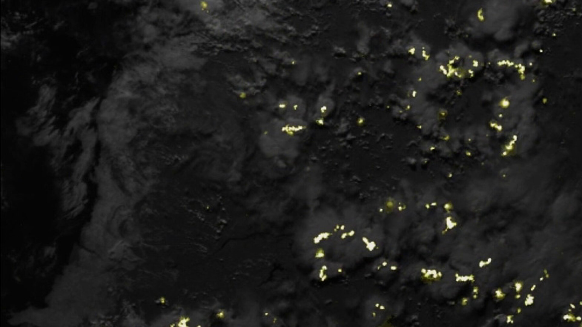
Access the video
Leonardo Project Engineering Manager for the Lightning Imager, Guia Pastorini, added, “The Lightning Imager has four cameras and each one can capture 1000 images per second, day and night, detecting even a single lightning bolt faster than the blink of an eye.
“Thanks to specific algorithms, data is processed on board to send only useful information to Earth, supporting the development of more accurate weather forecasts, as well as contributing to the study of weather phenomena and air transport safety.
“Together with ESA and Eumetsat, and coordinating an international industrial team, Leonardo has been working on this outstanding technology for 10 years, and today we are very proud to present the images of the first European lightning hunter, the only in the world with these unique performances.”
While the animations are a first initial result from the Lightning Imager, the Meteosat Third Generation Imager is currently undergoing its commissioning phase during which the instruments are calibrated and the data is validated. Data from the Lightning Imager will be available for operational use in early-2024 at an increased sensitivity.
The MTG satellites are built by a large consortium of European industries, led by Thales Alenia Space in cooperation with OHB. The innovative Lightning Imager was developed by Leonardo in Italy, while Telespazio provides Eumetsat with launch and in-orbit services.

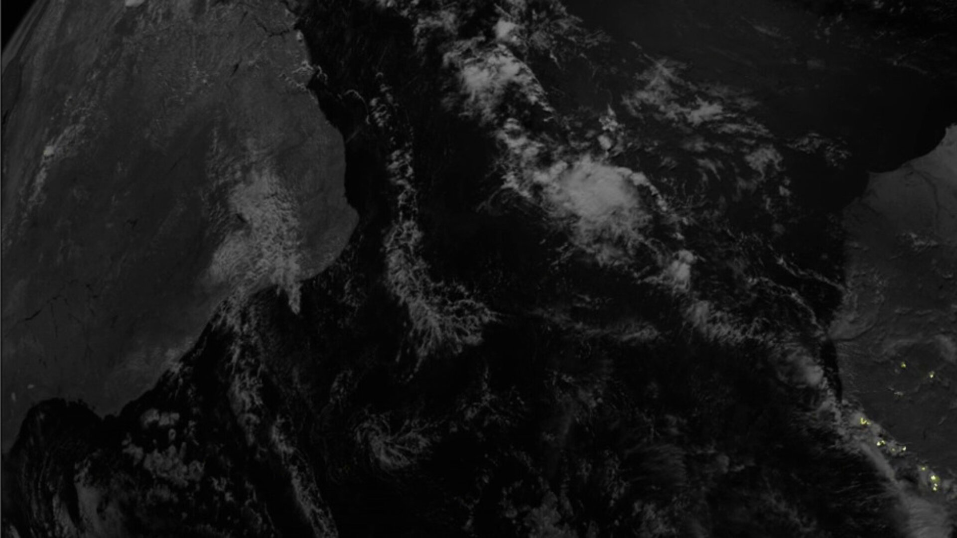
Access the video
About the Meteosat Third Generation Imager
The Meteosat Third Generation-Imager is the first of six satellites that form the full MTG system, which will provide critical data for short-term and early detection of potential extreme weather events over the next 20 years. In full operations, the mission will comprise two MTG-I satellites and one MTG Sounding (MTG-S) satellite working in tandem.
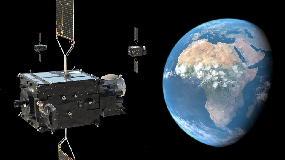
Images from the satellite’s other main Earth observation instrument, the Flexible Combined Imager, were released earlier this year.
The MTG-S sounding satellites – a first for Meteosat – will carry an Infrared Sounder and an Ultraviolet Visible Near-Infrared spectrometer.
By monitoring atmospheric instability in three dimensions throughout the clouds, the sounder will offer a major step forward for early warnings of severe thunderstorms and is expected to provide unique information from geostationary orbit on ozone, carbon monoxide and volcanic ash composition within the atmosphere.
Quelle: ESA
