.
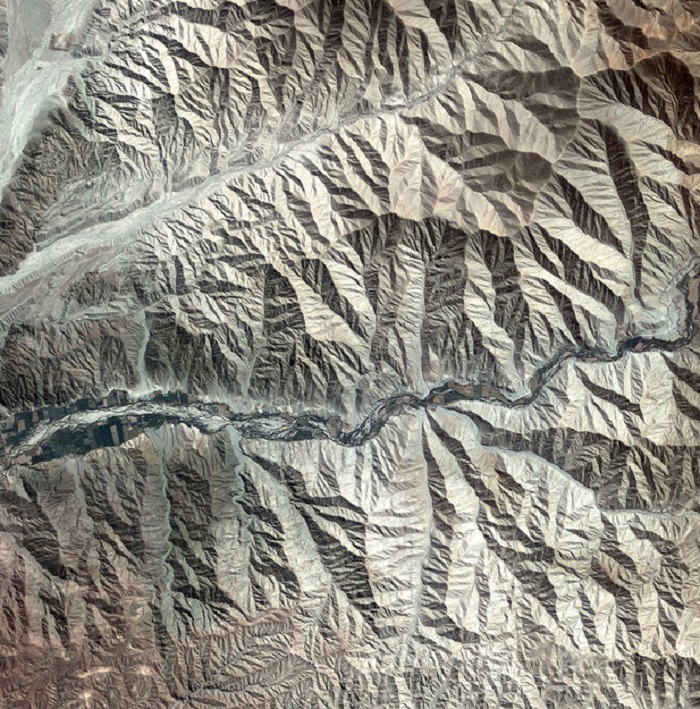
The foothills of the Andes mountains near the southern coast of Peru were captured by the Kompsat-2 satellite on 4 May 2011. The Andes stretch about 7000 km from Venezuela down South America’s west coast to the top of Argentina. The mountain rage is the result of the Nazca and Antarctic tectonic plates moving under the South American plate – a geological process called ‘subduction’. This process is also responsible for the Andes range’s volcanic activity.
.
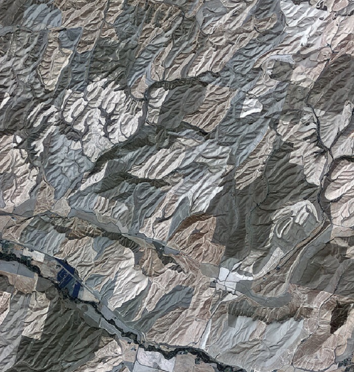
Rolling hills of farmland in the northwest United States are pictured in this image from the Kompsat-2 satellite. Acquired over Washington state, the south and west areas of the image are in Walla Walla county, while the central-eastern-upper area is Columbia County. The area pictured is part of the Palouse region – an agricultural zone that mainly produces wheat and legumes. The rolling, picturesque landscape has sometimes been compared to Italy’s Tuscany. Zooming in, we can see swirling patterns in the vegetation created by ploughs. Roads cut through the shallow valleys and buildings can also be seen. Touchet River, known for its trout fishing, can been seen in the lower left. The diagonal line running next to the river is a road that connects the town of Prescott to the west to Waitsburg to the east.
.
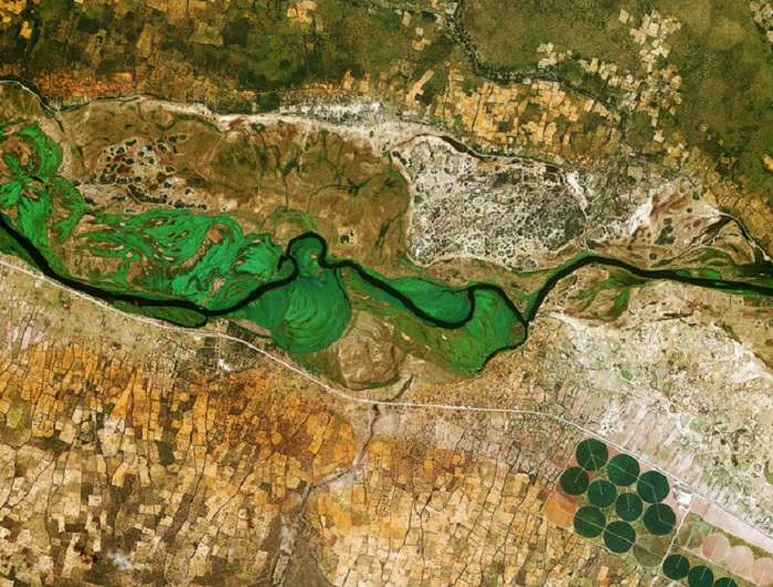
An area covering northern Namibia and southern Angola is pictured in this Kompsat-2 image. Running across the image, the Okavango River forms the border between Namibia to the south and Angola to the north. Zooming in on the upper left corner, dots of white and other bright colours near a road show rural settlements. The red soil typical of many tropical and subtropical areas of Africa is also evident. In the lower-right corner, we can see large-scale, circular agricultural plots up to about 600 m in diameter. The white lines running through the circle could be maintenance roads.
The Korea Multi-purpose Satellite (Kompsat-2) of the Korea Aerospace Research Institute acquired this image on 3 January 2013. ESA supports Kompsat as a Third Party Mission, meaning it uses its ground infrastructure and expertise to acquire, process and distribute data to users.
.
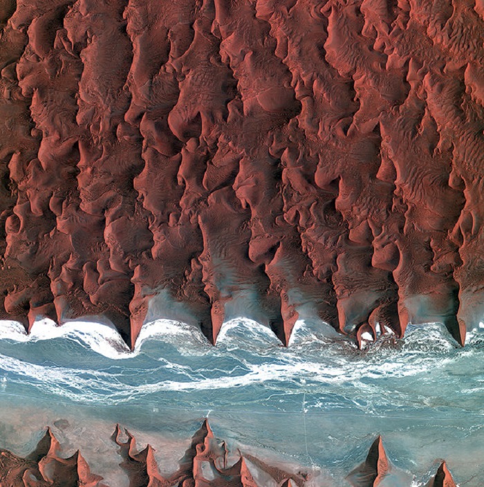
Korea’s Kompsat-2 satellite captured this image over the sand seas of the Namib Desert on 7 January 2012. The blue and white area is the dry river bed of the Tsauchab. Black dots of vegetation are concentrated close to the river’s main route, while salt deposits appear bright white. Running through the river valley, a road connects Sossusvlei to the Sesriem settlement. At the road’s 45th kilometre, seen at the lower-central part of the image, a white path shoots off and ends at a circular parking area at the base of a dune. This is Dune 45, a popular tourist stop on the way to and from Sossusvlei. In this image, there appears to be some shadow on the western side. From this we can deduce that the image was acquired during the late morning.
ESA supports Kompsat as a Third Party Mission, meaning it uses its ground infrastructure and expertise to acquire, process and distribute data to users.
.
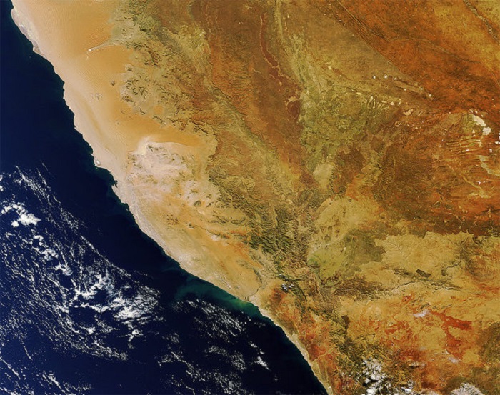
This Envisat image, acquired on 4 July 2011, shows southern Namibia and northern South Africa on Africa’s lower-west coast. We can clearly see the sand dunes of the Namib Desert – considered to be the oldest desert in the world. To the south of the desert is the Sperrgebiet diamond mining area. Further south, the Orange River forms part of the border between South Africa and Namibia before emptying into the Atlantic Ocean at Alexander Bay, which is noticeable by a lighter green colour in this image.
-
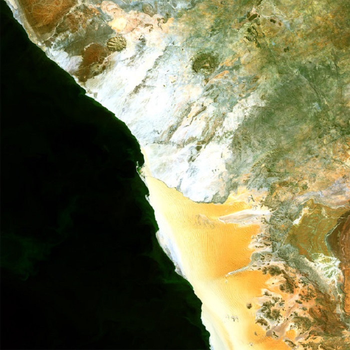
This Medium Resolution Imaging Spectrometer (MERIS) image is centred over the Namib Desert located in Namibia. The desert stretches about 1,930 kilometres along the coast of southwest Africa, mostly within the Namibian country. Visible are the huge sand dunes that rise near the coast of the Atlantic Ocean and extend inland for up to 160 kilometres, ending at the steep slopes of the Great Escarpment (lower centre right).
.
Quelle: ESA
