
13.05.2020
Delivering new information about Earth’s winds, ESA’s Aeolus mission has already been hailed a success. Today, this remarkable satellite mission has yet again achieved new heights: its data are now being distributed publicly to forecasting services and scientific users in less than three hours of measurements being made from space.
Aeolus is one of ESA’s Earth Explorer missions, which all set out to demonstrate how new ways of observing Earth can advance our understanding of how the planet works as a system.
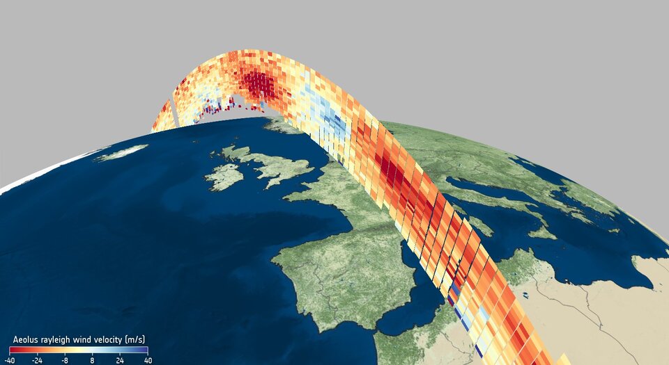
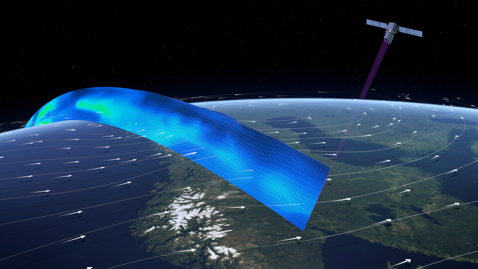
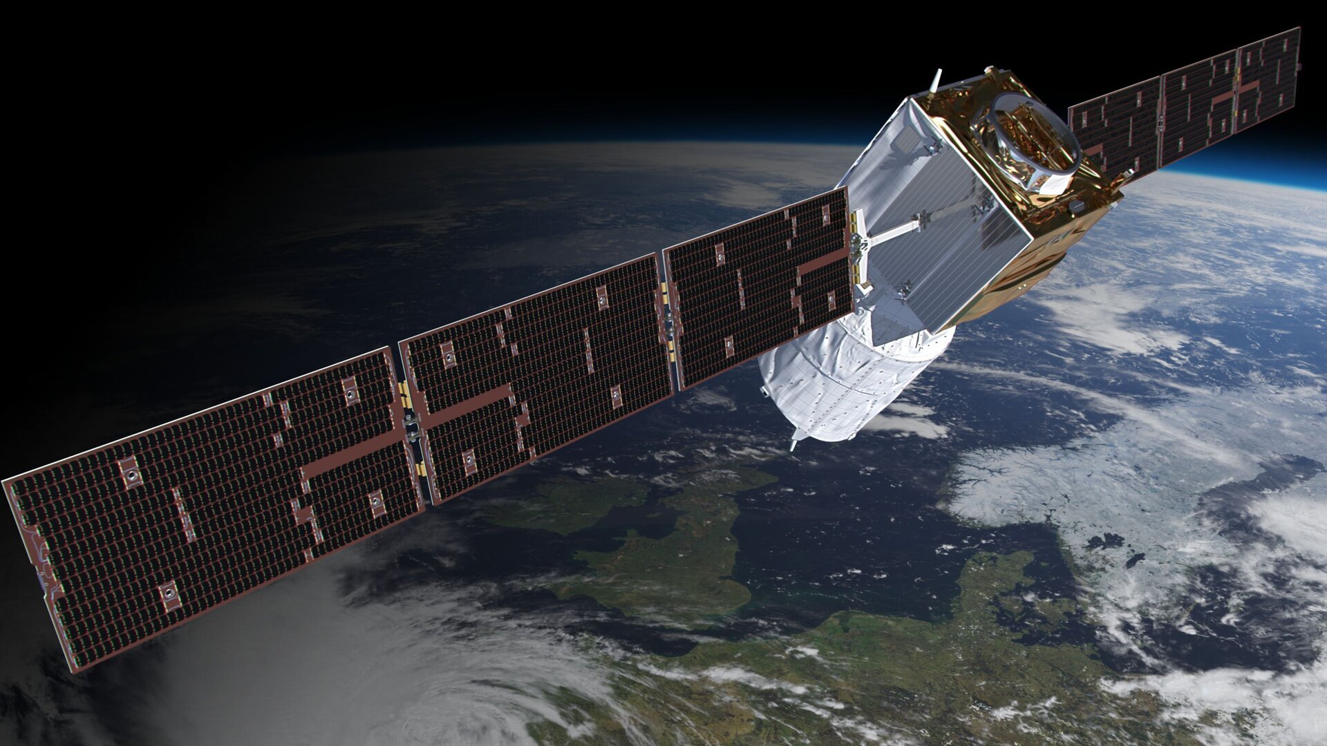
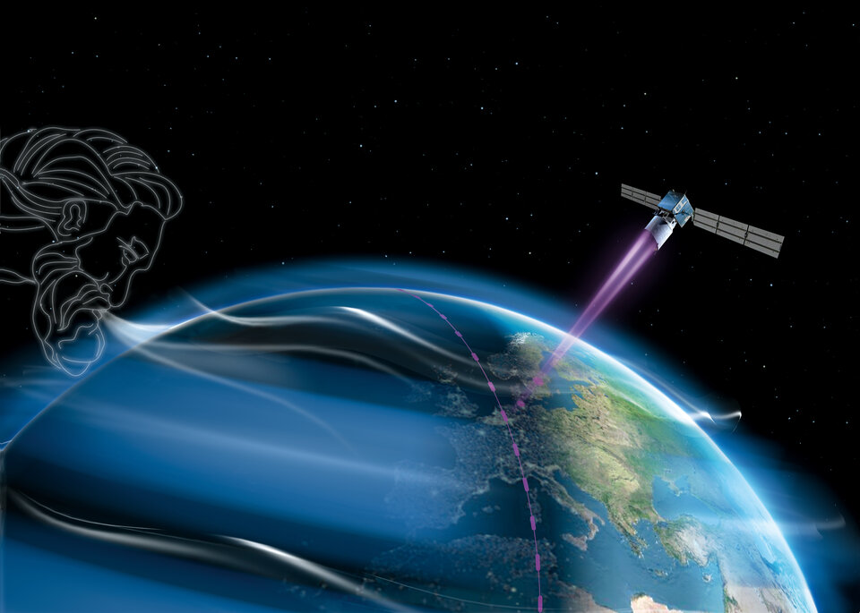
Carrying one of the most sophisticated instruments ever to be put into orbit, Aeolus is the first satellite mission to directly profile Earth’s winds from space.

It works by emitting short, powerful pulses of ultraviolet light from a laser and measures the Doppler shift from the very small amount of light that is scattered back to the instrument from molecules and particles to deliver vertical profiles that show the horizontal speed of the world’s winds in the lowermost 26 km of the atmosphere.
ESA’s Director of Earth Observation Programmes, Josef Aschbacher, said, “Aeolus was never going to be an easy satellite mission to develop, and, indeed, it took some years to get it right before it could be launched. The wait was certainly worth it though, and in the 20 months that it has been in orbit, it has gone from strength to strength that will lead to benefits for science and society alike.
“And, thanks to all the teams involved and in agreement with EUMETSAT, we are very proud to announce that as of today, Aeolus’ data are being distributed in near-real time for numerical weather prediction beyond the Aeolus core user community.”
ESA’s Peggy Fischer said, “A huge amount of work has gone into perfecting Aeolus’ data before today’s public release. This satellite technology is completely new so we have had to understand and correct certain biases in the data that were not known before launch.
“To do this, key Aeolus experts from different organisations worked together in the Data Innovation and Science Cluster team – the Aeolus DISC, to validate and optimise the data processing and bias correction methods.”
ESA’s Jonas von Bismarck, added “As the last and particularly tricky bit of the puzzle, a bias related to temperature variations across the instrument’s telescope was corrected, making the data ready to be used in numerical weather prediction without the forecast centres having to carry out further complex corrections.”
The European Centre for Medium-Range Weather Forecasts (ECMWF) in the UK has already been including Aeolus data in their forecasts since January, relying on their own bias correction scheme.

Access the video
Florence Rabier, Director-General at ECMWF, said, “After several months of testing last year we were confident of assimilating Aeolus wind data into our forecasts, which we’ve been doing since this January. We are now thrilled to see that the last biases have been corrected, benefiting us and additional weather centres that are getting ready to use the data.”
These new data are being distributed in near real-time through ESA’s Aeolus Online Dissemination Centreas well as other channels, namely EUMETCast, which is the European Organisation for the Exploitation of Meteorological Satellites’ (EUMETSAT’s) dissemination system, and the World Meteorological Organization’s Global Telecommunication System (GTS).
With Aeolus built as a research and demonstrator mission, it has shown its worth as an operational mission with the data being used for everyday weather forecasting, paving the way for a possible future fleet of operational Doppler wind lidar satellites in space.
Alain Ratier, Director-General of EUMETSAT, concluded, “EUMETSAT will now push Aeolus data in near-real time to the 4000 users of EUMETCast and to the full WMO community, to give the opportunity to every forecast centre to familiarise with the novel data and measure their value. This user feedback, together with the results of on-going ESA instrument and satellite studies, will support our planning of a possible operational Doppler Lidar mission adding a missing wind profiling capability to our next generation EPS-SG polar system.”
Quelle: ESA
----
Update: 22.09.2021
.
Joining forces for Aeolus
For a team of scientists and technicians from Europe and the US, the fact of ‘going back to the office’ this September has meant heading off to the Cabo Verde islands in the Atlantic – not to extend their summer holidays, but for a complex international experiment campaign that will scrutinise the data being delivered by one of today’s most innovative Earth observation satellites: ESA’s Aeolus wind mission.
Since it was launched three years ago, Aeolus has far exceeded expectations and frequently hailed a remarkable success. It was developed as a research mission and to demonstrate how novel laser technology could deliver vertical profiles of Earth’s wind. These measurements were much needed, for example by the World Meteorological Organization’s Global Observing System, which is a coordinated system of methods and facilities for making meteorological and environmental observations on a global scale.
Despite Aeolus being built as a research and demonstrator mission, it has proven to be so good that, for more than a year now, its data have been distributed publicly to forecasting services and scientific users in less than three hours of measurements being made from space.
Playing such an important part in forecasting, and with a potential follow-on satellite mission on the table, it is critical to ensure that its data are accurate, particularly for forecasts in the Tropics where large weather systems develop and where Aeolus is said to be making a real difference.
Hence, scientists from ESA, NASA, the German Aerospace Center, the French National Centre for Scientific Research, the CNES French space agency, Météo-France, Atmospheres Spatial Observations Laboratory, the National Observatory of Athens, the Leibniz Institute for Tropospheric Research, the University of Nova Gorica, the Ocean Science Centre Mindelo, and from many other institutes are all joining forces in Cabo Verde and also in the Virgin Islands for the Aeolus tropical Atlantic campaign.
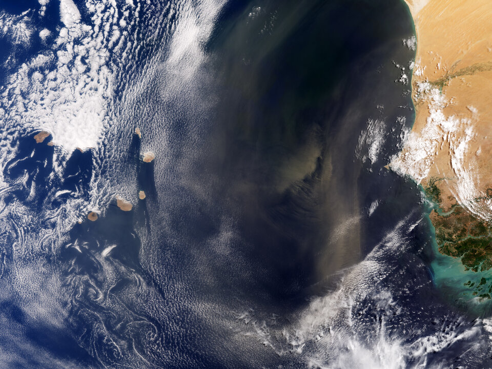
The Cabo Verde islands lie about 600 km off the coast west Africa. This tropical location is not only relevant for Aeolus, but it is also where strong winds often carry desert dust and aerosols from the African continent across the islands, making it an ideal place for investigating cloud–aerosol interaction and atmospheric dynamics.
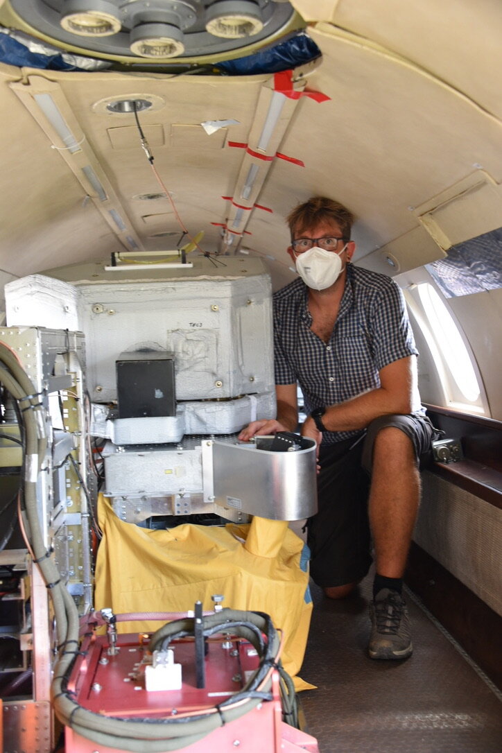
Throughout the month, this intrepid team are taking measurements of the wind, aerosols and clouds with a range of instrumentation on different aircraft flying at different altitudes.
Many flights are even coinciding with Aeolus as it orbits above. Measurements are also being taken by lasers and radars on the ground. This is all providing a wealth of data to compare with that from Aeolus and to support the science to tropical weather.
Thorsten Fehr, head of the atmospheric section at ESA, said, “We had hoped to run the field campaign last year, but of course the Covid pandemic thwarted our plans. It is an extremely complicated campaign and has been a mammoth task for us and our teams to arrange.
“This is truly an international effort and we are all thrilled to have the campaign now well underway, especially given Covid. I can’t thank everyone enough for all the work they’ve done to make it a reality.
“This extraordinary experiment campaign brings huge benefits, not only to our Aeolus mission, but also to our upcoming EarthCARE mission that is set to advance our understanding of the role that clouds and aerosols play in reflecting incident solar radiation back out to space and how the trap infrared radiation emitted from Earth’s surface.
“In addition, the data we collect will help in development of an Earth Explorer mission concept called Wivern, which aims to measure wind in clouds.
“You could never achieve an experiment of this scale without working together. International collaboration is key to so much of what we do, and we naturally build strong bonds our colleagues. So, we were deeply saddened by the sudden loss of a dear NASA colleague last week, which understandably led to NASA having to suspend their operations. Our thoughts and sincere condolences go to Gail Skofronick-Jackson’s family, friends and colleagues.”

ESA’s Aeolus mission manager, Tommaso Parrinello, said, “We are all extremely shocked by the tragic loss of Gail. NASA had been supporting our campaign in the Virgin Islands well before the fleet of European aircraft arrived in Cabo Verde and they had planned to join the team here for their second part of the campaign.
“We now hope that we will be able to resume this part of the campaign next year.”
Quelle: ESA
----
Update: 10.05.2023
.
Aeolus’ fiery demise to set standard for safe reentry
ESA’s wind mission, Aeolus, will soon be lowered in orbit leading to its fiery reentry and burn-up through Earth’s atmosphere. ESA’s efforts to ensure a safe return go well beyond international standards and place the Agency in the lead for space safety.
Having exceeded its planned life in orbit, the 1360-kg satellite is running out of fuel. Ensuring that enough fuel remains for a few final manoeuvres, ESA’s spacecraft operators will bring Aeolus back towards our planet’s atmosphere for its inevitable demise.
They will aim the mission towards the ocean, further reducing the very small chance that fragments could cause harm should any reach Earth’s surface.
This is the first assisted reentry of its kind and sets a precedent for a responsible approach to reduce the ever-increasing problem of space debris and uncontrolled reentries.
Why is Aeolus coming home?
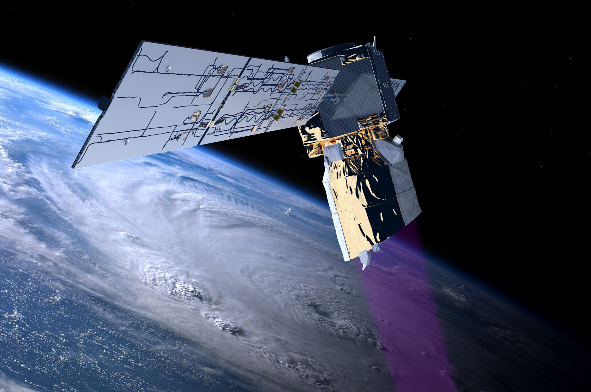
Launched in 2018, Aeolus has outlived its planned three-year life in space by more than 18 months. During its mission, its trailblazing wind-mapping laser, which at one stage was thought a nigh-impossible feat of engineering, has significantly improved weather forecasts worldwide.
Aeolus has been hailed as one of the most successful missions ever built and flown by ESA. As an Earth Explorer research mission, it was designed to demonstrate new space technology, but it became one of the highest impact-per-observation weather satellites, and its laser is still performing as well as ever.
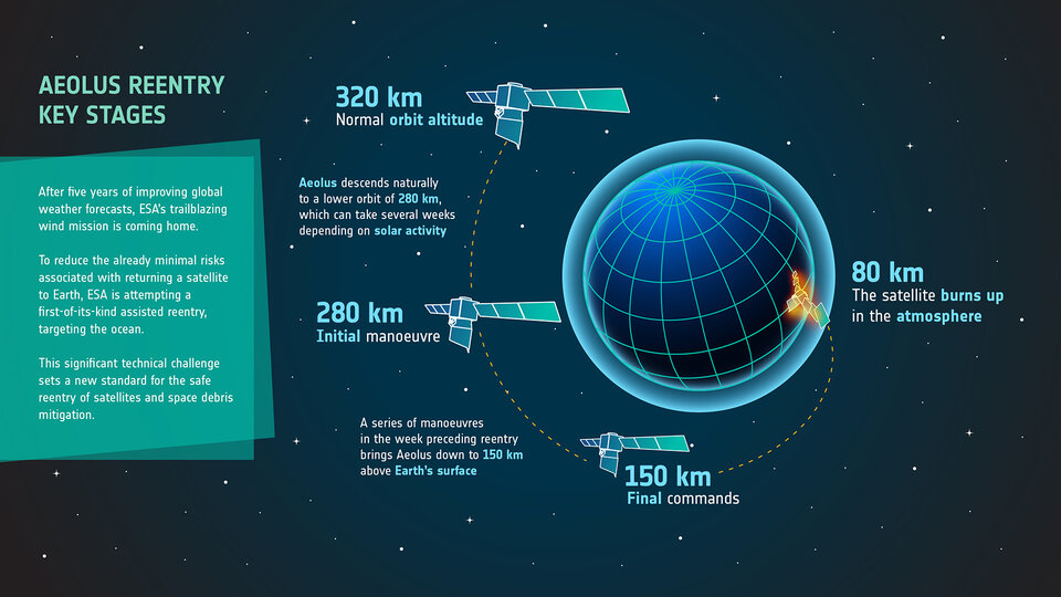
However, Aeolus’ fuel is now almost depleted and orbiting low, at an altitude of just 320 km, means it is already being caught up by Earth’s wispy atmosphere.
Speeding up Aeolus’ return is the Sun.
Solar flares and coronal mass ejections release matter and radiation, and when this washes past Earth, it increases the density of Earth’s atmosphere. Intense solar activity in recent months means that the satellite has been using even more fuel to remain in orbit. For Aeolus, it’s been like running against the wind.
This is why, after five years of spectacular science, ESA’s wind mission ended operations on 30 April 2023.
Making use of this phase, scientists have put its instrument into a special mode to perform end-of-life activities that will help to prepare the Aeolus-2 follow-on mission, which like a phoenix will emerge from the ashes of its pathfinding predecessor.
Aeolus’ final breaths
Over the next few months, Aeolus will descend naturally from its current altitude of 320 km to 280 km. At this point, spacecraft operators at ESA’s mission control centre, ESOC, in Darmstadt, Germany, will gradually lower it to 150 km above Earth’s surface. The satellite will burn up as it descends to around 80 km.
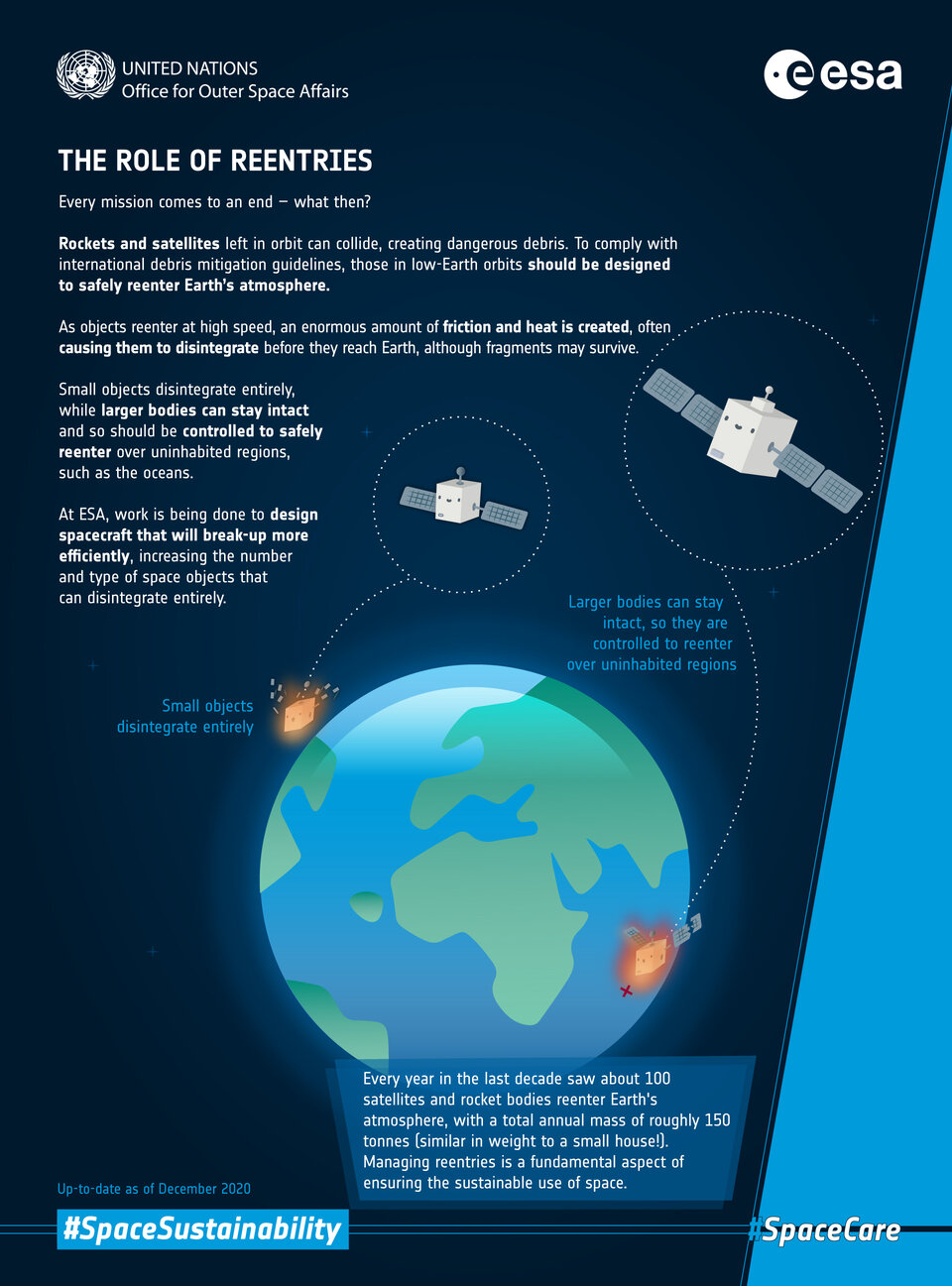
As populated regions make up a relatively small percentage of Earth’s surface, the chance of a re-entry causing any harm is exceptionally low.
The final date depends on how solar activity speeds up the process, but Aeolus is expected to be no more before the end of August.
Aeolus engineers and industry partners have carefully worked out how to best position Aeolus in Earth’s atmosphere to target open ocean waters upon reentry, hugely reducing the amount of land over which pieces fragments could fall.
ESA’s Aeolus Mission Manager, Tommaso Parrinello, said, “The exact details on the reentry approach and series of manoeuvres and operations, as well as a more detailed timeline will be made public in mid-June.
“For now, we can anticipate that we are targeting the best ocean corridor to reenter.”
With the assisted reentry of Aeolus, ESA is clearing the way for future missions to continue taking the pulse of our planet. They can only do this if Earth’s orbits aren’t filled with dangerous space debris, and safety is at the forefront of end-of-life activities.
Quelle: ESA
----
Update: 11.07.2023
.
Guiding Aeolus' safe reentry
After exceeding its planned life in orbit, ESA’s Aeolus wind satellite is on its way back to Earth. The satellite is currently falling around 1 km a day, and its descent is accelerating. ESA’s spacecraft operators will soon intervene and attempt to guide Aeolus in a first-of-its-kind assisted reentry. Why is ESA doing this?
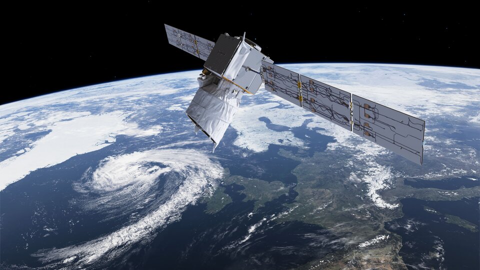
ESA’s wind mission has been orbiting our planet for nearly five years, well outliving its design life. Its remarkable Aladin instrument has beamed down seven billion pulses of UV light to profile Earth’s wind.
Although Aeolus was designed as a research mission and to demonstrate novel technology, it has been so successful that for most of its life in orbit it provided data to Europe’s leading meteorology centres, significantly improving global weather forecasts.
Having surpassed all expectations, Aeolus’ fuel is now almost spent, and the mission is over.
Engineers kept Aladin on for as long as they could before reentry operations begin. Until last week, when it was finally turned off, the trailblazing wind-mapping laser had been as strong as ever. In fact, engineers ramped up the instrument to record energy levels in its last weeks of operation.
Now, gravity and the grasping wisps of Earth’s atmosphere as well as solar activity are dragging Aeolus down from its operational altitude of 320 km.
Aeolus was never designed for a controlled reentry, so under normal circumstances the satellite would naturally fall back to Earth within a few months. However, ESA is going above and beyond by attempting an assisted reentry – the first of its kind.
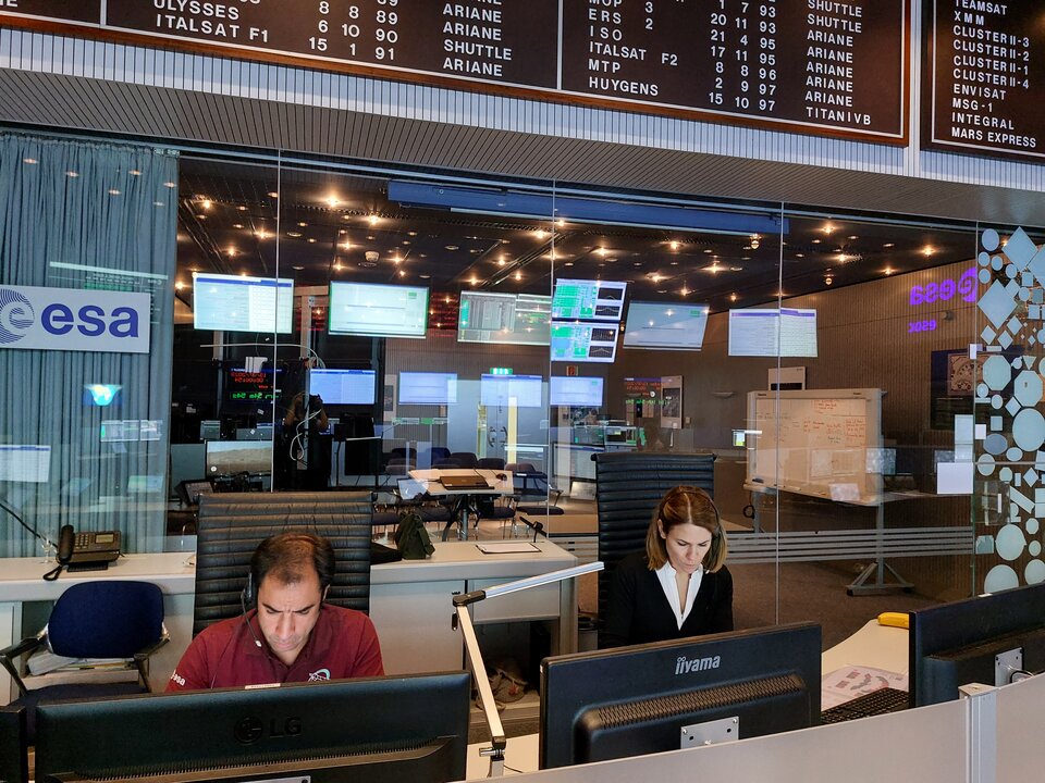
At ESA’s Space Operations Centre in Germany, mission control will use the remaining fuel to steer Aeolus during its return to Earth.
Most of the satellite will begin to burn up when it reaches an altitude of around 80 km. However, models show that several pieces of debris might reach Earth’s surface.
“This assisted reentry attempt goes above and beyond safety regulations for the mission, which was planned and designed in the late 1990s,” explains Tim Flohrer, Head of ESA’s Space Debris Office.
“Once ESA and industrial partners found that it might be possible to further reduce the already minimal risk to life or infrastructure even further, the wheels were set in motion. Should all go to plan, Aeolus would be in line with current safety regulations for missions being designed today.”
If this reentry attempt has to be aborted, which could still happen, Aeolus’ natural reentry continues.
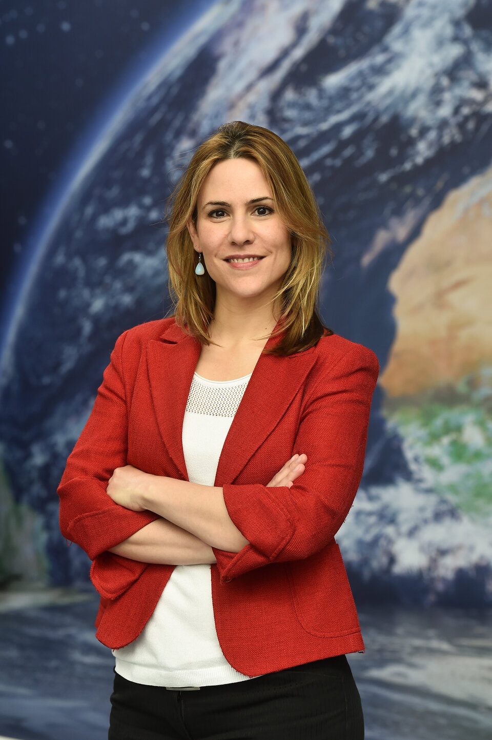
Isabel Rojo, Flight Director for Aeolus, said, “Our teams of engineers and experts in debris, flight dynamics and ground systems, have designed a series of manoeuvres and operations to assist Aeolus’, and attempt to make its reentry even safer than was originally designed.”
Today, missions are designed according to regulations that require them to either burn up entirely or undergo a controlled reentry at the end of their lives in orbit.
This first attempt at an assisted reentry sets a new precedent for missions that didn’t fall under such regulations when they were designed, but could be made to retroactively adhere to them.
With Aeolus, ESA is paving the way for safe reentries and responsible space, which is particularly important considering the rapidly increasing amount of space traffic in orbit and problem of space debris.
When will Aeolus reenter?
Aeolus is currently falling at around one kilometre a day, and accelerating. Predictions become more accurate as the days go by, so it is still difficult to say exactly when Aeolus will reenter Earth’s atmosphere. A lot depends on solar activity.
Solar flares and coronal mass ejections might speed things up. Charged particles in space weather heat up Earth’s atmosphere. This causes denser air below to rise, replacing expanding layers higher up, which increases the drag of the atmosphere on Aeolus.
Conversely, a relatively quiet period of solar activity could mean that it takes a little longer for Aeolus to descend.
It is difficult to predict solar activity precisely, but ESA is confident that the reentry, if all manoeuvres are successful, will most likely happen at the end of July or early August.
Where will Aeolus reenter?
Most of the satellite will begin to burn up at an altitude of around 80 km. However, some pieces of debris might reach Earth.
Many months of expertise have gone into planning the optimal location for reentry, which minimises the already extremely remote possibility that falling debris would pose a risk to life or infrastructure.
The flight control team is aiming at a stretch of ocean beneath the satellite’s track – a long stretch of open water as far away from land as possible.
What happens next?
For now, once Aeolus reaches an altitude of 280 km, a series of commands sent over six days will use the satellite’s remaining fuel to guide it towards the optimal position for reentry.
Then, a first manoeuvre will lower the satellite to an altitude of 250 km. This step will take several days, during which the teams will check on the health of the satellite and evaluate the next steps.
Four manoeuvres then usher Aeolus down to 150 km before 12 hours of final checks keep the satellite on track.
A final, critical manoeuvre at 150 km will direct Aeolus’ journey home. The satellite will return in a matter of hours, the vast majority of it burning up in Earth’s atmosphere.
“It has been incredible to see the skill and effort that has gone into preparing this ambitious reentry attempt,” said ESA’s Aeolus Mission Manager, Tommaso Parrinello. “We are confident we can succeed with this pioneering effort that will set a new standard for space safety and sustainability now and in the future.”
Quelle: ESA
----
Update: 20.07.2023
.
Simulating Aeolus’s return: mission control feels the heat
In-depth
No two missions are the same but launches have many milestones and features in common with each other: a satellite or spacecraft is launched on a gravity-defying rocket into space, after it separates and, exact sequences differ but it is woken up, solar arrays are deployed, instruments are switched on and tested and its thrusters are fired to get it where it needs to be.
Five years ago, Aeolus was doing just this. Now, mission complete, it’s days away from reentering through Earth’s atmosphere, and although it wasn’t designed for this, teams will be attempting to steer it on its path.
Aeolus was planned and built before current international regulations were put in place on end-of-life disposal, but ESA is nonetheless doing all it can to bring Aeolus, retrospectively, in line with the best standards of today. It’s the first time such an assisted reentry is being attempted by ESA’s mission control, but simulations are ongoing to make sure nothing comes as a surprise.
Simulating an assisted reentry: an ESA first
How do you simulate something you’ve never done before? That’s the question for Simulation Officer Filipe Metelo:
“First, we create a realistic simulation of the behaviour we expect from Aeolus as it returns, using the information we have from past reentry scenarios, controlled and uncontrolled, with tried and tested ‘telecommands’ and with various software already available to us,” explains Filipe.
“Then we chose specific scenarios that could happen, both likely and unlikely, and play these out in the Main Control Room. With a ‘pretend’ Aeolus and ground system, it feels to our teams just like the real thing.”
In general, the real operations shouldn’t be so different from the simulated events now being rehearsed, but this reentry comes with greater uncertainty than the launches and manoeuvres commonplace in this historic room.
Current high levels of solar activity, for one thing, are creating unpredictable fluctuations in the thickness of the atmosphere, speeding up Aeolus’s return. As such, aspects of this campaign are being continually adjusted as critical operations near.
Milestone manoeuvres
The key moments in Aeolus’s return will be a series of never-before-performed manoeuvres that should steer Aeolus on a return path over the most uninhabited regions possible, i.e. the ocean.
In case something doesn’t go to plan with any of the manoeuvres, it will be up to the various ground stations around the world to keep track of Aeolus’s signal, then for ESA’s flight dynamics experts to determine its orbit and potentially produce new commands for the Flight Control Team to send up to the satellite.
Five simulations are planned altogether that are more like rehearsals with minor issues surfacing, such as losing contact with Aeolus or parts of the spacecraft reaching unexpected temperatures, than the doomsday scenarios often thrown at teams before a launch.

What makes this reentry so special, and new, is that it takes a mission built with one ending in mind and, from the ground, is altering its future.
“I’ve probably taken part in more than 60 simulations over my career, but this one is extremely different as we work to execute the planned operations as accurately and safely as possible but with a number of unknowns that are outside of our control,” continues Isabel.
“I’m looking forward to uplinking the last set of commands that will execute Aeolus’s final manoeuvre, and seeing them onboard a spacecraft behaving nominally. Once that is done, our part will be over and can only hope for the best. I am of course nervous about seeing this all go to plan, and any reentering fragments ending up safely in the ocean.”
An unexpected end to the impossible mission
Aeolus Mission Manager Tommaso Parrinello, normally based at ESA’s Earth Observation heart at ESRIN, Italy, has been taking part in the simulations at mission control. Since just after Aeolus was launched, he has straddled the two worlds of Science and Operations and seen not just how challenging this mission has been to fly, but exactly why it’s been so worth it:
“Aeolus is a magical machine that has surprised even the most experienced engineers across the world,” concludes Tommaso.


Access the video
“Daily, we faced and resolved many technical and scientific challenges to make sure that we could deliver the best data to the meteorological community. But it’s been hard because it’s been new: Aeolus was always meant to be a demonstrator mission, nothing like it had ever been launched into space.”
And just as Aeolus went above and beyond during its mission, revolutionising wind profiling and improving weather models forever, its demise is now also proving to be a challenge of great importance.
“It is only now that you realise that an idea that was proposed just a year ago has become something that is real and tangible. We all know that this reentry is not going to be easy and we might not succeed. Probably, this is the biggest challenge of our professional life, but I could not imagine a different end for this “impossible mission”".
“Listening to the different voice loops and being part of the intertwined activities in the Main Control Room is really a “wow” moment. It’s difficult to describe. Not only is this real, but it is coming fast. We’ve never been readier than we are now!”
Quelle: ESA