-
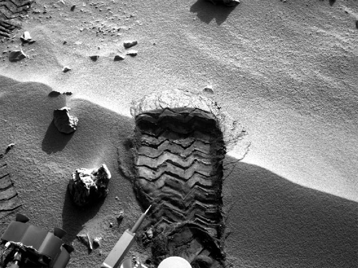
Wheel Scuff Mark at 'Rocknest'
NASA's Mars rover Curiosity cut a wheel scuff mark into a wind-formed ripple at the "Rocknest" site to give researchers a better opportunity to examine the particle-size distribution of the material forming the ripple. The rover's right Navigation camera took this image of the scuff mark on the mission's 57th Martian day, or sol (Oct. 3, 2012), the same sol that a wheel created the mark. For scale, the width of the wheel track is about 16 inches (40 centimeters).
-
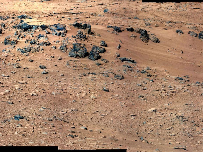
'Rocknest' From Sol 52 Location
This patch of windblown sand and dust downhill from a cluster of dark rocks is the "Rocknest" site, which has been selected as the likely location for first use of the scoop on the arm of NASA's Mars rover Curiosity. This view is a mosaic of images taken by the telephoto right-eye camera of the Mast Camera (Mastcam) during the 52nd Martian day, or sol, of the mission (Sept. 28, 2012), four sols before the rover arrived at Rocknest. The Rocknest patch is about 8 feet by 16 feet (1.5 meters by 5 meters).
Scientists white-balanced the color in this view to show the Martian scene as it would appear under the lighting conditions we have on Earth, which helps in analyzing the terrain.
-
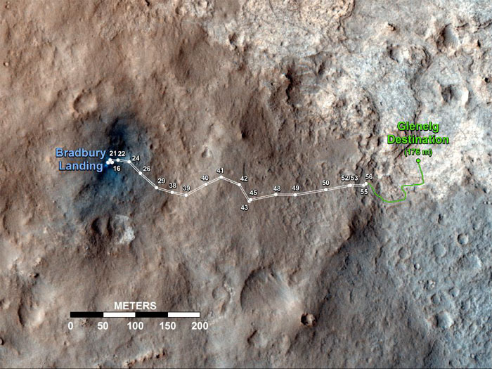
Curiosity's Travels Through Sol 56
This map shows the route driven by NASA's Mars rover Curiosity through the 56th Martian day, or sol, of the rover's mission on Mars (Oct. 2, 2012).
The route starts where the rover touched down, a site subsequently named Bradbury Landing. The white line extending toward the right (eastward) from Bradbury Landing is the rover's path so far, and the green line shows its planned future route. Numbering of the dots along the line indicate the sol number of each drive. North is up. The scale bar is 200 meters (656 feet). By Sol 56, Curiosity had driven at total distance of about 1,590 feet (484 meters).
The Glenelg area farther east is the mission's first major science destination, selected as likely to offer a good target for Curiosity's first analysis of powder collected by drilling into a rock.
The image used for the map is from an observation of the landing site by the High Resolution Imaging Science Experiment (HiRISE) instrument on NASA's Mars Reconnaissance Orbiter.
-

View on the Way to 'Glenelg'
This 360-degree panorama from NASA's Mars rover Curiosity shows the rocky terrain surrounding it as of its 55th Martian day, or sol, of the mission (Oct. 1, 2012). The base of Mount Sharp can be seen at upper left.
The sandy area seen to the right is a region called "Rocknest," which is the current candidate for Curiosity's first scooping experiments on Mars.
This image was taken by the rover's Navigation camera.
-
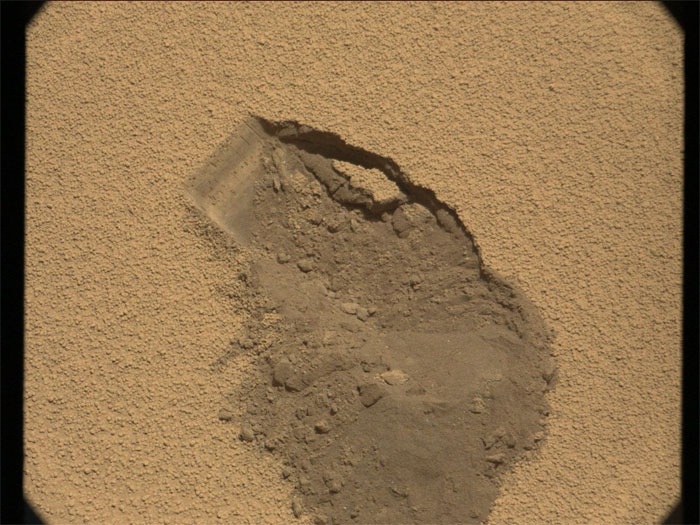
This image was taken by Mastcam: Right (MAST_RIGHT) onboard NASA's Mars rover Curiosity on Sol 61 (2012-10-07 18:23:50 UTC) .
-
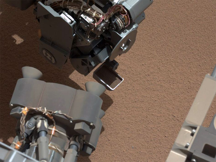
View of Curiosity's First Scoop Also Shows Bright Object
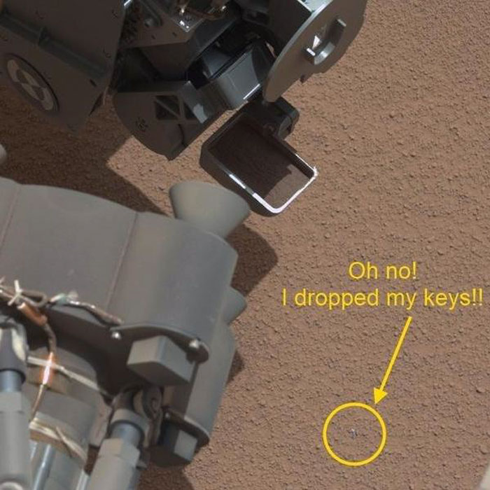
This image from the right Mast Camera (Mastcam) of NASA's Mars rover Curiosity shows a scoop full of sand and dust lifted by the rover's first use of the scoop on its robotic arm. In the foreground, near the bottom of the image, a bright object is visible on the ground. The object might be a piece of rover hardware.
This image was taken during the mission's 61st Martian day, or sol (Oct. 7, 2012), the same sol as the first scooping. After examining Sol 61 imaging, the rover team decided to refrain from using the arm on Sol 62 (Oct. 8). Instead, the rover was instructed to acquire additional imaging of the bright object, on Sol 62, to aid the team in assessing possible impact, if any, to sampling activities.
For scale, the scoop is 1.8 inches (4.5 centimeters) wide, 2.8 inches (7 centimeters) long.
-
-
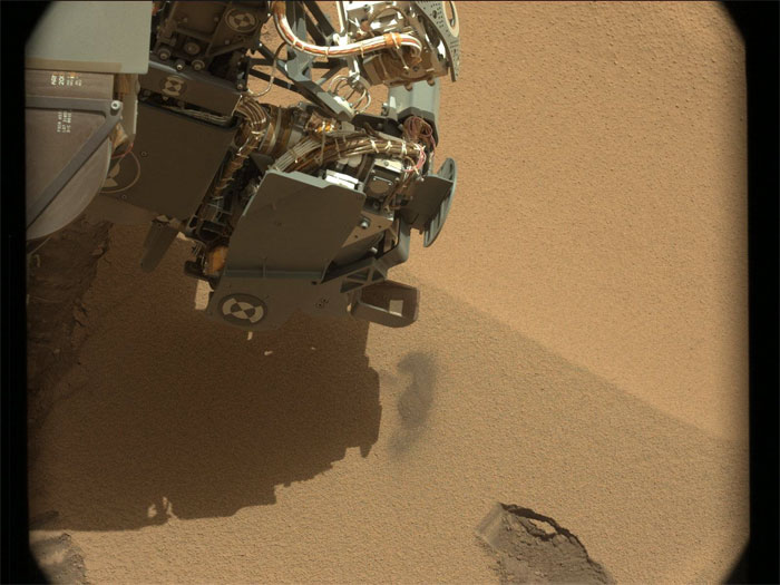
This image was taken by Mastcam: Left (MAST_LEFT) onboard NASA's Mars rover Curiosity on Sol 61 (2012-10-07 18:27:26 UTC) .
-
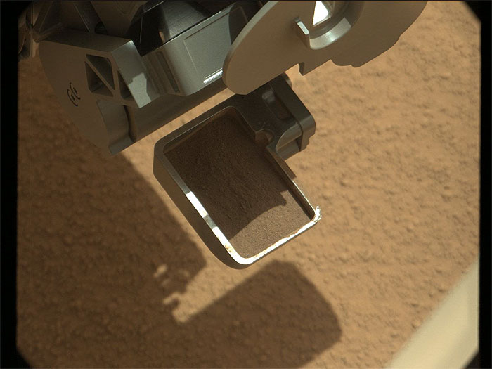
This image was taken by Mastcam: Right (MAST_RIGHT) onboard NASA's Mars rover Curiosity on Sol 61 (2012-10-07 18:37:46 UTC) .
-

This image was taken by Mastcam: Left (MAST_LEFT) onboard NASA's Mars rover Curiosity on Sol 61 (2012-10-07 18:41:20 UTC) .
-
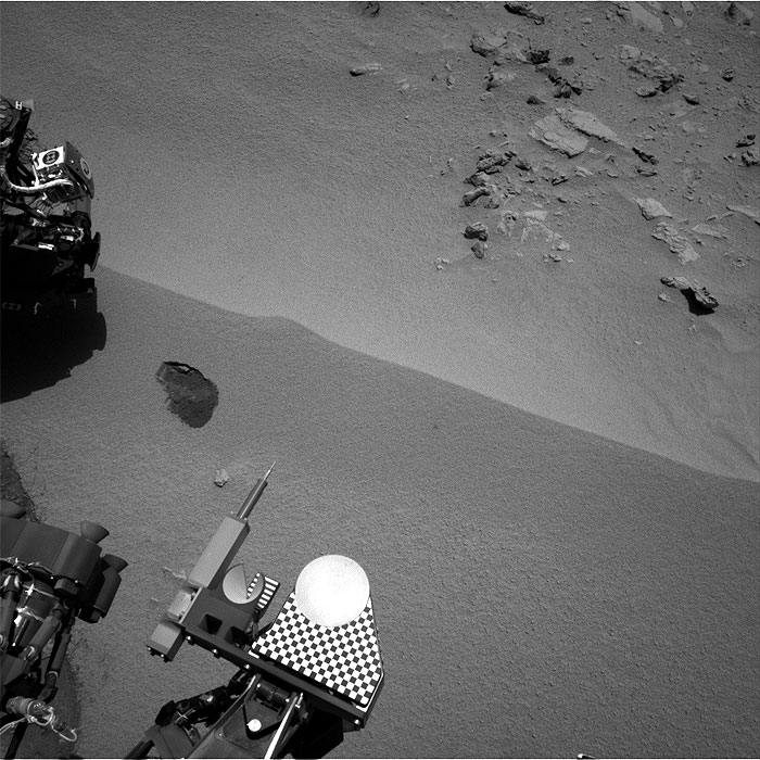
This image was taken by Navcam: Right A (NAV_RIGHT_A) onboard NASA's Mars rover Curiosity on Sol 61 (2012-10-07 18:24:21 UTC) .
-
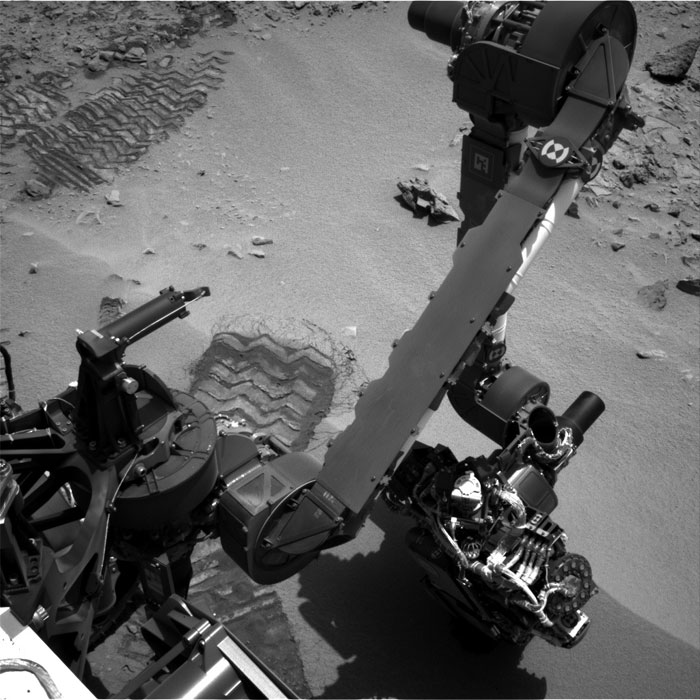
This image was taken by Navcam: Left A (NAV_LEFT_A) onboard NASA's Mars rover Curiosity on Sol 61 (2012-10-07 18:18:52 UTC) .
-
6708 Views
