-
Neben den täglich neuen Mars.Aufmahmen von Mars-Rover Curiosity, gibt es aber auch immr noch faszinierende Aufnahmen von den vorausgegangenen Rover.Missionen, die hier für einen kleinen Teil gezeigt werden sollen:
-
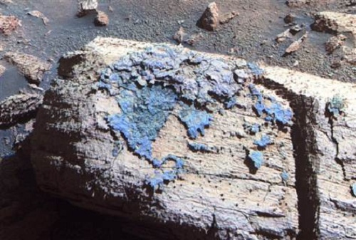
An enhanced-color image of the Chocolate Hills rock on Mars shows a strange coating that one researcher has called a "blueberry sandwich." The coating appears blue in this picture due to the false-color effect, but the naked eye would see this scene in shades of rusty red. Chocolate Hills is about the size of a loaf of bread.
-
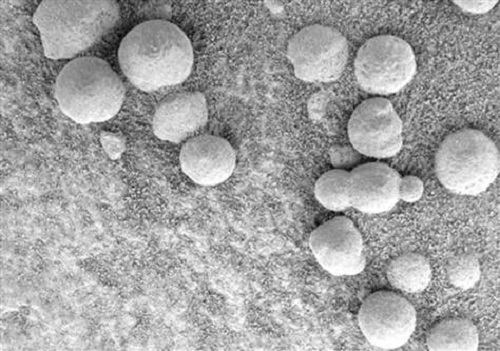
A microscopic image from NASA's Opportunity rover shows a concentration of spherules, or "blueberries," within a depression known as the "Berry Bowl," including an unusual triplet of connected blueberries. The triplet is a telltale sign that the spherules likely formed through the interaction of mineral-laden water with rock.
-
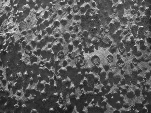
A photo from the Opportunity rover's Microscopic Imager shows strange spherules covering a Martian outcrop nicknamed Kirkwood. The view covers an area about 2.4 inches (6 centimeters) across.
-
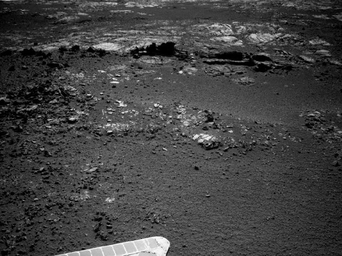
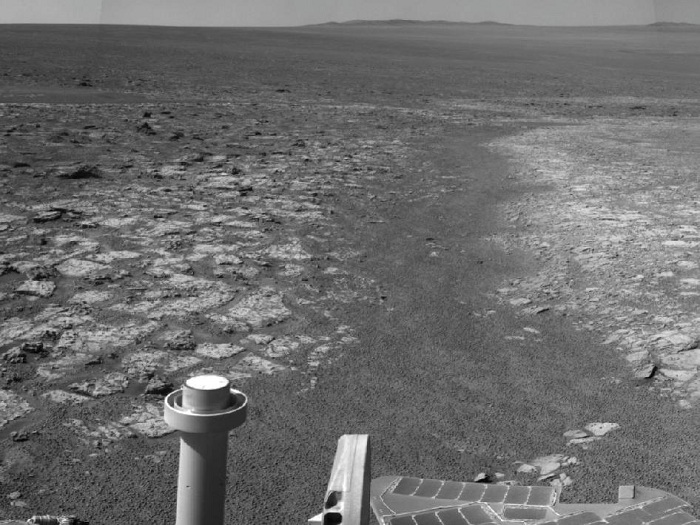
Outcrop Beckoning Opportunity, Sol 3057
The team operating NASA's Mars Exploration Rover Opportunity plans to investigate rocks in this area photographed by the rover's navigation camera during the 3,057th Martian day, or sol, of Opportunity's work on Mars (Aug. 23, 2012). Both the dark fins and the paler outcrop beyond them hold potential targets for studying with instruments on the rover.
Orbital investigation of the area has identified a possibility of clay minerals in this area of the Cape York segment of the western rim of Endeavour Crater.
This view is toward the west. A portion of the rover's solar array is in the foreground. Winds cleaned some of the accumulated dust from the array in June and July 2012.
Image credit: NASA/JPL-Caltech
-
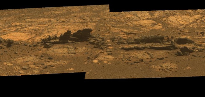
Opportunity Eyes Rock Fins on Cape York, Sol 3058
Orbital investigation of the area has identified a possibility of clay minerals in this area of the Cape York segment of the western rim of Endeavour Crater.
The view combines exposures taken through Pancam filters centered on wavelengths of 753 nanometers (near infrared), 535 nanometers (green) and 432 nanometers (violet). It is presented in approximate true color, the camera team's best estimate of what the scene would look like if humans were there and able to see it with their own eyes.
Opportunity's Surroundings on 3,000th Sol
The Sol 3000 site is near the northern tip of the Cape York segment of the western rim of Endeavour Crater. Bright toned material lines the perimeter of Cape York.
This panoramic view is centered to the south, with north at both ends. The component images were taken during sols 2989 through 2991.
Opportunity arrived at this location on Sol 2989 (June 20, 2012) with a drive bringing the mission's total driving distance as of Sol 3000 to 21.432 miles (34,492 meters). Here it examined a rock target called "Grasberg" with its microscopic imager and alpha particle X-ray spectrometer, both before and after grinding the surface off the target with the rover's rock abrasion tool. Opportunity departed this location with an eastward drive of about 105 feet (32 meters) on Sol 3008 (July 10, 2012).
The scene is presented as a cylindrical projection in this image.
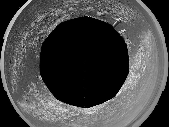
Opportunity's Surroundings on 3,000th Sol, Polar Projection
The scene is presented as a polar projection in this image, with north at the top.
Opportunity completed its 90-sol prime mission in April 2004. It has continued to explore the Meridiani Planum region of Mars for more than eight years of bonus extended missions.
The Sol 3000 site is near the northern tip of the Cape York segment of the western rim of Endeavour Crater. Bright toned material lines the perimeter of Cape York.
The component images of this scene were taken during sols 2989 through 2991. Opportunity arrived at this location on Sol 2989 (June 20, 2012) with a drive bringing the mission's total driving distance as of Sol 3000 to 21.432 miles (34,492 meters). It departed with an eastward drive of about 105 feet (32 meters) on Sol 3008 (July 10, 2012).
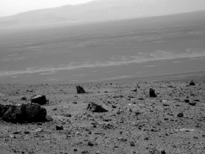
View Across Endeavour Crater
NASA's Mars Exploration Rover Opportunity used its panoramic camera to capture this raw image looking across Endeavour crater during the rover's 2,686th Martian day, or sol, of work on Mars (Aug. 14, 2011).
Opportunity had arrived at the western rim of 13-mile-diameter (21-kilometer-diameter) Endeavour crater five days earlier. The distant horizon in this image is a portion of the east-northeastern rim of Endeavour. The large rock on the left in the foreground, informally named "Tisdale 1," is about 30 inches (about 80 centimeters) tall. It is part of a group of rocks that appear to have been ejected by the excavation of Odyssey crater on the rim of Endeavour crater.
Image Credit: NASA/JPL-Caltech/Cornell/ASU
-
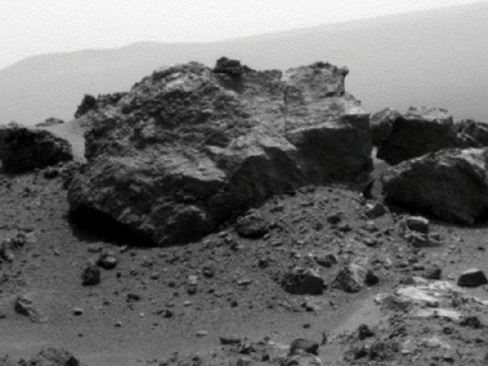
'Ridout' Rock on Rim of Odyssey Crater
Opportunity had arrived at the western rim of 13-mile-diameter (21-kilometer-diameter) Endeavour crater four days earlier. A portion of the northeastern rim of Endeavour forms the distant horizon in this view. A crater about 66 feet (20 meters) in diameter is on the Endeavour rim near Opportunity's arrival point. From a position south of Odyssey, this view is dominated by a rock informally named "Ridout" on the northeastern rim of Odyssey. The rock is roughly the same size as the rover, which is 4.9 feet (1.5 meters) long.
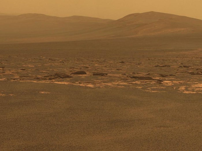
West Rim of Endeavour Crater on Mars
This view combines exposures taken by Opportunity's panoramic camera (Pancam) on the 2,678th Martian day, or sol, of the rover's work on Mars (Aug. 6, 2011) before driving on that sol. The subsequent Sol 2678 drive covered 246 feet (75.26 meters), more than half of the remaining distance to the rim of the crater. Opportunity arrived at the rim during its next drive, on Sol 2681 (Aug. 9, 2011).
Endeavour crater has been the rover team's destination for Opportunity since the rover finished exploring Victoria crater in August 2008. Endeavour offers access to older geological deposits than any Opportunity has seen before.
The closest of the distant ridges visible along the Endeavour rim is informally named "Solander Point." Opportunity may investigate that area in the future. The rover's first destination on the rim, called "Spirit Point" in tribute to Opportunity's now-inactive twin, Spirit, is to the left (north) of this scene.
The lighter-toned rocks closer to the rover in this view are similar to the rocks Opportunity has driven over for most of the mission. However, the darker-toned and rougher rocks just beyond that might be a different type for Opportunity to investigate.
The ground in the foreground is covered with iron-rich spherules, nicknamed "blueberries," which Opportunity has observed frequently since the first days after landing. They are about 0.2 inch (5 millimeters) or more in diameter.
This view combines images taken through three different Pancam filters admitting light with wavelengths centered at 753 nanometers (near infrared), 535 nanometers (green) and 432 nanometers (violet). This "natural color" is the rover team's best estimate of what the scene would look like if humans were there and able to see it with their own eyes. Seams have been eliminated from the sky portion of the mosaic to better simulate the vista a person standing on Mars would see.
