.
9.12.2015
Rocket/Payload: A United Launch Alliance Atlas V 401 will launch the GPS IIF-12 mission for the U.S. Air Force.
Date/Site/Launch Time: Wednesday, Feb. 3, 2016, from Space Launch Complex-41 at Cape Canaveral Air Force Station, Florida.
Mission Description: GPS satellites serve and protect our warfighters by providing navigational assistance for U.S. military operations on land, at sea, and in the air. Civilian users around the world also use and depend on GPS for highly accurate time, location, and velocity information.
GPS IIF-12 is one of the next-generation GPS satellites, incorporating various improvements to provide greater accuracy, increased signals, and enhanced performance for users.
Launch Notes: GPS IIF-12 will be ULA’s first mission of 2016 and the 60th operational GPS mission to launch on a ULA or heritage rocket.
Quelle: ULA
-
Update: 29.01.2016
.
Atlas V to Launch GPS IIF-12
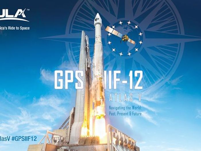
Atlas V GPS IIF-12 Mission ArtworkRocket/Payload: A United Launch Alliance Atlas V 401 will launch the GPS IIF-12 mission for the U.S. Air Force.
Date/Site/Launch Time: Friday, Feb. 5, 2016, from Space Launch Complex-41 at Cape Canaveral Air Force Station, Florida. The 19-minute launch window opens at 8:38 a.m. EST.
Mission Description: GPS satellites serve and protect our warfighters by providing navigational assistance for U.S. military operations on land, at sea, and in the air. Civilian users around the world also use and depend on GPS for highly accurate time, location, and velocity information.
GPS IIF-12 is one of the next-generation GPS satellites, incorporating various improvements to provide greater accuracy, increased signals, and enhanced performance for users.
Launch Notes: GPS IIF-12 will be ULA’s first mission of 2016 and the 60th operational GPS mission to launch on a ULA or heritage rocket.
Quelle: ULA
-
Update: 31.01.2016
.
GPS satellite moves to Atlas 5 facility for launch next Friday
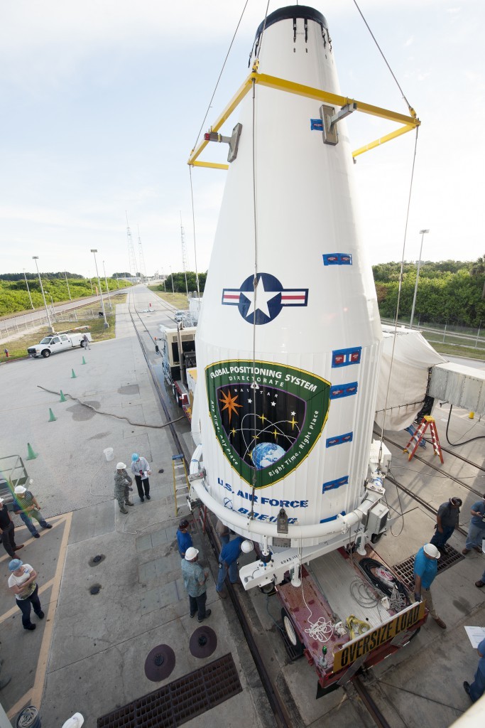
File photo of GPS satellite lift atop Atlas 5. Credit: ULA
-
CAPE CANAVERAL — After a quarter-century readying Global Positioning System satellites for launch at a Cape Canaveral Air Force Station processing hub, the final bird rolled out today as the navigation program transitions to a new era.
“This GPS 2F-12 satellite represents the end of a legacy as it will be the last of the 61 GPS satellites processed here at CCAFS,” Brig. Gen. Wayne Monteith, 45th Space Wing commander, said in a press release.
“This culminates an incredible 27-year legacy at our Area 59 Satellite Processing Facility. We are the nation’s premier gateway to space and are humbled to be a part of the team that provides GPS and its capabilities to the world.”
Beginning with the advanced GPS 3 series next year, preparing those satellites shifts off-base to nearby Titusville and the commercially-run Astrotech complex.
The GPS 2F-12 satellite, with its liftoff planned for next Friday, emerged from Area 59 early this morning to be hauled to the Atlas 5 rocket’s assembly building for attachment.
The satellite had flown to Florida on Oct. 8 from Boeing’s manufacturing facility in El Segundo, California. After arriving, it was taken to Area 59 for final testing, loading of hydrazine maneuvering propellant and encapsulation in the rocket’s nose cone.
Then, today, a convoy moved the 3,400-pound satellite north through Cape Canaveral Air Force Station to United Launch Alliance’s Vertical Integration Facility where the Atlas had been stacked.
Already shrouded in the launcher’s 39-foot-tall, 14-foot-diameter aluminum nose cone, the spacecraft was hoisted atop the Centaur upper stage for mating.
The fully assembled rocket will be transported to the launch pad on Thursday in advance of the countdown and liftoff Friday. The morning launch window extends from 8:38 to 8:57 a.m. EST (1338-1357 GMT).
This will be the 12th and last Block 2F satellite sent into the GPS network since 2010. Boeing built the dozen spacecraft of this kind featuring greater accuracy, more signals, better anti-jamming and longer design lives than previous models.
It replaces the oldest GPS satellite still in operation, a craft originally launched 25 years ago.
GPS launch operations at Cape Canaveral began with the advent of the Delta 2 rocket by McDonnell Douglas to construct a navigation system in the sky.
It was part of the U.S. military’s transition away from dependency on the space shuttle program for lifting satellites into space after Challenger. That accident in 1986 sparked development of small, medium and heavy-lift expendable launch vehicles for the Defense Department’s needs.
The maiden Delta 2 launch occurred on Feb. 14, 1989, carrying the initial operational craft into orbit for the NAVSTAR GPS network.
Over the next few years, a constellation of GPS satellites was successfully launched to give the military — and civilans — precision location and timing services anywhere in the world.
And all of those satellites were being processed for launch at Area 59 before moving to Complex 17 for launch atop Delta 2s. That rocket and payload pairing lasted for 20 years, through 2009, and 49 launches.
The past six years saw a continued passage through the processing hub for 12 satellites before launches on more-powerful Delta 4 and Atlas 5 rockets, affording the satellites to ride the boosters directly into the navigation network instead of taking circuitous routes after separating from the Delta 2 launchers.
GPS 2: 9 satellites launched (1989-1990)
GPS 2A: 19 satellites launched (1990-1997)
GPS 2R: 13 satellites launched (1997-2004)
GPS 2R-M: 8 satellites launched (2005-2009)
GPS 2F: 11 satellites launched so far (2010- )
As times change with the introduction of GPS 3, a whole new generation of satellite, a commercial approach the readying the craft for flight will occur in a new setting, Astrotech, where most spacecraft now flow through.
“There are no customers scheduled to use Area 59 following the GPS 2F-12 mission. The 45th Space Wing is currently investigating options for future use of the campus,” the Air Force tells Spaceflight Now.
A Delta 4 rocket is slated to launch GPS 3-01 in May 2017.
Quelle: SN
-
Update: 4.01.2016
.
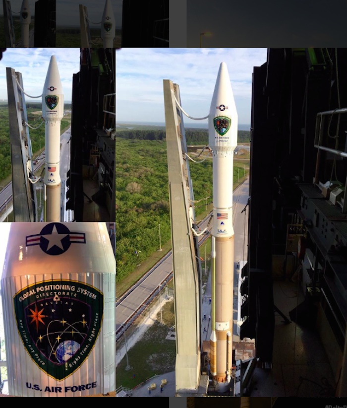
Quelle: ULA
.
Update: 5.01.2016
.
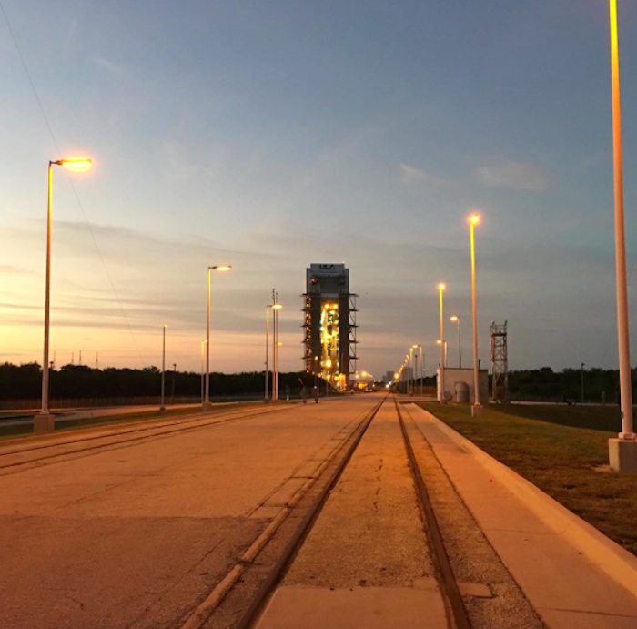
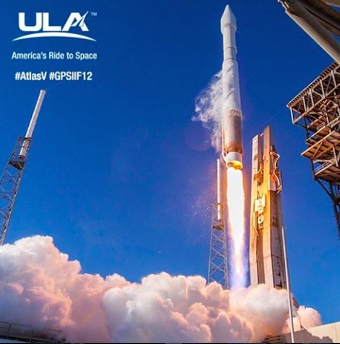
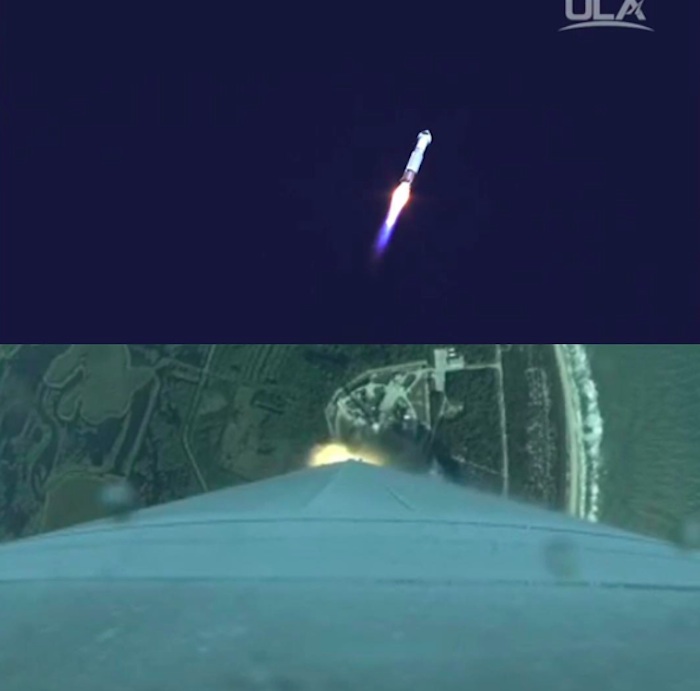
The Atlas 5 rocket emerges from the Vertical Integration Facility for rollout to Complex 41 at Cape Canaveral in preparation to launch GPS 2F-12 satellite on Friday at 8:38 a.m. EST.
.
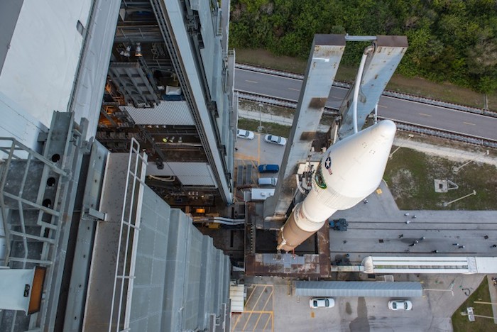
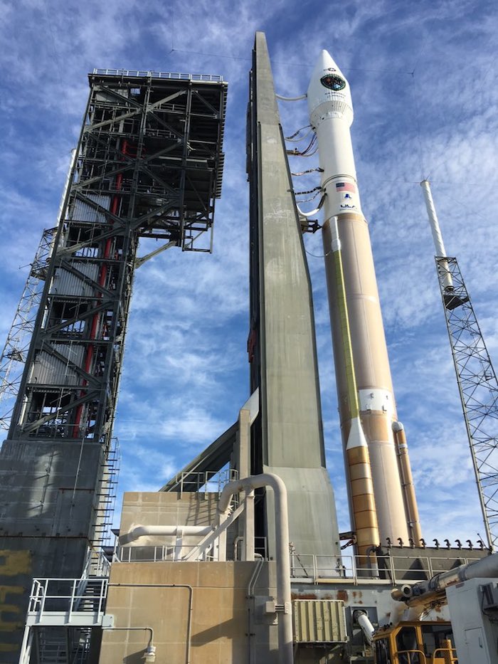
...
Quelle: ULA
-
Update: 6.02.2016
.
45th SW supports Air Force GPS IIF-12 launch aboard an Atlas V
-
2/5/2016 - CAPE CANAVERAL AIR FORCE STATION, Fla. -- The 45th Space Wing supported the U.S. Air Force's twelfth launch of a Boeing-built Global Positioning System IIF satellite aboard a United Launch Alliance Atlas V from Space Launch Complex 41 here Feb. 5 at 8:38 a.m. EST.
"Today's launch marks a momentous milestone in the history of the Global Positioning System. It is the twelfth and last GPS IIF satellite and closes out nearly 27 years of launches for the GPS Block II family of satellites," said Col. Shawn Fairhurst, 45th SW vice commander, who served as the Launch Decision Authority. "As the nation's premier gateway to space, we are proud to be part of the team providing GPS and its capabilities to the world and look forward to the future as we begin preparation for the next generation of GPS III satellites. Together with the Space and Missile Systems Center and our industry partners, we make up one team delivering assured space launch and combat capabilities for the nation."
An Airmen-led processing team at CCAFS has processed every satellite of the series since GPS IIF-1 launched here in May 2010.
"This is a significant milestone for GPS, the 50th GPS satellite to be delivered on-orbit," said Lt. Gen. Samuel Greaves, Space and Missile Systems Center commander and Air Force Program Officer for Space. "The GPS IIF satellite performance has been exceptional and is expected to be operational for years to come."
This mission proves the Air Force's dedication to deliver pre-eminent space-based positioning, navigation and timing service to users around the globe. GPS is the Department of Defense's largest satellite constellation with 31-operational satellites on orbit. GPS IIF is critical to U.S. national security and to sustainment of the GPS constellation for civil, commercial and military users. Originally designed for the military user, GPS has become a global utility depended upon by more than two billion users worldwide. Even 45th SW personnel rely on GPS satellites currently on orbit to track most missions they launch from the Eastern Range at CCAFS.
Eastern Range instrumentation provides radar tracking, telemetry, communications, command/control sites, camera and optical sites, and other support capabilities such as meteorology. Instrumentation is necessary to safely and successfully conduct civil, commercial, and national security spacelift operations and ballistic missile tests and evaluation. Eastern Range assets are based on dependable designs and technology, and are arrayed in a highly efficient architecture designed to ensure safety of the launch environment and the public at large.
Quelle: USAF
4337 Views
