.
![]()
When I learned to fly back in the early 1960s pilotage was one of the most important things to learn.
The joke for pilots starting out was that they flew “IFR” – I follow railroads!
Today one wonders what has happened to this very important lesson as modern pilots rely more and more on electronic navigational equipment like GPS.
Northwest Flight 188
Take, for example, an airline crew overflying their destination by not paying attention.
This crew overflew the Minneapolis Airport by 150 miles!
Now, the crew told the FAA that they had become distracted by a heated argument over airline policy and lost track of their location.
Really?
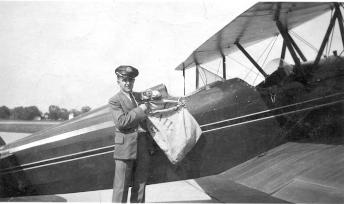
Perhaps we should go back to navigation by an early means that worked well for the first airmail pilots.
Concrete Arrows and Beacon Lights
On January 13, 2013 the Southern Utah EAA Chapter 936 posted about concrete arrows discovered around St. George, Utah.
Then The story behind the large concrete arrows across America was posted by General Aviation News.
Here is the article:
More than 100 years ago, pilots had to trust a compass and their own bearings to navigate long distances — there was no such thing as GPS. At night or during bad weather, air travel was almost impossible due to poor visibility.
.

The U.S. Postal Service was severely affected by this, as there would often be large delays in deliveries if flying conditions were not suitable. One of the first attempts at overcoming this dilemma was to light bonfires that would mark routes to various destinations.
Unsurprisingly, this proved to be rather impractical, as a lot of time, effort and money was required each time an aircraft required them. Learning from this, the government then decided on the construction of several large and illuminated concrete arrows along popular aviation routes, which directed pilots to cities in America.
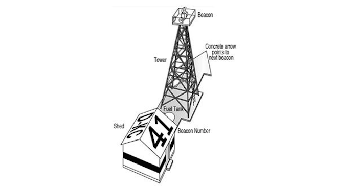
This development was named the Transcontinental Airway System, and it resulted in the construction of 1,500 concrete arrows across the country, outlining 18,000 miles of delivery routes. The arrows were 70 feet long and painted bright yellow to ensure maximum visibility.
.

At the center of each of them stood a 50-foot tower that illuminated the shapes when all other light was gone. They were around 10 miles apart from one another, and each arrow pointed to the location of the next along the course.
Construction began in 1923 and ended 10 years later, but by the 1940s, the arrows were already becoming obsolete.
That’s because of the radio. It was now the main form of communication, meaning that pilots were no longer alone while flying from one place to another. Radio and radar navigation meant that the Transcontinental Airway System became unnecessary, and eventually the beacons were removed.
Most of the towers were dismantled and recycled to aid the war effort, however a preservation program called Passport in Time was able to save three beacons, where the metal structures and generator huts are still intact.
The arrows, on the other hand, were not removed by the government. They were abandoned, with most of them losing their bright yellow coating of paint and their sharp edges due to yearly winter freezes.
Several of them are still stumbled upon by those trekking the American outback, and various travelers have set out to try and find them all. Some fanatics have even chartered private jets to follow the arrows as far as possible before the trail runs to an end.
Many of them have been removed so that the area they covered could be built upon, but other landowners have decided to keep them as a homage to history.
Quelle: Vytmin
4970 Views
