.
Aerosonde / Australien


Aerosonde is a strategic business of AAI Corporation, an operating unit of Textron Systems, a Textron Inc. company. We bring small unmanned aircraft system capabilities to the military and scientific communities, both in the U.S. and internationally. Aerosonde’s headquarters, which also serves as the Aerosonde aircraft manufacturing facility, is located in Victoria, Australia. Final Aerosonde aircraft integration is accomplished at AAI in its Hunt Valley, Md location. Flight operations are conducted in Victoria, Australia, and at Wallops Flight Facility in the United States and at various customer sites.
---
Entecho / Australien
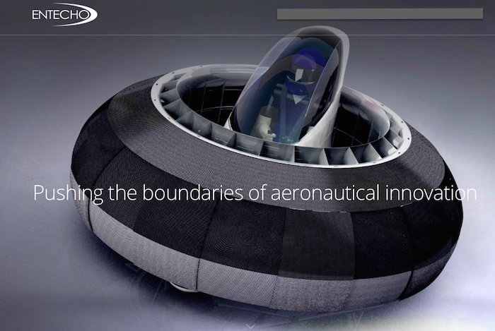
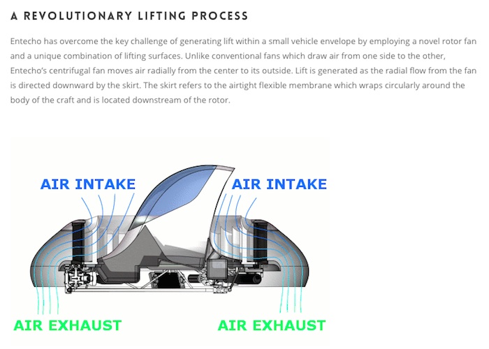
Rotor: The CAV rotor is a cylindrical drum (or centrifugal) fan which rotates about the central vertical axis of the craft.
Airflow: As the drum fan rotates it pumps air radially through its blades. The air is drawn into the intake duct and is then accelerated as it passes through the fan. It is then directed downward by the skirt creating lift.
High Pressure: High pressure regions form as a result of the air being accelerated through the ducts by the rotating drum fan. These regions of higher pressure act on specific surfaces of the craft producing lifting forces.
Overall lift: The overall lifting force is a result of summing together all of the lifting forces.
Why a Centrifugal Fan?
The use of a centrifugal fan to produce vertical lift is the central concept of Entecho’s advanced lifting technology. This is primarily because it allows the creation of an extremely compact craft which has VTOL capabilities and high lifting efficiencies.
In order to understand why this is possible, first it is necessary to examine the aerodynamics of an ordinary helicopter rotor blade. Helicopter blades are axial and therefore the rotational velocity of the blade varies along its length, reaching a maximum at the blade tip. Since lift is proportional to velocity squared only the outer section of the blade is travelling with enough velocity to produce significant lift. This results in a small outer portion of the blade producing the majority of the lift and, consequently, longer blades are required to achieve the desired flight performance.
Unlike a helicopter rotor blade, the centrifugal Entecho rotor locates the entire span of the blades at the same maximum radius from the rotational axis. Hence, each blade is travelling through the air with the same rotational velocity for any given rotor RPM. This allows us to design a simple two dimensional blade geometry that will achieve maximum efficiency along its entire length. Moreover, each blade is now travelling at the maximum velocity possible at that RPM and radius of rotation. Hence, every blade has the maximum possible energy to perform work on the air and consequently produce lift.
Unique Control Techniques
The skirt is a flow vectoring nozzle that can generate high levels of control power. This skirt accesses the entire moving air stream, so by simply controlling the movement of the skirt, we can develop very desirable response characteristics both in translation and rotation.
FlowVectoring2_1
Safety Focused Design
The blades of the hubless fan move at relatively low speeds, and are enclosed by the skirt. This eliminates the danger of high-speed, exposed blades that feature on helicopters and propeller planes. Furthermore, should a blade ever break for some reason, the broken blade will not penetrate the skirt since it is extremely light and will be moving relatively slowly. The lack of exposed blades means that safe operation near objects such as buildings and trees becomes possible.
The structure of Entecho’s YouFly incorporates a safety cell which has significant radial strength and maximizes the amount of energy that can be absorbed in a crash prior to any structure intruding into the central compartment.
Entecho has focussed initial development on a vehicle which is height controlled to approximately 1.5 m to maximize safety, but retains multi-terrain capability and the sensation of free flight.
---
DP Copter UAV / Austria
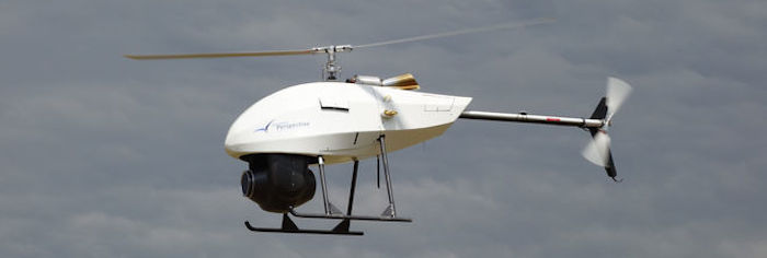
Dynamic Perspective's DP Copter UAV helicopter system
---
CAMCOPTER S100 / Austria
---
FT-150 / Brasilien
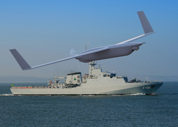
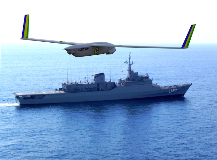
---
Sistema de Aeronave Remotamente Pilotada (SARP) / Brasilien
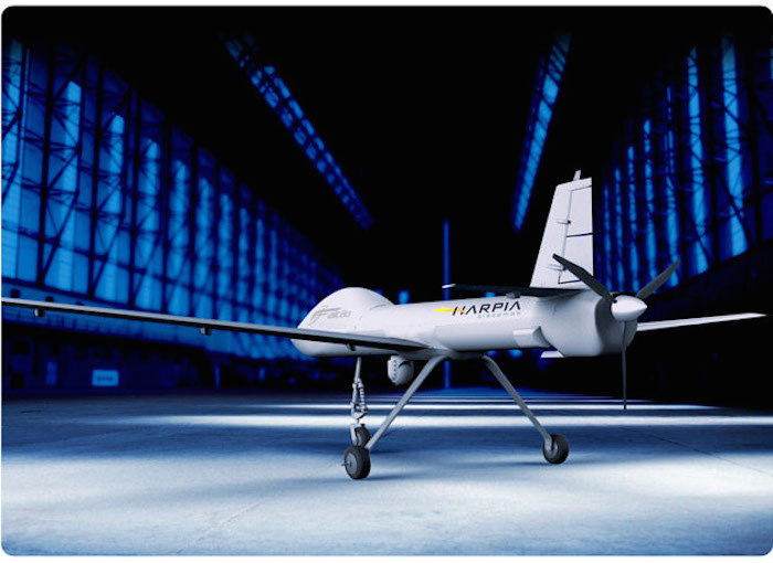
---
XMobots /Brasilien
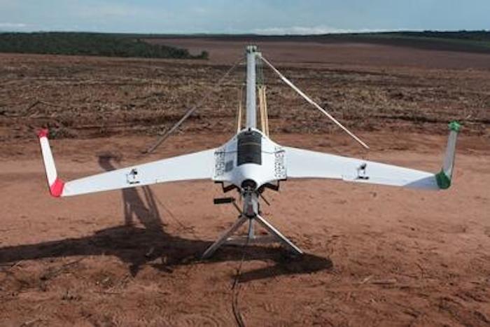
---
Challis Heliplane UAV E950 / Kanada
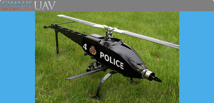
Challis Heliplane UAV E950
"Patented" - high speed Heliplane flight technology
- Almost twice the flight speed compared to conventional helicopter
- Hover characteristics of helicopter , cruise like an airplane
- Stealth, electric power
- Ability to maintain stable view of target in high winds
- Up to 35 klm range / Up to 15 Kg payload / Max gross 25Kg
- Rotor 2085mm - Tail 360mm - Prop 20.2" x 17
- Length 1810mm - Height 650mm
- 2-6 lipo batteries 20,000mAh - 60,000mAh
- Up to 1 hr flight endurance
- 1000 Multi programmable waypoints
- 3 axis stabilized camera system / HD video day / or FLIR night
---
Draganfly / Kanada
---
SnowGoose UAV / Kanada

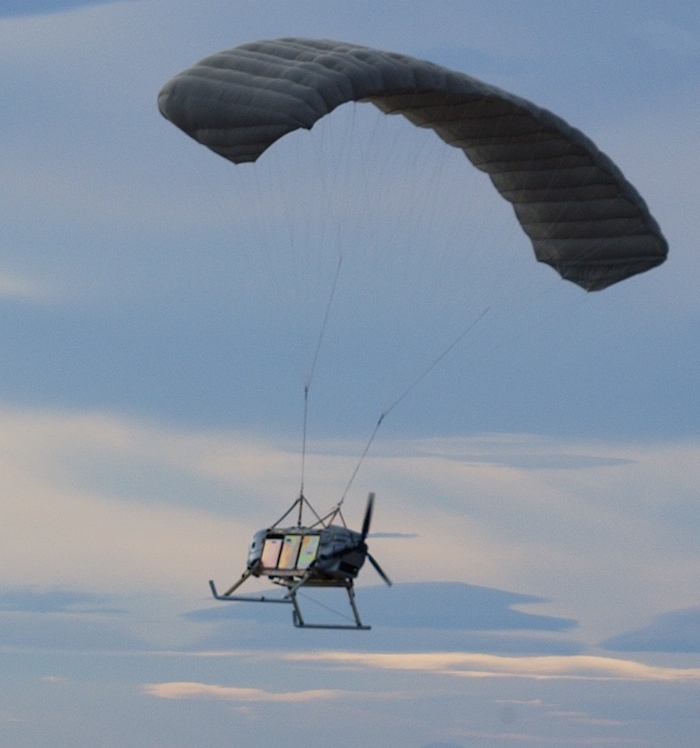
SnowGoose UAV
The SnowGoose Unmanned Aerial Vehicle (UAV), NSN 1550-01-505-3010, is a multi-purpose, autonomous, aerial cargo delivery system with a payload capability up to 575 lbs (260.8 Kg) carried in 6 individual cargo bays. It combines MMIST's latest developments in autonomous guidance and precision cargo delivery.
The SnowGoose UAV is capable of full autonomous flight within the boundaries of approved air space, according to the pre-programmed mission.
Flight of the UAV is monitored and controlled from a SATCOM ground control station. The SnowGoose modular payload bays allow for multi-mission capability with simple integration of a wide range of available payload equipment packages.
Ground Launch Capability
The SnowGoose UAV is not dependant on airfields or runways and can be ground launched from a 1200 ft (365 m) unprepaired level surface.
---
AG-Wing / Chile
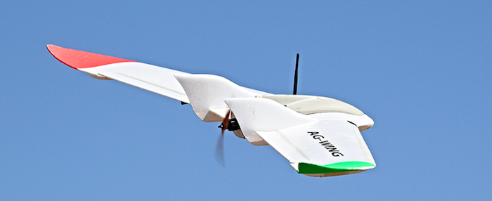
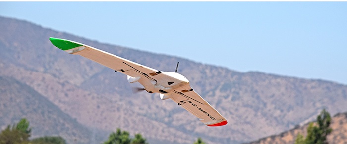
AG-Wing is a full automatic small Unmanned Aerial System (sUAS) for professional mapping and precision agriculture. Obtain outstanding results with a sUAS designed to operate in tough environment with maximum simplicity and performance.
AG-Wing is a ready to work system, easy to deploy and operate. It has been used by many operators in a wide range of conditions, demonstrating efficiency in each and every flight.
AG-Wing can be used to obtain high quality visual range and multispectral orthomosaics, as well as awesome digital surface models.
The system comes with all equipment required for immediate operation, including carrying case, payload, battery, charger and PC. AG-Wing has a fast learning curve, being ideal for entry level users. RC skills is not required.
---
China
---
Hypersphere HS-5k / Kroatien
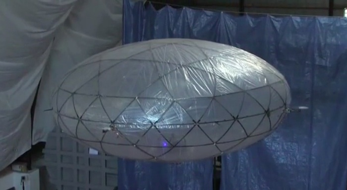
The Hypersphere HS-5k system for continuous surveillance represents a disruptive innovation for two major fast- growing industries - unmanned aerial vehicles and remote sensing.
With per-flight-hour expenses ten to fifteen times lower than other unmanned systems in the same class, the HS-5k system enables a considerable increase in profitability of the use of the unmanned aerial systems in public and commercial domains, as well as a significant market application expansion.
Furthermore, in the remote sensing industry the price per square kilometre for a very high resolution image (e.g. 20 cm/px) is more than 200 times higher than the production expense of the equivalent remote sensing date obtained through the HS-5k system.
Numerous other conceptual, technical and business advantages give this product an edge over existing solutions in the aforementioned industries.
The Hypersphere HS-5k system for continuous surveillance is comprised of a MALE UAV - unmanned aerial vehicle with extended endurance (24 to 100 hours of continuous flight, depending on the environmental conditions), and of the communication and ground infrastructure required for providing the field information in real time. The HS-5k system supports a wide variety of continuous surveillance missions, and is at the same time less expensive to use than any existing equivalent solution, based either on unmanned or manned aircrafts, or just on the ground surveillance infrastructure.
In short, HS-5k currently provides the best continuous surveillance service in the world.
---
HAES 400 UAS / Czech Republic
---
Huginn X1 / Dänemark
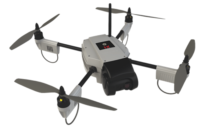
The Danish company Sky-watch produces surveillance drones. The company was established 4 years ago and now has 17 employees and can produce around 8 drones per week. They have their own test center and sell their drones to over 20 different countries – typically to customers in the Search & Rescue sector where there is a lot of business potential. The Huginn X1 drone from Sky-Watch is easy to operate and very reliable. It flies in temperatures from -20°C and up to 50°C, in rain, snow and dust. All of this makes it very attractive for many businesses. For instance, a fire brigade can monitor the development of a fire. Also Rescue teams can get quick overview of accidents like the train accident exercise shown, etc.
However, the regulations are still restrictive, constituting a grey zone. For example, it is difficult to get permission to fly drones in built-up areas. According to Jonas Johansen from Sky-watch, sales would rise significantly if Danish authorities would modernize these rules and regulations, thus creating easier access to the domestic market and consequently giving drone companies the possibility of creating jobs.
In the USA, authorities are planning to open airspace for civilian drones in 2015. In Sweden, they have already made special drone regulations.
Danish Transport Authorities understand this impatience but are reluctant to change the rules, since some potential negative aspects remain such as security (if control is lost), privacy violation and the possible use for terror activities.
For now, companies have to apply for special exemption to fly closer to buildings in built-up areas.
The Transport Authority has established a task group working with several ministries on how to regulate drones.
---
Muninn VX1 / Dänemark
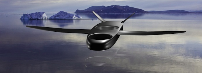
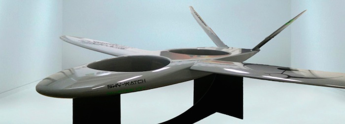
Muninn VX1 – INNOVATION THROUGH COMBINATION
Sky-Watch focus on usability and advanced sensor fusion technologies. The Muninn VX1 UAV offers advanced functionality at your fingertips. Autonomous vertical take-off and landing (VTOL), combined with easy control of waypoints via our Navigator, makes flying the Muninn VX1 UAV incredibly easy. Rather than concentrating on the operation of the craft, the operator is able to focus on the large amount of data provided by the system or on mission objectives. Once deployed, the Muninn VX1 UAV carries out its predefined mission objectives and provides real-time data needed for smart, fast and accurate decision making. The Muninn VX1 UAV is ideal for environmental monitoring, agriculture and perimeter security.
6363 Views
