
14.11.2025
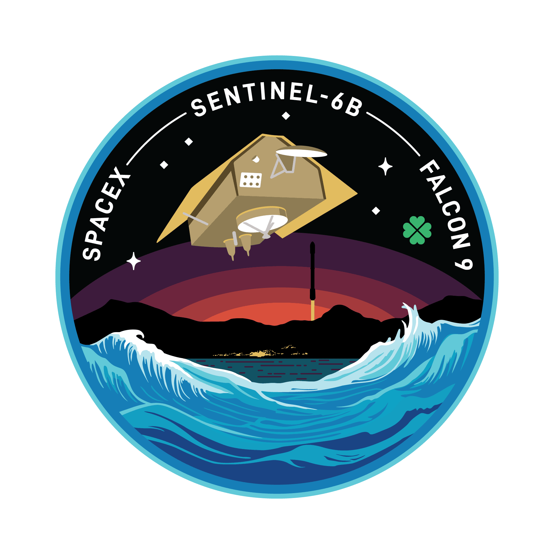
SpaceX to Launch NASA’s Sentinel-6B Satellite from Vandenberg on November 16
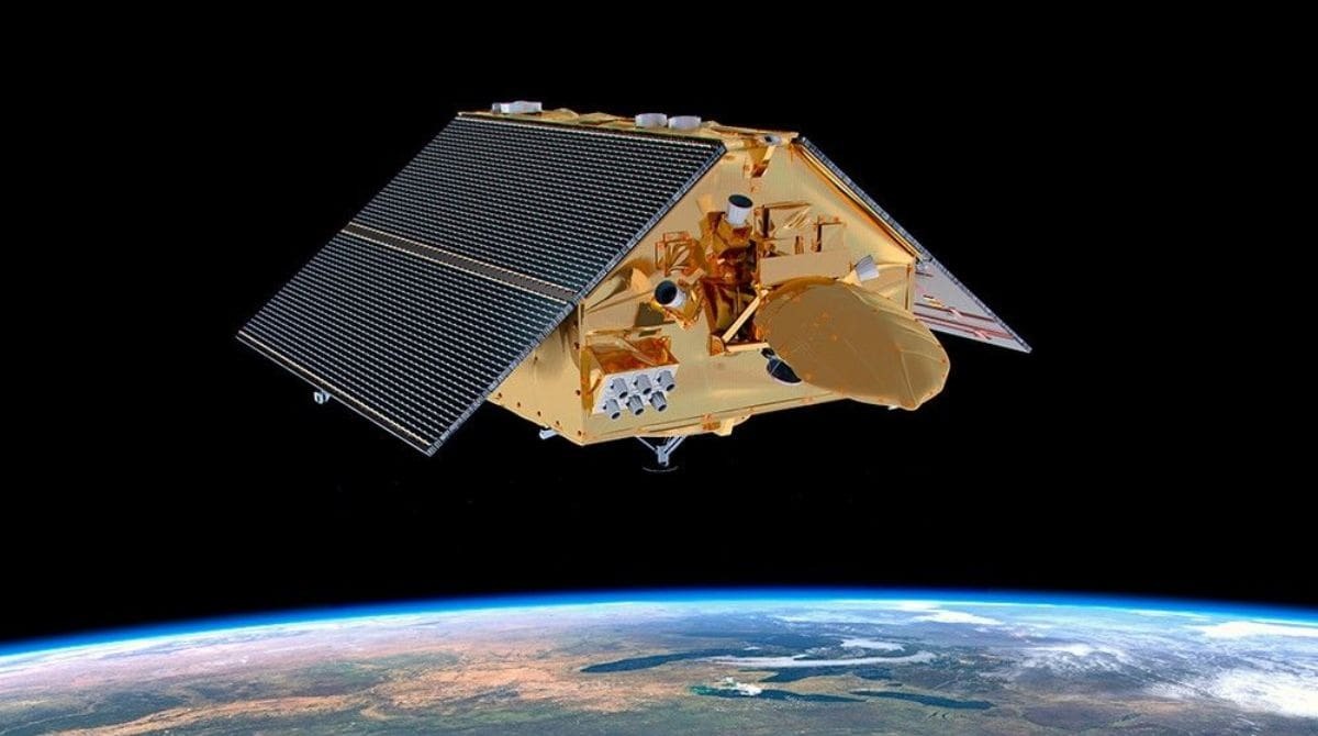
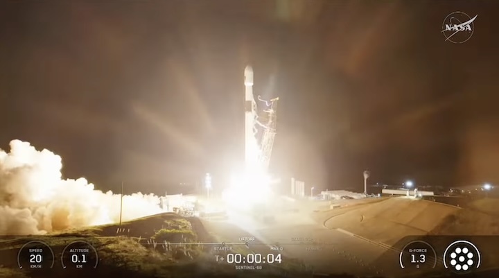
SpaceX launching NASA’s Sentinel-6B Satellite. Image Source: NASA website
SpaceX is set to launch NASA’s Sentinel-6B satellite from Vandenberg Space Force Base in California on November 16, 2025.
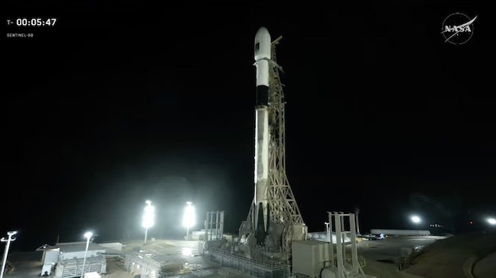
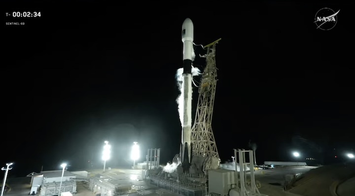
A SpaceX Falcon 9 rocket will launch NASA’s Sentinel-6B satellite, with liftoff targeted for 9:21 p.m. PT on November 16 from Space Launch Complex 4 East (SLC-4E). The Sentinel-6B is an identical twin of Sentinel-6 Michael Freilich, which launched aboard a Falcon 9 in November 2020.
The Falcon 9 rocket’s first-stage booster will be flying its third mission, having previously supported two Starlink launches. After liftoff, it is expected to land on Landing Zone 4 (LZ-4) at Vandenberg Space Force Base.
NASA’s Launch Services Program, based at Kennedy Space Center in Florida, will manage the launch, while the Jet Propulsion Laboratory (JPL) in Southern California will oversee NASA’s mission contributions.
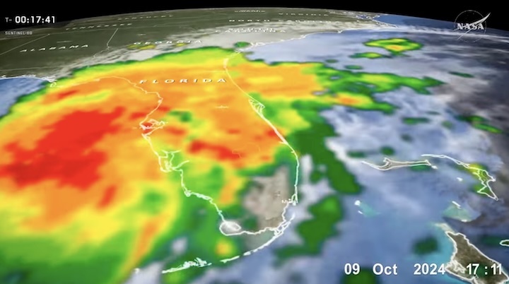
The launch marks the next phase of the global mission to track the sea level and atmospheric changes from space with high precision.
Depending on weather and atmospheric conditions, residents of Santa Barbara, San Luis Obispo, and Ventura counties may hear one or more sonic booms during the launch and landing.
Where to Watch the Sentinel-6B Launch
A live webcast will begin one hour before liftoff. Viewers can watch on NASA Television, NASA’s website, SpaceX’s official website, SpaceX’s official X account, and the X TV app.
NASA will hold a pre-launch and science briefing on November 15, 2025, offering insights into the spacecraft’s mission objectives.
About Sentinel-6B Mission
The mission is a collaboration among NASA, European Space Agency (ESA), the European Organization for the Exploitation of Meteorological Satellites (EUMETSAT), National Oceanic and Atmospheric Administration (NOAA), and the French Space Agency (CNES).
Sentinel-6B is part of the international Sentinel-6/Jason-CS (Continuity of Service) mission, which monitors global sea levels and atmospheric temperature measurements. The satellite uses the radar technology that bounces signals off the ocean surface to provide continuous, high-precision topography of the world’s oceans.
The twin satellites measure sea levels with an accuracy of about one inch across about 90% of the Earth’s oceans, providing critical data for climate and weather forecasting.
Legacy of Ocean Observation
Since the 1990s, NASA and its partners have relied on a series of satellites to provideprecise sea level measurements critical to understanding Earth’s changing climate.
Launched in 2020, the Sentinel-6 Michael Freilich satellite marked the next phase of a global partnership that began more than three decades ago.
Sentinel-6B will help scientists and policymakers to monitor rising sea levels, refine storm and weather prediction models, and protect coastal infrastructure. Once in orbit, Sentinel-6B will take over from its twin to continue vital ocean and climate monitoring into the next decade.
Quelle: edhat
----
Update: 17.11.2025
.
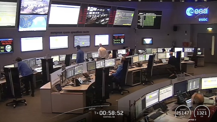
NASA, Partners ‘Go’ for Sentinel-6B Launch
NASA, international partners, and SpaceX are moving forward with the launch of the Sentinel-6B satellite, which will measure sea levels, atmospheric temperature, and humidity worldwide.
During the agency’s Launch Readiness Review at Vandenberg Space Force Base in California, NASA’s launch director and the launch team polled “go” for launch of Sentinel-6B.
NASA will host a prelaunch news teleconference at 4 p.m. EST (1 p.m. PST) Saturday to discuss Sentinel-6B’s mission. Audio coverage will stream on the NASA Video YouTube channel with the following participants:
- Karen St. Germain, director, Earth Science Division, NASA Headquarters
- Pierrik Veuilleumier, Sentinel-6B project manager, ESA (European Space Agency)
- Parag Vaze, Sentinel-6B project manager, NASA JPL
- Tim Dunn, senior launch director, Launch Services Program, NASA’s Kennedy Space Center
- Julianna Scheiman, director, NASA Science Missions, SpaceX
- 1st Lt. William Harbin, launch weather officer, U.S. Air Force
Liftoff of Sentinel-6B is targeted for 12:21 a.m. EST Monday, Nov. 17, (9:21 p.m. PST Sunday, Nov. 16) on a SpaceX Falcon 9 rocket from Space Launch Complex 4 East at Vandenberg. Watch coverage beginning at 11:30 p.m. EST (8:30 p.m. PST) on NASA+, Amazon Prime, and more. Learn how to watch NASA content through a variety of platforms, including social media.
NASA, European Partners Set to Launch Sentinel-6B Earth Satellite
Set to track sea levels across more than 90% of Earth’s ocean, the mission must first get into orbit. Here’s what to expect.
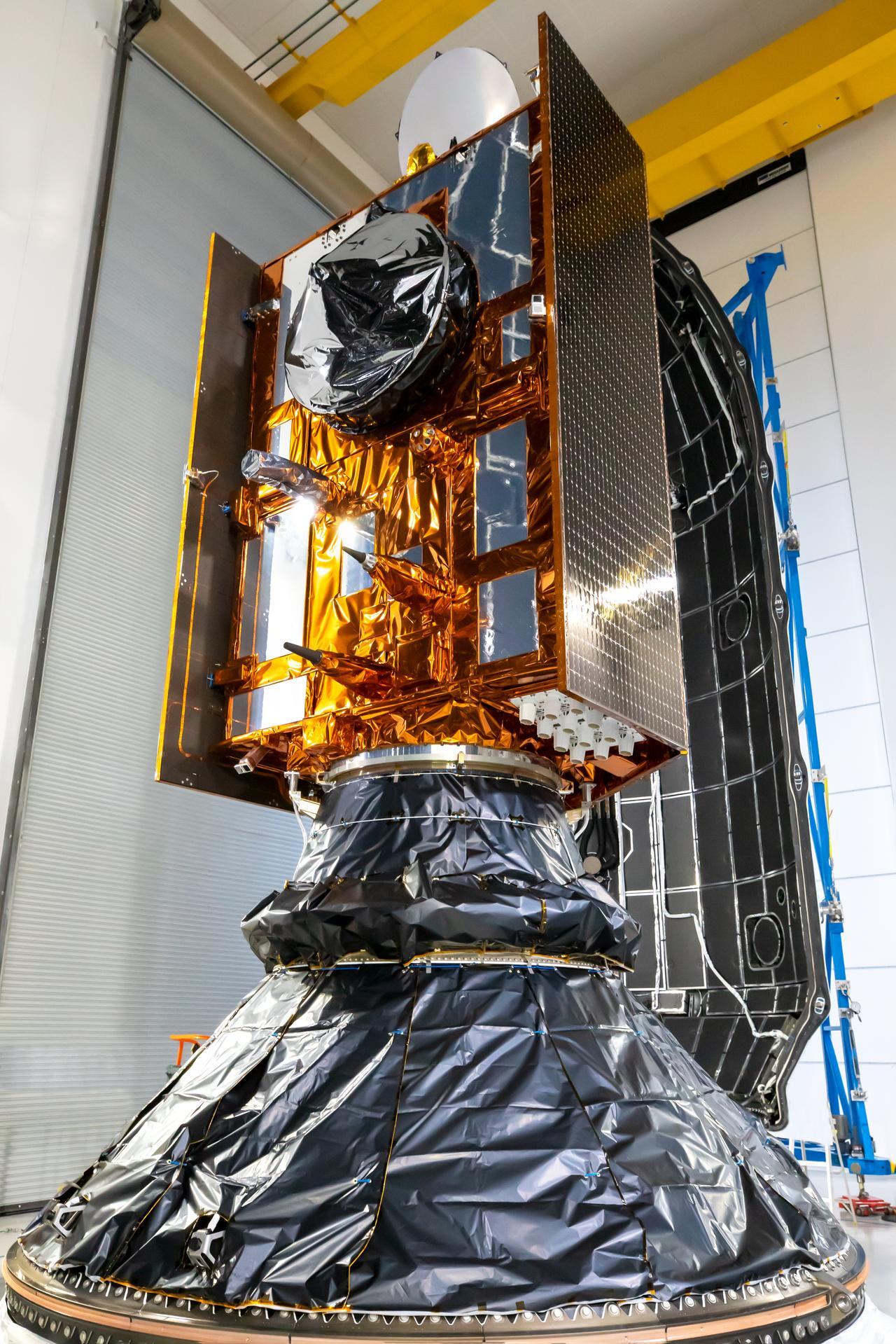
Sentinel-6B, an ocean-tracking satellite jointly developed by NASA and ESA (European Space Agency), is ready to roll out to the launch pad, packed into the payload fairing of a SpaceX Falcon 9 rocket.
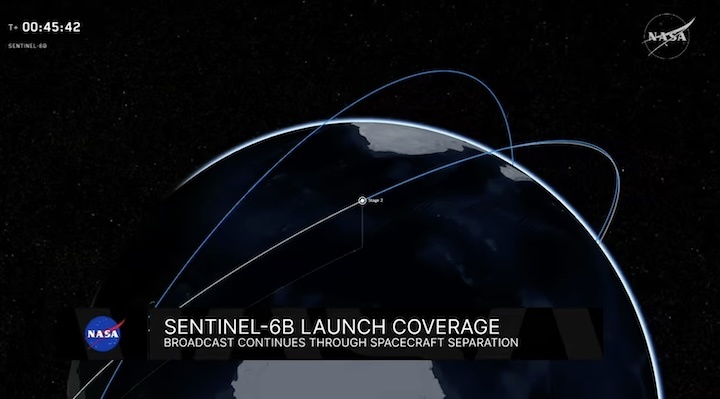
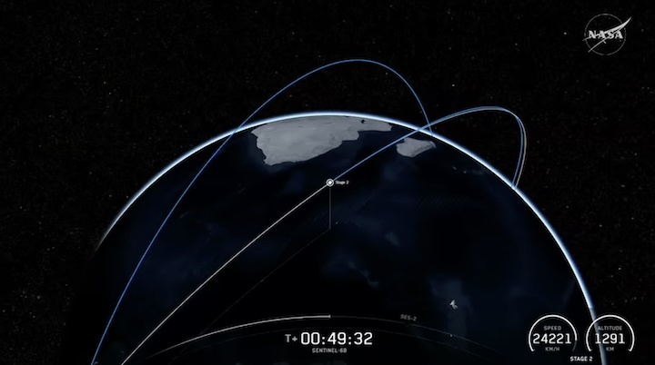
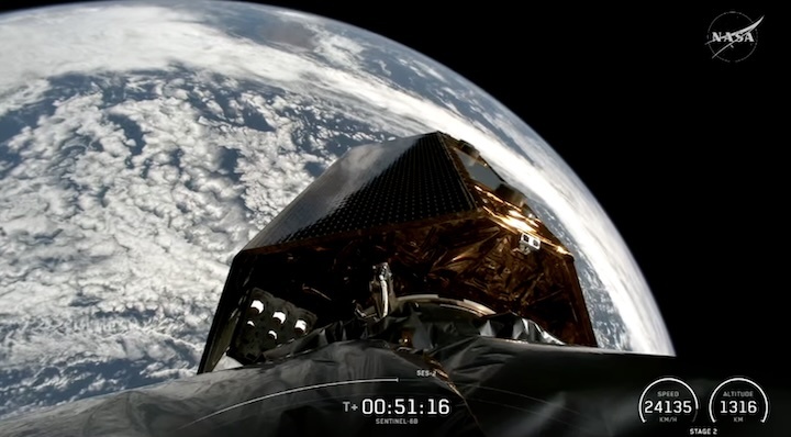
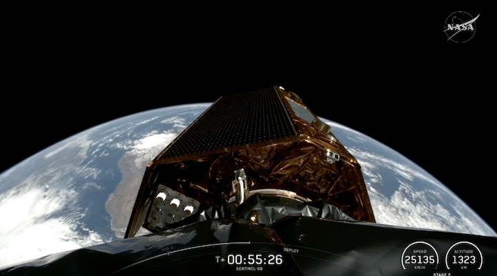
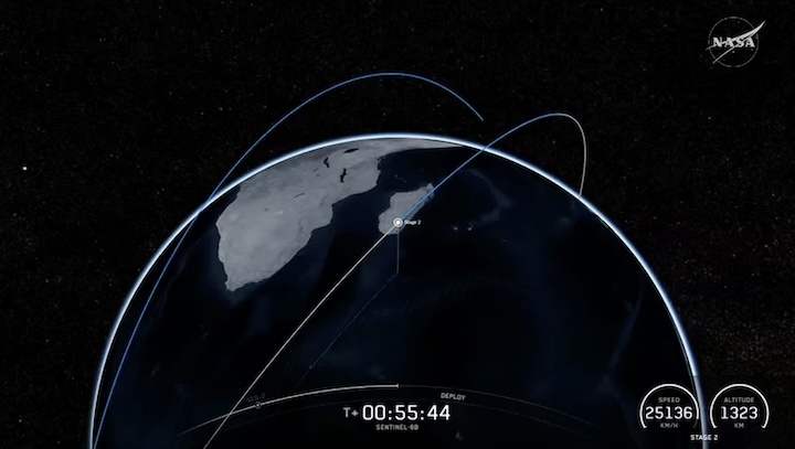
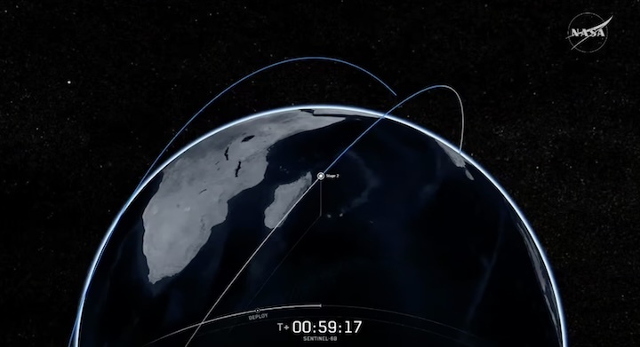
Launch is targeted at 12:21 a.m. EST, Monday, Nov. 17 (9:21 p.m. PST, Sunday, Nov. 16). Once it lifts off from Vandenberg Space Force Base in California, the satellite will ride out a 57-minute sequence of events ending in spacecraft separation, when the satellite detaches from the rocket.
Then Sentinel-6B’s real work begins. Orbiting Earth every 112 minutes at 4.5 miles (7.2 kilometers) per second, the satellite will eventually take over for its twin, Sentinel-6 Michael Freilich, launched five years ago, to continue a multidecade dataset for sea level measurements from space. Those measurements, along with atmospheric data the mission gathers, will help improve public safety and city planning while protecting coastal infrastructure, including power plants and defense interests. NASA will also use the data to refine atmospheric models that support the safe re-entry of Artemis astronauts.
Here’s a closer look at what lies ahead for the satellite in the coming days.
Launch timeline
Measuring 19.1 feet (5.82 meters) long and 7.74 feet (2.36 meters) high (including the communications antennas), the satellite weighs in at around 2,600 pounds (1,200 kilograms) when loaded with propellant at launch.
The satellite will lift off from Space Launch Complex 4 East at Vandenberg. If needed, backup launch opportunities are available on subsequent days, with the 20-second launch window occurring about 12 to 13 minutes earlier each day.
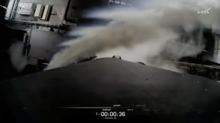
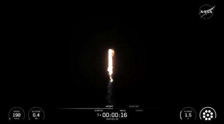
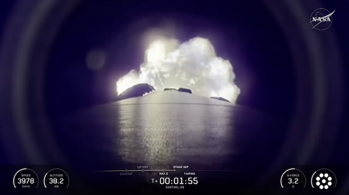
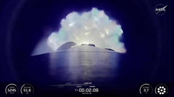
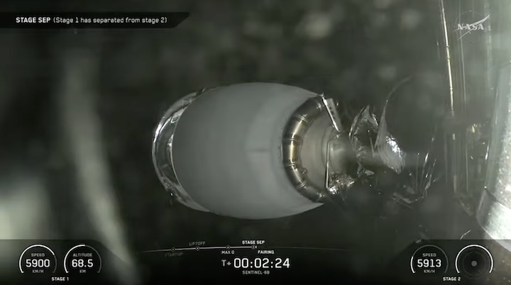
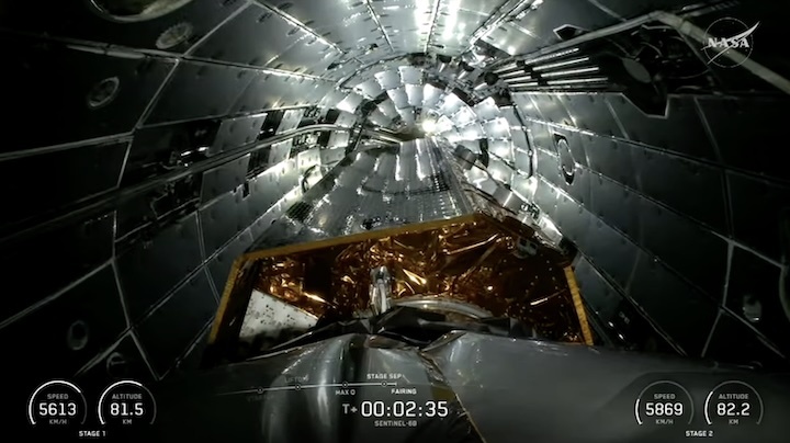
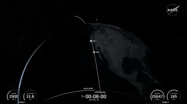
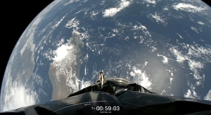
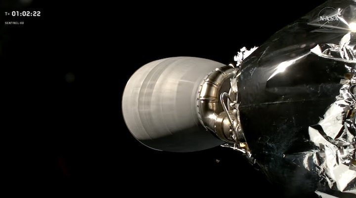
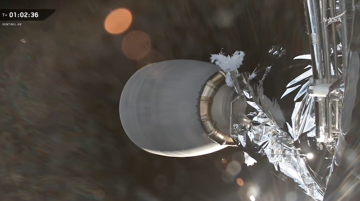
A little more than two minutes after the Falcon 9 rocket lifts off, the main engine cuts off. Shortly after, the rocket’s first and second stages separate, followed by second-stage engine start. The reusable Falcon 9 first stage then begins its automated boost-back burn to the launch site for a powered landing. About three minutes after launch, the two halves of the payload fairing, which protected the satellite as it traveled through the atmosphere, separate and fall safely back to Earth.
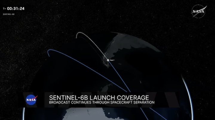
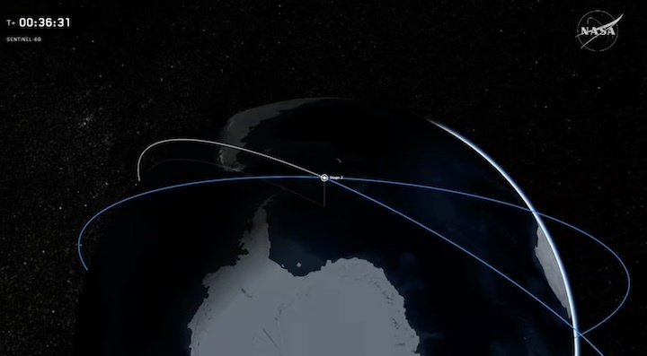
The first cutoff of the second stage engine takes place approximately eight minutes after liftoff, at which point the launch vehicle and the spacecraft will be in a temporary “parking” orbit. The second stage engine fires a second time about 44 minutes later, and about 57 minutes after liftoff, the rocket and the spacecraft separate. Roughly seven minutes after that, the satellite’s solar panels deploy. Sentinel-6B is expected to make first contact with ground controllers about 35 minutes after separation (roughly an hour and a half after liftoff) — a major milestone indicating that the spacecraft is healthy.
Science mission
Following launch operations, the team will focus on its next challenge: getting the spacecraft ready for science operations. Once in orbit, Sentinel-6B will fly about 30 seconds behind its twin, the Sentinel-6 Michael Freilich satellite. When scientists and engineers have completed cross-calibrating the data collected by the two spacecraft, Sentinel-6B will take over the role of providing primary sea level measurements while Sentinel-6 Michael Freilich will move into a different orbit. From there, researchers plan to use measurements from Sentinel-6 Michael Freilich for different purposes, including helping to map seafloor features (variations in sea surface height can reveal variations in ocean floor features, such as seamounts).
Where to find launch coverage
Launch day coverage of the mission will be available on the agency’s website, including links to live streaming and blog updates beginning no earlier than 11 p.m. EST, Nov. 16, as the countdown milestones occur. Streaming video and photos of the launch will be accessible on demand shortly after liftoff. Follow countdown coverage on NASA’s Sentinel-6B blog.
For more information about NASA’s live programming schedule, visit
More about Sentinel-6B
The Copernicus Sentinel-6/Jason-CS (Continuity of Service) mission is a collaboration between NASA, ESA, EUMETSAT (European Organisation for the Exploitation of Meteorological Satellites), and the National Oceanic and Atmospheric Administration (NOAA). The European Commission contributed funding support while France’s space agency CNES (Centre National d’Études Spatiales) provided technical expertise. The mission also marks the first international involvement in Copernicus, the European Union’s Earth Observation Programme.
A division of Caltech in Pasadena, JPL built three science instruments for each Sentinel-6 satellite: the Advanced Microwave Radiometer, the Global Navigation Satellite System - Radio Occultation, and the Laser Retroreflector Array. NASA is also contributing launch services, ground systems supporting operation of the NASA science instruments, the science data processors for two of these instruments, and support for the U.S. members of the international Ocean Surface Topography and Sentinel-6 science teams. The launch service is managed by NASA’s Launch Services Program, based at the agency’s Kennedy Space Center in Florida.
Quelle: NASA
----
Update: 17.11.2025 / 9:00 MEZ
.
Sentinel-6B Launch
Sentinel-6B, an international mission that will deliver critical sea level and ocean data, is scheduled to lift off at 12:21 a.m. EST (0521 UTC) on Monday, Nov. 17. The satellite will launch aboard a SpaceX Falcon 9 rocket from Vandenberg Space Force Base in California. Sentinel-6B is the second of twin satellites in the Copernicus Sentinel-6/Jason-CS mission. The first, Sentinel-6 Michael Freilich, launched in November 2020. The mission continues a decades-long effort to monitor global sea level and ocean conditions using radar to make precise measurements from space. The Copernicus Sentinel-6/Jason-CS mission is a collaboration between NASA, ESA (European Space Agency), EUMETSAT (European Organisation for the Exploitation of Meteorological Satellites), and the National Oceanic and Atmospheric Administration (NOAA).


Quelle: NASA