22.11.2024
A polar cap of carbon-dioxide ice may have provided the thermal blanket needed for rivers and a huge lake to form in the planet’s southern highlands.

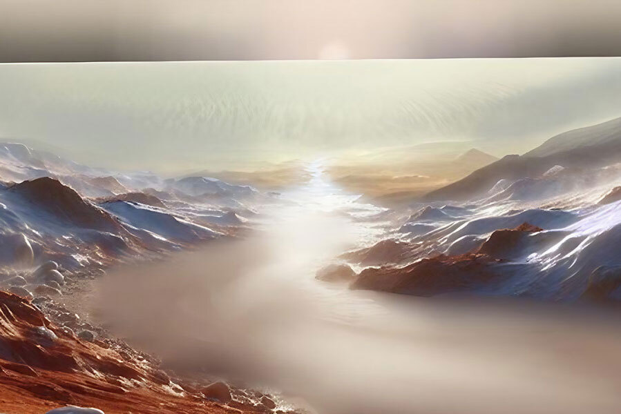
Artistic illustration of an ice-covered river sourced from meltwater beneath Mars’s south polar cap.
Peter Buhler / PSI
Mars is a frozen desert world, enshrouded in a thin atmosphere of carbon dioxide. This atmosphere is so wispy, the pressure is less than 1% that of Earth’s air at sea level — too rarefied to enable stable liquid water to flow on the planet’s surface.
Yet the planet’s landscape is replete with ancient valley networks, river channels, and gravel ridges called eskers, the latter carved by subglacial rivers. Thanks to such geologic evidence as well as careful study of Mars’s atmosphere, we know that the planet once had a thicker atmosphere, one long since eroded away by the solar wind.
Mars appears to have experienced multiple climate transitions over the past 4 billion years. (Earth has, too.) Spirited debate continues among scientists about what the earliest climate looked like, whether Mars was “warm and wet” or “cold and wet” and how steady, prolonged, and prevalent water’s activity was.
But around 3.6 billion years ago, the planet reached a crisis. Sheets of water ice blanketed the southern highlands, and the atmosphere had been whittled away to roughly 0.6 bar. (That’s 60% Earth’s sea-level air pressure, or 100 times denser than Martian air today).
The atmosphere was now so thin, it couldn’t efficiently transport heat from the warmer equatorial regions up to the poles. The carbon dioxide over the poles was now too cold to exist as vapor. Instead, it froze and fell to the ground, building up a polar cap of CO2 ice on top of the water ice. This collapse begat a feedback loop that ultimately drained the dwindling atmosphere away into the polar caps.
During this same era — when water shouldn’t have been able to easily flow — myriad valley networks and other signs of erosion by water formed. These appear to have been caused by spurts of liquid water in action, although whether they were short-lived floods or longer-lived rivers remains unclear.
Peter Buhler (Planetary Science Institute) has now explored how these two things might be related in the planet’s southern hemisphere. Given how the carbon-dioxide cycle could have been operating at the time, he found that the CO2 ice cap acted like a heavy thermal blanket on top of the water-ice sheet beneath it. The CO2 cap trapped the planet’s own internal heat, helping to melt the base of the water-ice sheet.
The meltwater snuck out from beneath the polar glacier, forming ice-encased rivers that oozed like solid-crusted lava flows, Buhler says. Eventually, these flows swelled to become vast, deep rivers of ice, underlain by perhaps a meter of liquid water.
These rivers could have wound their way equatorward, spilling into Argyre Planitia and filling that huge basin — we’re talking nearly 900 km wide, or about three-quarters the size of Texas — with an ice-cover lake. This lake could have had a volume similar to that of the Mediterranean Sea, Buhler writes in the November Journal of Geophysical Research: Planets. The basin eventually overflowed, the water meandering northward again and perhaps draining into the Margaritifer Terra plains near the equator, thousands of kilometers from the pole.

P. Buhler / Journal of Geophysical Research: Planets 2024 / https://doi.org/10.1029/ 2024JE008608 / CC BY-NC-ND 4.0
This scenario would explain several geologic features scientists have observed in this part of Mars, Buhler says: eskers at the south pole, river channels flowing from the south pole to Argyre, signs that water overflowed the basin, and evidence of flows throughout the region between Argyre and the equatorial lowlands. This is the first time scientists have linked a specific climate process to specific, major water-carved features from this period of Martian history, he adds.
Anna Grau Galofre (Laboratory of Planetology and Geosciences, Nantes, France), whose work has previously identified signs of subglacial rivers carving many Martian valleys, says that, as least as far as the larger valleys in the south circumpolar region are concerned, Buhler’s scenario is provocative but plausible. But she admits she’s skeptical of the large-scale implications — for one thing, she’d like to better understand how details of glacial sliding processes would affect the conclusions.
“I don’t think this mechanism provides a convincing source of water for the formation of valley networks at lower or equatorial latitudes, which are the best developed valleys on Mars,” Grau Galofre says. “However, pulses of basal melt under the southern polar water-ice cap could have contributed to large floods flowing northwards from the Argyre basin.”
Buhler plans to explore the effects of water ice’s glacial flow, but he says that prior research suggests it won’t substantially change how much water would melt.
Although he’s confident that his scenario can explain the chain of features he’s traced from the south pole to the equator, he notes that any connection to other Martian river systems would for now be speculative. He imagines several possible solutions for that connection, but his favorite is that downstream water may have sublimed into the atmosphere and then fallen as rain or snow elsewhere, feeding the water reservoirs there.

P. Buhler / Journal of Geophysical Research: Planets 2024 / https://doi.org/10.1029/ 2024JE008608 / CC BY-NC-ND 4.0
“Peter Buhler has done a magnificent job of exploring the implications of possible massive atmospheric collapse and CO2 ice accumulation in the south circumpolar region at a critical early time in the history of Mars,” says planetary geologist James Head (Brown University). “The strength of this idea is that we know the phenomenon of atmospheric collapse occurs, but can it have such a major effect? Fortunately the hypothesis is testable.”
These tests include more detailed analyses of geologic features and computer modeling of global climate processes, both Head and Buhler say. These could enable scientists to link specific features to model predictions with more confidence.
Quelle: Sky&Telescope
