
.
For the first time Britain’s major mapping agency has created a map truly out of this world, because it's of Mars.
For those of us who still keep a Rand McNally Road Atlas in their cars the idea is similar. Britain’s Ordnance Survey wanted to create the first map to be used by future inhabitants of Mars.
The mapping agency used NASA open data to make a 1:4,000,000 scale, 2,281X1690 mile (3672x2721 km) map of the Martian surface.
“The private sector and space agencies are currently in competition to land the first person on Mars,” said Ordnance Survey Director of Products David Henderson. “Becoming more familiar with space is something that interests us all and the opportunity to apply our innovative cartography and mapping tradecraft to a different planet was something we couldn’t resist."
The map’s designer Chris Wesson said the game plan was to treat Mars no different to how they would map "any other Earth-based geographic information or landscape.”
Wasson’s goal proved to be a challenge because of the lack of sea level and the difference in topography.
.
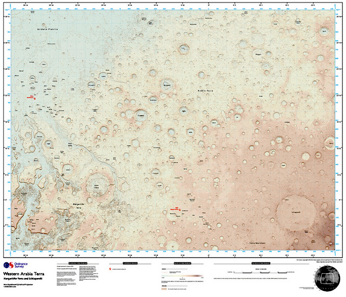
Ordnance Survey map of Mars
This map of Mars was created using NASA open data and made to a 1:4,000,000 scale. Britain's mapping agency Ordnance Survey made the map to see if the OS style of mapping has potential for future Mars missions. (Ordnance Survey)
“The surface is very bumpy but at such a large scale I had vast expanses of land that appeared flat relative to the craters each of several thousands of meters depth,” said Wesson on the Ordnance Survey blog. “Even though the principles are the same, the design and the aesthetics of an Earth map differ considerably.”
Styled with a soft color palette the map features grid lines and a legend similar to Earth maps, but none of the colors of the actual Red Planet. Wasson choose lighter shades to incorporate the British mapping agency signature style and for easier viewing.
“Red is also a very dominant color that is not very supporting of thematic overlays such as landing sites or place names,” explained Wasson.
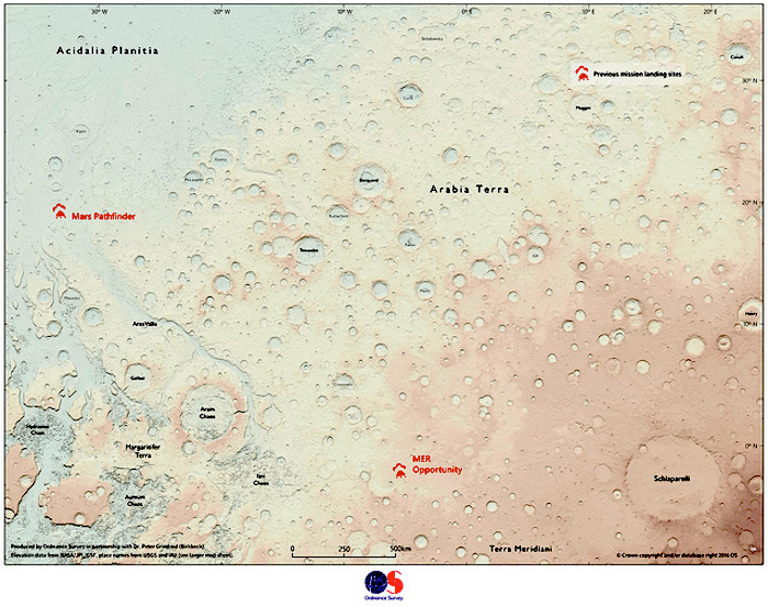
Just like maps of Earth, the Martian map will be updated with new information. Ordnance Survey and the UK paper The Times are currently hosting a competition seeking designs for a landing site symbol for the map. The icon will represent landing sites of previous missions and any future landing sites, according to the mapping agency. The winner will receive a large framed map of Mars with their winning design.
Quelle: Orlando Sentinel
4230 Views