20.01.2022
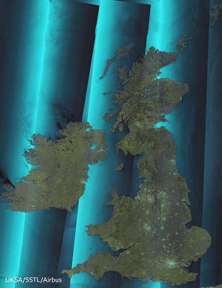

Here's a view of the UK and Ireland you won't have seen before.
The mosaic is made from imagery acquired by the NovaSar satellite.
Looking somewhat like a cheese-grater, this specialist spacecraft pictures the Earth's surface using radar.
The beauty of this technology is that it detects the ground even when there is thick cloud or, indeed, when it's night-time.
Consequently, this map was assembled by NovaSar in just seven passes.
A traditional optical satellite, which views scenes at wavelengths familiar to our eyes, would struggle to make such a map in so short a time. Britain's famously grey weather would be a constant frustration.
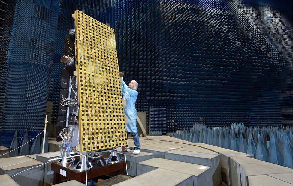 IMAGE SOURCE, SSTL
"Radar is a very deterministic thing," said Andrew Cawthorne, the director of Earth observation at Surrey Satellite Technology Ltd (SSTL), which built and owns NovaSar.
"You know that when you pass overhead, you're going to get an image without any external influences causing you problems."
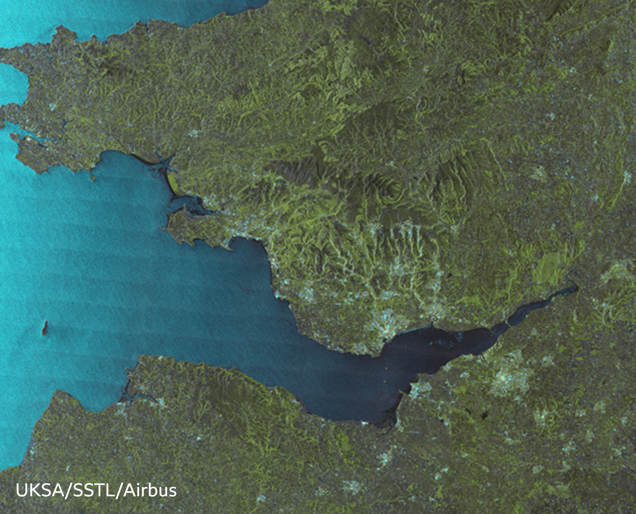
I can't render the full image on this page. The one in my possession is two gigabytes in size. But if you could open it on your computer, you'd see some glorious detail - of cities, bridges, ships, mountains, parklands, lakes and much, much more.
The mosaic corresponds to an area of approximately 1,500km by 1,168km (1.75 million square km), or 938 miles by 730 miles (685,000 square miles).
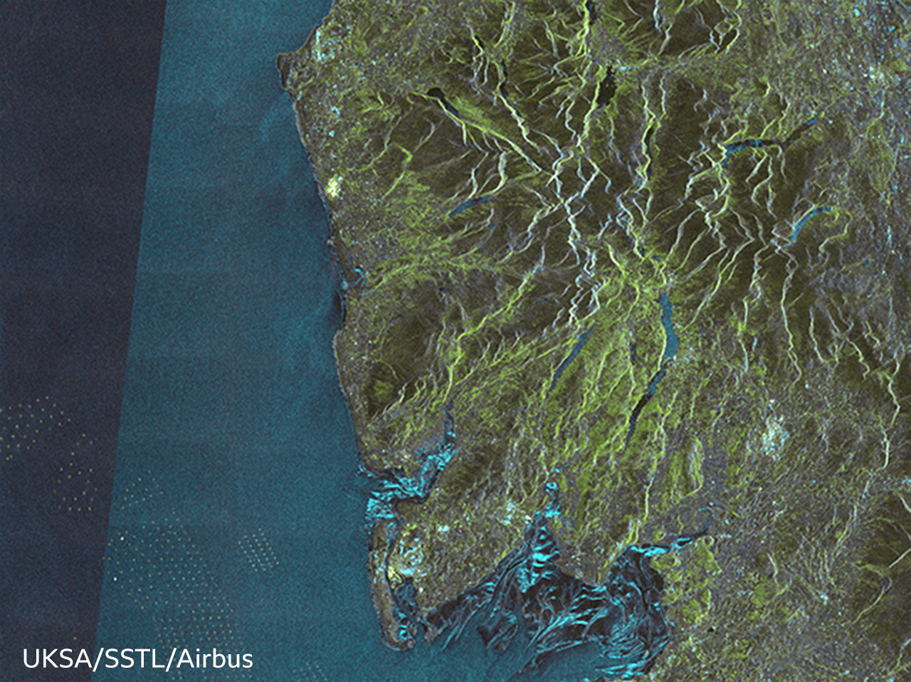
Each pixel represents a square on the ground that's about 50m across, which is really interesting because you can see very clearly the wind turbines out at sea. The turbine units are much less than 50m across, but their towers have hard, metallic surfaces which are excellent reflectors of radar energy, so they show up as brilliant specks.
There's a lot of information in the map. It can be used to study land-uses, for example, to understand the changing urban footprint of Britain or to monitor the types of crops being grown on its agricultural land.
NovaSar was seed-funded by government grant. It is the only sovereign radar capability the UK has.
If Britain falls out of the EU's Copernicus programme with its radar satellite capability (continued membership is currently caught up in a dispute over Brexit trade arrangements in Northern Ireland) then NovaSar will be the only direct space asset the UK can task around the globe to guarantee an immediate image of the ground.
In development at SSTL is a new low-cost radar satellite called CarbSar. It is being developed in partnership with novel antenna designer Oxford Space Systems.
"OSS is developing this interesting wrapped-rib antenna and we're developing the front-end radar electronics that attach to that antenna. Quite a lot of the elements are on the bench now being tested," explained Dr Cawthorne.
"But although we have the money to build the CarbSar payload, we don't yet have the money to launch it."
The UK government published its long-awaited space strategy in September, which set out the desire both to remain in the EU's Copernicus programme and to build a constellation of small Intelligence, Surveillance and Reconnaissance satellites.
However, no budget was announced to go with the strategy.
UK space industry figures have told the BBC that if the country's association to Copernicus fails to materialise then the unused subscription should be fully invested in home-grown systems. The sum involved would be €750m (£630m) over seven years.
"We could do a lot with that kind of money," said Dr Cawthorne.
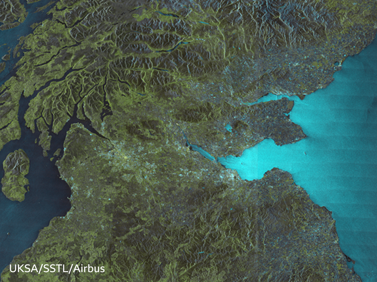
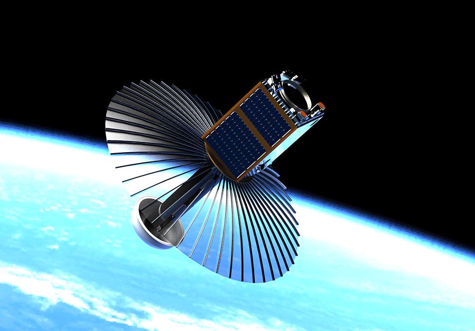 IMAGE SOURCE, SSTL