28.12.2021
Abstract
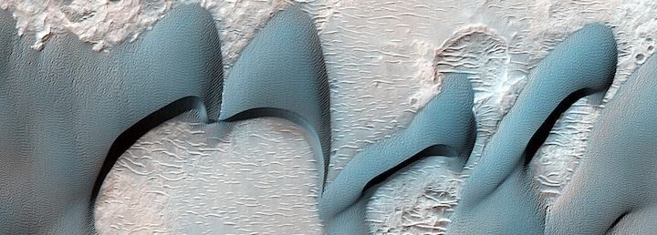
Planetary dune field properties and their bulk bedform morphologies relate to regional wind patterns, sediment supply, climate, and topography. On Mars, major occurrences of spatially contiguous low-albedo sand dunes are primarily found in three major topographic settings: impact craters, high-latitude basins, and linear troughs or valleys, the largest being the Valles Marineris (VM) rift system. As one of the primary present day martian sediment sinks, VM holds nearly a third of the non-polar dune area on Mars. Moreover, VM differs from other regions due to its unusual geologic, topographic, and atmospheric setting. Herein, we test the overarching hypothesis that VM dune fields are compositionally, morphologically, and thermophysically distinct from other low- and mid-latitude (50 degrees N-50 degrees S latitude) dune fields. Topographic measurements of dune fields and their underlying terrains indicate slopes, roughnesses, and reliefs to be notably greater for those in VM. Variable VM dune morphologies are shown with topographically-related duneforms (climbing, falling, and echo dunes) located among spur-and-gully wall, landslide, and chaotic terrains, contrasting most martian dunes found in more topographically benign locations (e.g., craters, basins). VM dune fields superposed on Late Amazonian landslides are constrained to have formed and/or migrated over >10s of kilometers in the last 50 My to 1 Gy. Diversity of detected dune sand compositions, including unaltered ultramafic minerals and glasses (e.g., high and low-calcium pyroxene, olivine, Fe-bearing glass), and alteration products (hydrated sulfates, weathered Fe-bearing glass), is more pronounced in VM. Observations show heterogeneous sand compositions exist at the regional-, basinal-, dune field-, and dune-scales. Although not substantially greater than elsewhere, unambiguous evidence for recent dune activity in VM is indicated from pairs of high-resolution images that include: dune deflation, dune migration, slip face modification (e.g., alcoves), and ripple modification or migration, at varying scales (10s-100s m2). We conclude that VM dune fields are qualitatively and quantitatively distinct from other low- and mid-latitude dune fields, most readily attributable to the rift’s unusual setting. Moreover, results imply dune field properties and aeolian processes on Mars can be largely influenced by regional environment, which may have their own distinctive set of boundary conditions, rather than a globally homogenous collection of aeolian sediment and bedforms
A New Dry Hypothesis for the Formation of Martian Linear Gullies
ABSTRACT
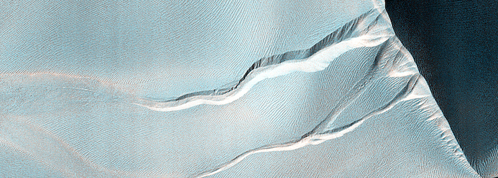
Long, narrow grooves found on the slopes of martian sand dunes have been cited as evidence of liquid water via the hypothesis that melt-water initiated debris flows eroded channels and deposited lateral levées. However, this theory has several short-comings for explaining the observed morphology and activity of these linear gullies. We present an alternative hypothesis that is consistent with the observed morphology, location, and current activity: that blocks of CO2 ice break from over-steepened cornices as sublimation processes destabilize the surface in the spring, and these blocks move downslope, carving out levéed grooves of relatively uniform width and forming terminal pits. To test this hypothesis, we describe experiments involving water and CO2 blocks on terrestrial dunes and then compare results with the martian features. Furthermore, we present a theoretical model of the initiation of block motion due to sublimation and use this to quantitatively compare the expected behavior of blocks on the Earth and Mars. The model demonstrates that CO2 blocks can be expected to move via our proposed mechanism on the Earth and Mars, a nd the experiments show that the motion of these blocks will naturally create the main morphological features of linear gullies seen on Mars.
The Current Martian Cratering Rate
Abstract
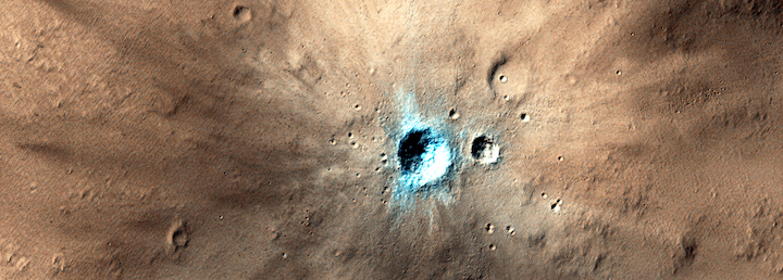
The discovery of 248 dated impact sites known to have formed within the last few decades allows us to refine the current cratering rate and slope of the production function at Mars. We use a subset of 44 of these new craters that were imaged before and after impact by Mars Reconnaissance Orbiter's Context Camera -- a thoroughly searched data set that minimizes biases from variable image resolutions. We find the current impact rate is 1.65×10⁻⁶ craters with an effective diameter ≥ 3.9 meters / km2 / year, with a differential slope (power-law exponent) of -2.45 ± 0.36. This results in model ages that are factors of three to five below the Hartmann (2005) and Neukum et al. (2001)/Ivanov (2001) model production functions where they overlap in diameter. The best-fit production function we measure has a shallower slope than model functions at these sizes, but model function slopes are within the statistical errors. More than half of the impacts in this size range form clusters, which is another reason to use caution when estimating surface ages using craters smaller than ~50 meters in diameter.
Examples of craters listed in this paper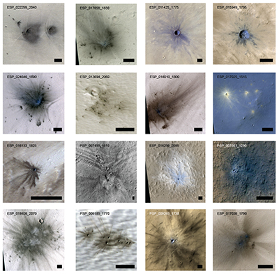
+++
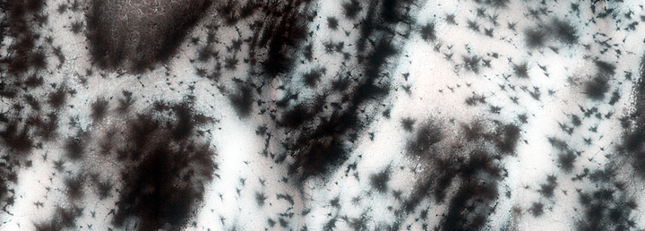
Observations of the Northern Seasonal Polar Cap on Mars: I. Spring Sublimation Activity and Processes
Abstract
Spring sublimation of the seasonal CO2 northern polar cap is a dynamic process in the current Mars climate. Phenomena include dark fans of dune material propelled out onto the seasonal ice layer, polygonal cracks in the seasonal ice, sand flow down slipfaces, and outbreaks of gas and sand around the dune margins. These phenomena are concentrated on the north polar erg that encircles the northern residual polar cap. The Mars Reconnaissance Orbiter has been in orbit for three Mars years, allowing us to observe three northern spring seasons. Activity is consistent with and well described by the Kieffer model of basal sublimation of the seasonal layer of ice applied originally in the southern hemisphere. Three typical weak spots have been identified on the dunes for escape of gas sublimed from the bottom of the seasonal ice layer: the crest of the dune, the interface of the dune with the interdune substrate, and through polygonal cracks in the ice. Pressurized gas flows through these vents and carries out material entrained from the dune. Furrows in the dunes channel gas to outbreak points and may be the northern equivalent of southern radially-organized channels (“araneiform” terrain), albeit not permanent. Properties of the seasonal CO2 ice layer are derived from timing of seasonal events such as when final sublimation occurs. Modification of dune morphology shows that landscape evolution is occurring on Mars today, driven by seasonal activity associated with sublimation of the seasonal CO2 polar cap.
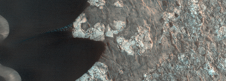
Earth-like Sand Fluxes on Mars
Abstract
Strong and sustained winds on Mars have been considered rare, on the basis of surface meteorology measurements and global circulation models, raising the question of whether the abundant dunes and evidence for wind erosion seen on the planet are a current process. Recent studies showed sand activity, but could not determine whether entire dunes were moving—implying large sand fluxes—or whether more localized and surficial changes had occurred. Here we present measurements of the migration rate of sand ripples and dune lee fronts at the Nili Patera dune field. We show that the dunes are near steady state, with their entire volumes composed of mobile sand. The dunes have unexpectedly high sand fluxes, similar, for example, to those in Victoria Valley, Antarctica, implying that rates of landscape modification on Mars and Earth are similar.
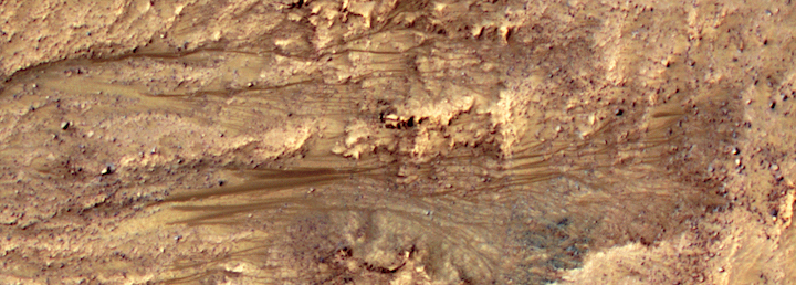
Seasonal Flows on Warm Martian Slopes
Abstract
Water likely flowed across ancient Mars, but whether it ever exists as a liquid on the surface today remains debatable. Recurring slope lineae (RSL) are narrow (0.5-5 m), relatively dark markings on steep (25°-40°) slopes; repeat MRO/HiRISE images show them to appear and incrementally grow during warm seasons and fade in cold seasons. They extend downslope from bedrock outcrops, often associated with small channels, and hundreds of them form in rare locations. RSL appear and lengthen in the late southern spring/summer from 48°S to 32°S latitudes favoring equator-facing slopes--times and places with peak surface temperatures from ~250-300 K. Liquid brines near the surface might explain this activity, but the exact mechanism and source of water are not understood.
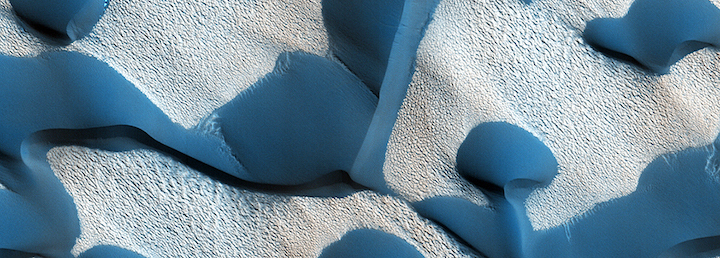
Seasonal Erosion and Restoration of Mars’ Northern Polar Dunes
Abstract
Despite radically different environmental conditions, terrestrial and Martian dunes bear a strong resemblance, indicating that the basic processes of saltation and grainfall (sand avalanching down the dune slipface) operate on both worlds. Here we show that Martian dunes are subject to an additional modification process not found on the Earth: springtime sublimation of Mars’ CO2 seasonal polar caps. Numerous dunes in Mars’ north polar region have experienced morphological changes within a Mars year, detected in images acquired by the High Resolution Imaging Science Experiment (HiRISE) on the Mars Reconnaissance Orbiter (MRO). Dunes show new alcoves, gullies, and dune apron extension. This is followed by remobilization of the fresh deposits by the wind, forming ripples and erasing gullies. The widespread nature of these rapid changes, and the pristine appearance of most dunes in the area, implicates active sand transport in the vast polar erg in Mars’ current climate.
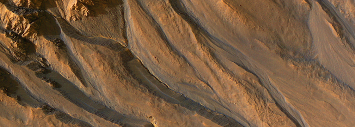
A Closer Look at Water-Related Geologic Activity on Mars
HiRISE images reveal (1) abundant boulders in surface units previously interpreted as fine-grained deposits from water or the air; (2) further evidence for water-carved gullies, although the most recent bright gully deposits could have been dry flows; and (3) evidence that recent large craters were the result of impact into volatile-rich ground. These results should help focus future exploration of Mars.
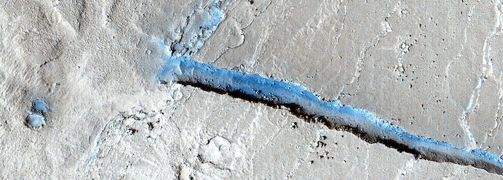
Athabasca Valles, Mars: A Lava-Draped Channel System
Athabasca Valles is a young “outflow” channel system in the equatorial region of Mars. Most researchers agree that it was carved by catastrophic floods of water, and some believe that frozen floodwaters survive to this day on the channel floor. However, new HiRISE observations reveal that Athabasca Valles is entirely coated by a thin veneer of solidified lava. The lava poured from a fissure, filled the channels, and then drained downstream leaving behind a thin layer of hard rock to coat and preserve the channel system.
Quelle: University of Arizona, HiRISE Operations Center
