28.07.2019

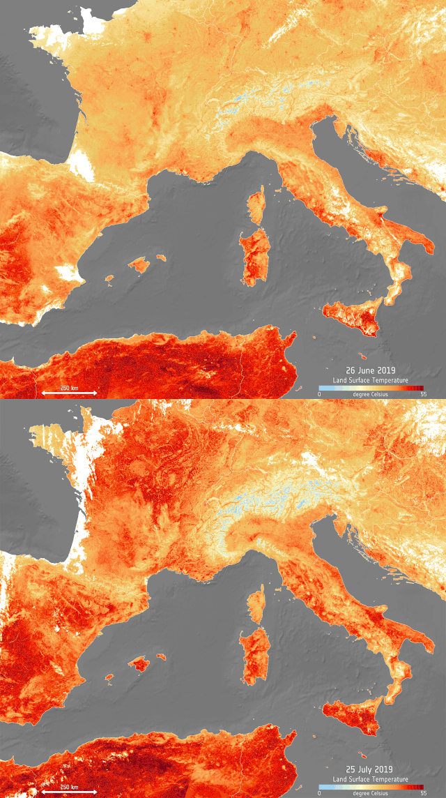
An image of Europe pulsing red shows the effects of a heat wave sweeping across the continent again in July, following extreme temperatures in June.
The image, based on data from the European Union's Copernicus program, represents high temperatures — particularly in the regions of the Netherlands, Belgium and Germany. Paris recently hit a peak of 105 degrees Fahrenheit (41 degrees Celsius), breaking a record set in 1947, according to a statementreleased by the European Space Agency.
The animation shows the warm temperatures on Thursday (July 25), compared with the peak of the previous heat wave on June 26, 2019. That weather event also broke records.
The data displayed in the images was gathered by the Copernicus Sentinel-3's sea and land surface temperature radiometer, which measures the energy radiating from the Earth. That makes this approach a more accurate representation of land temperature than traditional weather forecasts that predict air temperatures, according to ESA.
eat is shown in shades of red; ice, such as in the Alps, in blue; the white patches are clouds.
In response to the current heat wave, many countries have issued warnings, recommending that residents drink lots of water and avoid traveling.
The Earth does goes through natural cycles of warming and cooling, and individual weather events cannot typically be ascribed to climate change. But current warming trends and other climatic disruptions are driven by an unprecedented, human-caused increase in atmospheric concentrations in carbon dioxide, a greenhouse gas commonly released by vehicles and industrial activities. Today's warming has only taken about 150 years, compared to tens of thousands of years during a particularly fast warming period in the past known as the Paleo-Eocene Thermal Maximum.
Quelle: SC
