27.11.2018
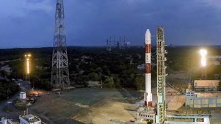
ISRO is all set to launch its workhorse rocket PSLV-C43 carrying India’s earth observation satellite HysIS and 30 co-passenger satellites, including 23 from the US, from Sriharikota on November 29.
The space agency said the 45th flight of PSLV will be launched from the First Launch Pad (FLP) of Satish Dhawan Space Centre (SDSC) SHAR, Sriharikota.
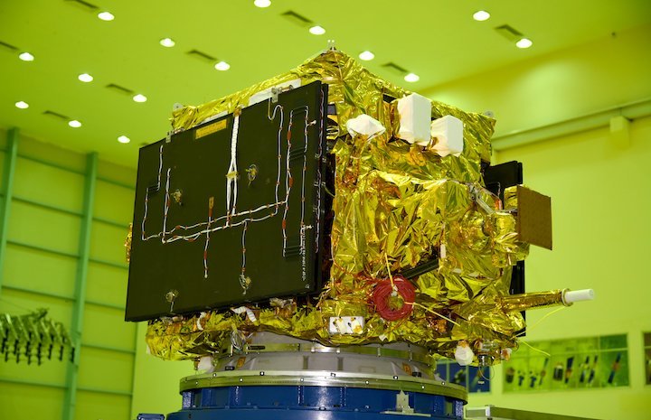
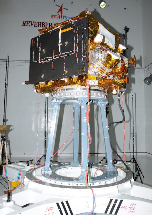
“HysIS is an earth observation satellite developed by ISRO. It is the primary satellite of the PSLV-C43 mission.
The satellite will be placed in 636 km polar sun synchronous orbit (SSO) with an inclination of 97.957 deg. The mission life of the satellite is 5 years,” ISRO said.
According to the space agency, the primary goal of HysIS is to study the earth’s surface in visible, near infrared and shortwave infrared regions of the electromagnetic spectrum.
The co-passengers of HysIS include one Micro and 29 Nano satellites from eight different countries, the agency said, adding, all these satellites will be placed in a 504 km orbit by PSLV-C43.
The countries comprise United States of America (23 satellites), Australia, Canada, Columbia, Finland, Malaysia, Netherlands and Spain (one satellite each).
These satellites have been commercially contracted for launch through Antrix Corporation Limited, the commercial arm of ISRO, the space agency said.
PSLV is ISRO’s third generation launch vehicle. It can carry upto 1,750 kg of payload into polar SSO of 600 km altitude.
Additionally, PSLV has been used to launch planetary missions and also satellites into Geosynchronous Transfer Orbit, ISRO said.
Quelle: hindustantimes
+++
PSLV-C43 / HysIS Mission
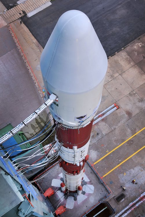
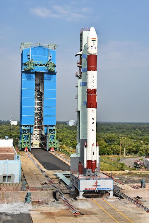
The Polar Satellite Launch Vehicle (PSLV), in its 45th flight PSLV-C43, will launch HysIS and 30 co-passenger satellites from the First Launch Pad (FLP) of Satish Dhawan Space Centre (SDSC) SHAR Sriharikota on 29th November 2018.
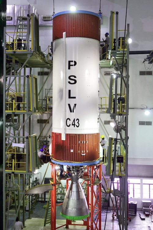
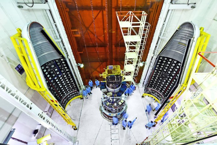
PSLV is a four stage launch vehicle with alternating solid and liquid stages. PSLV-C43 is the Core Alone version of PSLV which is the lightest version of PSLV.
HysIS is an earth observation satellite developed by ISRO. It is the primary satellite of the PSLV-C43 mission. The mass of the spacecraft is about 380 kg. The satellite will be placed in 636 km polar sun synchronous orbit with an inclination of 97.957 deg. The mission life of the satellite is 5 years. The primary goal of HysIS is to study the earth’s surface in visible, near infrared and shortwave infrared regions of the electromagnetic spectrum.
The co-passengers of HysIS include 1 Micro and 29 Nano satellites from 8 different countries. All these satellites will be placed in a 504 km orbit by PSLV-C43. These satellites have been commercially contracted for launch through Antrix Corporation Limited, the commercial arm of ISRO.


Quelle: ISRO
---
Update: 29.11.2018
.

ISRO has confirmed the successful launch of the PSLV-C43 mission that carried the HysIS satellite as part of its payload. This was the 45th launch flight of the polar satellite launch vehicle (PSLV) rocket, conducted from the Satish Dhawan Space Centre in Sriharikota.
Through PSLV-C43, ISRO has launched a total of 31 satellites with a combined payload of 641.5kg. While HysIS was put into orbit around 10.15am, the 30 other satellites were oriented into space around 11.45am. The latter was projected at a height of 504.5km, as the HysIS satellite was projected from 636.6km above the Earth’s surface.
The Indian space agency has confirmed that the core-alone PSLV version was used to set off India’s latest earth-imaging satellite. Through this, the HysIS satellite has been projected to a polar Sun synchronous orbit. News of the same was announced by mission director R Hutton, and also confirmed by ISRO online.
Phase-1 of the mission post launch, that involved the projection of HysIS, was monitored by the Sriharikota based of the Indian space agency. On the other hand, the launch of the other 30 satellites were monitored by ISRO’s observation units situated at Thiruvananthapuram and Lucknow, and news of the same was relayed to Sriharikota.
With this launch, HysIS will be able to monitor the Earth’s surface within a bandwidth of 400nm-2500nm wavelength. This include visible, near infrared and far infrared bands of the spectrum. With its orbit, it will remain at the same position relative to the Sun throughout its five-year mission, as it relays information about weather patterns, coastlines, atmospheric behaviour, and more.
The PSLV rockets are also being considered for launching manned missions into space that ISRO plans to achieve within the next few years.

Through the ISRO live stream, the metrics at time of writing show an altitude of over 640km from the Earth's surface. In the process, it has completed its first three stages without failure. The 30 partnering satellites will be projected from PSLV-C39 in another 90 minutes, as HysIS has been successfully separated from the rocket.
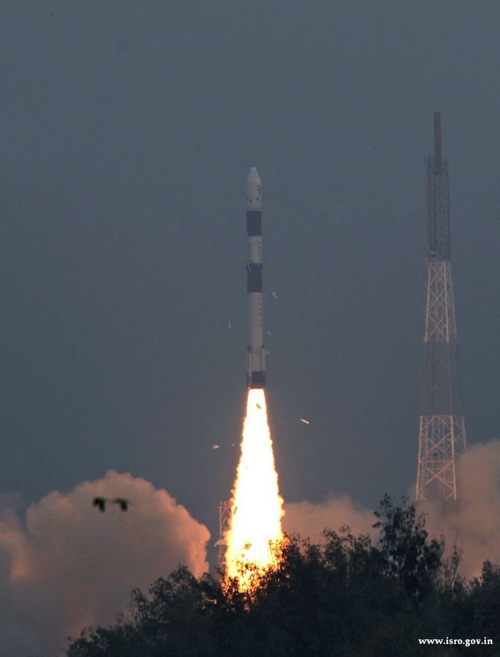
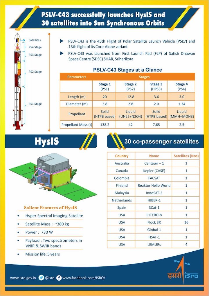
Quelle: ISRO
+++
LIFT OFF FOR PIONEERING NANOSATS
The first ‘Pioneer’ mission lifted off early this morning from Sriharikota, India, with the two inventive little nanosatellites now circling the Earth, ready for action.
The shoebox-sized satellites were launched at 04:27 GMT into low Earth orbit by the Indian Space Research Organisation’s PLSV launcher, and opened their first communication windows with their owner, Spire Global, less than an hour after they separated from the rocket.
Both satellites were developed under ESA’s ARTES Pioneer programme, and will aim to prove the value of using nanosats for space-based Radio Occultation: the process of using satellites to measure how GNSS signals are refracted by the Earth’s atmosphere.
Experts can use these measurements to glean temperature, pressure and humidity information for weather forecasting and climate change monitoring.
In contrast, weather data gathered by weather balloons and aircraft can only reach certain altitudes, leaving the higher atmospheric layers untouched.
Satellites have no such restrictions. They can gather massive amounts of this data from the ground up to the mesosphere as they fly over the Earth.
This is usually done by large satellites. Spire’s nanosatellites weigh just five kg each, and were assembled and tested entirely by Spire in under three months, at their headquarters in Glasgow, Scotland.
Named ‘Space as a Service’, the Spire Pioneer mission intends to prove that nanosat GNSS-RO is a commercially-viable alternative to traditional methods.
ESA’s Pioneer initiative partners with companies like Spire to help them provide this kind of in-orbit demonstration and validation for third parties.
ESA Pioneer Programme Manager Khalil Kably said: “We saw a gap in the market for what we call Space Mission Providers: companies that offer all aspects of a space mission to validate a new technology or service for the benefit of others.
“ESA is always looking to champion innovation in the space industry, and the idea of Pioneer is that these Space Mission Providers can help this by being a one-stop-shop for in-orbit demonstration and therefore reduce the barriers and complexity that can stifle new ideas.”
Spire Global CEO Peter Platzer said: “Spire has been focused on developing unique data sources with high frequency updates for the entire Earth and has over 60 LEMUR-2 class satellites deployed in space complimented with a global ground station network.
“Under Pioneer, we can offer our extensive experience in manufacturing and managing small spacecraft like these to those who cannot afford to waste money and time doing it themselves.
“This work with ESA helps further support the global development of commercial aerospace’s potential to make space access universal.”
UK Space Agency Chief Executive Graham Turnock said: “These incredibly clever shoebox-sized satellites built in Glasgow could slash the complexity and cost of access to space, presenting an exciting opportunity for the UK to thrive in the commercial space age.
“Through our £4m development funding, the government’s Industrial Strategy and by working closely with our international partners, we are helping UK businesses transform their ideas into commercial realities, resulting in jobs, growth and innovation.”
The two tiny satellites will collect and distribute GNSS-RO data during their commissioning phase, after which they will go into full commercial data production mode, gathering weather information for meteorological institutions, maritime and aviation customers on demand.
Quelle: ESA

