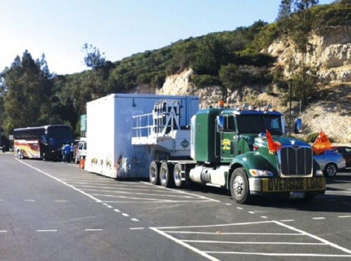
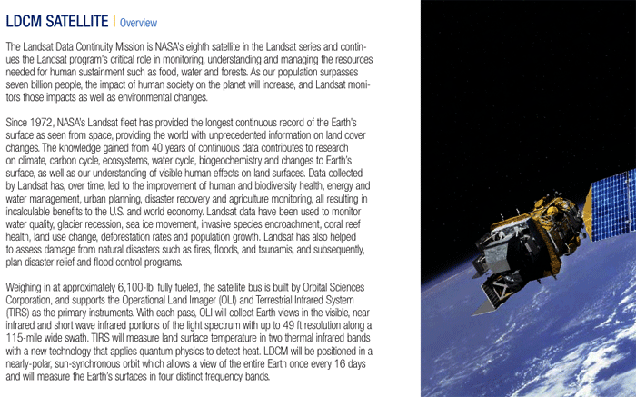
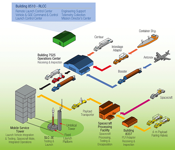
An oversized semitrailer has brought NASA’s Landsat Data Continuity Mission spacecraft to Vandenberg Air Force Base in preparation for the satellite’s trip to space in early 2013.
The satellite, built by Orbital Sciences Corp., will continue the Landsat mission of providing images of Earth’s land, oceans and other natural resources. At Vandenberg, it will undergo preparations for a launch Feb. 11 aboard an Atlas 5 rocket. Liftoff is planned between 10:04 and 10:48 a.m. from Space Launch Complex-3 on South Base.
This will be the eighth satellite in the Landsat series of spacecraft since the first one flew in 1972.
The NASA and U.S. Geological Survey mission will continue a 40-year record of measuring changes on Earth from space.
“It will extend and expand global land observations that are critical in many sectors, including energy and water management, forest monitoring, human and environmental health, urban planning, disaster recovery and agriculture,” NASA officials said.
The satellite will undergo additional testing at Vandenberg before being attached to the Atlas 5 rocket.
Tucked into a shipping container, the huge truck bearing the satellite left Orbital’s Gilbert, Ariz., facility on Dec. 17.
“LDCM builds on and strengthens a key American resource: a decades-long, unbroken Landsat-gathered record of our planet’s natural resources, particularly its food, water and forests,” said Jim Irons, Landsat project scientist at NASA’s Goddard Space Flight Center in Greenbelt, Md.
LDCM actually carries two instruments, the Operational Land Imager built by Ball Aerospace & Technologies Corp. in Boulder, Colo., and the Thermal Infrared Sensor built by NASA Goddard.
“Both of these instruments have evolutionary advances that make them the most advanced Landsat instruments to date and are designed to improve performance and reliability to improve observations of the global land surface,” said Ken Schwer, LDCM project manager at NASA Goddard.
Earlier in December, crews at Vandenberg conducted a fueling exercise for the Atlas 5 rocket.
The most recent spacecraft in this series, the Landsat-7 satellite, headed to space April 15, 1999, aboard a Delta 2 rocket that launched from Vandenberg.
Quelle: USAF/NASA
-
Update: 10.01.2013
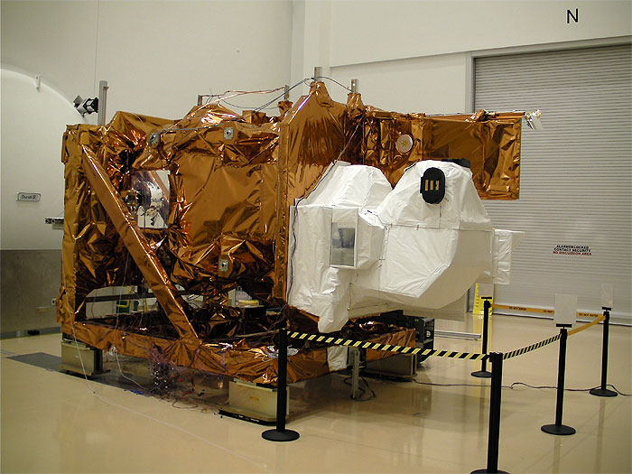
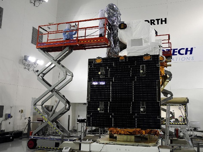
LDCM Spacecraft
Technicians inspect NASA's Landsat Data Continuity Mission, or LDCM, satellite at the Astrotech facility at Vandenberg Air Force Base in California where it will undergo prelaunch processing.
-

Spacecraft Processing
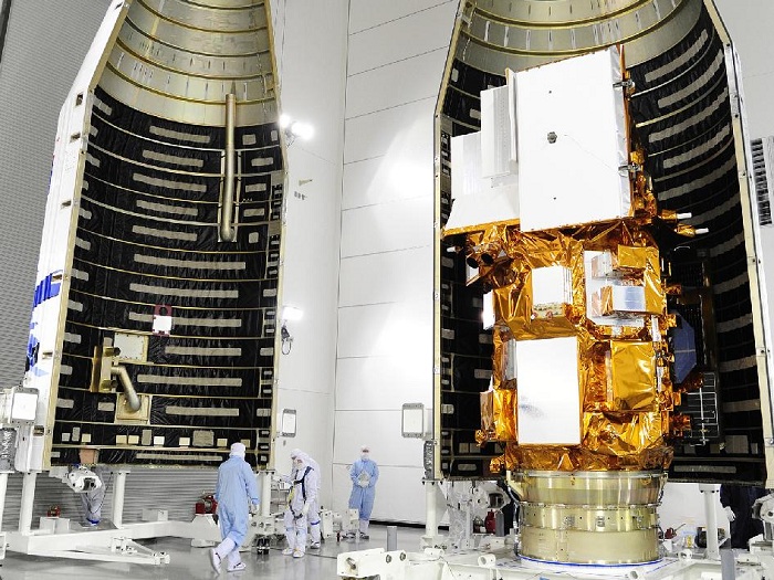
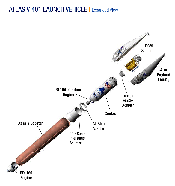
Fairing Encloses Spacecraft
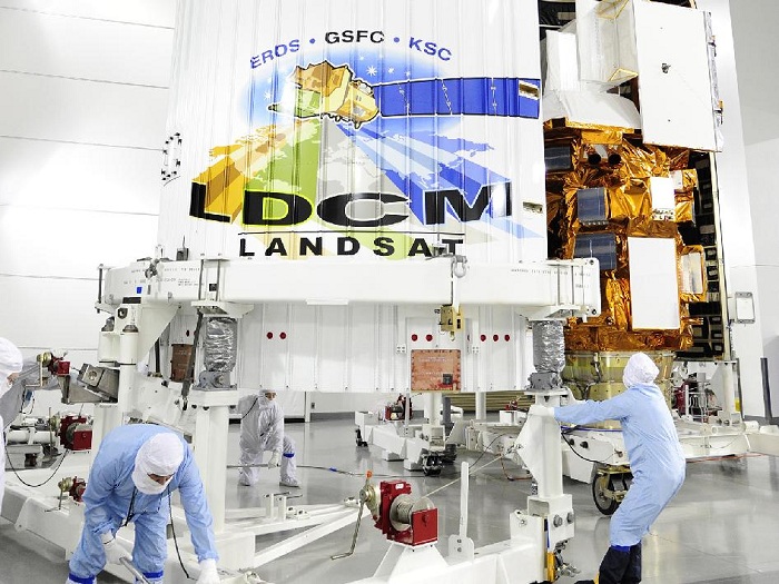
Fairing Encloses Spacecraft
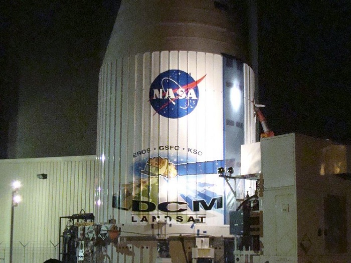
Fairing Encloses Spacecraft

In his first visit to his agency’s western spaceport, NASA Administrator Charles F. Bolden Jr. declared himself “giddy” about today’s planned Atlas 5 rocket launch of an Earth-observing satellite.
“I’m sort of like a kid, I’m kind of giddy about it,” Bolden, a former astronaut on four shuttle missions and a retired Marine Corps major general, said while standing in front of the rocket at Vandenberg Air Force Base on Sunday.
“To see something leave the planet — I’m not sure how many people appreciate that,” Bolden added. “Some of you who live out here probably don’t appreciate it because you’ve grown accustomed to seeing it. But that’s absolutely phenomenal to see something leave the planet, knowing that it’s going to go to do something worthwhile.”
Bolden traveled west for today’s scheduled launch of an Atlas 5 rocket carrying NASA’s Landsat Data Continuity Mission spacecraft to observe Earth.
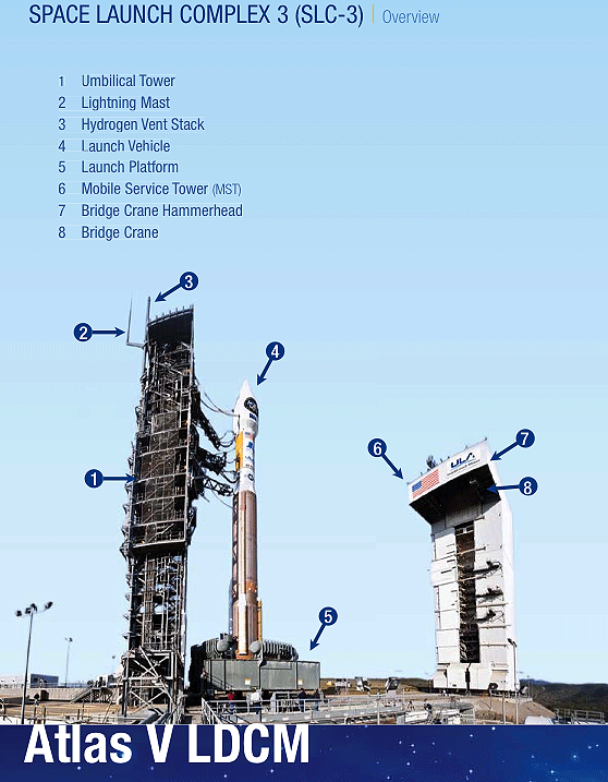
Sunday afternoon, he saw the United Launch Alliance Atlas 5 rocket tucked inside Space Launch Complex-3 on South Base. Liftoff is planned for 10:02 a.m. today but the team has until 10:50 a.m. to get the rocket off the ground or postpone its departure to try another day.
This will be the eighth Landsat craft to launch from Vandenberg, continuing a 40-year archive of Earth images. NASA officials have said the mission costs $855 million.
“I think Landsat has played a huge role to help other people explore our Earth in ways that they could not before,” Bolden said.
He was accompanied by Anne Castle, the Interior Department's assistant secretary for water and science, who hailed the crucial role Landsat has played throughout the years and the importance of continuing to gather those images from space.
Yet, future Landsat craft remain uncertain and unfunded. Landsat 7 continues to operate but only has a few more years of fuel left. Landsat 6 never reached orbit and Landsat 5 was recently retired after a record-setting 29 years of observations.
“It’s very important to have an operational Landsat program so that we minimize the risk of the data gap,” Castle said, adding that the program needs a launch schedule to avoid a lapse in the Landsat image archives.
Talks have taken place with officials on Capitol Hill and at other levels that the program needs to continue beyond LDCM, she noted.
“We’re hopeful that with a successful launch (today) that that will be the platform for the next generation of Landsat satellites,” Castle said.
“I echo what was just said about the importance of continuing this mission,” Bolden added.
Landsat involves a partnership between NASA and the Interior Department, a relationship that “will continue to give us the tools to better manage our natural resources and to preserve the Earth for future generations,” Castle said.
From climate change to other areas, Landsat delivers valuable data that isn’t otherwise available to scientific and other communities, she added.
“We can see changes in the course of rivers,” Castle said. “We can observe the marks of wildfire. With the thermal imagery we can see how energy is used and stored. We can see how water is consumed and evaporated.
“All of those things give us a visual of linkages and connections that aren’t visible to us any other way,” Castle added. “So it lets scientists, researchers develop tools to predict future developments and to adapt and prevent adverse impacts on the Earth.”
Landsat data, once only available for sale, now is free, which has only led to expanded and increased usage across the globe, while creating a common database for researchers around the world.
In the middle of a press conference Sunday, Bolden became momentarily distracted by the 200-foot-tall rocket tucked inside the gantry behind him.
“I was just saying ‘shucks, I forgot to turn around and look at the rocket,” he noted.
Bolden said he plans to remain NASA’s leader — as long as President Barack Obama wants him to stay through his second term.
“We’ve got lots of plans,” Bolden said. “I’m not doing this for my health. I’m doing it because I love it and I plan to be around. I just wish I could be here when we put humans on Mars in 2030.”
.
Quelle: NASA

