After an unusually dry winter, a late-season storm finally soakedCalifornia in early March, piling up several feet of snow across the high granite reservoirs of the Sierra Nevada mountains.
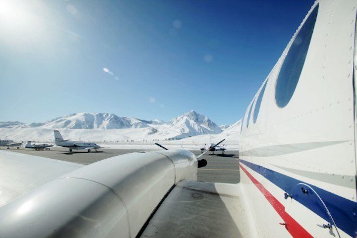
On the Sunday morning after the weather cleared, a pair of NASA researchers loaded onto a small plane at the Mammoth Yosemite Airport, a single-runway operation that stretches out before the pyramid peak of Mount Morrison.
After final safety checks, the pilots lifted off, marking the Airborne Snow Observatory’s inaugural flight of the season. The ASO is a twin-turboprop Beechcraft King Air 90, equipped with a pair of sensors pointing through a glass cutout on the bottom of the plane. The lidar measures the volume of the mountain snowpack while a spectrometer gauges its reflectivity, together providing a highly accurate estimate of how much water will run off the mountain in the spring and when it will flow through California’s warren of dams, reservoirs, and aqueducts.
The data allows water authorities to more carefully manage the water charging hydroelectric power plants, feeding towns and cities, and nourishing one of the United States’ most productive agricultural regions. Doing that job well has become increasingly critical as the state alternately struggles with prolonged droughts and widespread floodingas climate change appears to exacerbate seasonal volatility.
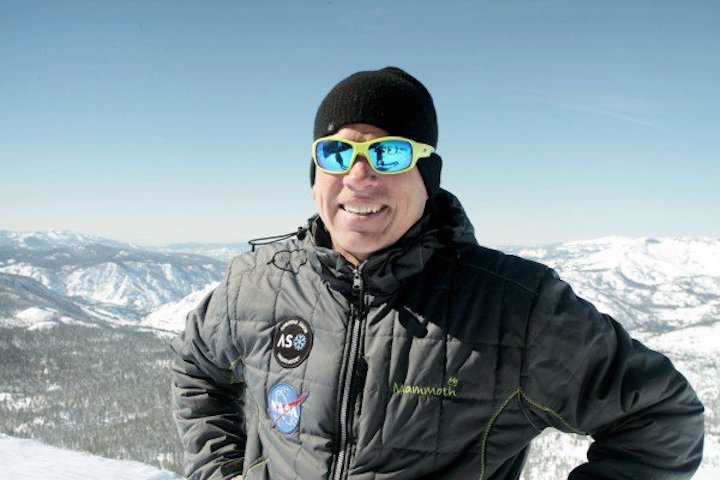
“You can’t manage what you can’t measure,” says Thomas Painter, principal investigator with the ASO program, managed by NASA’s Jet Propulsion Lab in Pasadena.

Thomas Painter, principal investigator with NASA’s Airborne Snow Observatory program, stands before the San Joaquin watershed.
-
Climate whiplash
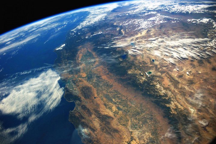
The Sierra Nevada stretches 400 miles along the southeast border of California. Each year, its melting snowpack supplies up to a third of the state’s water.
Managing that resource is a tricky task. Reservoir operators have to let out enough to avoid flooding, sustain fish and ecosystems, recharge groundwater, and supply cities and industries. But they also need to hold onto enough to meet the needs of farmers, businesses, and residents through the dry summer months.
The ASO program began its snow surveys in the spring of 2013 as a devastating drought gripped California. The historic dry spell forced mandatory water restrictions, doomed more than one hundred million trees, exacerbated wildfires, and squeezed the profits of the state’s massive agriculture industry. Then it came to an abrupt halt in the winter of 2016–2017 as a series of storms dumped nearly 95 inches of rain in some parts of the Sierra, marking California’s second-wettest year on record.
This sort of “climate whiplash” could become up to twice as common in the state, driven by rising temperatures, increasing atmospheric water vapor, and other climatic shifts, according to an April paper in Nature Climate Change. One-time 200-year floods could occur every 40 years by the middle of the century, the authors found.
Total rainfall might not change much averaged across these sharp shifts between very dry and very wet years, but “it doesn’t just wash out in the end,” says Daniel Swain, lead author of the study and a climate scientist at the University of California, Los Angeles. “You have all the downsides of wet years and drought years. You have more of the risks, and fewer of the benefits, of that water.”
Amid such turbulence, the foresight that the NASA ASO program can provide into shifting snowpack conditions will be “critical to managing water” within a system designed for the climate of the past, Swain says.
In wet years, the program helps reservoir operators prevent water from overtopping the basins and deluging downstream communities. In dry years, the data enables them to make more efficient use of limited supplies. For the Friant Water Authority, which manages a dam and canals that feed a million acres of Central Valley farmland, that means putting more of the water to work growing the state’s fruits and vegetables, says Jeff Payne, the public agency’s director of water policy.
Bouncing lasers
After cresting the steep eastern face of the range, the plane reached a high-altitude stretch of the San Joaquin basin, which stores water in its frozen form right up until the thousands of Friant district farms need it each spring.
Dan Berisford, a bearded 38-year-old NASA technologist wearing a knitted beanie and mirrored sunglasses, sat in the rear left seat in front of the lidar monitor. He flipped a switch that initiated data collection from the sensor.
The plane cut a lawnmower path over the terrain, covering long lines before banking 180 degrees. The lidar emits pulsed laser beams hundreds of thousands of times per second, sweeping laterally across the landscape. By measuring the time it takes for the light to reflect off the surface and return to the sensor, the device’s software is able to plot out a 3-D map of the snow surface. Combining that information with earlier observations, the scientists are able to calculate the “snow-water equivalent,” or the total volume of water stored in the watershed at that point.
Berisford’s main job on the plane is quality control, watching for telltale signs that the light is bouncing off of clouds or air moisture.

NASA’s Airborne Snow Observatory, a Beechcraft King Air 90, at the Mammoth Yosemite Airport.
The spectrometer runs at the same time. It’s essentially a camera, but one that can detect light far beyond the range of the human eye. It determines how much of the sunlight hitting the snow is reflecting off the surface.
Fresh snow is highly reflective, which slows melting and helps throw heat back into the atmosphere. But the snowpack becomes steadily less reflective as the ice crystals merge and grow, and air pollution and storms litter the fields with dark absorbent spots in the form of dust and soot.
Determining shifting reflectively levels helps the team calculate how quickly the snow will melt, and when it will ultimately reach downstream reservoirs, Berisford says.
Most accurate
Californians have been trying to accurately measure the Sierra snowpack for more than a century. Every winter, the California Department of Water Resources dispatches surveyors on cross-country skis and snowshoes to hundreds of designated spots, where they plunge aluminum measuring tubes deep into the snow. That data is supplemented by more than one hundred remote sensor stations situated throughout the range, where “snow pillows” provide estimates based on the shifting weight of snow above them.
But these snapshots often don’t add up to an accurate picture of these sprawling high-mountain watersheds. In some years, the estimated amount of water that eventually reaches reservoirs like the Hetch Hetchy system, which serves nearly three million customers around San Francisco, can be off as much as 40 percent. That’s a plus or minus of tens of billions of gallons of water.
But after five years of operation, through very wet, very dry, and average years, the NASA program’s error rate is averaging around 2 percent, Painter says.
“It’s the most accurate survey on snowpack ever done,” he says.
Measuring from space
So far, the NASA ASO program, which is transitioning from a pilot to an operational phase, has been covering only around a third of the Sierra. But NASA, the California Department of Water Resources, and several water districts are making the case to expand it across California. That would require additional planes, facilities, and several million in annual funding. Representatives of the Friant Water Authority and other water districts have been in discussions with legislators to set aside money for the program.
Painter says NASA is also in discussions about setting up similar efforts in the Columbia Basin stretching through Oregon, Washington, and Canada, and the Colorado River Basin, where they’ve also conducted early survey flights.
NASA’s ultimate goals are far loftier. The Goddard Space Flight Center in Greenbelt, Maryland, has been carrying out a series of tests on the snow-covered mountains and plateaus around Grand Mesa, Colorado. The aim of the multiyear research project, known as SnowEx, is to determine what combination of sensors and techniques will enable NASA to measure snow-water equivalent from space.
As it stands, current satellites can determine only the extent of snow across the continents, not the amount of water it contains.
The effort could help other regions around the world struggling with the same sorts of water challenges and uncertainties as California. It could also provide data on the planet’s shifting reflectivity as temperatures rise and less snow accumulates, offering insight into a crucial feedback mechanism of climate change.
“We need a satellite mission that can measure snow globally,” Charles Gatebe, the deputy project scientist for SnowEx, has said. “We are looking for the tools.”
Hard to adapt
But ultimately, more and better information can only do so much.
If precipitation patterns shift as much as Swain’s study predicts, the situation will demand far bigger changes in California’s water infrastructure and practices. And adjusting to a new normal is hard when that new normal is volatility.
Notably, some argue that more and worse droughts will require the state to build additional reservoirs. But that same measure would exacerbate flooding risks during wet years, as heavy rains overtop the basins.
Other California water management experts believe the state will need to develop a much more flexible system, by leaning more heavily on natural flood plains and aquifers rather than human-made reservoirs. That’ll require entirely different infrastructure, likely including levees, pipelines, and canals, to protect communities and transport water.
“That may be the most promising way to mitigate the risk,” Swain says. “But honestly, it’s going to be a tough challenge. It’s going to be hard to adapt.”

