
13.03.2024
Isro's INSAT-3DS delivers first pictures: India looks incredible
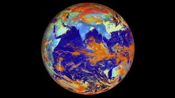
First picture captured by the INSAT-3DS. (Photo: Isro)
- Isro released a set of images captured by the spacecraft
- The INSAT-3DS mission is designed to build upon and expand metrology capabilities
- The satellite's Imager payload captures high-resolution images across six wavelength bands
India's latest geostationary satellite, INSAT-3DS, has begun transmitting its first set of data back to Earth.
Launched on February 17, 2024, by the Indian Space Research Organisation (Isro) from Sriharikota, this state-of-the-art satellite is equipped with advanced Imager and Sounder payloads, offering unprecedented views and insights into Earth's atmospheric dynamics.
Isro released a set of images captured by the spacecraft, which show the planet and India in new detail.
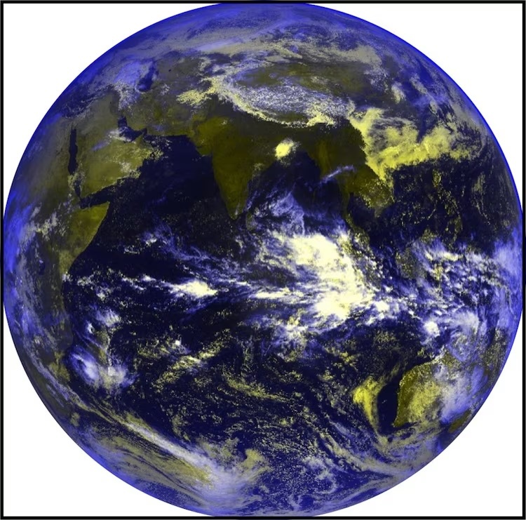
The use of multiple channels allows for gathering information about various atmospheric and surface phenomena. (Photo: Isro)
Isro said that the 6-channel imager equipment captures images of the Earth's surface and atmosphere across multiple spectral channels or wavelengths. The use of multiple channels allows for gathering information about various atmospheric and surface phenomena, such as clouds, aerosols, land surface temperature, vegetation health, and water vapour distribution.
The INSAT-3DS mission is designed to build upon and expand the capabilities of its predecessors, INSAT-3D and INSAT-3DR, which have been pivotal in meteorological operations since their respective launches in 2003 and 2016. With a weight of 2,274 kilograms and funded by the Ministry of Earth Sciences, INSAT-3DS aims to ensure continuity in the observation and monitoring of Earth's surface, oceans, and atmosphere.
The satellite's Imager payload captures high-resolution images across six wavelength bands, enabling detailed visualisation of crucial atmospheric parameters such as water vapour content. This capability is instrumental in tracking cyclones, monsoon systems, thunderstorms, and other natural disasters, thereby enhancing disaster warning systems.
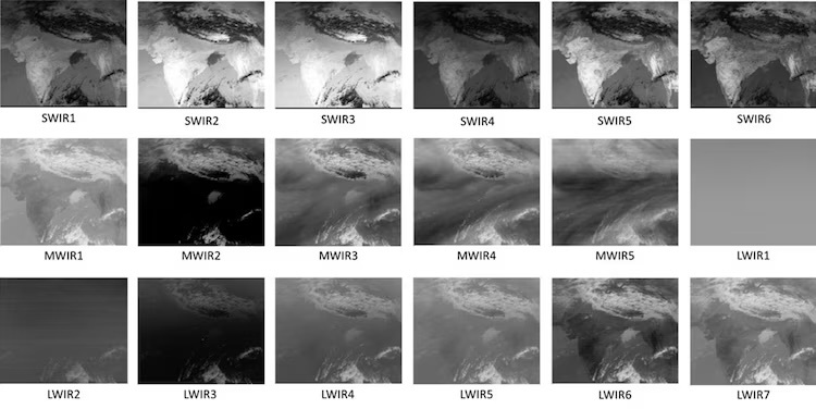
The satellite's Imager payload captures high-resolution images. (Photo: Isro)
Moreover, the Sounder payload, a first-time instrument in the geostationary INSAT series developed at Isro, measures the temperature and humidity profiles vertically through the atmosphere. This provides a three-dimensional representation of the atmosphere, crucial for accurate weather forecasting and understanding atmospheric dynamics.
The inclusion of a data relay transponder and a satellite-aided search and rescue transponder further underscores the multifaceted utility of INSAT-3DS. These features not only aid in meteorological observations but also play a vital role in disaster management and rescue operations.
The successful launch and operation of INSAT-3DS mark a significant milestone in India's space endeavours, particularly in the field of meteorology.
Quelle: INDIA TODAY