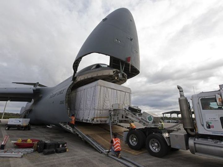
NOAA's GOES-S weather satellite, slated for 2018 launch, arrives at KSC
An Air Force C-5M Super Galaxy delivers the NOAA's latest weather satellite to Kennedy Space Center on Monday.
-
A rocket from the same Atlas V family launched its $1 billion forerunner in 2016, also known as GOES-R, and was designated GOES-16 after coming online. GOES-S will follow the same pattern and become GOES-17 after achieving the intended orbit and completing tests.
Quelle: Florida Today
+++
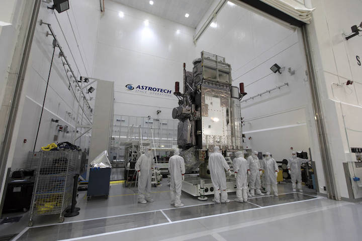
NASA Invites Media to See NOAA Weather Spacecraft Before March Launch
At Astrotech Space Operations in Titusville, Florida, technicians and engineers move NOAA's Geostationary Operational Environmental Satellite-S (GOES-S) into a clean room for further processing.
Media are invited to view the Geostationary Operational Environmental Satellite-S (GOES-S), the second in the National Oceanic and Atmospheric Administration’s (NOAA’s) series of next-generation geostationary weather satellites, at 9:30 a.m. EST Tuesday, Jan. 16.
This event, to be held at the Astrotech Space Operations payload processing facility in Titusville, Florida, is an opportunity to photograph GOES-S and interview project and program officials. Media interested in attending this event must email ksc-media-accreditat@mail.nasa.govno later than noon on Thursday, Jan. 11.
Due to clean room requirements, no more than 20 individuals will be allowed to participate, and no more than two per media organization. This event is open only to U.S. citizens who possess a government-issued photo identification, such as a driver's license, and proof of U.S. citizenship, such as a passport or birth certificate.
Facility Access
Please read these instructions carefully, or you may be denied access to the clean room.
Procedures for optically sensitive spacecraft must be followed by individuals entering the clean room where the spacecraft is being prepared for launch. Long pants and closed-toe shoes must be worn. No tank tops, shorts or skirts will be permitted. Full clean-room attire (bunny suits) must be worn and will be furnished. Please do not wear perfume, cologne, hair spray or makeup. Those wearing makeup will be required to remove it prior to entry.
Photographers will need to clean camera equipment under the supervision or assistance of contamination-control specialists. All camera equipment must be self-contained. Nonessential equipment, such as suede, leather or vinyl camera bags, carrying cases, camera straps, or accessories with Velcro must be left outside the clean room. No notebook paper, pencils or click-type ball point pens are permitted; clean-room paper and non-retractable ball point pens will be provided.
Use of wireless microphones and cell phones will be permitted if not contained in external cases or holding devices. Electronic flash will be permitted. The lighting in the facility is metal halide (white) for pictures. No food, chewing gum, tobacco, lighters, matches or pocketknives will be allowed and so should not be brought to the Astrotech clean room.
The GOES-R satellite series, which includes GOES-R, -S, -T and -U, is the nation’s most advanced fleet of geostationary weather satellites that will extend the availability of the operational GOES satellite system through 2036.
GOES-S is scheduled to launch on a United Launch Alliance Atlas V rocket at 5:02 p.m. EST Thursday, March 1, from Space Launch Complex 41 at Cape Canaveral Air Force Station in Florida. The spacecraft will significantly improve the detection and observation of environmental phenomena that directly affect public safety, protection of property and the nation's economic health and prosperity.
NOAA manages the GOES-R Series Program through an integrated NOAA-NASA office and is responsible for the science and data applications. NASA’s Goddard Space Flight Center in Greenbelt, Maryland, provides spacecraft project management, systems engineering, and safety and mission assurance. Lockheed Martin Space of Littleton, Colorado, built the spacecraft and is responsible for spacecraft development, integration and testing.
Mission operations will be performed by NOAA at the NOAA Satellite Operations Facility in Suitland, Maryland. Harris Corp., of Melbourne, Florida, provided the main instrument payload, the Advanced Baseline Imager, the antenna system for data receipt and the ground segment. NASA’s Launch Services Program is responsible for launch management. United Launch Alliance of Centennial, Colorado, is the provider of the Atlas V launch service.
Quelle: NASA
---
Update: 10.01.2018
.
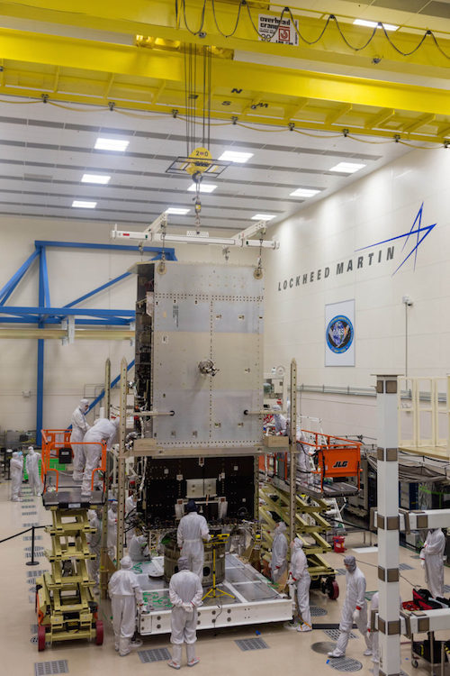
NOAA prepares GOES-S for launch as Lockheed Martin builds successors
Lockheed Martin engineers and technicians are assembling NOAA's Geostationary Operational Environmental Satellite (GOES) T at the company's Littleton, Colorado facility in preparation for launch in late 2020. Credit: Lockheed Martin
-
AUSTIN, Texas — As the National Oceanic and Aeronautics Administration prepares for the March 1 launch of its next Geostationary Operational Environmental Satellite (GOES) S on an Atlas 5 rocket from Cape Canaveral Air Force Station in Florida, prime contractor Lockheed Martin is working in Denver on its successors GOES-T and GOES-U.
GOES-S is in the Astrotech Space Operations facility in Titusville, Florida, and “functionally, things look good,” Tim Walsh, NOAA’s acting system program director for the GOES-R series, said Jan. 9 at the American Meteorological Society meeting here. “Soon, we’ll be stacking it on the rocket.”
GOES-S, which will be renamed GOES-17 when it reaches geostationary orbit, will go into service immediately upon commissioning, Steve Volz, NOAA acting assistant secretary for environmental observation and prediction, said Jan. 9 at the AMS meeting to a round of applause from researchers eager for access to the data. Within six months of launch, NOAA plans to move the GOES-S satellite into position to serve as the GOES-west satellite, Volz added.
As final preparations for the GOES-S launch continue in Florida, Lockheed Martin is working in Denver on its successors GOES-T and GOES-U. Engineers are installing the solar pointing instruments, Extreme Ultraviolet and X-Ray Irradiance Sensors and Solar Ultraviolet Imager, on the GOES-T satellite. In February, they plan to begin integrating GOES-T’s nadir instruments, Advanced Baseline Imager and Global Lightning Mapper, Tim Gasparinni, Lockheed Martin GOES-R Series program manager, said in an interview.
After launch slated for 2020, GOES-T will be stored over the middle of the continental United States where it will serve as NOAA’s spare geostationary satellite, Walsh said.
Technicians at Lockheed Martin work on GOES-T satellite. Credit: Lockheed Martin
Quelle: SN
---
Update: 12.01.2018
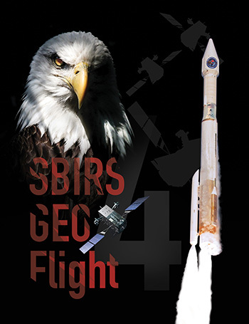
SBIRS GEO Flight-4 encapsulation completed
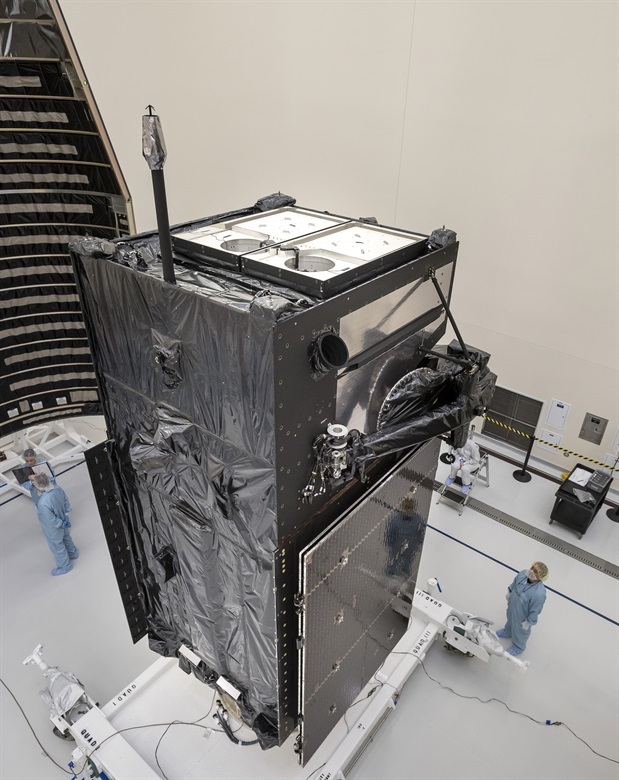
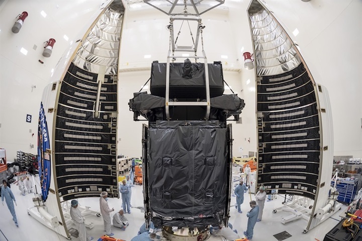
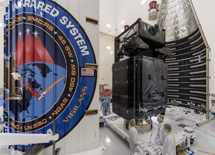
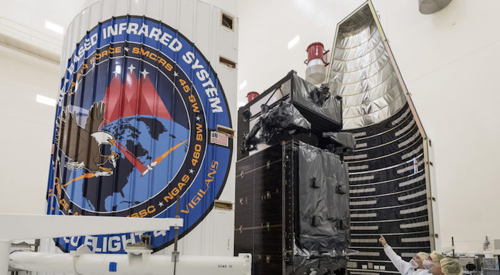
Technicians make last-minute preparations for the encapsulation of the Air Force's Space Based Infrared System Geosynchronous Earth Orbit Flight-4 (SBIRS GEO-4) satellite at Cape Canaveral Air Force Station, Florida, Jan. 9. GEO Flight-4 will make the journey to Space Launch Complex-41 on Jan. 11, where it will be mated with its Atlas V-411 rocket. It is scheduled for launch on Jan. 18 at 7:52 p.m., Eastern (4:52 p.m. Pacific). (Photo courtesy Lockheed Martin Space Systems, Colorado)
-
LOS ANGELES AIR FORCE BASE, Calif. --
The Air Force's Space Based Infrared System Geosynchronous Earth Orbit Flight-4 (SBIRS GEO-4) satellite completed encapsulation today at Cape Canaveral Air Force Station, Florida.
This encapsulation event is a significant milestone in GEO Flight-4's launch process as it marks the satellite's completion of all major testing milestones prior to launch.
On Jan. 11, GEO Flight-4 will make the journey to Space Launch Complex-41, where it will be mated with its Atlas V-411 rocket. It is scheduled for launch on Jan. 18 at 7:52 p.m., Eastern (4:52 p.m. Pacific).
Quelle: USAF
---
Update: 16.01.2018
.
New U.S. missile-warning satellite set for launch at Cape Canaveral
The Space Based Infrared System Geosynchronous Earth Orbit Flight-4 satellite completed encapsulation on January 9, 2018. (Lockheed Martin photo)
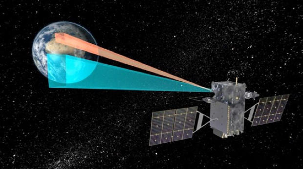
SBIRS is the United States’ main source of persistent, space-based surveillance of missile launches around the globe.
WASHINGTON — The U.S. military’s newest missile-warning satellite is set to lift off later this week just as tensions continue to mount over North Korea’s ICBM program.
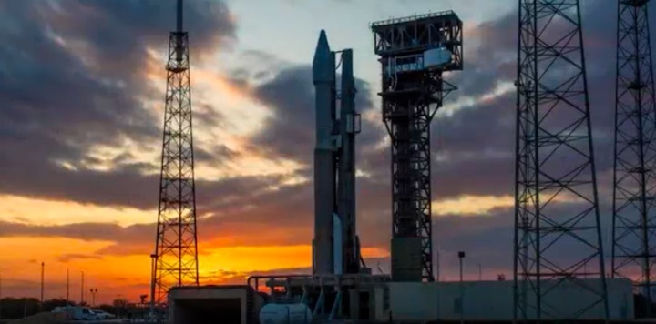
Crews at Cape Canaveral Air Force Station, Florida, are preparing to launch the SBIRS GEO Flight-4 satellite on Thursday from a United Launch Alliance Atlas V rocket.
“Everything is progressing toward the ULA Atlas V launch carrying the Space Based Infrared System GEO Flight 4 mission for the U.S. Air Force,” ULA announced on Monday. The forecast shows an 80 percent chance of favorable weather conditions for the planned 7:52PM EST liftoff on Thursday.
Lockheed Martin manufactured the satellite in Sunnyvale, California. It was delivered to Florida on Oct. 31 and encapsulated on Jan. 9. During encapsulation, the satellite was sealed in its launch fairing, an aerodynamic, nose-cone shell that protects the satellite during launch. In the days leading up to the launch, the fairing with the satellite enclosed will be mounted on top of the Atlas V rocket.
SBIRS is the United States’ main source of persistent, space-based surveillance of missile launches around the globe.
The Flight-4 launch comes less than a year since SBIRS GEO Flight-3 sent its first images down to Earth in a milestone known as “first light.” These two satellites join SBIRS GEO-1 and GEO-2, which have been in operation since 2013.
The constellation includes four geostationary satellites, two SBIRS hosted payloads on satellites in highly elliptical orbit, two replenishment satellites and sensors, and fixed and mobile ground stations.
The Center for Strategic and Budgetary Assessments estimated that total costs for the two payloads and four geo satellites, plus ground support, come to approximately $13.6 billion. Each satellite with spares and accessories is estimated to cost $1.7 billion. The Pentagon requested $1.3 billion in 2018 for SBIRS — $862 million more than was appropriated in 2017.
The Air Force plans to soon move forward with the next batch of satellites, GEO-5 and GEO-6. Lockheed Martin intends to use a modernized LM 2100 satellite bus. After a “critical design review” in September, the Air Force, authorized the GEO 5 and 6 satellites to begin the manufacturing and integration phase.
The SBIRS satellites are equipped with powerful scanning and staring infrared surveillance sensors that collect data for use by the U.S. military to detect missile launches, support ballistic missile defense and gather broader intelligence.
+++
Air Force launches new project to update missile-warning ground software
Airmen at the Global Strategic Warning and Space Surveillance System Center at Cheyenne Mountain, Colorado, monitor strategic missile warning systems. (Air Force photo)
The “future operationally resilient ground evolution,” or FORGE, is part of a broader SBIRS modernization plan.
WASHINGTON — Air Force officials are talking to potential vendors this week about an upcoming project to update the software used to control the military’s missile-warning satellites and to analyze the data beamed from space.
The ground-based systems are the less exciting but nonetheless important piece of the SBIRS space-based infrared surveillance satellites that provide initial warning of a ballistic missile attack on the United States, deployed forces and allies.
The plan is to shift the current ground software architecture — a closed system developed by traditional defense contractors that is not compatible with commercial software from competing vendors — to an open-systems platform that the Air Force would own and update with new technology as it becomes available.
The project is called “future operationally resilient ground evolution,” or FORGE. It is part of a broader $173.5 million SBIRS modernization plan. And it is one of several projects where Air Force hopes to attract nontraditional vendors that can bring fresh ideas and cutting-edge products.
The “space enterprise consortium,” overseen by the Space and Missile Systems Center in Los Angeles, is hosting a conference with potential vendors this week in El Segundo, California. Interest in the FORGE program has been so strong that the consortium had to cut off registration for one-on-one meetings.
“Due to overwhelming interest,” not everyone who requested a meeting will get one, said a posting on the consortium’s website.
The enthusiasm may be a sign that companies believe the Air Force is about to shake up the status quo in some of its major space programs. FORGE and other projects managed by the consortium will test the rhetoric of Air Force leaders who have promised to open the market to commercial businesses and startups. In this case, the Air Force will create a common software framework that will be owned by the government but where companies will be able to host software applications.
The ground software associated with SBIRS, like other major military space systems, is costly and increasingly difficult to update, according to government and industry officials. Because it is not an open architecture, the Air Force is not able to insert fresh software on a regular basis.
The plan is to migrate SBIRS mission management, telemetry, tracking, and satellite ground control to a “command-and-control common platform” enterprise. The Air Force will use commercial contracting methods, known as “other transactions authority,” or OTA, to fund prototype designs of a common framework. The other portion of the FORGE program will focus on software to analyze and disseminate the data provided by the SBIRS satellites.
Lockheed Martin is the prime contractor for SBIRS. Northrop Grumman Aerospace Systems is the payload integrator. The 460th Space Wing at Buckley Air Force Base, Colorado, operates the system.
The space enterprise consortium has been mentioned by senior Air Force officials as proof that the service is opening up opportunities for newcomers that thus far have been shut out of the military market.
The Space and Missile Systems Center funded the consortium under a $100 million OTA agreement. Membership costs $7,500 per year for large companies and $500 per year for small businesses. About 40 companies so far have joined.
An industry official told SpaceNews that the reviews of the consortium generally have been positive. Commercial companies for years have been disappointed by the military’s procurement and contracting processes that tend to favor incumbent companies. A case in point is a highly touted Air Force effort to acquire hosted payloads from the commercial sector. The program came under heavy industry criticism for awarding far fewer contracts than promised.
The OTA agreements usually require that the vendor fund a portion of the project. To prevent established defense companies from buying their way into every project, the contracts require participation by nontraditional suppliers. The bidder has to prove that a nontraditional space company plays a significant role.
Als through the consortium, the Space and Missile Systems Center has published a solicitation for microsatellites intended to operate in high-Earth orbit that would cost less than $5 million each. This project will be highly watched by the small-satellite industry as an indicator of how the service will procure products from the commercial market. SMC would use small satellites to design a “flexible spacecraft architecture” for missions like communication, overhead persistent infrared, precision navigation and timing, weather and space situational awareness.
The potential use of small satellites for the overhead persistent infrared mission — currently performed by SBIRS — should be of interest to advocates of moving away from large expensive satellites that make for “high value” targets to U.S. enemies. U.S. Strategic Command commanding general John Hyten said he was disappointed that the Air Force already is making plans to build a new missile-warning constellation similar to SBIRS that would be deployed in 2029. Hyten said it is imperative that “we go faster.”
Quelle: SN
---
Update: 18.01.2018 / 12.45 MEZ
.
Atlas V to Launch SBIRS GEO Flight 4 for the U.S. Air Force
Mission: Space Based Infrared System (SBIRS) GEO Flight 4
Launch Date: Thursday, Jan. 18, 2018
Launch Time: The 40-minute launch window opens at 7:52 p.m. EST
Live Broadcast: Tune in beginning at 7:32 p.m. EST
Launch Location: Space Launch Complex 41, Cape Canaveral Air Force Station
Mission Description: SBIRS, considered one of the nation's highest priority space programs, is designed to provide global, persistent, infrared surveillance capabilities to meet 21st century demands in four national security mission areas: missile warning, missile defense, technical intelligence and battlespace awareness. The SBIRS team is led by the Remote Sensing Systems Directorate at the U.S. Air Force Space and Missile Systems Center. Lockheed Martin is the prime contractor, with Northrop Grumman as the payload integrator. Air Force Space Command operates the SBIRS system.
Launch Notes: ULA also launched the first three SBIRS GEO missions. SBIRS GEO Flight 4 mission will mark ULA’s 125th mission overall since the company was founded in 2006. It’s also the 75th Atlas V launch since the rocket’s inaugural flight in 2002.
Quelle: ULA
---
Update: 19.01.2018
.
Atlas V to Launch SBIRS GEO Flight 4 for the U.S. Air Force
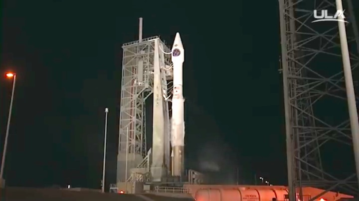
Jan. 18, 2018, 7:28 p.m. EST: The launch of a United Launch Alliance Atlas V carrying the SBIRS GEO Flight 4 mission was scrubbed today due to a ground issue associated with the booster liquid oxygen system.
The launch is planned for Friday, Jan. 19, from Space Launch Complex-41 at Cape Canaveral Air Force Station. The forecast shows a 90 percent chance of favorable weather conditions for launch. The launch time is 7:48 p.m. ET.
Quelle: ULA
+++
Update: 17.30 MEZ
+++
Update: 20.01.2018 / 7.30 MEZ
.
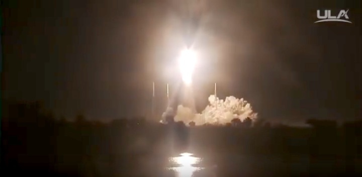
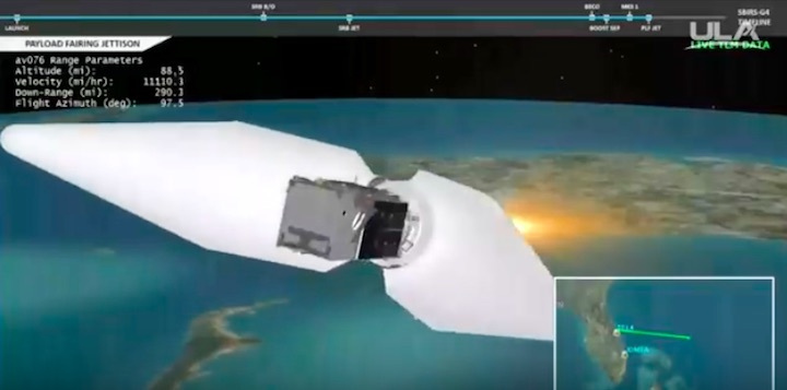
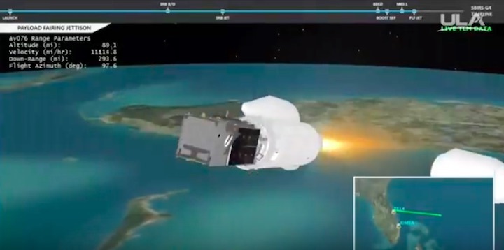
United Launch Alliance Successfully Launches SBIRS GEO Flight 4 Mission for the U.S. Air Force
Two launches from two coasts in just one week.
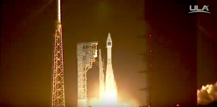
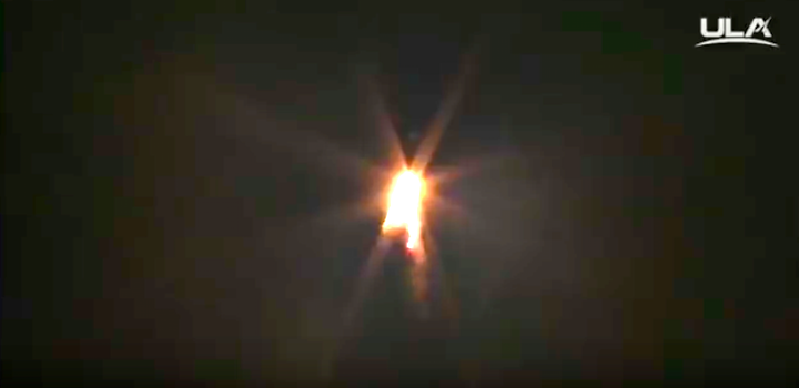
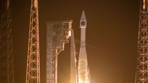
Cape Canaveral Air Force Station, Fla., A United Launch Alliance (ULA) Atlas V rocket carrying the Space Based Infrared System (SBIRS) GEO Flight 4 mission lifted off from Space Launch Complex-41 on Jan. 19 at 7:48 p.m. EST. SBIRS is considered one of the nation’s highest priority space programs, and is designed to provide global, persistent, infrared surveillance capabilities to meet 21st century demands.
“Meeting the challenge of launching two critical national security missions from opposite coasts within a week, the entire ULA team once again demonstrated its unwavering dedication to 100% mission success,” said Laura Maginnis, ULA vice president of Government Satellite Launch. “Thank you to our U.S. Air Force and industry teammates for their outstanding partnership in successfully delivering SBIRS to orbit today.”
This mission was launched aboard an Atlas V Evolved Expendable Launch Vehicle (EELV) 411 configuration vehicle, which includes a 4-meter Payload Fairing (PLF). The Atlas booster for this mission was powered by the RD AMROSS RD-180 engine. Aerojet Rocketdyne provided the AJ-60A solid rocket booster (SRB) and RL10C-1 engine for the Centaur upper stage.
This is the 75th launch of the Atlas V rocket, ULA’s 2nd launch in 2018 and the 125th successful launch since the company was formed in December 2006.
The EELV program was established by the U.S. Air Force to provide assured access to space for Department of Defense and other government payloads. The commercially developed EELV program supports the full range of government mission requirements, while delivering on schedule and providing significant cost savings over the legacy launch systems.
ULA's next launch is the GOES-S mission for NASA and NOAA on an Atlas V rocket. The launch is scheduled for March 1 from Space Launch Complex-41 at Cape Canaveral Air Force Station, Florida.
With more than a century of combined heritage, United Launch Alliance is the nation’s most experienced and reliable launch service provider. ULA has successfully delivered more than 120 satellites to orbit that aid meteorologists in tracking severe weather, unlock the mysteries of our solar system, provide critical capabilities for troops in the field and enable personal device-based GPS navigation.
+++
Quelle: ULA
+++
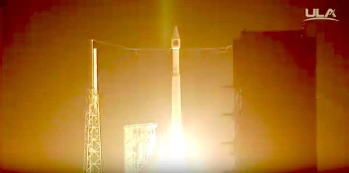
Atlas 5 launches missile-detecting satellite
United Launch Alliance (ULA) Atlas V rocket carrying the Space Based Infrared System (SBIRS) GEO Flight 4 mission lifted off from Space Launch Complex-41 on Jan. 19 at 7:48 p.m.ET.
UNITED LAUNCH ALLIANCE
One week after launching a spy satellite from California atop a Delta 4 rocket, United Launch Alliance boosted a missile early warning satellite into space aboard an Atlas 5 booster Friday evening after a sky-lighting launch from Cape Canaveral.
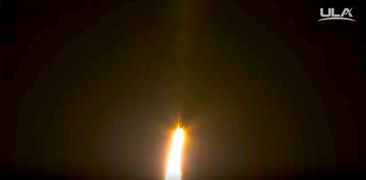
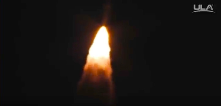
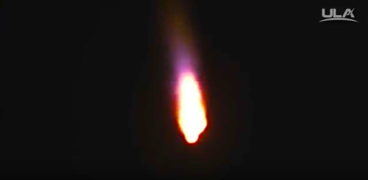
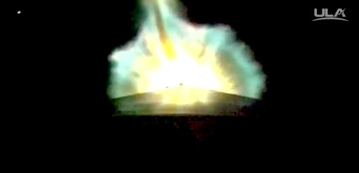
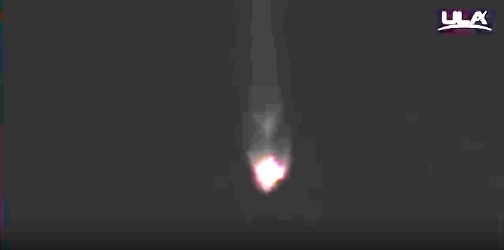
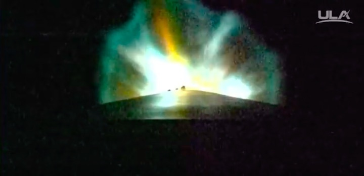
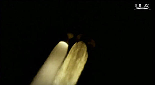
With a crescent moon setting in the west, the Atlas 5's Russian-built RD-180 engine thundered to life at 7:48 p.m. ET, followed an instant later by ignition of a single strap-on solid-fuel booster. Trailing a jet of brilliant exhaust, the 194-foot-tall rocket quickly climbed skyward from complex 41 at the Cape Canaveral Air Force Station, arcing away to the east over the Atlantic Ocean.
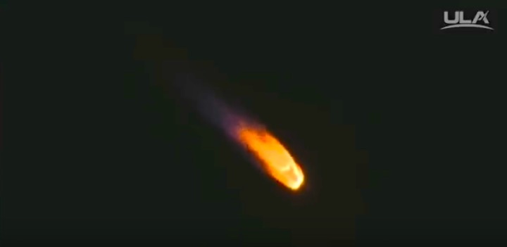
Liftoff came a day late because of trouble with a liquid oxygen valve in the pad's propellant system, but it was smooth sailing Friday. The strap-on booster burned out and fell away shortly after launch and the ascent continued under the power of the first-stage engine, looking like a fiery "star" in the evening sky.
A United Launch Alliance (ULA) Atlas V rocket carrying the Space Based Infrared System (SBIRS) GEO Flight 4 mission lifted off from Space Launch Complex-41 on Jan. 19 at 7:48 p.m. T.E
UNITED LAUNCH ALLIANCE
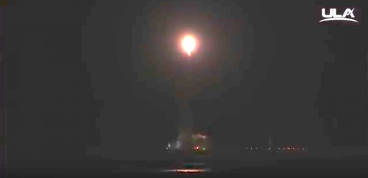
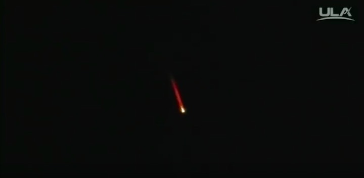
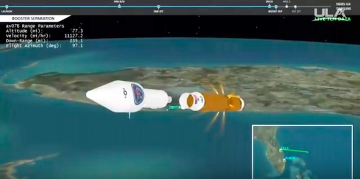
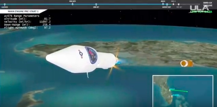
The first stage fired normally, falling away four minutes after liftoff, and a little less than 10 minutes after that, the rocket's Centaur second stage completed the first of two firings to put the spacecraft into a preliminary orbit.
A second firing 10 minutes later was designed to put the Space Based Infrared System -- SBIRS -- satellite into an elliptical "transfer" orbit with a high point, or apogee, of around 35,850 miles and a low point, or perigee, of 115 miles.
The satellite's on-board thruster will be fired over the next two weeks to circularize the orbit at an altitude of 22,300 miles above the equator. In such geosynchronous orbits, satellites take 24 hours to complete one trip around the planet and thus appear stationary in the sky.
The new satellite will join three other SBIRS (pronounced SIB-ers) spacecraft already in geosynchronous orbit that use telescopes and sophisticated infrared sensors to constantly monitor the world below, on the lookout for the heat generated by a rocket during launch. The SBIRS GEO-4 satellite completes the constellation, providing overlapping global coverage.
The SBIRS system also incorporates data from older Defense Support Program, or DSP, early warning satellites along with stand-alone infrared sensors mounted on other classified military satellites in lower elliptical orbits.
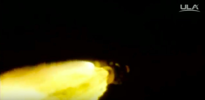
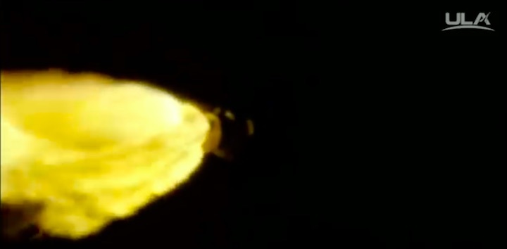
The brilliant plume from the Atlas 5's RD-180 first stage engine competes with the glare from a single strap-on solid-fuel booster as the rocket climbed away from Cape Canaveral.
UNITED LAUNCH ALLIANCE
"Missiles, as they fly, create a heat signature, and certainly our adversaries are moving to make that heat signature smaller and smaller, and we are moving to maintain a capability to detect those as we move forward," Col. Dennis Bythewood, director of the Remote Sensing Systems Directorate at Los Angeles Air Force Base, told reporters before launch.
"The missile warning constellation, comprised of both the Defense Support Program and the SBIRS satellites, provides that initial warning to our nation's leaders. So whether there be an actual launch or a false indication of a launch, the missile warning architecture is there to provide the true data that allows us to understand what actually happened."
The SBIRS satellites are built by Lockheed Martin, using sensors provided by Northrup Grumman. SBIRS GEO 3 and 4 are valued at $1.2 billion all together, including the costs of the rockets needed to launch them.
"The Defense Support Program has provided missile warning data since 1970," Bythewood said. "It has been the bedrock of our missile warning constellation and continues to provide phenomenal data.
The SBIRS early warning satellites uses sophisticated infrared sensors to look for the heat produced by ballistic and tactical rockets.
LOCKHEED MARTIN
"However, the sensors that we have on the SBIRS constellation are leaps and bounds ahead of them in capability, and as we launch those and move them into the constellation, we are able to get dimmer targets and keep pace with the missiles that our adversaries are fielding day-to-day."
Along with detecting intercontinental ballistic missiles, the SBIRS sensors are also able to "see" the heat produced by smaller tactical weapons, improving "battlespace awareness" and providing technical intelligence.
"When the system was originally designed in a Cold War era, we were really worried about the Soviet Union and its allies," Bythewood said before the third SBIRS launch last January. "In today's world, and certainly over the last 20 years, the proliferation of missiles outside of that concentrated area has grown demonstrably.
"Regional systems present in Asia and the Middle East are well within the range of our deployed forces. So the SBIRS constellation is tasked with providing timely, reliable and accurate missile warning information to protect our nation and our troops operating abroad."