

13.02.2021
It is a busy time for Mars at the moment.
This month the Red Planet entered its new year, what is known as Year 36, and it has not long been overtaken by Earth in its orbit of the Sun.
The distance between Earth and Mars constantly changes because of their different speeds around the Sun, therefore the optimum launch window for missions is just once every 26 months when the planets come closest together.
Many are anticipating the touchdown of Nasa's Perseverance rover - the most sophisticated vehicle ever sent to land on a planet - on 18 February.
However, the Red Planet is already being closely observed.
Since its launch in 2016 and its subsequent orbit insertion around Mars, an instrument named the Colour and Stereo Surface Imaging System (CaSSIS) has been used to enhance scientists' knowledge of the planet's surface.
The camera is travelling with the European Space Agency's (Esa) Exomars Trace Gas Orbiter, which is studying methane and other rare gases in the Martian atmosphere.
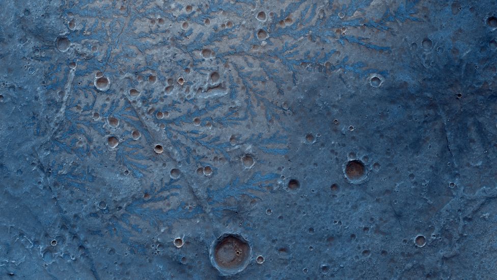 IMAGE COPYRIGHTESA/ROSCOSMOS/CASSIS
The technical goal of CaSSIS is to look at potential landing sites for future missions - one being Esa's Exomars mission that is due to launch in 2022.
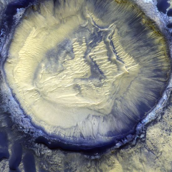
However, as part of its scientific activities, it has also observed a variety of minerals, canyons, craters and other geological features on the surface.
The images, which have been published on Instagram, also show frost deposits and dust storms.

Prof Nicolas Thomas, from Oswestry in Shropshire, built the high-resolution instrument and leads the project at the University of Bern, Switzerland, which has now taken more than 20,000 images of Mars.
"There are things that we already know about, but we have got lots more information by using CaSSIS.
"The ability of CaSSIS to see sedimentary layering in some areas is very interesting," he told BBC News.
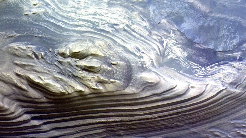 IMAGE COPYRIGHTESA/ROSCOSMOS/CASSIS
"The other thing I like is we have seen remarkable numerous dust devil tracks on the surface on Mars.
"It stands out in a way that it has never done when we used other instruments."
Over the past few months, CaSSIS has been taking up to 300 images per week.
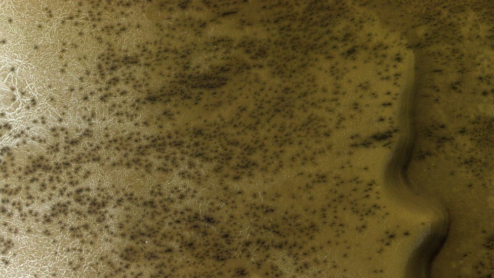 IMAGE COPYRIGHTESA/ROSCOSMOS/CASSIS
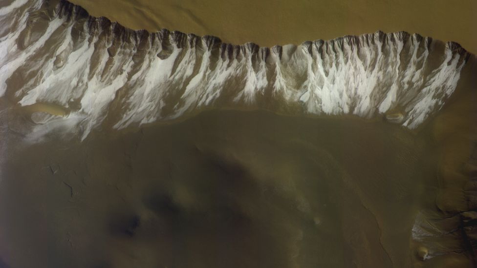 IMAGE COPYRIGHTESA/ROSCOSMOS/CASSIS
The instrument has a strong colour capability so the team combines its findings with those of Nasa's ultra-high resolution imaging system, HiRISE, which flies on the Mars Reconnaissance Orbiter.
"We are very much working together right now in the scientific field," Prof Thomas said.
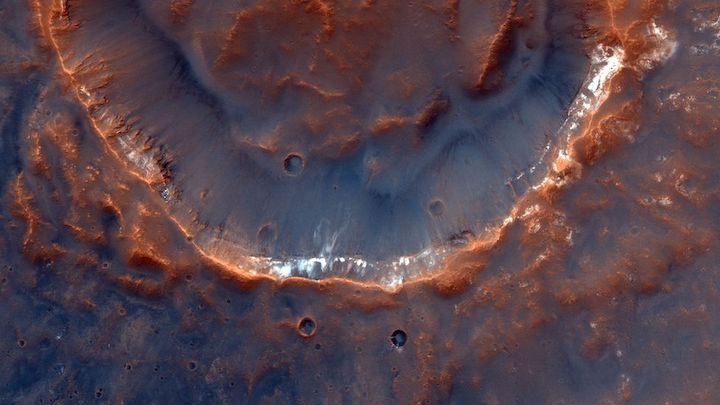
An area of the Red Planet CaSSIS has photographed is a region near Sisyphi Tholus, where frost deposits have been documented.
At high latitudes, carbon dioxide ice and frost develop, which can be seen with the cracks in the terrain.
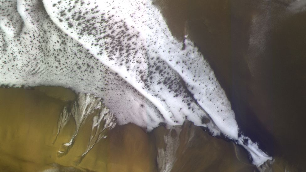 IMAGE COPYRIGHTESA/ROSCOSMOS/CASSIS
How does CaSSIS work?
The team selects specific targets from a database before capturing them.
CaSSIS flies over the surface at about 3km/s, so the images have to be taken very quickly. The exposure time for the images is only 1.5ms.
"We get around 4.5m per pixel on the surface from a distance of about 400 km - so it is a little looking at a bus in London from Liverpool," Prof Thomas explains.
The camera uses false-colour imagery to enrich its findings.
The colours differ from how they would appear to the human eye, but it helps the CaSSIS team search for different minerals that reflect sunlight in different colours.
"We wanted CaSSIS to do science so we decided not to put simple red, green and blue colours into the camera system, but optimise the colours for science return," Prof Thomas added.
One of the sites the CaSSIS team has looked at is the Jezero Crater.
This is where Nasa's Perseverance rover is due to land next week before it starts its search for evidence of past life on the planet.
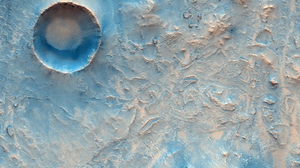 IMAGE COPYRIGHTESA/ROSCOSMOS/CASSIS
Prof Thomas said the team typically has four to six opportunities per year to take pictures of sites like Jezero.
Five days after the expected touchdown of Perseverance, CaSSIS hopes to capture its parachute and heat-shield discarded during the landing.
"We've got permission, so if it touches down successfully on the surface then all is good and we should see its heat-shield.
"However, if it lands upside down or in a wrong place somehow, then we will help search for it," Prof Thomas added.
The camera will continue orbiting and is scheduled to assist ExoMars with its mission in 2022.
Prof Thomas is hoping the project will run until at least 2025.
Quelle: BBC