

21.11.2020
+++


Quelle: SpaceX
+++
Falcon 9 launches Sentinel-6 Michael Freilich ocean science satellite
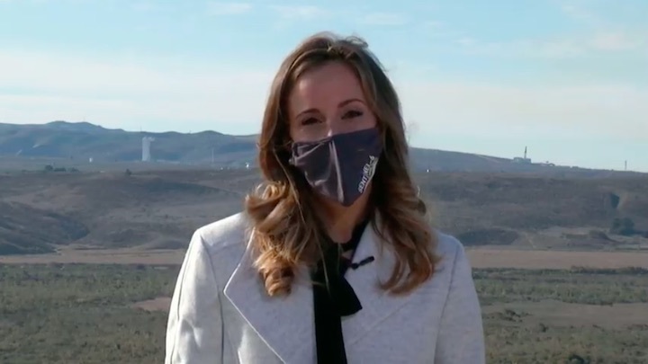
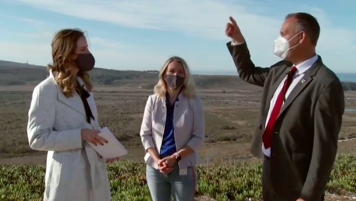
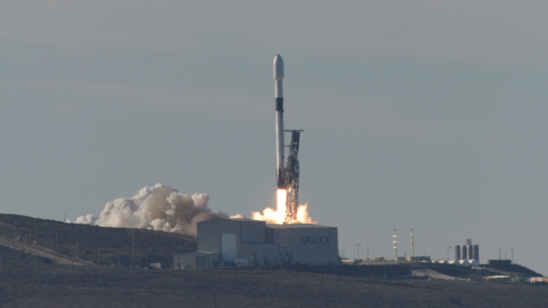
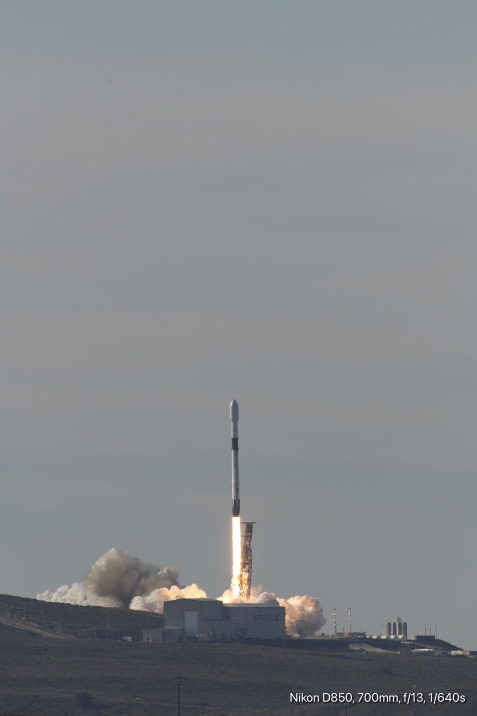
WASHINGTON — A SpaceX Falcon 9 successfully launched Nov. 21 the latest in a series of satellites developed by the United States and Europe to track rising sea levels.
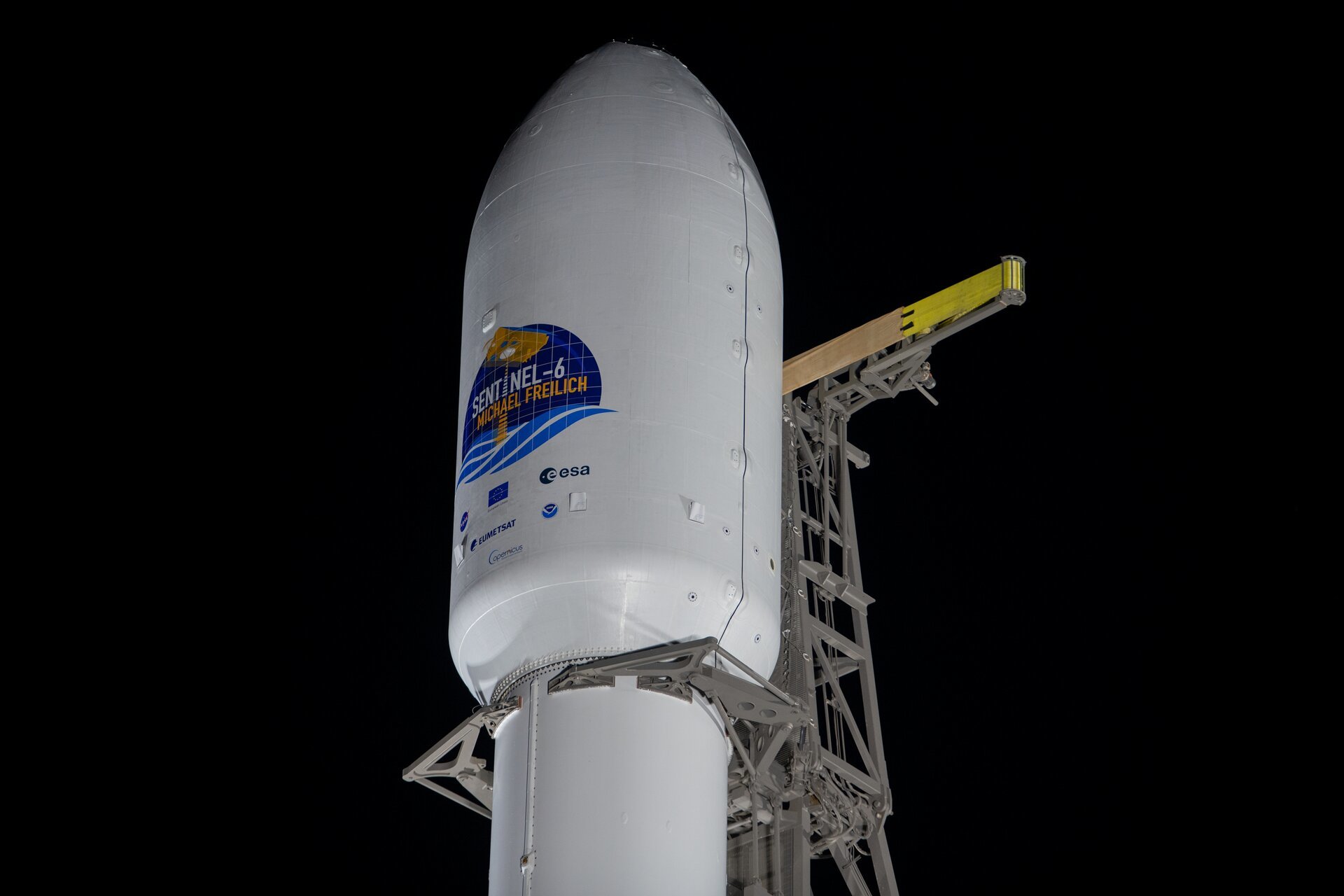
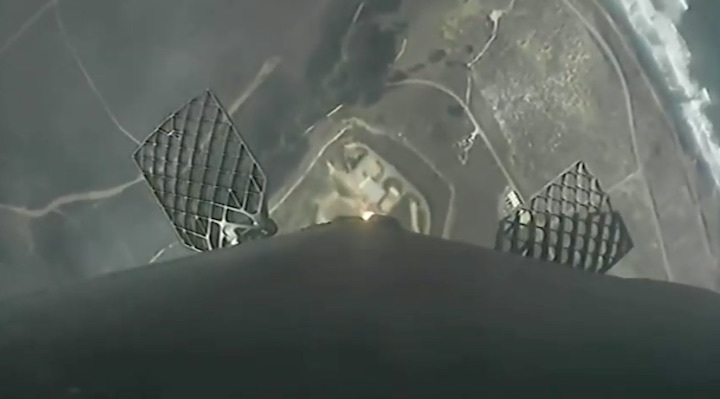
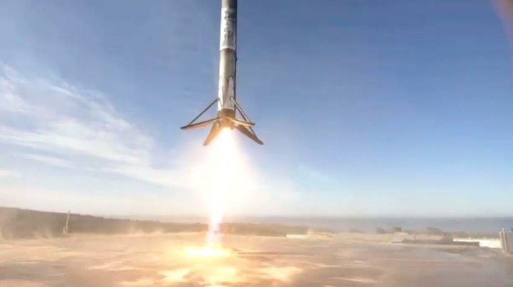
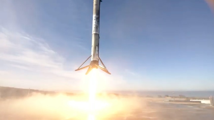
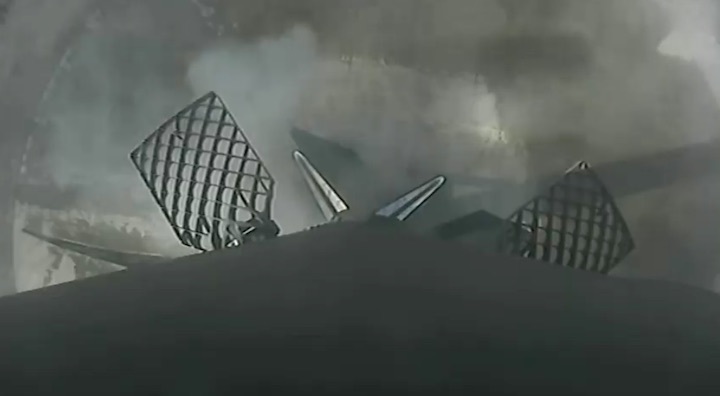
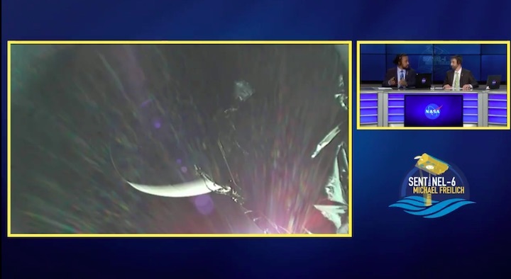
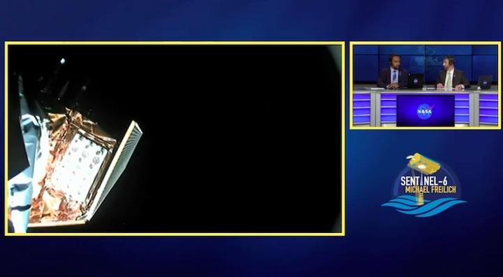
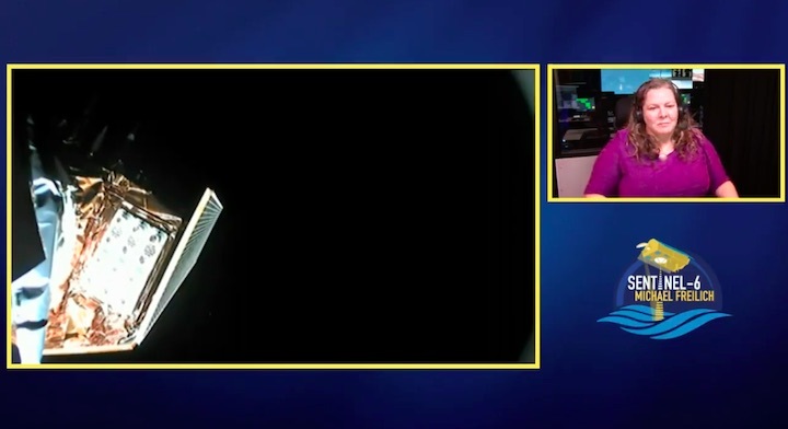
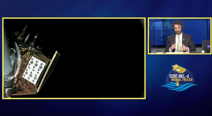
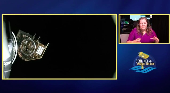
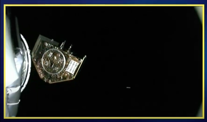
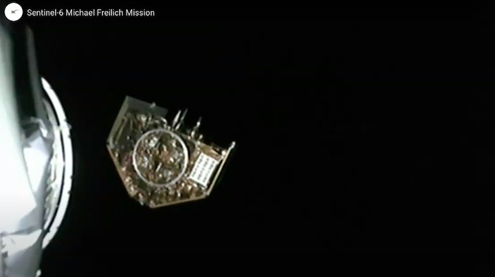
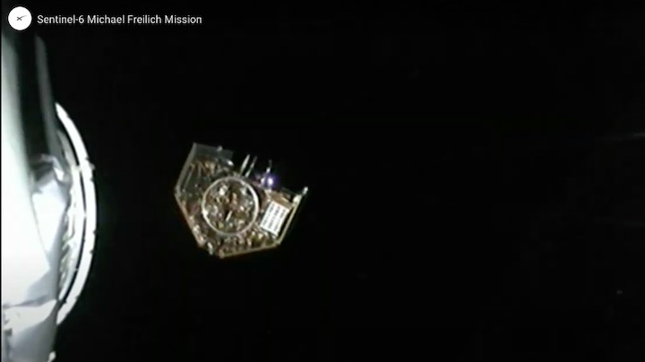
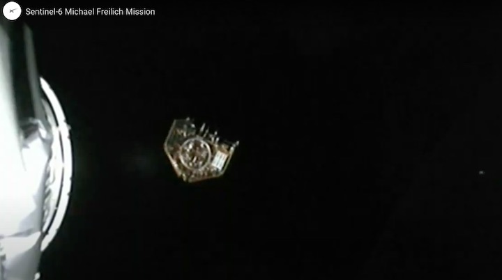
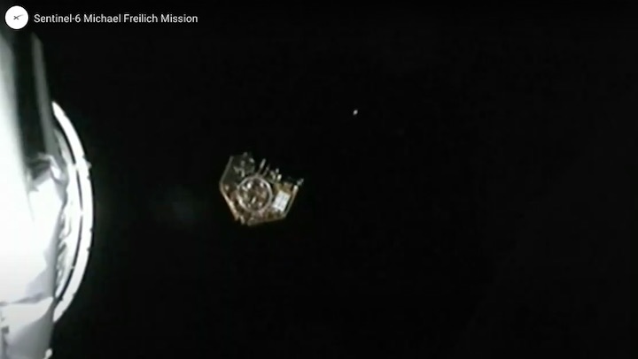
The Falcon 9 lifted off from Space Launch Complex (SLC) 4 East at Vandenberg Air Force Base in California at 12:17 p.m. Eastern. Its payload, the Sentinel-6 Michael Freilich satellite, separated from the rocket’s upper stage nearly an hour later, after a brief second burn of the upper stage. The rocket’s first stage landed on a pad back at SLC-4.
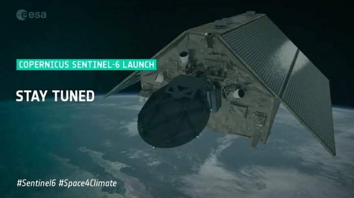
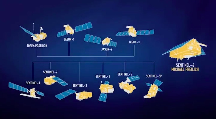
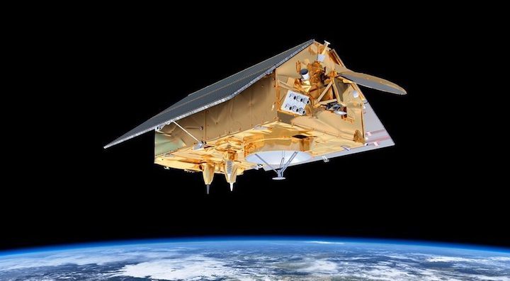
Sentinel-6 Michael Freilich is the first of two satellites jointly developed by a group of agencies in the United States and Europe, including NASA, NOAA, the European Space Agency, Eumetsat and the European Commission, to provide precise measurements of rising sea levels.
The spacecraft will ensure a continuity of measurements dating back nearly three decades, starting with the TOPEX/Poseidon satellite launched in 1992 and followed by the three Jason spacecraft launched in 2001, 2008 and 2016. Those earlier spacecraft were joint projects of NASA, NOAA, Eumetsat and the French space agency CNES, while Sentinel-6 Michael Freilich is considered part of the Copernicus program of Earth observation satellites by ESA and the EU.
“It’s the first time that ESA and NASA have really collaborated in such an integrated way on an Earth observation satellite,” said Pierrik Vuilleumier, Sentinel-6 project manager at ESA, during a Nov. 20 pre-launch briefing. NASA and ESA are each spending about half a billion dollars on the total program, which includes a second Sentinel-6 satellite that will launch in the middle of the decade.
The spacecraft itself, weighing 1,192 kilograms at launch, was built by Airbus Defence and Space in Germany. It has a distinctive appearance with two body-mounted solar panels that look like the roof of a house. That design is intended to maximize the power they can provide without requiring the use of deployable arrays and motors than can induce vibrations in the spacecraft.
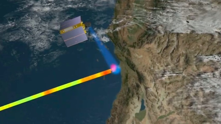
The spacecraft’s main instrument is a radar altimeter provided by ESA, which bounces radio pulses off the ocean to measure sea level as well as wave height and ocean speed. It is supported by a microwave radiometer developed at NASA’s Jet Propulsion Laboratory, which measures water vapor in the atmosphere to providing timing corrections for the radar altimeter.
Also on Sentinel-6 Michael Freilich is a global navigation satellite system radio occultation (GNSS-RO) instrument to provide measurements of the atmospheric temperature and moisture by measuring signals from GPS and other navigation satellites. That instrument is similar to those on the six COSMIC-2 satellites launched in June 2019. In addition to measuring atmospheric conditions, data from the GNSS-RO instrument will be used with that from three other sensors to precisely measure the spacecraft’s orbit, at an altitude of 1,336 kilometers and an inclination of 66 degrees.
Sentinel-6 Michael Freilich will operate in the same orbit as Jason-3, with the two satellites about 30 seconds apart. That will assist in the commissioning of the new spacecraft, a process that will take about a year, said Remko Scharroo, project scientist for the mission at Eumetsat. “They will basically see the same ocean conditions, and that, of course, makes comparing the measurements much better,” he said at a pre-launch briefing.
While the spacecraft features improved resolution and precision compared to its predecessors, scientists emphasized the importance of continuing a series of measurements of sea level height dating back nearly three decades. Sentinel-6 Michael Freilich “will continue our record of sea surface height observations well into the next decade,” said Karen St. Germain, director of NASA’s Earth science division.
“It’s a critical observation for a number of reasons, but its power is really unleashed when we combine our altimetry observations of the sea surface height measurements with the observations we get from the other satellites in the NASA fleet and the international fleet,” she continued. “We can see not only that the sea level is rising but we can also tell how much of that change is coming from melting ice sheets and glaciers, and how much of that change is coming from thermal expansion of the oceans themselves.”
That satellite data has shown that sea levels are not only rising, but also that the rate of increase is accelerating. Sea levels were rising at the rate of about two millimeters per year in the 1990s, said Josh Willis, project scientist for the mission at JPL, but are now increasing at four to five millimeters per year. “We’re watching the rate of sea-level rise increase right before our very eyes, and it’s satellites like this that allow us to do it,” he said.
“We cannot ignore that our planet is changing,” said Pierre Delsaux, deputy director general for space for the European Commission, at a briefing about the mission in October. “The climate is changing. Nobody can deny it. From that point of view, we need to understand why the climate is changing, what are the factors, and we need to monitor the situation.”
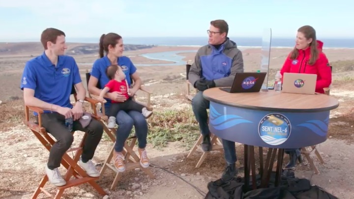
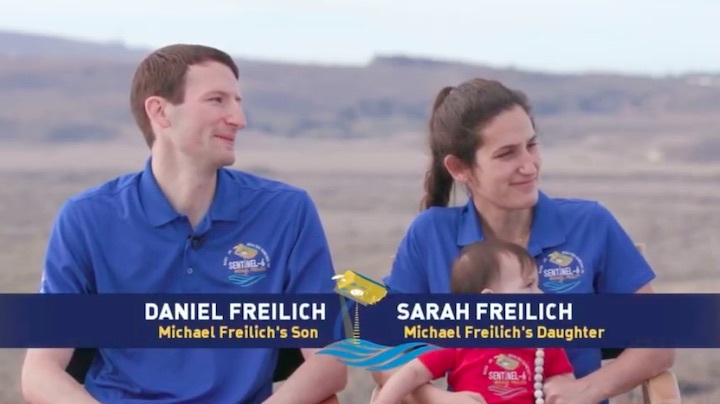
NASA and ESA named the spacecraft after Michael Freilich, a former director of NASA’s Earth science division, during a ceremony early this year. Freilich, who retired from NASA in 2019 after leading NASA’s Earth science programs for more than a decade, died of cancer in August.
“This partnership is very much aligned with what Mike Freilich’s passion has been,” said Thomas Zurbuchen, NASA associate administrator for science, at the pre-launch briefing, noting Freilich’s research in ocean sciences before taking the NASA position. “I want to tell you how honored I feel, and how it still moves me today, that the name of Michael Freilich is, in fact, on this spacecraft.”
“It’s an extra special day when we will see this satellite launch, the satellite that he worked so hard to put in place,” said St. Germain.
Quelle: SN
+++
New Copernicus satellite to monitor sea-level rise launched
The Copernicus Sentinel-6 Michael Freilich satellite has been launched into orbit around Earth on a SpaceX Falcon 9 rocket. Using the latest radar altimetry technology, this new satellite is set to provide a new overview of ocean topography and advance the long-term record of sea-surface height measurements that began in 1992 – measurements that are essential for climate science, for policy-making and, ultimately, for protecting the lives of millions at risk of sea-level rise.
Carrying the 1.2 tonne Sentinel-6 satellite, the Falcon 9 rocket lifted off from the Vandenberg Air Force Base in California, US, at 17:17 GMT (18:17 CET, 09:17 PST) on 21 November. The satellite was delivered into orbit just under an hour after liftoff and contact was established at the ground station in Alaska at 19:49 CET.

Access the video
ESA's Director of Earth Observation Programmes, Josef Aschbacher, said, “I'm extremely proud to have seen Copernicus Sentinel-6 liftoff this evening and know that it's well on its way to starting its mission of continuing the measurements of sea level that are so needed to understand and monitor the worrying trend of rising seas. I would not only like to thank the ESA teams that have worked so hard to get to this point, but also the EC, Eumetsat, NASA, NOAA and CNES, and, of course, we very much look forward to further fruitful cooperation between our respective organisations.”
With millions of people living in coastal communities around the world, rising seas are at the top of the list of major concerns linked to climate change. Monitoring sea-surface height is critical to understanding the changes taking place so that decision-makers have the evidence to implement appropriate policies to help curb climate change and for authorities to take action to protect vulnerable communities.
Over the last three decades, the French–US Topex-Poseidon and Jason mission series served as reference missions, and in combination with ESA’s earlier ERS and Envisat satellites, as well as today’s CryoSat and Copernicus Sentinel-3, they have shown how sea level has risen about 3.2 mm on average every year. More alarmingly, this rate of rise has been accelerating; over the last few years, the average rate of rise has been 4.8 mm a year.
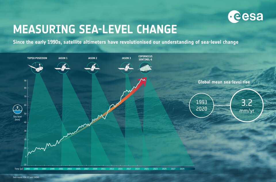
Now in orbit, Copernicus Sentinel-6 Michael Freilich will soon pick up the baton and extend this dataset – a dataset that is the ‘gold standard’ for climate studies. The mission comprises two identical satellites launched sequentially – so in five years, Copernicus Sentinel-6B will be launched to take over. The mission as a whole will ensure the continuity of data until at least 2030.
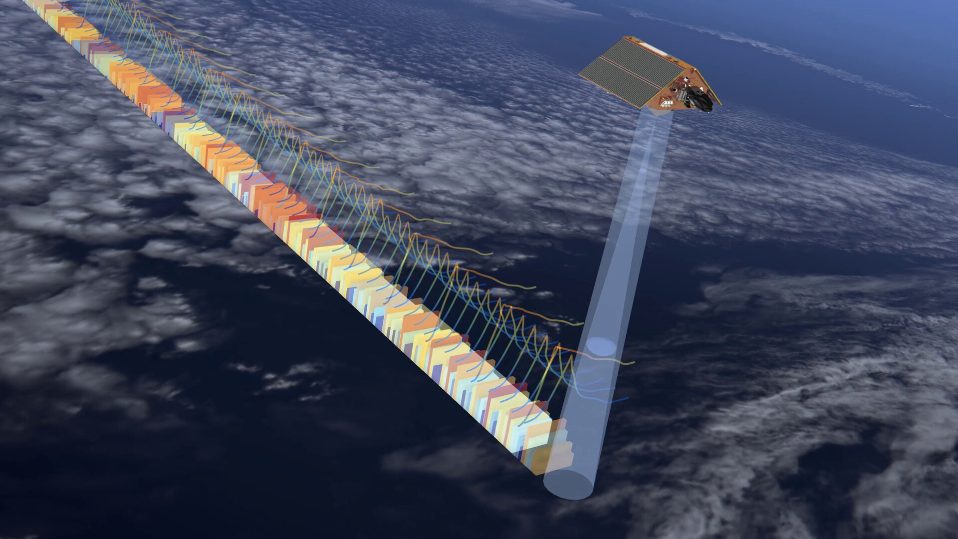
Each satellite carries a radar altimeter, which works by measuring the time it takes for radar pulses to travel to Earth’s surface and back again to the satellite. Combined with precise satellite location data, altimetry measurements yield the height of the sea surface.
The satellites’ instrument package also includes an advanced microwave radiometer that accounts for the amount of water vapour in atmosphere, which affects the speed of the altimeter’s radar pulses.
Access the video
While heritage has been key to the mission’s design, Sentinel-6 brings, for the first time, synthetic aperture radar into the altimetry reference mission time series. To ensure that no bias is introduced into the time series, the radar instrument operates in a continuous burst mode, simultaneously providing conventional low-resolution mode measurements and the improved performance of synthetic aperture radar processing.
To ensure that the data time series is continuous despite the change of instrument technologies, Sentinel-6 Michael Freilich is spending its first year in orbit flying just 30 seconds behind Jason-3.
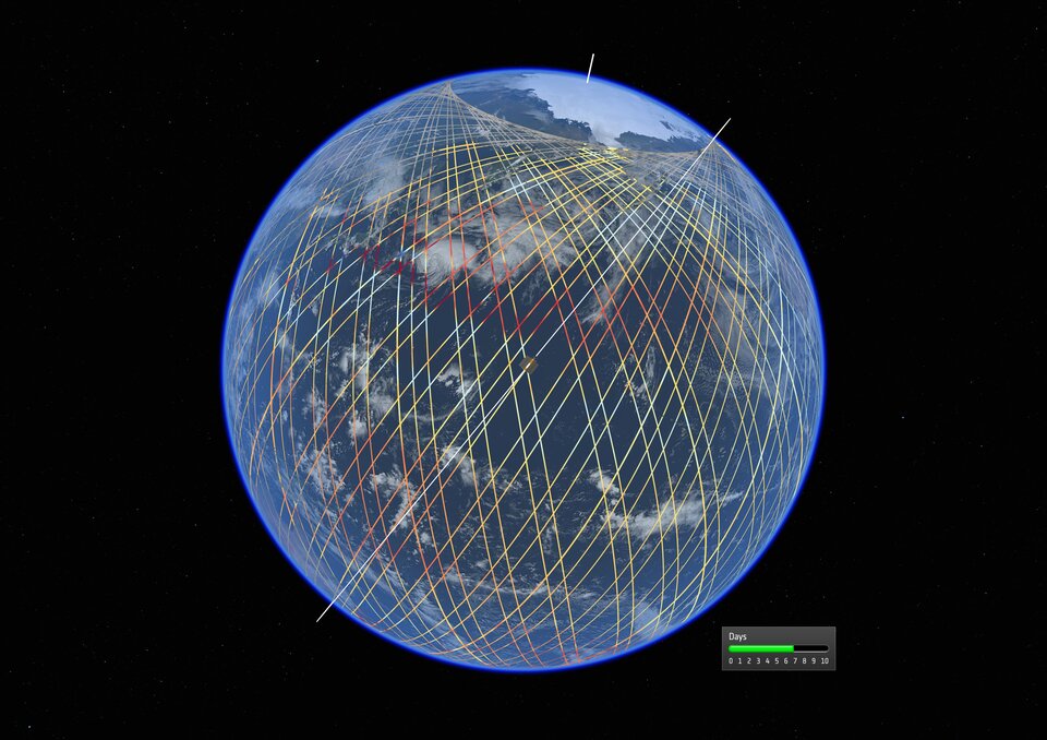
Orbiting at an altitude of over 1300 km and reaching 66°N and 66°S, Sentinel-6 provides sufficient measurements to map the height of the sea surface over 95% of the world’s ice-free oceans every 10 days.
While Sentinel-6 is one of the European Union’s family of Copernicus missions, its implementation is the result of a unique cooperation between the European Commission ESA, Eumetsat, NASA and NOAA, with contribution from the CNES French space agency.
The European Commission’s Director-General for Defence Industry and Space, Timo Pesonen, said, “We are very pleased to welcome this newcomer to the EU’s fleet of Copernicus Sentinel satellites. Copernicus Sentinel-6 Michael Freilich will enable delivering enhanced products and information concerning the oceans and the atmosphere to improve the daily lives of our citizens. The arrival of this satellite is another success for Copernicus, for Europe, for all mission partners and worldwide.”
ESA has been responsible for the development of the Poseidon-4 radar altimeter and development of the Copernicus Sentinel-6 Michael Freilich, as a whole. It is also responsible for the procurement of Copernicus Sentinel-6B on behalf of the European Commission and Eumetsat.
Transfer of ownership goes to the EC at the point of liftoff. ESA takes care of the early orbit phase as well as in-orbit verification planning, and supports flight operations performed by Eumetsat.
Eumetsat is responsible for the development of the ground segment and for operations after the launch and early orbit phases. Eumetsat processes the data and delivers the data products services to European users.
Eumetsat’s Director General, Alain Ratier, said, “Data from Copernicus Sentinel-6 Michael Freilich will be the most accurate yet and will be used to gain a deeper understanding of global sea-level rise, a key indicator of climate change. The data will also be used for weather forecasting, from improving the accuracy of seasonal forecasts to predicting the tracks of hurricanes and cyclones.”
NASA has the responsibility for the launch services, the development of the microwave radiometer, the laser retroreflector and GNSS radio occultation receiver. It also provides ground segment support and contributes to the operations and data processing in the US. NASA and NOAA share responsibility for the distribution of data products to users in the US.
“Mike Freilich helped ensure NASA was a steadfast partner with scientists and space agencies worldwide, and his love of oceanography and Earth science helped us improve the understanding of our beautiful planet," said Thomas Zurbuchen, NASA's Associate Administrator for Science at the Agency's Headquarters in Washington. “This satellite, so graciously named for him by our European partners, will carry out the critical work Mike so believed in – adding to a legacy of crucial data about our oceans and paying it forward for the benefit of future generations.”
Quelle: ESA