

.
1.01.2015
Satellite with Extraordinary Antenna to Study Soil Moisture
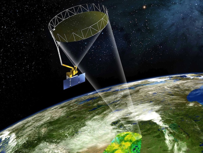
It's active. It's passive. And it's got a big, spinning lasso.
Scheduled for launch on Jan. 29, 2015, NASA's Soil Moisture Active Passive (SMAP) instrument will measure the moisture lodged in Earth's soils with an unprecedented accuracy and resolution. The instrument's three main parts are a radar, a radiometer and the largest rotating mesh antenna ever deployed in space.
.
Remote sensing instruments are called “active” when they emit their own signals and “passive” when they record signals that already exist. The mission's science instrument ropes together a sensor of each type to corral the highest-resolution, most accurate measurements ever made of soil moisture -- a tiny fraction of Earth's water that has a disproportionately large effect on weather and agriculture.
To enable the mission to meet its accuracy needs while covering the globe every three days or less, SMAP engineers at NASA's Jet Propulsion Laboratory in Pasadena, California, designed and built the largest rotating antenna that could be stowed into a space of only one foot by four feet (30 by 120 centimeters) for launch. The dish is 19.7 feet (6 meters) in diameter.
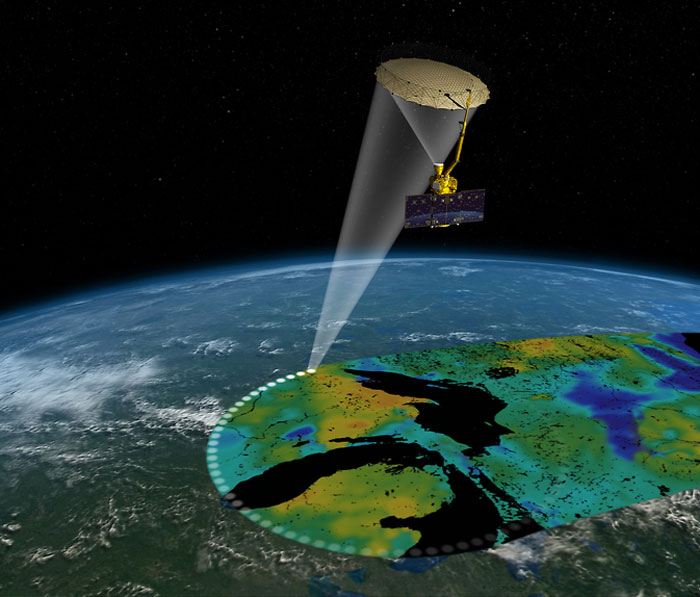
"We call it the spinning lasso," said Wendy Edelstein of NASA's Jet Propulsion Laboratory, Pasadena, California, the SMAP instrument manager. Like the cowboy's lariat, the antenna is attached on one side to an arm with a crook in its elbow. It spins around the arm at about 14 revolutions per minute (one complete rotation every four seconds). The antenna dish was provided by Northrop Grumman Astro Aerospace in Carpinteria, California. The motor that spins the antenna was provided by the Boeing Company in El Segundo, California.
"The antenna caused us a lot of angst, no doubt about it," Edelstein noted. Although the antenna must fit during launch into a space not much bigger than a tall kitchen trash can, it must unfold so precisely that the surface shape of the mesh is accurate within about an eighth of an inch (a few millimeters).
The mesh dish is edged with a ring of lightweight graphite supports that stretch apart like a baby gate when a single cable is pulled, drawing the mesh outward. "Making sure we don't have snags, that the mesh doesn't hang up on the supports and tear when it's deploying -- all of that requires very careful engineering," Edelstein said. "We test, and we test, and we test some more. We have a very stable and robust system now."
SMAP's radar, developed and built at JPL, uses the antenna to transmit microwaves toward Earth and receive the signals that bounce back, called backscatter. The microwaves penetrate a few inches or more into the soil before they rebound. Changes in the electrical properties of the returning microwaves indicate changes in soil moisture, and also tell whether or not the soil is frozen. Using a complex technique called synthetic aperture radar processing, the radar can produce ultra-sharp images with a resolution of about half a mile to a mile and a half (one to three kilometers).
SMAP's radiometer detects differences in Earth's natural emissions of microwaves that are caused by water in soil. To address a problem that has seriously hampered earlier missions using this kind of instrument to study soil moisture, the radiometer designers at NASA's Goddard Space Flight Center, Greenbelt, Maryland, developed and built one of the most sophisticated signal-processing systems ever created for such a scientific instrument.
The problem is radio frequency interference. The microwave wavelengths that SMAP uses are officially reserved for scientific use, but signals at nearby wavelengths that are used for air traffic control, cell phones and other purposes spill over into SMAP's wavelengths unpredictably. Conventional signal processing averages data over a long time period, which means that even a short burst of interference skews the record for that whole period. The Goddard engineers devised a new way to delete only the small segments of actual interference, leaving much more of the observations untouched.
Combining the radar and radiometer signals allows scientists to take advantage of the strengths of both technologies while working around their weaknesses. "The radiometer provides more accurate soil moisture but a coarse resolution of about 40 kilometers [25 miles] across," said JPL's Eni Njoku, a research scientist with SMAP. "With the radar, you can create very high resolution, but it's less accurate. To get both an accurate and a high-resolution measurement, we process the two signals together."
SMAP will be the fifth NASA Earth science mission launched within the last 12 months.
.
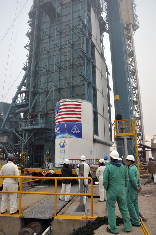
NASA's Soil Moisture Active Passive Spacecraft
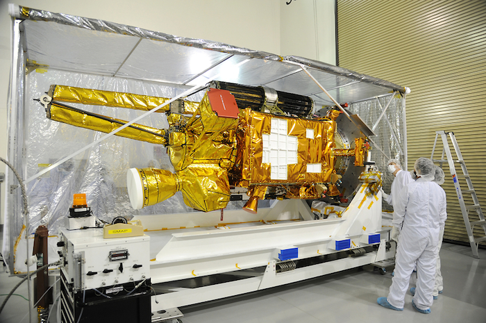
NASA's Soil Moisture Active Passive, or SMAP, spacecraft comes into view as the protective covering is removed in the Astrotech payload processing facility on Vandenberg Air Force Base in California during a post-shipment inspection. The covering protected the spacecraft from static-charge buildup and contamination while it was in transit from NASA's Jet Propulsion Laboratory in Pasadena, California. SMAP will launch on a Delta II 7320 configuration vehicle featuring a United Launch Alliance first stage booster powered by an Aerojet Rocketdyne RS-27A main engine and three Alliant Techsystems, or ATK, strap-on solid rocket motors. Once on station in Earth orbit, SMAP will provide global measurements of soil moisture and its freeze/thaw state. These measurements will be used to enhance understanding of processes that link the water, energy and carbon cycles, and to extend the capabilities of weather and climate prediction models. SMAP data also will be used to quantify net carbon flux in boreal landscapes and to develop improved flood prediction and drought monitoring capabilities. Launch from Space Launch Complex 2 is targeted for Jan. 29, 2015. To learn more about SMAP,
.
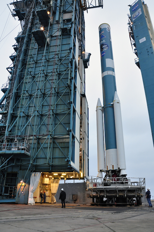
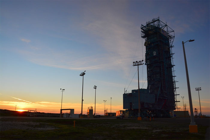
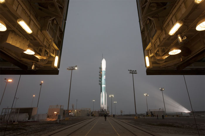
Delta II at the Pad
The mobile service tower at Space Launch Complex 2 on Vandenberg Air Force Base in California is rolled back from the first stage of the Delta II rocket for NASA's Soil Moisture Active Passive mission, or SMAP, during preparations for the arrival of the rocket's second stage. Photo credit: NASA/Randy Beaudoin
.
Mission Overview
SMAP is one of four first-tier missions recommended by the National Research Council's Committee on Earth Science and Applications from Space (Earth Science and Applications from Space: National Imperatives for the Next Decade and Beyond, Space Studies Board, National Academies Press, 2007). SMAP data have both high science value and high applications value. The accuracy, resolution, and global coverage of SMAP soil moisture and freeze/thaw measurements are invaluable across many science and applications disciplines including hydrology, climate, carbon cycle, and the meteorological, environmental and ecology applications communities.
Executive Summary to Satellite Observations to Benefit Science and Society Future water resources are a critical societal impact of climate change, and scientific understanding of how such change may affect water supply and food production is crucial for policy makers. Current climate models uncertainties result in disagreement on whether there will be more or less water regionally compared to today; SMAP data will enable climate models to be brought into agreement on future trends in water resource availability. For these reasons, the Committees Water Resources Panel gave SMAP the highest mission priority within its field of interest.
On Feb 2, 2008, NASA announced that SMAP would be one of two new start missions initiated in FY08. The Earth Science Division (ESD) of the Science Mission Directorate (SMD) at NASA Headquarters determined that SMAP will be implemented as a directed mission within the NASA Earth Systematic Mission (ESM) Program managed by Goddard Space Flight Center (GSFC). The Jet Propulsion Laboratory (JPL) is assigned responsibility for the overall success of the SMAP project.
"...Addressing the environmental challenges will not be possible without increased collaboration between Earth scientists and researchers in other disciplines including the social, behavioral, and economic sciences and policy experts. It is necessary now to build on the paradigm of Earth system science and strengthen its dual role Science and applications. This duality has always been an element of Earth science, but it must be leveraged more effectively than in the past..." (Chapter 1: Earth Science: Scientific Discovery and Societal Applications)
"...The global water cycle describes the circulation of water a vital and dynamic substance in its liquid, solid, and vapor phases as it moves through the atmosphere, the land, and the rivers, lakes, and oceans. Water affects everything animal, vegetable, and mineral on the surface of Earth and in the oceans. Life in its many forms exists because of water, and humans have flourished as a hydraulic civilization. Modern civilization depends on learning how to live within the constraints imposed by the availability of water its excesses and its deficiencies.
"...On a global scale, there are important gaps in knowledge of where water is stored, where it is going, and how fast it is moving. Global measurements from space open a vision for the advancement of water science, or hydrology. This vision includes advances in understanding, data, and information that will improve the ability to manage water and to provide the water-related infrastructure that is needed to provide for human needs and to protect and enhance the natural environment and associated biological systems..." (Chapter 11: Water Resources and the Global Hydrologic Cycle)
Quelle: NASA
.
Update: 13.01.2015
.
NASA water mapper set for move to the launch pad
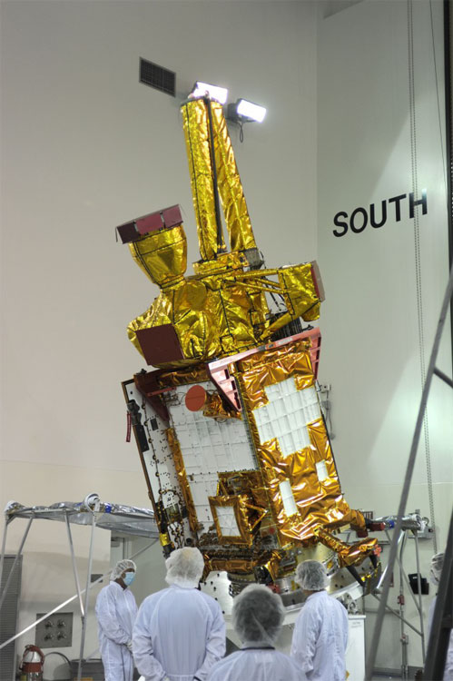
SMAP folded up for launch. Credit: NASA
.
Making a scientific measurement of planet Earth on a global scale never before attempted by NASA is the objective of an environment satellite to be mounted atop its booster rocket Tuesday in California.
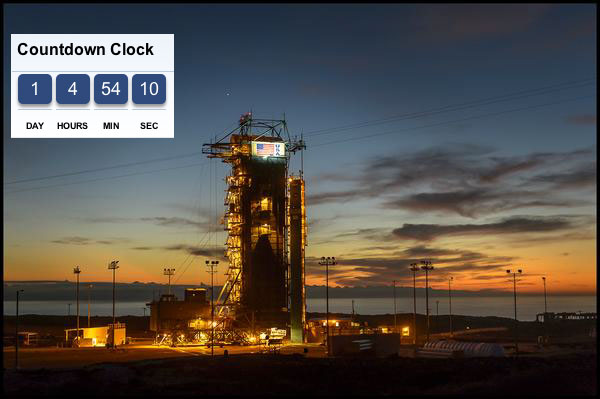
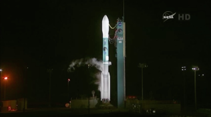
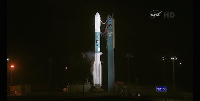
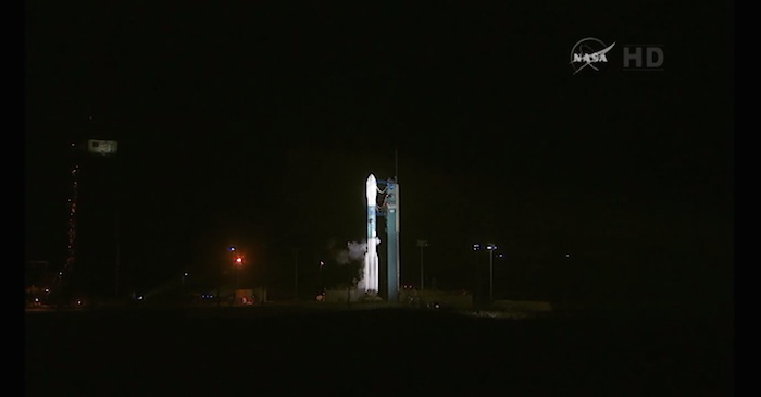
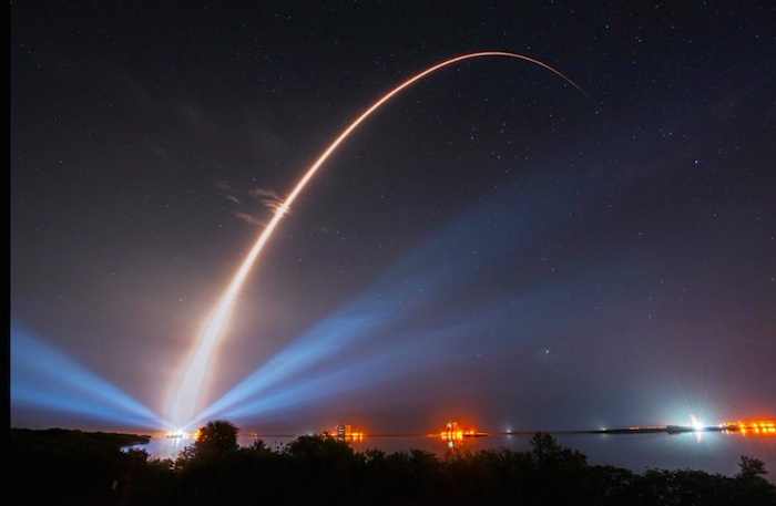
Liftoff of the United Launch Alliance Delta 2 rocket is slated for Jan. 29 at 6:20 a.m. local time (9:20 a.m. EST; 1420 GMT).
The Soil Moisture Active Passive (SMAP) spacecraft will detect the moisture content in land surfaces and determine whether it’s frozen or thawed during a three-year mission.
“The relevance is (soil moisture) is a pretty sensitive indicator of future water availability and can be used in climate models to help improve forecasts,” said Kent Kellogg, the project manager for SMAP.
“One of the really nice things about this mission is we have a lot of relevance for climate science, but the data is also very useful for everyday practical applications. It will improve weather forecasting significantly, drought and flood forecasting, food productivity and diseases.”
The mission was born out of first-ever Earth Science Decadal Survey in 2007, which tagged a soil moisture mission like SMAP as a high-ranking objective.
Capable of peering beneath clouds, vegetation and other surface features, the SMAP mission will produce global maps every 2-3 days.
.
File image of payload hoist at launch pad. Credit: NASA
.
Early Tuesday morning, crews with United Launch Alliance will carefully transport the 2,081-pound satellite from the commercial Astrotech processing facility to the pad at Space Launch Complex 2 of Vandenberg Air Force Base.
Once at the ocean-front pad, workers will lift the canister containing the observatory into the gantry for payload mating to the rocket’s second stage.
A combined systems check of the rocket and spacecraft is coming up this week. The payload fairing will be installed next week.
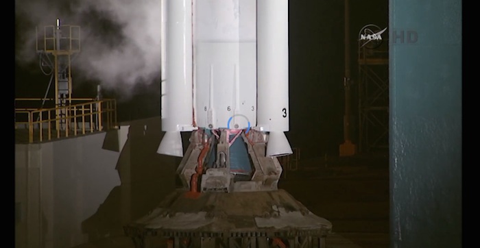
A two-stage Delta 2 rocket, with three strap-on solid motors, will haul the observatory into a near-polar, sun-synchronous orbit.
Quelle: SN
-
Update: 23.01.2015
-
Flight Readiness Review passed for next week’s Delta 2 launch
The Delta 2 rocket and the SMAP spacecraft passed the Flight Readiness Review today that assessed the progress of work and granted approval to proceed with loading the storable hypergolics into the second stage.
A NASA spokesperson says there are no major issues from the FRR and the “go” was given for second stage fueling starting tomorrow as planned.
“At its conclusion, there were significant issues identified for either the observatory or the United Launch Alliance Delta 2 rocket,” the spokesman said.
Technicians clad in protective suits at Vandenberg Air Force Base’s Space Launch Complex 2 began filling the stage with nitrogen tetroxide oxidizer tomorrow (Friday). The hydrazine propellant mixture will be placed aboard Monday.
The fuels will power the stage’s Aerojet Rocketdyne-made engine during the two firings needed to propel the SMAP satellite into the proper polar orbit.
Officials do not take the decision to start loading the rocket lightly. Commencing the second stage fueling is a major milestone in preparing for launch, one that starts a “clock” of 37 days for the rocket.
That “clock” is based on how long the stage remains certified to fly after the storable propellants begin flowing into the vehicle. Exposure to the fuels limits the lifetime for seals and other parts of the stage.
Liftoff remains targeted for Jan. 29 at 6:20 a.m. local time.
Quelle: SN
-
Update: 26.01.2015
.
NASA TV Coverage Set for Launch of Newest Earth-Observing Mission
NASA's Soil Moisture Active Passive mission (SMAP) will lift off from Space Launch Complex 2 at Vandenberg Air Force Base in California at 9:20 a.m. EST (6:20 a.m. PST) on a United Launch Alliance Delta II rocket.
Image Credit: NASA
-
NASA is preparing for a Thursday, Jan. 29, launch of the first U.S. Earth-observing satellite designed to collect global observations of surface soil moisture. The agency’s Soil Moisture Active Passive mission (SMAP) will lift off from Space Launch Complex 2 at Vandenberg Air Force Base in California at 9:20 a.m. EST (6:20 a.m. PST) on a United Launch Alliance Delta II rocket.
NASA Television coverage will begin at 7 a.m. In addition to launch coverage, NASA also will host a series of prelaunch news conferences Tuesday, Jan. 27, at Vandenberg. All briefings, which are subject to change in time, will air live on NASA TV and the agency's website.
SMAP will provide high resolution, space-based measurements of soil moisture and its state -- frozen or thawed -- a new capability that will allow scientists to better predict natural hazards of extreme weather, climate change, floods and droughts, and help reduce uncertainties in our understanding of Earth's water, energy and carbon cycles.
The mission will map the entire globe every two to three days for at least three years and provide the most accurate and highest-resolution maps of soil moisture ever obtained. The spacecraft's final circular polar orbit will be 426 miles (685 kilometers), at an inclination of 98.1 degrees. The spacecraft will orbit the Earth once every 98.5 minutes and repeat the same ground track every eight days.
During the first news conference, at 4 p.m. EST Tuesday, Jan. 27, participants will discuss the latest information on the mission and launch status. Immediately following the prelaunch news conference will be a discussion of the CubeSat auxiliary payloads aboard the rocket.
Quelle: NASA
-
Update: 27.01.2015
-
Weather looking good for Delta 2 launch
VANDENBERG AIR FORCE BASE — The weather outlook is 80 percent favorable for launch of the Delta 2 rocket early Thursday morning from California, with cloud thickness posing the only worry, meteorologists report.
At launch time, the forecast predicts mid- and high-level clouds, good visibility, light northeasterly winds and a temperature of 45-50 degrees F.
Mission officials will convene the Launch Readiness Review Tuesday morning at Vandenberg Air Force Base to confirm all systems are set to enter into the countdown for Thursday’s liftoff.
The Launch Readiness Review will give the “go” to continue with the liftoff plans. Tuesday’s meeting examines the status of the Delta rocket, the SMAP spacecraft, the network of ground support and the weather forecast. The review culminates with official consensus to press ahead with countdown operations starting Wednesday afternoon.
After the LRR concludes, the pre-launch press conference is planned for 1 p.m. local (4 p.m. EST; 2100 GMT) with the NASA launch director, ULA’s program manager, SMAP officials and the weather officer.
The loading of storable propellants into the second stage was completed on Monday with the filling of hydrazine fuel. The oxidizer was loaded aboard on Friday.
Also Friday, the mission dress rehearsal was held for official personnel to practice the countdown and launch sequences.
“At this time, all pre-launch preparations are on schedule,” a NASA spokesman said Monday afternoon. “There are no significant issues being worked by the launch team.”
Quelle: SN
-
Update: 28.01.2015
.
Quelle: NASA
-
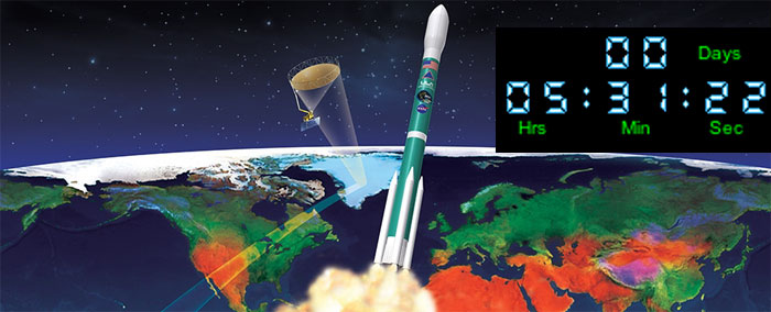
Update: 29.01.2015
.
...
Update: 15.45 MEZ: Start wegen starker Winde um 24 Stunden verschoben
NASA's Soil Moisture Active Passive (SMAP) observatory, which will produce the highest-resolution and most accurate maps of soil moisture ever obtained from space, is scrubbed today from Vandenberg Air Force Base in California. There was no time left to resolve the upper level wind shear constraint before the end of today’s launch window, so managers have decided to postpone launch by 24 hours.
Quelle: NASA
-
Update: 30.01.2015
-
Two more MSU satellites set to launch on Jan. 30, MSU program to be featured on NASA TV
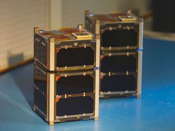
BOZEMAN – Two more satellites built by Montana State University students and partners at the University of New Hampshire are set to launch Friday, Jan. 30, on a NASA mission. About 75 minutes later, MSU’s satellite development program will be featured on NASA TV.
“The opportunity our MSU students have to design and build sophisticated space flight hardware, get it launched on a NASA mission, and then actually operate their own satellite once it’s in space adds an incredibly important element to their education not available at most universities,” said David Klumpar, director of MSU’s Space Science and Engineering Laboratory.
FIREBIRD 3 and 4 – the name of the tiny cube satellites called CubeSats -- were originally scheduled to launch Thursday, Jan. 29, but NASA scrubbed the launch a few minutes before it took place because of upper level winds. The launch is now set for 7:20 a.m. Mountain time on Jan. 30. The satellites will ride on a Delta II rocket from Vandenberg Air Force Base in California.
At 8:34 a.m. Mountain time -- after the launch and when the satellites are deployed -- a segment on MSU’s satellite program is expected to begin airing on NASA EDGE, a program that gives an “offbeat, funny and informative look behind the NASA curtain.” MSU’s segment will last more than 30 minutes and include a live interview with MSU student Matthew Handley. It will also include pre-produced videos with Klumpar, research engineer Keith Mashburn and four MSU students. An MSU commercial about the satellite program is expected to air, as well.
Viewers watch NASA TV on every floor of NASA headquarters in Washington, D.C., and every NASA facility in the United States, said Klumpar, who returned to MSU in the fall after working two years at NASA headquarters. NASA EDGE co-host Blair Allen said NASA EDGE can be seen on NASA TV or accessed on iTunes, YouTube and the NASA website at http://www.nasa.gov/nasaedge.
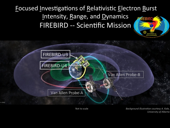
Three MSU-built satellites are currently orbiting the Earth. The Hiscock Radiation Belt Explorer (HRBE) was launched Oct. 28, 2011. FIREBIRD 1 and 2 – the precursors of the new satellites -- were launched Dec. 6, 2013. FIREBIRD refers to “Focused Investigations of Relativistic Electron Burst Intensity, Range, and Dynamics.”
Because of that work, Allen said MSU’s satellite development program has been on NASA EDGE’s radar for a while. To feature MSU on the program, Allen and two other NASA EDGE crew members came to MSU in September to film the CubeSats before they headed to California to be loaded onto the rocket. The crew filmed inside the Space Science and Engineering Laboratory in Cobleigh Hall. They interviewed Klumpar, Mashburn and four students or recent graduates who were involved in building and operating the satellites. The students were Handley, Jerry Johnson, Adam Gunderson and Nathan Fite.
Fite is a recent MSU graduate with a master’s degree in engineering management. A native of Wheelersburg, Ohio, he has worked on CubeSats for at least six years and continued to work on them as a graduate research assistant in the Space Science and Engineering Laboratory until November when he left MSU for an aerospace position in southern California.
Gunderson, a Kalispell native, told NASA EDGE that he started working on CubeSats as an undergraduate in electrical engineering and eventually became responsible for their power systems. He recently earned his master’s degree in electrical engineering. Four days after the NASA EDGE interview, he left Bozeman to start working for Northrop Grumman Corp., an aerospace and defense technology company.
Being able to say that he had been involved with four satellite missions from cradle to the grave made him a much better job candidate than if he hadn’t had the experience, Gunderson said.
MSU is the third university to have its satellite program featured on NASA EDGE, Blair said. One past show focused on California Polytechnic State University (Cal Poly), but it included an appearance by Ehson Mosleh, an MSU graduate and current employee of MSU’s Space Science and Engineering Laboratory. Another show featured Medgar Evers College of The City University of New York (CUNY).
FIREBIRD 3 and 4 are the fifth and sixth MSU satellites to be launched through NASA’s Educational Launch of Nanosatellites (ELaNa) program. Their most important job is gathering more information about the loss of electrons from the Van Allen Radiation Belts, Klumpar said. Radiation in space affects Earth in a variety of ways, including interference with communication systems and power grids.
Klumpar said electrons become trapped in the Earth’s magnetic field, but the trap is leaky, causing electrons to be lost into the upper atmosphere from the Van Allen Radiation Belts. To better understand the process and impacts, MSU and the University of New Hampshire designed satellites that will gather information in tandem. The satellites are slightly taller than HRBE, which is a cube about four inches on each side. The FIREBIRD satellites conform to a nanosatellite size standard, known as the CubeSat standard, which allows them to ride together in a container called a PPOD.
FIREBIRD was funded by the National Science Foundation under the NSF’s CubeSat-based Science Missions for Geospace and Atmospheric Research program. The University of New Hampshire, where Klumpar earned his Ph.D., built the instruments that will take scientific measurements. MSU students designed and built the satellite buses that hold those instruments. They also integrated the instruments into the satellites and tested them to prepare them for launch.
The main job of the rocket carrying FIREBIRD 3 and 4 is to launch a NASA mission, called Soil Moisture Active Passive. SMAP will measure and map the moisture and freeze/thaw state of soil to better understand water, carbon and energy cycles on the Earth.
Quelle:Montana State University
...
...
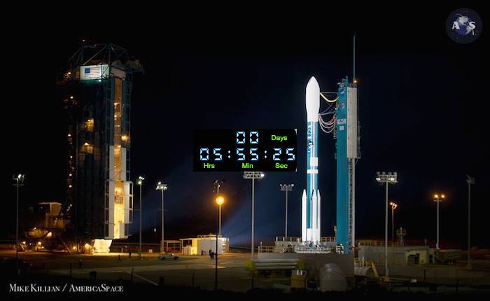
The launch of NASA’s Soil Moisture Active Passive (SMAP) observatory, which will produce the highest-resolution maps of soil moisture ever obtained from space, has been delayed to a targeted launch date of Jan. 31, pending completion of minor repairs to the United Launch Alliance Delta II launch vehicle. During inspections following the Jan. 29 launch attempt, minor “debonds” to the booster insulation were identified; a standard repair is being implemented. A launch attempt on Jan. 31 would take place at 9:20 a.m. EST.
Quelle: NASA
-
Update: 31.01.2015
.
...
Update: 13.50
Weather Update
Vandenberg Air Force Base 30th Operations Support Squadron Launch Weather Officer Lt. Johnny Martin provided a weather update to NASA Launch Manager Tim Dunn and the NASA and United Launch Alliance SMAP launch team a few minutes ago.
There is a 100 percent chance of favorable launch weather with no range safety launch commit criteria violations predicted. At the time of liftoff, there is a slight chance of patchy ground fog, 5-7 mile visibility, winds from the northeast at 8 to 12 knots and a temperature between 48 and 53 degrees.
Currently, upper level winds are “red.” However, Dunn briefed the launch team that there is an opportunity for them to go “green” closer to the time of launch.
-
Quelle: NASA
...
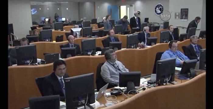
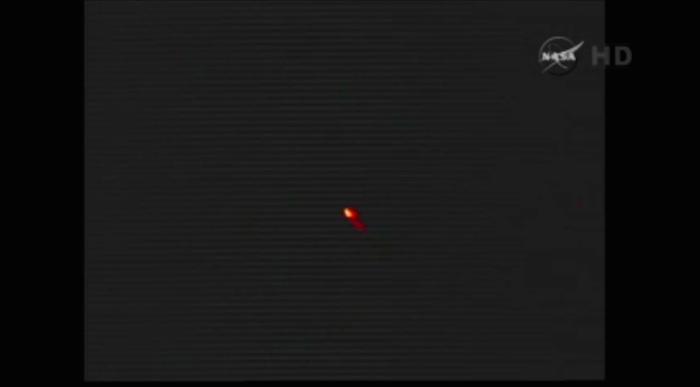
LIVE
...
...
...
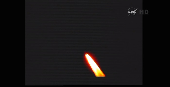
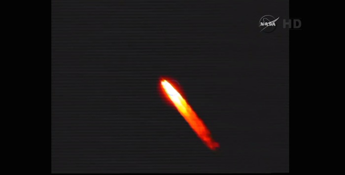
...Frams: ulalaunch
-
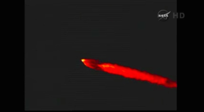
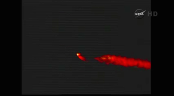
Update: 16.45 MEZ:
-
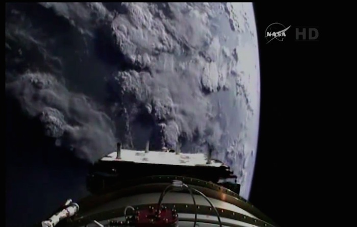
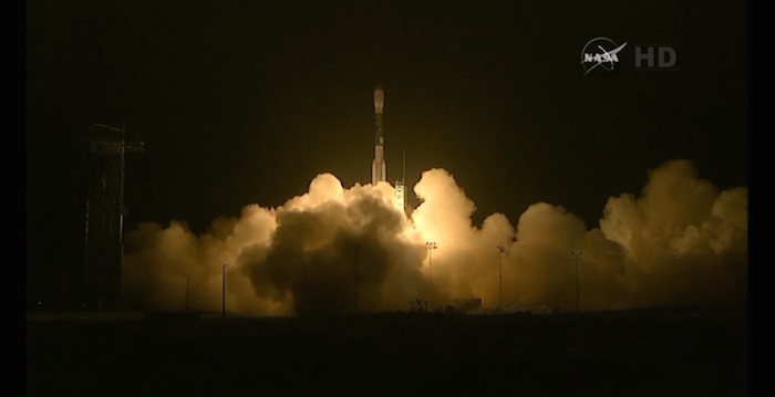
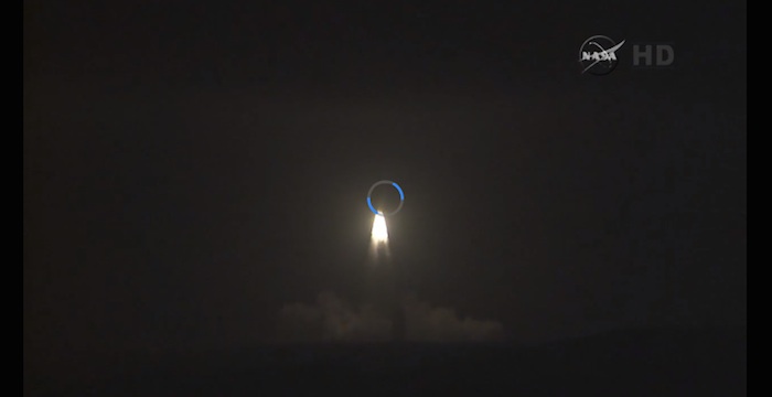
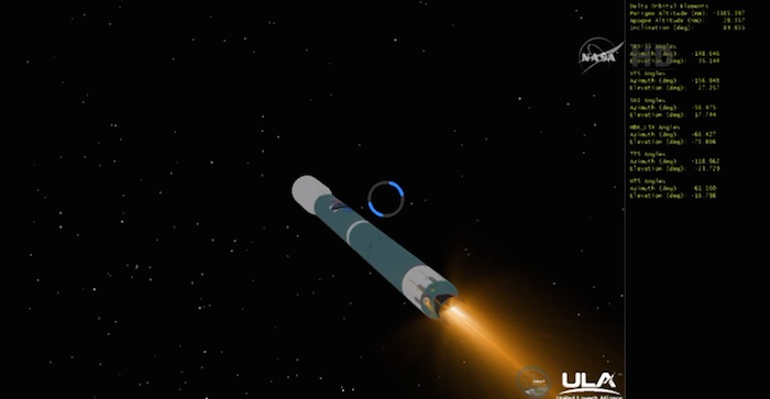
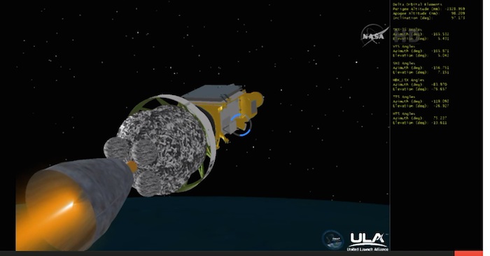
Trennphase von SMAP-Satelliten von Trägerstufe...
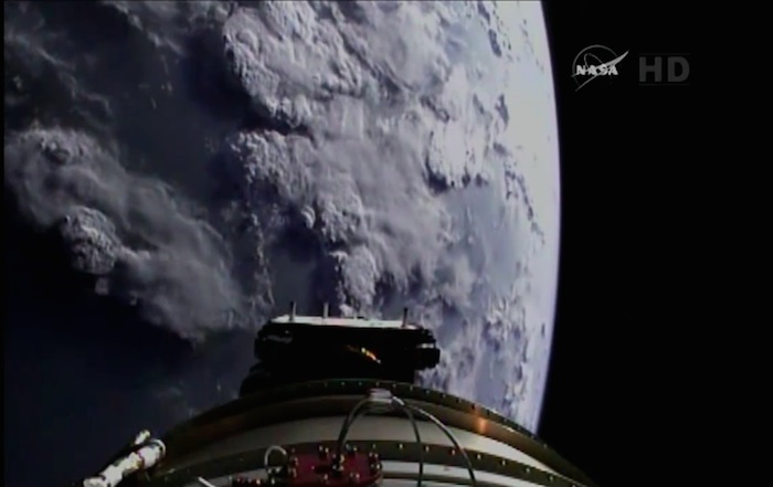

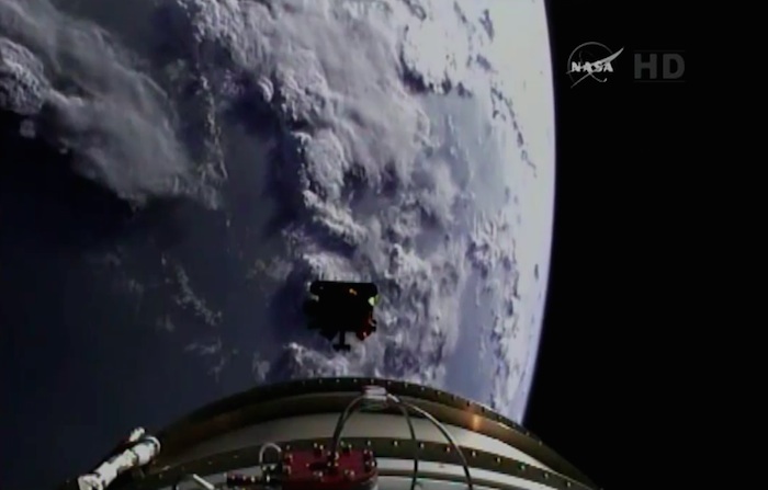
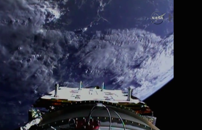
Quelle: ulalaunch
4614 Views